 Block
Brooklyn Park, Minnesota
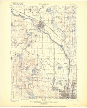
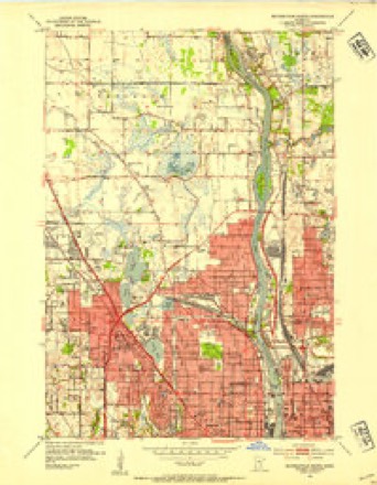
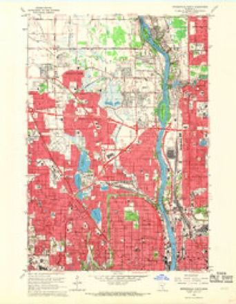
21 topographic sheets cover this place, the earliest surveyed in 1902 and the latest in 1991. It stands in Brooklyn Park City. It lies in ZIP code area 55443. The Survey maps it on the Minneapolis North quadrangle. 86,478 people lived here at the 2020 count. It stands 869 feet above sea level.
Population over time
2 figuresBrooklyn Park grew from 75,781 to 86,478 between 2010 and 2020. These are the recorded population figures Wikidata holds for this place, reached through the Geographic Names Information System number this page is keyed on rather than by name, so they belong to this place and not to another of the same name. Most are census counts, but not all are: an early figure may be a founding or settlement estimate, and an estimate published within five years of a census is left out. The change column is computed, and is left blank where more than 20 years separate a figure from the one before it, because a gap that long is not a change between two counts.
| Year | People | Change |
|---|---|---|
| 2010 | 75,781 | |
| 2020 | 86,478 | +10,697 (+14%) |
Topographic sheets covering this place
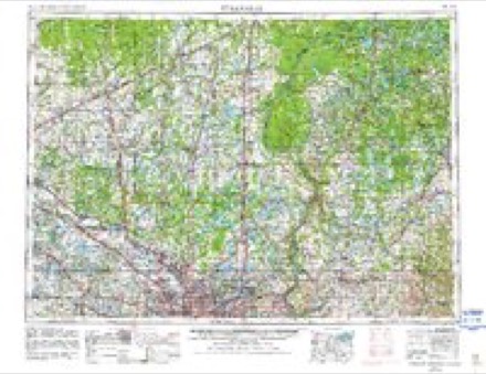
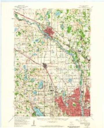
11 surveys from 21 printed sheetsMatched by testing this settlement's coordinate against the published boundary of every sheet in the United States Geological Survey's historical collection. Each opens the scanned sheet at the Survey.
- 1902 USGS Anoka quadrangle1:62500, 4 printings
- 1952 USGS Minneapolis North quadrangle1:24000, 2 printings
- 1953 USGS Stillwater quadrangle1:250000
- 1955 USGS Anoka quadrangle1:62500
- 1955 USGS Stillwater quadrangle1:250000
- 1958 USGS Stillwater quadrangle1:250000, 2 printings
- 1965 USGS Stillwater quadrangle1:250000
- 1967 USGS Minneapolis North quadrangle1:24000, 5 printings
- 1975 USGS Stillwater quadrangle1:250000, 2 printings
- 1985 USGS Anoka quadrangle1:100000
- 1991 USGS Anoka quadrangle1:100000
Fires near this place
12 since 1999Regional context, not property-specific evidence. The federal wildfire occurrence database lists 12 fires within 5 miles of Brooklyn Park between 1999 and 2019, burning about 103 acres in total. None started naturally. 8 were recorded as arson. Distance is straight-line from the map coordinates, so a fire counted here may appear on a neighbouring settlement's page as well.
| Reported cause | Fires |
|---|---|
| Arson/incendiarism | 8 |
| Railroad operations and maintenance | 4 |
The most recent of them, most recent first, with the day each was reported and the service that recorded it.
| Date | Cause | Size | Reported by | Name on the report |
|---|---|---|---|---|
| 17 August 2003 | Arson/incendiarism | under an acre | Minnesota Department of Natural Resources | not named |
| 5 June 2009 | Arson/incendiarism | under an acre | Minnesota Department of Natural Resources | not named |
| 4 May 2001 | Railroad operations and maintenance | under an acre | Minnesota Department of Natural Resources | not named |
| 3 May 1999 | Arson/incendiarism | 3.0 acres | Minnesota Department of Natural Resources | not named |
| 3 May 1999 | Railroad operations and maintenance | under an acre | Minnesota Department of Natural Resources | not named |
| 3 May 1999 | Railroad operations and maintenance | 6.0 acres | Minnesota Department of Natural Resources | not named |
| 14 May 2000 | Arson/incendiarism | 20 acres | Minnesota Department of Natural Resources | not named |
| 4 April 2012 | Arson/incendiarism | 60 acres | Minnesota Department of Natural Resources | not named |
Settlements close enough to share some of these fires:
Mines and quarries near this place
10 of 17 shownRegional context, not property-specific evidence. The federal mineral resources record lists 17 workings within 5 miles of Brooklyn Park: 16 producers, 1 past producer. 16 still produce. What was taken out: Sand and Gravel, Construction. Distance is straight-line from the map coordinates, so a quarry counted here may appear on a neighbouring settlement's page as well.
| Where | Site | Commodity | Status | Recorded |
|---|---|---|---|---|
| Anderson No 609 Pit | Sand and Gravel, Construction | Producer | ||
| Barton Pit No 704 | Sand and Gravel, Construction | Producer | ||
| Barton Pit No 707 | Sand and Gravel, Construction | Producer | ||
| Barton Pit No 708 | Sand and Gravel, Construction | Producer | ||
| Barton Pit No 725 | Sand and Gravel, Construction | Producer | ||
| Barton Pit No 730 | Sand and Gravel, Construction | Producer | ||
| Chas M Freidheim S&G Pit | Sand and Gravel, Construction | Producer | ||
| Gottchalk Pit No 706 | Sand and Gravel, Construction | Producer | ||
| Johnson Pit No 724 | Sand and Gravel, Construction | Producer | ||
| Landers Pit and Mill No 710 | Sand and Gravel, Construction | Producer |
Storms near this place
34 since 1994Regional context, not property-specific evidence. The National Weather Service names Brooklyn Park in 34 storm reports between 1994 and 2025: 16 hail, 11 thunderstorm wind, 2 lightning, 2 heavy rain. The reports record 1 injury. Each account below is quoted exactly as the forecast office filed it, from the NOAA Storm Events Database, and each date opens the federal record of that event.
| When | Event | Place named | Harm | What the report says |
|---|---|---|---|---|
| August 1996 | Thunderstorm Wind | Brooklyn Park | 1 hurt | no account filed |
| June 2014 | Flood | Brooklyn Park | $4,000,000 | Several sources in Hennepin County compiled a summary of flood related damages and locations for the flood of June 2014. In Minneapolis a 100-yard mudslide occurred at the edge of the Fairview-University of Minnesota Hospital. No structural damage occurred and engineers determined that there was no threat to the hospital. Debris from this mudslide did flow into the Mississippi River and caused problems downstream at the locks and dams. In Edina and St. Louis Park, flood waters approached Methodist Hospital due to the swollen Minnehaha Creek. Several streets along Minnehaha Creek were flooded from the headwaters near Woodland, downstream to the Mississippi River. Numerous homes and businesses along the Minnehaha Creek were sandbagged due to the potential of being flooded. In addition, area lakes had a no wake zone for boats due to very high lake levels. Local officials indicated that in the city of Edina, 48 homes had flood damage, both from creek and other flooding, as well as from sewer backups.||The record rainfall on Thursday, June 19 caused Lake Minnetonkas water level to reach an all-time high of 930.77 feet above sea level, breaking the previous record of 930.66 feet set on June 3, 2014.||In addition to the high lake levels in Hennepin County, 40 homes in the city of Mound were uninhabitable due to flood-related sewage backups near Lake Minnetonka. |
| July 2011 | Lightning | Brooklyn Park | $200,000 | Lightning struck a home in Brooklyn Park, Minnesota and caused the main gas line to explode. |
| May 2012 | Lightning | Brooklyn Park | $75,000 | Brooklyn Park authorities said that lightning sparked a fire at a home in the 7000 block of 90th Avenue North about 11 a.m CDT. The residents were home at the time and escaped without injury, but much of the home was left uninhabitable and there was extensive damage to the garage. |
| August 2009 | Thunderstorm Wind | Brooklyn Park | $25,000 | About two dozen trees were blown down in the neighborhood just northeast of Highway 252 and 85th Avenue. The trees were all blown down from east to west and scattered across the neighborhood. |
| May 2022 | Thunderstorm Wind | Brooklyn Park | - | Several large tree branches were blown down in Brooklyn Park. |
| August 2019 | Hail | Brooklyn Park | - | The hailstones caused major damage to cars, a camper and siding near 92nd Avenue, and Hampshire Avenue in Brooklyn Park. |
| June 2017 | Thunderstorm Wind | Brooklyn Park | - | Trees were knocked down by the strong wind. |
| June 2016 | Heavy Rain | Brooklyn Park | - | A rainfall report of 2.80 inches occurred north of Brooklyn Park in less than 6 hours. |
| September 2016 | Flash Flood | Brooklyn Park | - | Flood waters caused parts of Noble Parkway to close along Shingle Creek. Several cars were stalled along Noble Parkway. |
| July 2011 | Hail | Brooklyn Park | - | Nickel size hail fell near 85th Avenue North, and County Road 14. |
| August 2011 | Heavy Rain | Brooklyn Park | - | A trained spotter measured 2.20 inches of rainfall in the past three hours. |
| May 2008 | Hail | Brooklyn Park | - | Hail occurred at County Road 169 AND 63RD. |
| May 2008 | Hail | Brooklyn Park | - | Occured at Brooklyn Blvd. and Zane. |
| May 2008 | Thunderstorm Wind | Brooklyn Park | - | At Highway 610 and Zane Ave. |
| May 2007 | Hail | Brooklyn Park | - | Hail of 2.7 inches in diameter was measured at the intersection of Schmitt Lake Road and Highway 169. Tennis ball size hail (2.5) was estimated at the intersection of 73rd and Zane Avenues. Golf ball size hail (1.75) was estimated in the northeast corner of Brooklyn Park at the intersection of 109th Avenue and West River Road. Nickel size hail (0.88) was reported at the corner of Zane Avenue and County Road 30. Several car dealerships commented on hail damage to vehicles. |
| May 2007 | Thunderstorm Wind | Brooklyn Park | - | Large tree limbs down. |
| July 2005 | Thunderstorm Wind | Brooklyn Park | - | Three trees up to 15 inches in diameter were downed in Schilling Park near the intersection of Regent Avenue and Brooklyn Boulevard. The time was estimated. |
| September 2005 | Hail | Brooklyn Park | - | A trained spotter reported one to two inch diameter hail. |
| September 2005 | Tornado (F0) | Brooklyn Park | - | A damage survey determined there was a brief tornado just north of widespread and significant wind damage in Brooklyn Park. The tornado touched down just west of the intersection of Oxbow Creek Drive and Kyle Avenue. |
| May 2002 | Hail | Brooklyn Park | - | At 694 and 81. |
| May 1999 | Thunderstorm Wind | Brooklyn Park | - | Trees Down. Wind Speed Estimated. |
| June 1999 | Thunderstorm Wind | Brooklyn Park | - | Trees down. Estimated windspeed. |
| July 1997 | Thunderstorm Wind | Brooklyn Park | - | Trees and power lines down. Similar damage also reported in Brooklyn Center, and Champlin. Estimated windspeed. |
| May 1994 | Thunderstorm Wind | Brooklyn Park | - | A home under construction was damaged by strong thunderstorm winds and debris damaged several adjacent homes. |
| August 2025 | Hail | Brooklyn Park | - | no account filed |
| August 2019 | Hail | Brooklyn Park | - | no account filed |
| August 2018 | Hail | Brooklyn Park | - | no account filed |
| September 2007 | Hail | Brooklyn Park | - | no account filed |
| September 2005 | Hail | Brooklyn Park | - | no account filed |
| September 2005 | Hail | Brooklyn Park | - | no account filed |
| June 2004 | Hail | Brooklyn Park | - | no account filed |
| May 2002 | Hail | Brooklyn Park | - | no account filed |
| June 1997 | Hail | Brooklyn Park | - | no account filed |
Nearest settlements
The eight closest, with where each one stands in the county. Distances are straight-line, computed from the Geographic Names Information System coordinates.
| Map | Place | Distance | Sheets |
|---|---|---|---|
| Brooklyn Center | 1.8 miles | 21 | |
| Osseo | 3.0 miles | 21 | |
| New Hope | 4.2 miles | 21 | |
| Crystal | 4.2 miles | 21 | |
| Robbinsdale | 4.4 miles | 21 | |
| West Coon Rapids | 4.5 miles | 20 | |
| Maple Grove | 5.5 miles | 21 | |
| Golden Valley | 5.8 miles | 21 |
Elsewhere
Matched on this settlement's Geographic Names Information System number rather than its name, so it cannot be a different place of the same name in another state.
| Wikipedia article on Brooklyn Park | An encyclopaedic summary. Its text is share-alike, so it is linked here rather than copied. |
| Wikidata item Q864128 | The structured record the population and elevation above come from. Public domain (CC0). |
Provenance
This settlement is recorded in the Geographic Names Information System as feature 640511. The sheet list is computed by point-in-boundary test against the United States Geological Survey's historical topographic inventory. Both are works of the United States government and carry no copyright under 17 U.S.C. 105.
Wildfire. Short, Karen C. 2022. Spatial wildfire occurrence data for the United States, 1992-2020 [FPA_FOD_20221014]. 6th Edition. Fort Collins, CO: Forest Service Research Data Archive. https://doi.org/10.2737/RDS-2013-0009.6 Collected with United States Government funding and usable without additional permissions or fees.
Mines and quarries. USGS Mineral Resources Data System (MRDS) https://mrdata.usgs.gov/mrds/ A work of the United States government, no copyright under 17 U.S.C. 105.
Storms. NOAA National Centers for Environmental Information, Storm Events Database https://www.ncei.noaa.gov/stormevents/ A work of the United States government, no copyright under 17 U.S.C. 105. Narratives are quoted verbatim from the National Weather Service report and are not edited or summarised.