 Block
Corcoran, Minnesota
15 topographic sheets cover this place, the earliest surveyed in 1909 and the latest in 1991. It stands in Corcoran City. It lies in ZIP code area 55340. The Survey maps it on the Hamel quadrangle. 6,185 people lived here at the 2020 count. It stands 968 feet above sea level.
On record in Corcoran
Buildings and businesses the archive holds for this place. Each opens its own page, with the source record it came from.
On the National Register 1 record
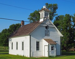 District No. 107 Schoollisted 2018
Population over time
2 figuresCorcoran grew from 5,379 to 6,185 between 2010 and 2020. These are the recorded population figures Wikidata holds for this place, reached through the Geographic Names Information System number this page is keyed on rather than by name, so they belong to this place and not to another of the same name. Most are census counts, but not all are: an early figure may be a founding or settlement estimate, and an estimate published within five years of a census is left out. The change column is computed, and is left blank where more than 20 years separate a figure from the one before it, because a gap that long is not a change between two counts.
| Year | People | Change |
|---|---|---|
| 2010 | 5,379 | |
| 2020 | 6,185 | +806 (+15%) |
Topographic sheets covering this place
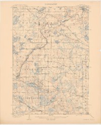
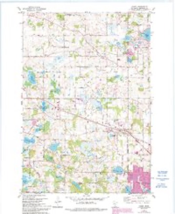
10 surveys from 15 printed sheetsMatched by testing this settlement's coordinate against the published boundary of every sheet in the United States Geological Survey's historical collection. Each opens the scanned sheet at the Survey.
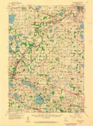
- 1909 USGS Rockford quadrangle1:62500, 2 printings
- 1953 USGS Stillwater quadrangle1:250000
- 1955 USGS Stillwater quadrangle1:250000
- 1958 USGS Rockford quadrangle1:62500, 2 printings
- 1958 USGS Stillwater quadrangle1:250000, 2 printings
- 1965 USGS Stillwater quadrangle1:250000
- 1975 USGS Stillwater quadrangle1:250000, 2 printings
- 1981 USGS Hamel quadrangle1:24000, 2 printings
- 1985 USGS Anoka quadrangle1:100000
- 1991 USGS Anoka quadrangle1:100000
In the county-history sources
7,933 words on this townshipHistory of Hennepin County and the City of Minneapolis, Including the Explorers and Pioneers of Minnesota, published 1881 names this settlement in its chapter on Corcoran City. These are the passages that mention it, exactly as the scans read.
The township of Corcoran is located in the north-western part of Hennepin county, and is boxmded on the north by Hassan, east by Maple Grove, south by Medina and west by Greenwood. Its surface is rolling, in the south part bluffy. It is heavily timbered with liard and soft maple, oak, elm and basswood. There are occasional patches of wild meadow-land, which produce a good quality of grass. Tlie soil is light in the south part, in the central part it is a heavy l)lack loam, and lighter in the north ]iart. witli a cla\ subsoil throughout. i>roducing wlieat, barley, oats and corn abundantly. Amber cane is grown to some extent. Jubert's Lake, the largest body of w^ater in the the town, is located on sections twenty-nine and thirty-two; there are two other small lakes that are lumamed, one located in the southern part, and the other in the western part of the town. '
Passage source: History of Hennepin County and the City of Minneapolis, Including the Explorers and Pioneers of Minnesota, published 1881.
Benjamin Pounder, was the first man to enter the unbroken wilderness, and connnenced in lHo-j to lay the foundation <if what is now the flourishing town of Corcoran. He was followed in a few days by P. B. Corcoran, one of the fomiders of the town. lie was accompanied by Morris Eyan, who died in 1878; his family still reside here.
Passage source: History of Hennepin County and the City of Minneapolis, Including the Explorers and Pioneers of Minnesota, published 1881.
Mr. P. B. Corcoran is one of those men who are justly entitled to more than a passing notii'c, and we regret that our limits will not jjermit. as much as we desire to write of this enterprising pioneer. He threaded his way on foot into this then wilderness, with but one hand to help him. having lost his right hand in a InnilxT-iiiill in the state of New York. With his left li;uid he stuck his stake on section twenty-three, and commenced to build around it, adding acre to acre until he now is the possessor of six hundred and forty (640) of them, wliich gradually yielded to his intelligent and aggressive strokes, until the wild stillness that siu'rounded him had been converteil into the busy hum of an intelligent and advancing civilization.
Passage source: History of Hennepin County and the City of Minneapolis, Including the Explorers and Pioneers of Minnesota, published 1881.
Machine-read from a century-old scan, so expect the errors a machine makes: misspelled names, dropped words, stray characters.
Read the whole chapter on Corcoran City - it names this place 35 more 35 times.
Fires near this place
10 since 2000Regional context, not property-specific evidence. The federal wildfire occurrence database lists 10 fires within 5 miles of Corcoran between 2000 and 2013, burning about 72 acres in total. None started naturally. 3 were recorded as arson. Distance is straight-line from the map coordinates, so a fire counted here may appear on a neighbouring settlement's page as well.
| Reported cause | Fires |
|---|---|
| Railroad operations and maintenance | 5 |
| Arson/incendiarism | 3 |
| Smoking | 1 |
| Debris and open burning | 1 |
The most recent of them, most recent first, with the day each was reported and the service that recorded it.
| Date | Cause | Size | Reported by | Name on the report |
|---|---|---|---|---|
| 3 May 2001 | Railroad operations and maintenance | under an acre | Minnesota Department of Natural Resources | not named |
| 3 May 2001 | Railroad operations and maintenance | under an acre | Minnesota Department of Natural Resources | not named |
| 3 May 2001 | Railroad operations and maintenance | under an acre | Minnesota Department of Natural Resources | not named |
| 3 May 2001 | Railroad operations and maintenance | under an acre | Minnesota Department of Natural Resources | not named |
| 3 May 2001 | Railroad operations and maintenance | under an acre | Minnesota Department of Natural Resources | not named |
| 1 May 2000 | Debris and open burning | 8.0 acres | Minnesota Department of Natural Resources | not named |
| 6 April 2012 | Smoking | 15 acres | Minnesota Department of Natural Resources | not named |
| 24 April 2007 | Arson/incendiarism | 16 acres | Minnesota Department of Natural Resources | not named |
Settlements close enough to share some of these fires:
Mines and quarries near this place
1 within 5 milesRegional context, not property-specific evidence. The federal mineral resources record lists 1 working within 5 miles of Corcoran: 1 producer. All of them still produce. What was taken out: Sand and Gravel, Construction. Distance is straight-line from the map coordinates, so a quarry counted here may appear on a neighbouring settlement's page as well.
| Where | Site | Commodity | Status | Recorded |
|---|---|---|---|---|
| Barton Pit No 704 | Sand and Gravel, Construction | Producer |
Storms near this place
16 since 1995Regional context, not property-specific evidence. The National Weather Service names Corcoran in 16 storm reports between 1995 and 2023: 6 thunderstorm wind, 4 hail, 2 funnel cloud, 2 heavy rain. No death or injury is recorded in these reports. Each account below is quoted exactly as the forecast office filed it, from the NOAA Storm Events Database, and each date opens the federal record of that event.
| When | Event | Place named | Harm | What the report says |
|---|---|---|---|---|
| September 2016 | Heavy Rain | Corcoran | - | A local trained weather observer measured 9.05 inches of rainfall in southwestern Maple Grove between Wednesday afternoon, September 21st, to the early morning of Thursday, September 22nd. |
| June 2015 | Hail | Corcoran | - | Numerous reports of large hail occurred between Corcoran and Maple Grove, southeast toward Highway 55. The largest hail stone was two inches in diameter. |
| June 2013 | Thunderstorm Wind | Corcoran | - | Measured at the public safety center. |
| May 2012 | Heavy Rain | Corcoran | - | A local observer measured 3.32 inches in the last 24 hours. |
| May 2011 | Hail | Corcoran | - | Hail fell at 93rd Street and Trail Haven. |
| May 2008 | Funnel Cloud | Corcoran | - | Funnel oscillated up and down while being observed. |
| September 2005 | Thunderstorm Wind | Corcoran | - | Signs were blown down at the intersection of County Road 116 and County Road 30. |
| June 2002 | Flash Flood | Corcoran | - | Three to five inches of rain resulted in the washout of one road and closure of two others. |
| May 1998 | Thunderstorm Wind | Corcoran | - | Roof blown off business. Police trailer toppled. |
| July 1995 | Tornado (F1) | Corcoran | - | Barn and garage destroyed. Garage roof found one-quarter mile away. Shown live on local television. |
| September 2023 | Thunderstorm Wind | Corcoran | - | no account filed |
| April 2021 | Hail | Corcoran | - | no account filed |
| May 2011 | Hail | Corcoran | - | no account filed |
| June 2003 | Funnel Cloud | Corcoran | - | no account filed |
| May 1996 | Thunderstorm Wind | Corcoran | - | no account filed |
| August 1996 | Thunderstorm Wind | Corcoran | - | no account filed |
Nearest settlements
The eight closest, with where each one stands in the county. Distances are straight-line, computed from the Geographic Names Information System coordinates.
| Map | Place | Distance | Sheets |
|---|---|---|---|
| Dupont | 2.7 miles | 15 | |
| Hamel | 3.9 miles | 15 | |
| Leighton | 4.4 miles | 15 | |
| Medina | 4.5 miles | 15 | |
| Maple Grove | 5.1 miles | 21 | |
| Burschville | 5.1 miles | 15 | |
| Fletcher | 5.3 miles | 15 | |
| Loretto | 5.4 miles | 15 |
Elsewhere
Matched on this settlement's Geographic Names Information System number rather than its name, so it cannot be a different place of the same name in another state.
| Wikipedia article on Corcoran | An encyclopaedic summary. Its text is share-alike, so it is linked here rather than copied. |
| Wikidata item Q1926997 | The structured record the population and elevation above come from. Public domain (CC0). |
Provenance
This settlement is recorded in the Geographic Names Information System as feature 641493. The sheet list is computed by point-in-boundary test against the United States Geological Survey's historical topographic inventory. Both are works of the United States government and carry no copyright under 17 U.S.C. 105.
Wildfire. Short, Karen C. 2022. Spatial wildfire occurrence data for the United States, 1992-2020 [FPA_FOD_20221014]. 6th Edition. Fort Collins, CO: Forest Service Research Data Archive. https://doi.org/10.2737/RDS-2013-0009.6 Collected with United States Government funding and usable without additional permissions or fees.
Mines and quarries. USGS Mineral Resources Data System (MRDS) https://mrdata.usgs.gov/mrds/ A work of the United States government, no copyright under 17 U.S.C. 105.
Storms. NOAA National Centers for Environmental Information, Storm Events Database https://www.ncei.noaa.gov/stormevents/ A work of the United States government, no copyright under 17 U.S.C. 105. Narratives are quoted verbatim from the National Weather Service report and are not edited or summarised.