 Block
Delano, Minnesota
12 topographic sheets cover this place, the earliest surveyed in 1953 and the latest in 1991. It stands in Delano City. It lies in ZIP code area 55328. The Survey maps it on the Delano quadrangle. 6,484 people lived here at the 2020 count. It stands 922 feet above sea level.
On record in Delano
Buildings and businesses the archive holds for this place. Each opens its own page, with the source record it came from.
On the National Register 4 records
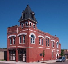 Delano Village Halllisted 1979
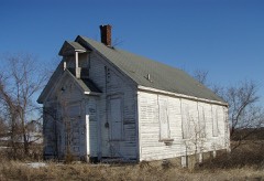 District No. 48 Schoollisted 1979
 Eagle Newspaper Officelisted 1979
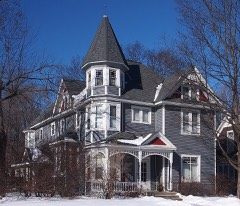 Simon Weldele Houselisted 1979
Population over time
2 figuresDelano grew from 5,464 to 6,484 between 2010 and 2020. These are the recorded population figures Wikidata holds for this place, reached through the Geographic Names Information System number this page is keyed on rather than by name, so they belong to this place and not to another of the same name. Most are census counts, but not all are: an early figure may be a founding or settlement estimate, and an estimate published within five years of a census is left out. The change column is computed, and is left blank where more than 20 years separate a figure from the one before it, because a gap that long is not a change between two counts.
| Year | People | Change |
|---|---|---|
| 2010 | 5,464 | |
| 2020 | 6,484 | +1,020 (+19%) |
Topographic sheets covering this place
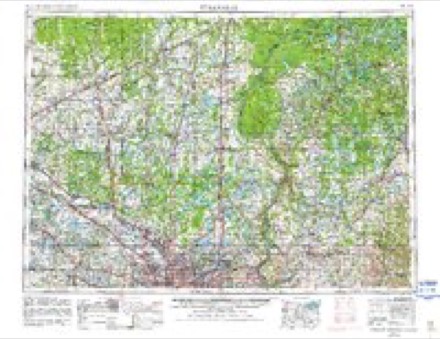
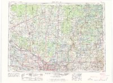
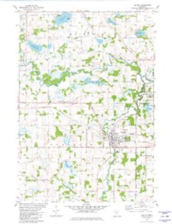
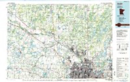
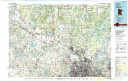
9 surveys from 12 printed sheetsMatched by testing this settlement's coordinate against the published boundary of every sheet in the United States Geological Survey's historical collection. Each opens the scanned sheet at the Survey.
- 1953 USGS Stillwater quadrangle1:250000
- 1955 USGS Stillwater quadrangle1:250000
- 1958 USGS Buffalo quadrangle1:62500, 2 printings
- 1958 USGS Stillwater quadrangle1:250000, 2 printings
- 1965 USGS Stillwater quadrangle1:250000
- 1975 USGS Stillwater quadrangle1:250000, 2 printings
- 1981 USGS Delano quadrangle1:24000
- 1985 USGS Anoka quadrangle1:100000
- 1991 USGS Anoka quadrangle1:100000
In the county-history sources
7,719 words on this townshipHistory of Wright County, Minnesota Volume II, published 1915 names this settlement in its chapter on Delano City. These are the passages that mention it, exactly as the scans read.
The first land claimant, James P. Lyle, who came on June 15, 1855, located a claim lying partly within the present village limits, and John E, Ellis, who came with Lyle when he took up his permanent residence here, secured the main part of what is now Delano, James and Samuel Padden and James B. White, who came at the same time, settled in the same vicinity.
Passage source: History of Wright County, Minnesota Volume II, published 1915.
The first school was taught by John C. Ellis, in 1858, in the claim shanty which stood on the line between the Ellis and White pre-emptions. Later a log schoolhouse was erected near the mill block, and Stella Strickland taught the first school. In 1870 a two-story frame building, 26 by 40, was erected on the corner of Bim and Second streets. In 1882 a large building was erected.
Passage source: History of Wright County, Minnesota Volume II, published 1915.
The old grain house with a capacity of 8,000 bushels was one of the Davidson chain of elevators and was built soon after Delano was founded. It was bought by W. H. Landis and later rented to Louis Rausch. The Delano Elevator Co. was organized May 5, 1881, with a capital stock of $10,000, and the following officers: President, I. Gutzwiller, Jr.; secretary and treasurer, C. G, Roosen; trustees, John Coolen, Charles Eppel and John Haffner. An elevator was erected having a capacity of 32,000 bushels. In 1881, John Charles put up a hotel, and John W. Connole and P. B. O'Loughlin erected a store nearby, Mr. O'Loughlin being the postmaster.
Passage source: History of Wright County, Minnesota Volume II, published 1915.
Machine-read from a century-old scan, so expect the errors a machine makes: misspelled names, dropped words, stray characters.
Read the whole chapter on Delano City - it names this place 8 more 8 times.
Fires near this place
6 since 2000Regional context, not property-specific evidence. The federal wildfire occurrence database lists 6 fires within 5 miles of Delano between 2000 and 2012, burning about 116 acres in total. None started naturally. None was recorded as arson. Distance is straight-line from the map coordinates, so a fire counted here may appear on a neighbouring settlement's page as well.
| Reported cause | Fires |
|---|---|
| Railroad operations and maintenance | 4 |
| Missing data/not specified/undetermined | 2 |
The most recent of them, most recent first, with the day each was reported and the service that recorded it.
| Date | Cause | Size | Reported by | Name on the report |
|---|---|---|---|---|
| 8 April 2012 | Missing data/not specified/undetermined | 17 acres | Minnesota Department of Natural Resources | not named |
| 26 March 2007 | Railroad operations and maintenance | under an acre | Minnesota Department of Natural Resources | not named |
| 26 March 2007 | Railroad operations and maintenance | under an acre | Minnesota Department of Natural Resources | not named |
| 26 March 2007 | Railroad operations and maintenance | 87 acres | Minnesota Department of Natural Resources | LAKE SARAH |
| 26 March 2007 | Railroad operations and maintenance | 3.2 acres | Minnesota Department of Natural Resources | not named |
| 21 October 2000 | Missing data/not specified/undetermined | 8.0 acres | Minnesota Department of Natural Resources | not named |
Settlements close enough to share some of these fires:
Mines and quarries near this place
2 within 5 milesRegional context, not property-specific evidence. The federal mineral resources record lists 2 workings within 5 miles of Delano: 2 producers. All of them still produce. What was taken out: Granite, Sand and Gravel, Construction. Distance is straight-line from the map coordinates, so a quarry counted here may appear on a neighbouring settlement's page as well.
| Where | Site | Commodity | Status | Recorded |
|---|---|---|---|---|
| Delano Granite Works Plant | Granite | Producer | ||
| Hanover Pit | Sand and Gravel, Construction | Producer |
Storms near this place
58 since 1993Regional context, not property-specific evidence. The National Weather Service names Delano in 58 storm reports between 1993 and 2025: 27 hail, 24 thunderstorm wind, 2 tornado, 2 heavy rain. No death or injury is recorded in these reports. Each account below is quoted exactly as the forecast office filed it, from the NOAA Storm Events Database, and each date opens the federal record of that event.
| When | Event | Place named | Harm | What the report says |
|---|---|---|---|---|
| June 2002 | Tornado (F1) | Delano | $50,000 | Tornado touched down briefly, knocking down trees and damaging two houses. One house had a roof blown off while the other had damage to siding and shingles. |
| July 2016 | Thunderstorm Wind | Delano | $25,000 | A metal roof was blown off a barn, with several large trees and power lines blown down south of Delano. |
| September 2023 | Thunderstorm Wind | Delano | - | A storm survey determined damaging winds accompanied a brief tornado. The damaging winds were offset south and east of the tornado path. At least two dozen trees were downed. |
| September 2023 | Tornado (EF0) | Delano | - | A brief tornado touched down just south of the intersection of Wright County Road 14 and 30th Street Southeast. The tornado tracked northeast and mainly uprooted or broke over 100 trees, most of them at one farmstead. A storm survey was conducted and maximum winds were estimated at 85 mph. |
| May 2022 | Thunderstorm Wind | Delano | - | Numerous trees were blown down near Delano. |
| March 2019 | Flood | Delano | - | Numerous roads were closed for several days due to snow melt, and the flood waters that develop from it. Rapidly runoff led to impassable roads, especially along streams and creeks along county roads. |
| June 2019 | Thunderstorm Wind | Delano | - | A social media picture posted a large tree that was blown down in Delano. |
| August 2019 | Hail | Delano | - | The four inch diameter hailstone was measured with a ruler, and posted on social media. |
| August 2019 | Hail | Delano | - | A picture from social media with the baseball sized hailstone. |
| August 2019 | Hail | Delano | - | There were numerous pictures from social media on the large hailstone. |
| August 2016 | Thunderstorm Wind | Delano | - | Windows were damaged near Delano. |
| August 2016 | Thunderstorm Wind | Delano | - | Several large oak trees were blown down, some of which were severed 15 feet above the ground near Delano. |
| June 2014 | Flood | Delano | - | Several sources in Wright County compiled a summary of flood related damages and locations for the flood of June 2014. The Crow River At Delano rose to its highest level in 50 years. The primary impacts were flooding of low-level roads and minor basement flooding that begun to affect homes closest to the river. In addition, several parks were closed. |
| June 2014 | Heavy Rain | Delano | - | A 24 hour rainfall total of 4.60 inches was reported. |
| June 2013 | Thunderstorm Wind | Delano | - | Several large trees and branches were blown down in eastern Wright County, with the worst area in the far northeast. |
| May 2012 | Heavy Rain | Delano | - | A local observer measured 5.20 inches in the last 24 hours. |
| May 2011 | Hail | Delano | - | Located in downtown Rockford. |
| May 2011 | Hail | Delano | - | Located in Rockford, near Highway 55 and Main Street. |
| July 2008 | Thunderstorm Wind | Delano | - | Eight inch diameter branches severed. A two foot diameter and a one foot diameter tree toppled. |
| July 2008 | Thunderstorm Wind | Delano | - | Eight inch branch and two foot diameter tree downed over road. |
| July 2008 | Thunderstorm Wind | Delano | - | Three to 4 inch branches severed. |
| July 2008 | Thunderstorm Wind | Delano | - | Strong winds bending trees over. |
| June 2007 | Thunderstorm Wind | Delano | - | Several six inch branches down one mile northeast of Rockford. |
| July 2006 | Thunderstorm Wind | Delano | - | Trees down. |
| September 2005 | Thunderstorm Wind | Delano | - | A few trees were downed north of Highway 12 and East of Highway 14 on the south end of Cook's Lake. |
| September 2005 | Thunderstorm Wind | Delano | - | A shed was blown apart and a tree was downed onto 44th Street in Franklin Township outside of Delano. |
| June 2002 | Thunderstorm Wind | Delano | - | Few trees down. |
| June 2002 | Thunderstorm Wind | Delano | - | Few trees and power lines down. |
| July 1999 | Hail | Delano | - | Occurred in the city of Rockford on the Wright County side. |
| July 1999 | Thunderstorm Wind | Delano | - | Trees toppled. Winds estimated. |
| July 1997 | Thunderstorm Wind | Delano | - | Roof damage to high school. Numerous large trees blown down onto homes and power lines. Estimated windspeed. |
| July 1997 | Thunderstorm Wind | Delano | - | Trees down. Estimated windspeed. |
| July 1997 | Thunderstorm Wind | Delano | - | Barn destroyed. Scattered damage across southeastern Wright county. Estimated windspeed. |
| July 1994 | Thunderstorm Wind | Delano | - | Several large trees were blown down. |
| September 2025 | Hail | Delano | - | no account filed |
| August 2023 | Hail | Delano | - | no account filed |
| August 2019 | Hail | Delano | - | no account filed |
| May 2018 | Hail | Delano | - | no account filed |
| June 2017 | Hail | Delano | - | no account filed |
| June 2016 | Hail | Delano | - | no account filed |
| August 2016 | Hail | Delano | - | no account filed |
| July 2015 | Hail | Delano | - | no account filed |
| June 2013 | Hail | Delano | - | no account filed |
| August 2013 | Hail | Delano | - | no account filed |
| August 2013 | Hail | Delano | - | no account filed |
| May 2011 | Hail | Delano | - | no account filed |
| May 2011 | Hail | Delano | - | no account filed |
| May 2011 | Hail | Delano | - | no account filed |
| July 2008 | Hail | Delano | - | no account filed |
| September 2007 | Hail | Delano | - | no account filed |
| April 2007 | Hail | Delano | - | no account filed |
| June 2007 | Hail | Delano | - | no account filed |
| July 2006 | Hail | Delano | - | no account filed |
| May 2006 | Hail | Delano | - | no account filed |
| September 2000 | Hail | Delano | - | no account filed |
| July 1997 | Flash Flood | Delano | - | no account filed |
| August 1996 | Thunderstorm Wind | Delano | - | no account filed |
| August 1993 | Thunderstorm Wind | Delano | - | no account filed |
Nearest settlements
The eight closest, with where each one stands in the county. Distances are straight-line, computed from the Geographic Names Information System coordinates.
| Map | Place | Distance | Sheets |
|---|---|---|---|
| Rockford Riverview Estates | 3.8 miles | 15 | |
| Rockford | 4.3 miles | 15 | |
| Montrose | 6.7 miles | 12 | |
| Waverly | 9.5 miles | 12 | |
| Buffalo Manor East | 9.9 miles | 12 | |
| Bufflao Manor | 9.9 miles | 12 | |
| Buffalo | 10.1 miles | 12 | |
| Hanover | 10.2 miles | 15 |
Elsewhere
Matched on this settlement's Geographic Names Information System number rather than its name, so it cannot be a different place of the same name in another state.
| Wikipedia article on Delano | An encyclopaedic summary. Its text is share-alike, so it is linked here rather than copied. |
| Wikidata item Q1926976 | The structured record the population and elevation above come from. Public domain (CC0). |
Provenance
This settlement is recorded in the Geographic Names Information System as feature 642749. The sheet list is computed by point-in-boundary test against the United States Geological Survey's historical topographic inventory. Both are works of the United States government and carry no copyright under 17 U.S.C. 105.
Wildfire. Short, Karen C. 2022. Spatial wildfire occurrence data for the United States, 1992-2020 [FPA_FOD_20221014]. 6th Edition. Fort Collins, CO: Forest Service Research Data Archive. https://doi.org/10.2737/RDS-2013-0009.6 Collected with United States Government funding and usable without additional permissions or fees.
Mines and quarries. USGS Mineral Resources Data System (MRDS) https://mrdata.usgs.gov/mrds/ A work of the United States government, no copyright under 17 U.S.C. 105.
Storms. NOAA National Centers for Environmental Information, Storm Events Database https://www.ncei.noaa.gov/stormevents/ A work of the United States government, no copyright under 17 U.S.C. 105. Narratives are quoted verbatim from the National Weather Service report and are not edited or summarised.