 Block
Montrose, Minnesota
12 topographic sheets cover this place, the earliest surveyed in 1953 and the latest in 1991. It stands in Montrose City. It lies in ZIP code area 55363. The Survey maps it on the Waverly quadrangle. 3,775 people lived here at the 2020 count. It stands 994 feet above sea level.
On record in Montrose
Buildings and businesses the archive holds for this place. Each opens its own page, with the source record it came from.
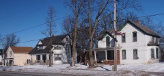
On the National Register 1 record
Population over time
2 figuresMontrose grew from 2,847 to 3,775 between 2010 and 2020. These are the recorded population figures Wikidata holds for this place, reached through the Geographic Names Information System number this page is keyed on rather than by name, so they belong to this place and not to another of the same name. Most are census counts, but not all are: an early figure may be a founding or settlement estimate, and an estimate published within five years of a census is left out. The change column is computed, and is left blank where more than 20 years separate a figure from the one before it, because a gap that long is not a change between two counts.
| Year | People | Change |
|---|---|---|
| 2010 | 2,847 | |
| 2020 | 3,775 | +928 (+33%) |
Topographic sheets covering this place
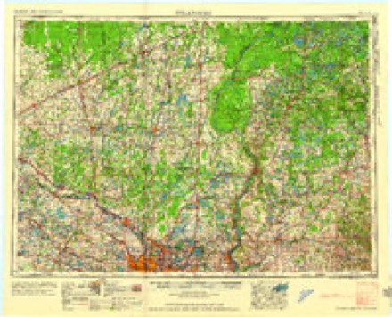
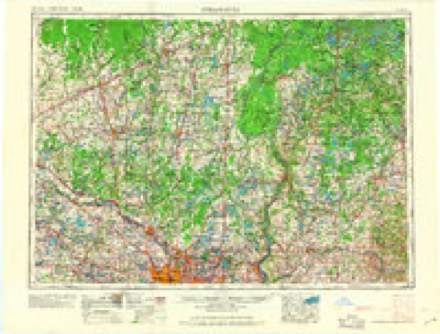
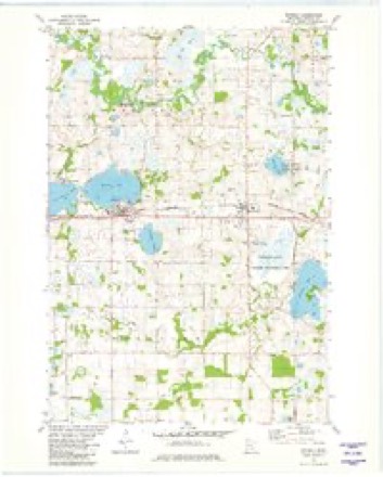
9 surveys from 12 printed sheetsMatched by testing this settlement's coordinate against the published boundary of every sheet in the United States Geological Survey's historical collection. Each opens the scanned sheet at the Survey.
- 1953 USGS Stillwater quadrangle1:250000
- 1955 USGS Stillwater quadrangle1:250000
- 1958 USGS Buffalo quadrangle1:62500, 2 printings
- 1958 USGS Stillwater quadrangle1:250000, 2 printings
- 1965 USGS Stillwater quadrangle1:250000
- 1975 USGS Stillwater quadrangle1:250000, 2 printings
- 1981 USGS Waverly quadrangle1:24000
- 1985 USGS Anoka quadrangle1:100000
- 1991 USGS Anoka quadrangle1:100000
In the county-history sources
1,126 words on this townshipHistory of Wright County, Minnesota Volume II, published 1915 names this settlement in its chapter on Montrose City. These are the passages that mention it, exactly as the scans read.
Montrose was surveyed and platted in 1878 by J. F. Miller, T. S. Gunn and J, N, Haven, The plat included the southwest quarter of section 35 and the southwest quarter of section 36, The proprietors opened a grain house and a general store and did a big business in grain, lumber and ties.
Passage source: History of Wright County, Minnesota Volume II, published 1915.
Edward P. Hawkins, M. D., physician and surgeon of Montrosé, is one of the most useful citizens in Wright county, and his general practice, his hospital and his training school, have done much to alleviate suffering, lengthen life, and promote sanitation. He was born in Carthage, Ill, August 9, 1863, son of William R. and Julia (Wright) Hawkins. He received his preparatory education in the schools of his native town. In 1887 he graduated from the Adventist College, at Battle Creek, Mich. With the class of 1897 he completed his course in the medical department of the University of Michigan, at Ann Arbor. In the interim he had taught school for several years. In October, 1897, he located at Montrose, and opened an office. His suecess was assured from the start. His skill, his sympathy, his knowledge won him friends from many miles around, and his practice soon grew to large proportions. People from the country pleaded to be taken into his home for operations, and finally he established a hospital. As a natural outcome of this came the Incorporated Training School for Nurses, in which are six young ladies in training. Dr. Hawkins has a sightly residence, and a roomy hospital building, He is a skilled surgeon and is assisted in his operations by Dr. E. A. Warner, of Waverly. His head nurse is Christine Olson. Dr. Hawkins has traveled extensively, and has made wide research and deep studies. He has done good service as school officer and health office of Montrose, and has also served the village in other capacities. Dr. Hawkins was married January 15, 1889, to Vesta Miller, of Battle Creek, Mich., a classmate of his school days. They have an adopted daughter, Fern Leona.
Passage source: History of Wright County, Minnesota Volume II, published 1915.
The Montrose Hospital, with Dr. E. P. Hawkins as chief surgeon, is beautifully located in the pretty village of Montrose, in the center of a rural community noted for its healthful climate. Velvety lawns surround the Hawkins buildings, and sightly trees give shade and comfort. The hospital itself is equipped with the most modern methods of heating, lighting, ventilation and sanitation, and fitted with the most recent of scientific appliances, The institution was opened in March, 1903, in response to an immediate need for a place in the community where surgical cases could be treated amid the best surroundings. There are now twelve beds and six nurses. Only prospective surgical eases are admitted. Although a private hospital it is open for use by other physicians. In connection with the Montrose Hospital, the Montrose Training School for Nurses is maintained. It was incor. porated in 1914 with Dr. E. P. Hawkins as president; Dr. EB. A. Warner as vice president, and Mrs. E. P. Hawkins as secretary. Christine Olson is the head nurse. A full, three-year course of training is given,
Passage source: History of Wright County, Minnesota Volume II, published 1915.
Machine-read from a century-old scan, so expect the errors a machine makes: misspelled names, dropped words, stray characters.
Read the whole chapter on Montrose City - it names this place 2 more 2 times.
Fires near this place
2 since 2001Regional context, not property-specific evidence. The federal wildfire occurrence database lists 2 fires within 5 miles of Montrose between 2001 and 2012, burning about 81 acres in total. None started naturally. None was recorded as arson. Distance is straight-line from the map coordinates, so a fire counted here may appear on a neighbouring settlement's page as well.
| Reported cause | Fires |
|---|---|
| Missing data/not specified/undetermined | 1 |
| Debris and open burning | 1 |
The most recent of them, most recent first, with the day each was reported and the service that recorded it.
| Date | Cause | Size | Reported by | Name on the report |
|---|---|---|---|---|
| 8 April 2012 | Missing data/not specified/undetermined | 17 acres | Minnesota Department of Natural Resources | not named |
| 4 November 2001 | Debris and open burning | 64 acres | Minnesota Department of Natural Resources | not named |
Settlements close enough to share some of these fires:
Mines and quarries near this place
1 within 5 milesRegional context, not property-specific evidence. The federal mineral resources record lists 1 working within 5 miles of Montrose: 1 past producer. None of them still produces. What was taken out: Sand and Gravel, Construction. Distance is straight-line from the map coordinates, so a quarry counted here may appear on a neighbouring settlement's page as well.
| Where | Site | Commodity | Status | Recorded |
|---|---|---|---|---|
| Carlson Pit and Mill | Sand and Gravel, Construction | Past Producer |
Storms near this place
29 since 1999Regional context, not property-specific evidence. The National Weather Service names Montrose in 29 storm reports between 1999 and 2024: 15 hail, 11 thunderstorm wind, 2 heavy rain, 1 funnel cloud. No death or injury is recorded in these reports. Each account below is quoted exactly as the forecast office filed it, from the NOAA Storm Events Database, and each date opens the federal record of that event.
| When | Event | Place named | Harm | What the report says |
|---|---|---|---|---|
| June 2014 | Thunderstorm Wind | Montrose | $5,000 | Numerous trees were snapped off from about half way up. One tree landed on a trained spotter's house. |
| July 2024 | Thunderstorm Wind | Montrose | - | Several trees were downed. |
| June 2024 | Heavy Rain | Montrose | - | The storm total was 1.6 inches of rainfall. |
| September 2023 | Thunderstorm Wind | Montrose | - | Strong thunderstorm wind gusts brought down trees in part of Marysville Township, one mile northeast of Montrose. |
| May 2022 | Thunderstorm Wind | Montrose | - | Numerous trees were blown down northeast of Montrose. |
| June 2016 | Thunderstorm Wind | Montrose | - | A large tree was blown down across Highway 25, between Montrose and Watertown. |
| June 2016 | Hail | Montrose | - | There was a photo of 2 inch diameter hail near Montrose. |
| August 2016 | Thunderstorm Wind | Montrose | - | Numerous two foot diameter trees were blown down north of Montrose. |
| July 2015 | Thunderstorm Wind | Montrose | - | A large tree was blown over in Montrose. |
| May 2012 | Heavy Rain | Montrose | - | A local observer measured 3.83 inches in the last 24 hours. |
| August 2011 | Thunderstorm Wind | Montrose | - | A large tree brew down and blocked a road in Montrose. |
| July 2008 | Thunderstorm Wind | Montrose | - | A commerical greenhouse toppled over near County Road 12 and Highway 12. |
| June 2007 | Hail | Montrose | - | Hail occurred at the intersection of Highways 25 and 112. |
| September 2005 | Thunderstorm Wind | Montrose | - | A shed was blown down. Wind blown debris tore a gas meter off a house. |
| June 2004 | Hail | Montrose | - | The nickel sized hail stripped leaves and small branches from trees. |
| July 1999 | Thunderstorm Wind | Montrose | - | Trees toppled. Winds estimated. |
| September 2023 | Hail | Montrose | - | no account filed |
| April 2012 | Hail | Montrose | - | no account filed |
| May 2011 | Hail | Montrose | - | no account filed |
| June 2010 | Hail | Montrose | - | no account filed |
| August 2010 | Funnel Cloud | Montrose | - | no account filed |
| September 2007 | Hail | Montrose | - | no account filed |
| September 2007 | Hail | Montrose | - | no account filed |
| June 2007 | Hail | Montrose | - | no account filed |
| July 2006 | Hail | Montrose | - | no account filed |
| September 2005 | Hail | Montrose | - | no account filed |
| May 2002 | Hail | Montrose | - | no account filed |
| June 2002 | Hail | Montrose | - | no account filed |
| July 2000 | Hail | Montrose | - | no account filed |
Nearest settlements
The eight closest, with where each one stands in the county. Distances are straight-line, computed from the Geographic Names Information System coordinates.
| Map | Place | Distance | Sheets |
|---|---|---|---|
| Waverly | 2.9 miles | 12 | |
| Delano | 6.7 miles | 12 | |
| Oster | 7.0 miles | 11 | |
| Rassat | 7.4 miles | 12 | |
| Highland | 7.6 miles | 10 | |
| Buffalo | 7.6 miles | 12 | |
| Bufflao Manor | 8.1 miles | 12 | |
| Buffalo Manor East | 8.1 miles | 12 |
Elsewhere
Matched on this settlement's Geographic Names Information System number rather than its name, so it cannot be a different place of the same name in another state.
| Wikipedia article on Montrose | An encyclopaedic summary. Its text is share-alike, so it is linked here rather than copied. |
| Wikidata item Q2192163 | The structured record the population and elevation above come from. Public domain (CC0). |
Provenance
This settlement is recorded in the Geographic Names Information System as feature 648049. The sheet list is computed by point-in-boundary test against the United States Geological Survey's historical topographic inventory. Both are works of the United States government and carry no copyright under 17 U.S.C. 105.
Wildfire. Short, Karen C. 2022. Spatial wildfire occurrence data for the United States, 1992-2020 [FPA_FOD_20221014]. 6th Edition. Fort Collins, CO: Forest Service Research Data Archive. https://doi.org/10.2737/RDS-2013-0009.6 Collected with United States Government funding and usable without additional permissions or fees.
Mines and quarries. USGS Mineral Resources Data System (MRDS) https://mrdata.usgs.gov/mrds/ A work of the United States government, no copyright under 17 U.S.C. 105.
Storms. NOAA National Centers for Environmental Information, Storm Events Database https://www.ncei.noaa.gov/stormevents/ A work of the United States government, no copyright under 17 U.S.C. 105. Narratives are quoted verbatim from the National Weather Service report and are not edited or summarised.