 Block
Delhi, Minnesota
11 topographic sheets cover this place, the earliest surveyed in 1952 and the latest in 1986. It stands in Delhi Township. It lies in ZIP code area 56283. The Survey maps it on the Delhi quadrangle. 46 people lived here at the 2020 count. It stands 1,030 feet above sea level.
On record in Delhi
Buildings and businesses the archive holds for this place. Each opens its own page, with the source record it came from.
On the National Register 1 record
- Delhi Coronet Band Halllisted 1984
Population over time
2 figuresDelhi fell from 70 to 46 between 2010 and 2020. These are the recorded population figures Wikidata holds for this place, reached through the Geographic Names Information System number this page is keyed on rather than by name, so they belong to this place and not to another of the same name. Most are census counts, but not all are: an early figure may be a founding or settlement estimate, and an estimate published within five years of a census is left out. The change column is computed, and is left blank where more than 20 years separate a figure from the one before it, because a gap that long is not a change between two counts.
| Year | People | Change |
|---|---|---|
| 2010 | 70 | |
| 2020 | 46 | -24 (-34%) |
Topographic sheets covering this place
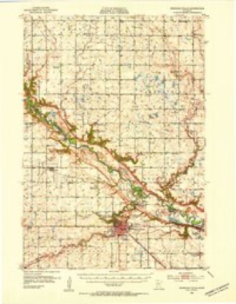
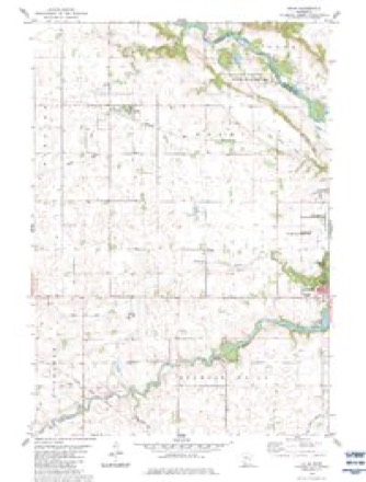
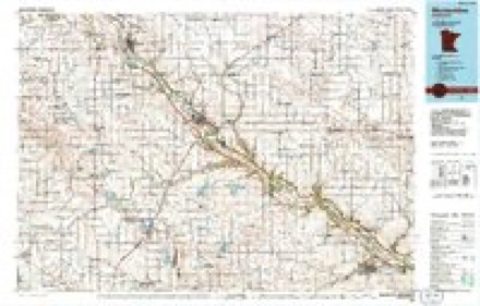
7 surveys from 11 printed sheetsMatched by testing this settlement's coordinate against the published boundary of every sheet in the United States Geological Survey's historical collection. Each opens the scanned sheet at the Survey.
- 1952 USGS Redwood Falls quadrangle1:62500, 2 printings
- 1953 USGS New Ulm quadrangle1:250000, 3 printings
- 1957 USGS New Ulm quadrangle1:250000
- 1958 USGS New Ulm quadrangle1:250000
- 1967 USGS New Ulm quadrangle1:250000
- 1983 USGS Delhi quadrangle1:24000
- 1986 USGS Montevideo quadrangle1:100000, 2 printings




In the county-history sources
3,253 words on this townshipThe History of Redwood County, Minnesota, published 1916 names this settlement in its chapter on Delhi Township. These are the passages that mention it, exactly as the scans read.
Delhi township is located on the north-central border of Redwood county, and comprises Congressional fractional townships 113-36 and 114-36. It is bounded on the north by the Minnesota river, on the east by Honner, on the west by Kintire, and on the south by Redwood Palls, and half a mile of Sheridan, due to the irregularity of half a mile in the survey. Ramsey creek crosses it on the southern side, and Rice creek flows northeast in the northwest part of this township. The surface is rolling and well-watered. The Pacific division of the Minneapolis and St. Louis passes through the center from east to west. The only village is Delhi with a population in 1910 of 174. The trading centers are Delhi and Redwood Falls. There are three schoolhouses. The predominating nationality is American and Scotch, the township being the center of the Scotch settlement in Redwood comity.
Passage source: The History of Redwood County, Minnesota, published 1916.
Beginning with the organization of the county, Delhi was considered a part of Redwood Falls. Delhi township was created February 1, 1878, and consisted of all of township 113-36 in this county. Fractional township 114-36 (which since September 4, 1872, had been a part of Swedes Forest) was added to Delhi, May 11, 1880, thus giving it its present boundaries.
Passage source: The History of Redwood County, Minnesota, published 1916.
Honner township is located on the north side of Redwood county and embraces the Congressional fractional township 113-35 and fractional section 31, township 113-34 and east by the Minnesota river on the west by Delhi, and on the south by Paxton, also Redwood Falls there being a variation of half a mile made in the survey. Little Crow creek crosses it on the eastern side and empties into the Minnesota river. The Redwood river crosses the northwest corner of it and also empties into the Minnesota river. The Pacific division of the Minneapolis and St. Louis crosses this township passing in a northwesterly direction. The surface is partly rolling and partly level. The northeast part of Redwood Falls city is located in this township. The village of North Redwood is located near the place where the Redwood river joins the Minnesota. The trading centers are Redwood Falls, in Redwood county, and Morton in Renville county. There is one school house. The predominating nationality is German and American.
Passage source: The History of Redwood County, Minnesota, published 1916.
Machine-read from a century-old scan, so expect the errors a machine makes: misspelled names, dropped words, stray characters.
Read the whole chapter on Delhi Township - it names this place 7 more 7 times.
Mines and quarries near this place
1 within 5 milesRegional context, not property-specific evidence. The federal mineral resources record lists 1 working within 5 miles of Delhi: 1 unknown. None of them still produces. What was taken out: Gold. Distance is straight-line from the map coordinates, so a quarry counted here may appear on a neighbouring settlement's page as well.
| Where | Site | Commodity | Status | Recorded |
|---|---|---|---|---|
| Delhi Prospect | Gold | Unknown | Gold |
Storms near this place
7 since 2008Regional context, not property-specific evidence. The National Weather Service names Delhi in 7 storm reports between 2008 and 2018: 2 thunderstorm wind, 1 hail, 1 flood, 1 funnel cloud. No death or injury is recorded in these reports. Each account below is quoted exactly as the forecast office filed it, from the NOAA Storm Events Database, and each date opens the federal record of that event.
| When | Event | Place named | Harm | What the report says |
|---|---|---|---|---|
| July 2018 | Flash Flood | Delhi | $500,000 | Numerous reports of flash flooding occurred across Redwood County from Belview in the far north, to Walnut Grove and Lamberton in the far south. The town of Wabasso had so much water that baseball fields were covered in a few inches of water. Over 50 township and county roads were impassable during the height of the flood waters. Once the flash flooding part of the storm abated, river flooding took over with river cresting to near or record levels. |
| August 2010 | Thunderstorm Wind | Delhi | $15,000 | Several trees and power lines were blown down. |
| June 2016 | Thunderstorm Wind | Delhi | - | Several large tree branches, up to six inches in diameter, were severed near County Road 6, north of Delhi. |
| June 2014 | Heavy Rain | Delhi | - | A 48 hour rainfall total of 4.60 inches was reported. |
| March 2011 | Flood | Delhi | - | Several county roads and U.S. Highways became impassable due to Spring snow melt and the associated runoff that continued through the end of the month. The worst areas were along the Redwood and Cottonwood Rivers, and their tributaries. |
| June 2008 | Hail | Delhi | - | Relayed by meteorologist at Weather Eye Radio. |
| April 2012 | Funnel Cloud | Delhi | - | no account filed |
Nearest settlements
The eight closest, with where each one stands in the county. Distances are straight-line, computed from the Geographic Names Information System coordinates.
| Map | Place | Distance | Sheets |
|---|---|---|---|
| Belview | 6.3 miles | 9 | |
| Redwood Falls | 6.5 miles | 13 | |
| North Redwood | 6.7 miles | 13 | |
| Seaforth | 10.4 miles | 10 | |
| Vesta | 12.6 miles | 9 | |
| Wabasso | 13.8 miles | 10 | |
| Rowena | 14.8 miles | 9 | |
| Gilfillan | 15.0 miles | 10 |
Elsewhere
Matched on this settlement's Geographic Names Information System number rather than its name, so it cannot be a different place of the same name in another state.
| Wikipedia article on Delhi | An encyclopaedic summary. Its text is share-alike, so it is linked here rather than copied. |
| Wikidata item Q1924781 | The structured record the population and elevation above come from. Public domain (CC0). |
Provenance
This settlement is recorded in the Geographic Names Information System as feature 642755. The sheet list is computed by point-in-boundary test against the United States Geological Survey's historical topographic inventory. Both are works of the United States government and carry no copyright under 17 U.S.C. 105.
Mines and quarries. USGS Mineral Resources Data System (MRDS) https://mrdata.usgs.gov/mrds/ A work of the United States government, no copyright under 17 U.S.C. 105.
Storms. NOAA National Centers for Environmental Information, Storm Events Database https://www.ncei.noaa.gov/stormevents/ A work of the United States government, no copyright under 17 U.S.C. 105. Narratives are quoted verbatim from the National Weather Service report and are not edited or summarised.