 Block
Redwood Falls, Minnesota
13 topographic sheets cover this place, the earliest surveyed in 1952 and the latest in 1992. It stands in Redwood Falls City. It lies in ZIP code area 56283. It stands on Ramsey Creek. The Survey maps it on the Redwood Falls quadrangle. 5,102 people lived here at the 2020 count. It stands 1,040 feet above sea level.
Research this city
On record in Redwood Falls
Buildings and businesses the archive holds for this place. Each opens its own page, with the source record it came from.
On the National Register 7 records
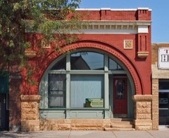 Bank of Redwood Falls Buildinglisted 1980
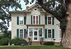 H. D. Chollar Houselisted 1980
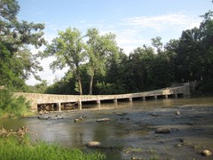 Ramsey Park Swayback Bridgelisted 1980
 Redwood Falls Carnegie Librarylisted 1980
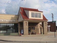 Scenic City Cooperative Oil Companylisted 1980
- Gilfillanlisted 1980
- Redwood Falls Retaining Wall Roadside Development Projectlisted 2012
Population over time
2 figuresRedwood Falls fell from 5,254 to 5,102 between 2010 and 2020. These are the recorded population figures Wikidata holds for this place, reached through the Geographic Names Information System number this page is keyed on rather than by name, so they belong to this place and not to another of the same name. Most are census counts, but not all are: an early figure may be a founding or settlement estimate, and an estimate published within five years of a census is left out. The change column is computed, and is left blank where more than 20 years separate a figure from the one before it, because a gap that long is not a change between two counts.
| Year | People | Change |
|---|---|---|
| 2010 | 5,254 | |
| 2020 | 5,102 | -152 (-3%) |
Topographic sheets covering this place
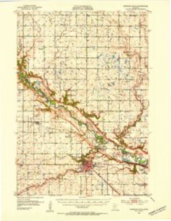
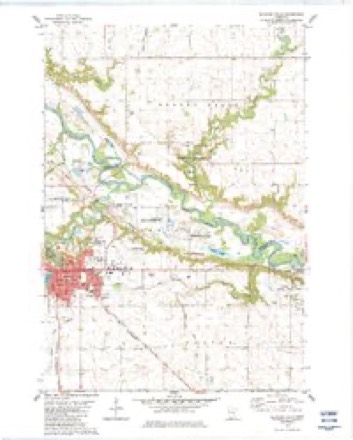
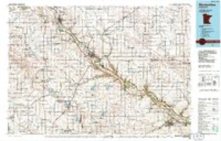
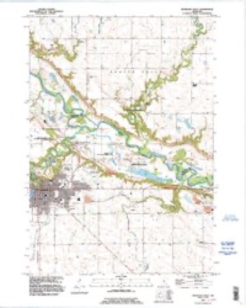
8 surveys from 13 printed sheetsMatched by testing this settlement's coordinate against the published boundary of every sheet in the United States Geological Survey's historical collection. Each opens the scanned sheet at the Survey.
- 1952 USGS Redwood Falls quadrangle1:62500, 2 printings
- 1953 USGS New Ulm quadrangle1:250000, 3 printings
- 1957 USGS New Ulm quadrangle1:250000
- 1958 USGS New Ulm quadrangle1:250000
- 1967 USGS New Ulm quadrangle1:250000
- 1982 USGS Redwood Falls quadrangle1:24000, 2 printings
- 1986 USGS Montevideo quadrangle1:100000, 2 printings
- 1992 USGS Redwood Falls quadrangle1:24000




In the county-history sources
4,866 words on this townshipThe History of Redwood County, Minnesota, published 1916 names this settlement in its chapter on Redwood Falls City. These are the passages that mention it, exactly as the scans read.
Redwood Falls is picturesquely located on the high banks of the Redwood river, about one mile south of the Minnesota river. It is the terminus of what is now known as the Sleepy Eye-Redwood Falls branch of the Chicago & North Western, but which when built in 1878 was called the Minnesota Valley division of the Winona & St. Peter.
Passage source: The History of Redwood County, Minnesota, published 1916.
The trees set out in the early days give the city the appearance of a settlement set in a beautiful grove, while the nearby parks have given to Redwood Falls the justly deserved title of "The Scenic City." The streets are well kept, the public buildings are unusually sightly, the churches are noted for their splendid architecture, the business houses are modern and progressive, the homes are attractively built and surrounded with lawns and shrubbery. From the earliest days, the city had been noted for its religious and educational activities, and the clean moral atmosphere of its social life.
Passage source: The History of Redwood County, Minnesota, published 1916.
A history of Redwood Falls would be incomplete without mentioning its incomparable system of waterworks and sewers. The water plant was installed in 1892, and consisted of four miles of 4, 6, 8 and 10-inch mains, a water tower with a capacity of 92,000 gallons, giving a gravity pressure of 47 pounds ; a power building, 40x80. in which are installed one Duplex non-condensing Gordon pump, 2,000,000 gallons capacity, one 80-horsepower Springfield boiler, with foundation and piped for a duplicate set of boiler and pumps, should necessity arise for more power. The station is 175 feet lower and one-half mile west of the tower, on one of the most beautiful reaches of the Redwood river. The source of supply is a number of springs that are collected in a gallery and are conducted to a receiving reesrvoir, from whence it is pumped to the tower as needed for fire purposes. Water is taken from the river and forced direct into mains, the tower being shut off by a combination electric and air valve. The spring water is strongly impregnated with magnesia with a trace of iron ; it is certainly the most wholesome water to be found anywhere in this part of the state, as no case of contagious disease has ever occurred where the people have used city water exclusively. It is absolutely free from all animal life. Since its installation the system has been gradually extended, and the extension is still going on. The principal parts of the city are covered, and as the city grows, the system is most admirably adapted to expansion.
Passage source: The History of Redwood County, Minnesota, published 1916.
Machine-read from a century-old scan, so expect the errors a machine makes: misspelled names, dropped words, stray characters.
Read the whole chapter on Redwood Falls City - it names this place 18 more 18 times.
Mines and quarries near this place
2 within 5 milesRegional context, not property-specific evidence. The federal mineral resources record lists 2 workings within 5 miles of Redwood Falls: 2 producers. All of them still produce. What was taken out: Kaolin, Clay. Distance is straight-line from the map coordinates, so a quarry counted here may appear on a neighbouring settlement's page as well.
| Where | Site | Commodity | Status | Recorded |
|---|---|---|---|---|
| Morton Pit | Kaolin | Producer | Gibbsite, Illite, Kaolinite, Montmorillonite, Quartz | |
| Norton Clay Pit | Clay | Producer |
Storms near this place
43 since 1995Regional context, not property-specific evidence. The National Weather Service names Redwood Falls in 43 storm reports between 1995 and 2020: 17 thunderstorm wind, 17 hail, 3 heavy rain, 2 flash flood. The reports record 1 death. Each account below is quoted exactly as the forecast office filed it, from the NOAA Storm Events Database, and each date opens the federal record of that event.
| When | Event | Place named | Harm | What the report says |
|---|---|---|---|---|
| September 2019 | Flood | Redwood Falls | 1 killed | The local police department reported that an individual had disappeared in the Redwood River near the 100 block of West Bridge Street and was presumed dead from drowning. |
| August 2017 | Flash Flood | Redwood Falls | $350,000 | Very heavy rainfall, and associated flooding led to numerous reports of basement flooding in Redwood Falls, and surrounding communities. Flood waters caused damage to roads and drainage systems. |
| March 2017 | Hail | Redwood Falls | $25,000 | Several reports of large hail occurred from south of Redwood Falls, north-northeast toward the Renville County line. The largest hail stone was 2 inches in diameter. There was damage to local vehicles and vinyl siding due to the hail. |
| May 2012 | Thunderstorm Wind | Redwood Falls | $25,000 | Several trees were blown down, and one half of a barn's roof was blown off. |
| September 2020 | Thunderstorm Wind | Redwood Falls | - | Several trees and power lines were blown down in Redwood Falls. |
| July 2018 | Heavy Rain | Redwood Falls | - | A measured rainfall report of 5.21 inches fell west of Redwood Falls in 24 hours. |
| July 2018 | Heavy Rain | Redwood Falls | - | A measured rainfall report of 8.20 inches fell west of Redwood Falls in 24 hours. |
| August 2017 | Thunderstorm Wind | Redwood Falls | - | Trees and power lines were blown down in Redwood Falls. |
| June 2014 | Heavy Rain | Redwood Falls | - | A local observer had a 12 hour rainfall report of 5.10 inches. |
| August 2012 | Thunderstorm Wind | Redwood Falls | - | A trained spotter measured a wind gust of 67 mph on the west side of Redwood Falls. |
| July 2011 | Thunderstorm Wind | Redwood Falls | - | In addition to the wind gust at the airport, hundreds of trees were reported uprooted throughout the city of Redwood Falls, Minnesota. |
| July 2011 | Thunderstorm Wind | Redwood Falls | - | The wind was measured at the Redwood Valley High School. |
| July 2011 | Thunderstorm Wind | Redwood Falls | - | The wind was measured on a car's anemometer. |
| June 2007 | Hail | Redwood Falls | - | One inch hail report relayed by KMSP-TV. |
| August 2007 | Flash Flood | Redwood Falls | - | Water flooded the intersection of Highway 67 and 68 in the city of Morgan. Water flowed out of ditches along Highway 71 near Redwood Falls. |
| March 2007 | Flood | Redwood Falls | - | Water flooded Ramsey Park, covering a road. |
| June 2006 | Thunderstorm Wind | Redwood Falls | - | Forty to fifty foot tall tree with a diameter larger then two feet felled. In twenty minutes 0.86 inches of rain fell. |
| September 2006 | Thunderstorm Wind | Redwood Falls | - | ASOS located at Redwood Falls airport on the east side of town. |
| July 2003 | Thunderstorm Wind | Redwood Falls | - | Numerous trees and power lines down. |
| August 2002 | Thunderstorm Wind | Redwood Falls | - | Numerous large branches down. Numerous tents blown down at the county fair. |
| September 2020 | Hail | Redwood Falls | - | no account filed |
| September 2020 | Hail | Redwood Falls | - | no account filed |
| September 2020 | Hail | Redwood Falls | - | no account filed |
| March 2017 | Hail | Redwood Falls | - | no account filed |
| June 2016 | Hail | Redwood Falls | - | no account filed |
| June 2016 | Hail | Redwood Falls | - | no account filed |
| August 2012 | Thunderstorm Wind | Redwood Falls | - | no account filed |
| August 2012 | Thunderstorm Wind | Redwood Falls | - | no account filed |
| August 2012 | Thunderstorm Wind | Redwood Falls | - | no account filed |
| June 2012 | Hail | Redwood Falls | - | no account filed |
| July 2011 | Hail | Redwood Falls | - | no account filed |
| July 2011 | Hail | Redwood Falls | - | no account filed |
| July 2011 | Thunderstorm Wind | Redwood Falls | - | no account filed |
| June 2005 | Hail | Redwood Falls | - | no account filed |
| June 2004 | Hail | Redwood Falls | - | no account filed |
| May 2002 | Hail | Redwood Falls | - | no account filed |
| May 2002 | Hail | Redwood Falls | - | no account filed |
| August 2002 | Hail | Redwood Falls | - | no account filed |
| June 1998 | Tornado (F0) | Redwood Falls | - | no account filed |
| June 1996 | Hail | Redwood Falls | - | no account filed |
| August 1996 | Funnel Cloud | Redwood Falls | - | no account filed |
| August 1996 | Thunderstorm Wind | Redwood Falls | - | no account filed |
| June 1995 | Thunderstorm Wind | Redwood Falls | - | no account filed |
Nearest settlements
The eight closest, with where each one stands in the county. Distances are straight-line, computed from the Geographic Names Information System coordinates.
Elsewhere
Matched on this settlement's Geographic Names Information System number rather than its name, so it cannot be a different place of the same name in another state.
| Wikipedia article on Redwood Falls | An encyclopaedic summary. Its text is share-alike, so it is linked here rather than copied. |
| Wikidata item Q1924130 | The structured record the population and elevation above come from. Public domain (CC0). |
Provenance
This settlement is recorded in the Geographic Names Information System as feature 649900. The sheet list is computed by point-in-boundary test against the United States Geological Survey's historical topographic inventory. Both are works of the United States government and carry no copyright under 17 U.S.C. 105.
Mines and quarries. USGS Mineral Resources Data System (MRDS) https://mrdata.usgs.gov/mrds/ A work of the United States government, no copyright under 17 U.S.C. 105.
Storms. NOAA National Centers for Environmental Information, Storm Events Database https://www.ncei.noaa.gov/stormevents/ A work of the United States government, no copyright under 17 U.S.C. 105. Narratives are quoted verbatim from the National Weather Service report and are not edited or summarised.