 Block
Essig, Minnesota
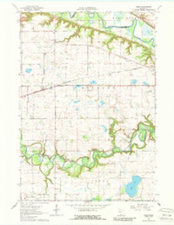
10 topographic sheets cover this place, the earliest surveyed in 1953 and the latest in 1991. It stands in Milford Township. It lies in ZIP code area 56073. The Survey maps it on the Essig quadrangle.
On record in Essig
Buildings and businesses the archive holds for this place. Each opens its own page, with the source record it came from.
On the National Register within a mile 2 records
The National Register names another town for these. They stand within one mile of this settlement's coordinate.
- Lampert Lumber Company Line Yardlisted 1979 · 0.1 miles away
- District No. 50 Schoollisted 2017 · 0.7 miles away
Topographic sheets covering this place
7 surveys from 10 printed sheetsMatched by testing this settlement's coordinate against the published boundary of every sheet in the United States Geological Survey's historical collection. Each opens the scanned sheet at the Survey.
- 1953 USGS New Ulm quadrangle1:250000, 3 printings
- 1957 USGS New Ulm quadrangle1:250000
- 1958 USGS New Ulm quadrangle1:250000
- 1964 USGS Essig quadrangle1:24000, 2 printings
- 1967 USGS New Ulm quadrangle1:250000
- 1986 USGS New Ulm quadrangle1:100000
- 1991 USGS New Ulm quadrangle1:100000




Fires near this place
1 since 2014Regional context, not property-specific evidence. The federal wildfire occurrence database lists 1 fire within 5 miles of Essig in 2014, burning about 4 acres in total. None started naturally. None was recorded as arson. Distance is straight-line from the map coordinates, so a fire counted here may appear on a neighbouring settlement's page as well.
| Reported cause | Fires |
|---|---|
| Railroad operations and maintenance | 1 |
The most recent of them, most recent first, with the day each was reported and the service that recorded it.
| Date | Cause | Size | Reported by | Name on the report |
|---|---|---|---|---|
| 7 April 2014 | Railroad operations and maintenance | 4.0 acres | Minnesota Department of Natural Resources | not named |
Settlements close enough to share some of these fires:
Mines and quarries near this place
1 within 5 milesRegional context, not property-specific evidence. The federal mineral resources record lists 1 working within 5 miles of Essig: 1 producer. All of them still produce. What was taken out: Sand and Gravel, Construction. Distance is straight-line from the map coordinates, so a quarry counted here may appear on a neighbouring settlement's page as well.
| Where | Site | Commodity | Status | Recorded |
|---|---|---|---|---|
| Schneider Pit | Sand and Gravel, Construction | Producer |
Storms near this place
16 since 1996Regional context, not property-specific evidence. The National Weather Service names Essig in 16 storm reports between 1996 and 2024: 6 tornado, 5 thunderstorm wind, 5 hail. No death or injury is recorded in these reports. Each account below is quoted exactly as the forecast office filed it, from the NOAA Storm Events Database, and each date opens the federal record of that event.
| When | Event | Place named | Harm | What the report says |
|---|---|---|---|---|
| June 2010 | Thunderstorm Wind | Essig | $300,000 | A barn, and two sheds west of New Ulm, Minnesota, were destroyed due to severe straight-line winds. |
| June 2008 | Tornado (EF1) | Essig | $100,000 | Photographed by storm chaser. The tornado destroyed a grain bin along with a few sheds and outbuildings. A pole barn had its roof partially removed. |
| August 2024 | Tornado (EFU) | Essig | - | A storm chaser took video of a tornado and a nearby resident confirmed its specific location. The tornado moved across open fields before dissipating. |
| August 2024 | Hail | Essig | - | Delayed report of picture from via social media, time estimated from radar. |
| August 2024 | Hail | Essig | - | Delayed report, time estimated from radar. |
| August 2021 | Thunderstorm Wind | Essig | - | A narrow path of crop damage, possibly related to a misovortex within a broader wind field, was identified using Sentinel satellite imagery. It was not possible to correlate the crop damage with any radar circulation. |
| August 2021 | Thunderstorm Wind | Essig | - | A narrow path of crop damage, possibly related to a misovortex within a broader wind field, was identified using Sentinel satellite imagery. It was not possible to correlate the crop damage with any radar circulation. |
| August 2021 | Tornado (EF0) | Essig | - | Track based on satellite imagery and damage survey. Time based on radar. Tornado knocked down large branches in a small grove at the end of its path. |
| August 2021 | Tornado (EFU) | Essig | - | Satellite image showed tornado path through corn that matched up with circulation on radar. Damage survey could not locate any downed branches or any other damage indicator. |
| June 2010 | Tornado (EF2) | Essig | - | Two farmsteads were hit near the intersection of 260th Street and County Road 10, with one receiving considerable damage. A barn was 2/3 destroyed, a harvestore silo was dented in about 70 feet off the ground, a corn crib was flattened, multiple wagons were displaced approximately 50 yards, and a wooden pole rated to 118 mph was cracked at the base. |
| June 2005 | Thunderstorm Wind | Essig | - | Trees were downed onto two mobile homes. |
| May 1998 | Thunderstorm Wind | Essig | - | Roof damage. Estimated windspeed. |
| October 2023 | Hail | Essig | - | no account filed |
| April 2005 | Hail | Essig | - | no account filed |
| May 2003 | Hail | Essig | - | no account filed |
| July 1996 | Tornado (F0) | Essig | - | no account filed |
Nearest settlements
The eight closest, with where each one stands in the county. Distances are straight-line, computed from the Geographic Names Information System coordinates.
| Map | Place | Distance | Sheets |
|---|---|---|---|
| Stark | 6.3 miles | 9 | |
| Traulich Estates | 6.4 miles | 11 | |
| Sleepy Eye | 6.6 miles | 9 | |
| Iberia | 7.6 miles | 9 | |
| New Ulm | 7.7 miles | 11 | |
| Searles | 11.2 miles | 9 | |
| Leavenworth | 12.6 miles | 9 | |
| Evan | 12.7 miles | 10 |
Provenance
This settlement is recorded in the Geographic Names Information System as feature 643416. The sheet list is computed by point-in-boundary test against the United States Geological Survey's historical topographic inventory. Both are works of the United States government and carry no copyright under 17 U.S.C. 105.
Wildfire. Short, Karen C. 2022. Spatial wildfire occurrence data for the United States, 1992-2020 [FPA_FOD_20221014]. 6th Edition. Fort Collins, CO: Forest Service Research Data Archive. https://doi.org/10.2737/RDS-2013-0009.6 Collected with United States Government funding and usable without additional permissions or fees.
Mines and quarries. USGS Mineral Resources Data System (MRDS) https://mrdata.usgs.gov/mrds/ A work of the United States government, no copyright under 17 U.S.C. 105.
Storms. NOAA National Centers for Environmental Information, Storm Events Database https://www.ncei.noaa.gov/stormevents/ A work of the United States government, no copyright under 17 U.S.C. 105. Narratives are quoted verbatim from the National Weather Service report and are not edited or summarised.