 Block
Sleepy Eye, Minnesota
9 topographic sheets cover this place, the earliest surveyed in 1953 and the latest in 1991. It stands in Home Township. It lies in ZIP code area 56085. The Survey maps it on the Sleepy Eye quadrangle. 3,452 people lived here at the 2020 count. It stands 1,024 feet above sea level.
On record in Sleepy Eye
Buildings and businesses the archive holds for this place. Each opens its own page, with the source record it came from.
On the National Register 5 records
 C. Berg's Hotellisted 2012
 Chicago and North Western Depotlisted 1992
 W. W. Smith Houselisted 1979
 Winona and St. Peter Freight Depotlisted 1979
- Sleepy Eye Milling Companylisted 1991
Population over time
2 figuresSleepy Eye fell from 3,599 to 3,452 between 2010 and 2020. These are the recorded population figures Wikidata holds for this place, reached through the Geographic Names Information System number this page is keyed on rather than by name, so they belong to this place and not to another of the same name. Most are census counts, but not all are: an early figure may be a founding or settlement estimate, and an estimate published within five years of a census is left out. The change column is computed, and is left blank where more than 20 years separate a figure from the one before it, because a gap that long is not a change between two counts.
| Year | People | Change |
|---|---|---|
| 2010 | 3,599 | |
| 2020 | 3,452 | -147 (-4%) |
Topographic sheets covering this place
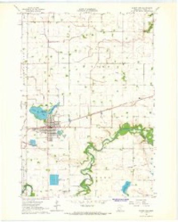
7 surveys from 9 printed sheetsMatched by testing this settlement's coordinate against the published boundary of every sheet in the United States Geological Survey's historical collection. Each opens the scanned sheet at the Survey.
- 1953 USGS New Ulm quadrangle1:250000, 3 printings
- 1957 USGS New Ulm quadrangle1:250000
- 1958 USGS New Ulm quadrangle1:250000
- 1964 USGS Sleepy Eye quadrangle1:24000
- 1967 USGS New Ulm quadrangle1:250000
- 1986 USGS New Ulm quadrangle1:100000
- 1991 USGS New Ulm quadrangle1:100000




Storms near this place
32 since 1996Regional context, not property-specific evidence. The National Weather Service names Sleepy Eye in 32 storm reports between 1996 and 2025: 17 thunderstorm wind, 10 hail, 2 tornado, 2 funnel cloud. No death or injury is recorded in these reports. Each account below is quoted exactly as the forecast office filed it, from the NOAA Storm Events Database, and each date opens the federal record of that event.
| When | Event | Place named | Harm | What the report says |
|---|---|---|---|---|
| June 2008 | Tornado (EF0) | Sleepy Eye | $100,000 | Photographed by storm chaser. The tornado destroyed a barn and an old shed. |
| June 1997 | Lightning | Sleepy Eye | $15,000 | Significant damage to farmhouse. |
| May 2025 | Funnel Cloud | Sleepy Eye | - | Multiple trained spotters provided photos of funnel cloud 5 miles SE of Sleepy Eye, MN. |
| June 2025 | Thunderstorm Wind | Sleepy Eye | - | Large tree branch down in Sleepy Eye MN. |
| October 2023 | Hail | Sleepy Eye | - | Reports of golf ball to tennis ball size hail damaged windshields 3 miles west of Sleepy Eye, MN. |
| May 2022 | Thunderstorm Wind | Sleepy Eye | - | Several trees were blown down near Sleepy Eye. |
| August 2021 | Thunderstorm Wind | Sleepy Eye | - | A narrow path of crop damage, possibly related to a misovortex within a broader wind field, was identified using Sentinel satellite imagery. It was not possible to correlate the crop damage with any radar circulation. |
| August 2021 | Thunderstorm Wind | Sleepy Eye | - | A narrow path of crop damage, possibly related to a misovortex within a broader wind field, was identified using Sentinel satellite imagery. It was not possible to correlate the crop damage with any radar circulation. |
| August 2021 | Thunderstorm Wind | Sleepy Eye | - | There were several trees and many large branches blown down in the south half of Sleepy Eye, just east if Highway 4. A few trees and branches fell on houses and vehicles. A damage survey by the NWS was inconclusive, as the damage had been cleaned up quickly. The south to north path did seem to broaden out somewhat. |
| June 2016 | Thunderstorm Wind | Sleepy Eye | - | A few trees were blown down in Sleepy Eye. |
| June 2016 | Thunderstorm Wind | Sleepy Eye | - | Several large tree branches were blown down in the southeast side of Sleepy Eye. Most of the damage was kept in an 8-9 block area in the far southeast side of town. |
| June 2015 | Thunderstorm Wind | Sleepy Eye | - | Crops were damaged due to severe straight line winds around Sleepy Eye. In addition, tree branches were blown down in the town of Sleepy Eye, which blocked part of Highway 4. |
| August 2013 | Thunderstorm Wind | Sleepy Eye | - | A large tree was blown down near Sleepy Eye. |
| June 2008 | Thunderstorm Wind | Sleepy Eye | - | Outflow from a thunderstorm knocked down a few trees. Leaves were plastered onto the side of two nearby houses. |
| April 2004 | Thunderstorm Wind | Sleepy Eye | - | A storm spotter reported a wind gust of 71 MPH. A vehicle was nearly blown off a road. |
| September 2004 | Thunderstorm Wind | Sleepy Eye | - | A few trees were downed. |
| May 2003 | Tornado (F0) | Sleepy Eye | - | Tornado touched down just west of an oats field, moved across a grassy field, crossed the Cottonwood River, then dissipated. There were a few broken trees near the Cottonwood River, but no damage was caused to any structure. The oats were just coming out of the ground and were laid down only for about 12 hours before returning to normal growth. |
| May 2003 | Funnel Cloud | Sleepy Eye | - | The first of three confirmed funnel clouds and one tornado on May 14 developed near Sleepy Eye. The airmass was very cold aloft, a weak surface trough was draped over south central Minnesota, and partly cloudy skies during the late morning hours enabled the development of scattered thunderstorms. |
| August 2002 | Thunderstorm Wind | Sleepy Eye | - | Several trees down, including one on roof. Fence knocked down. |
| July 2000 | Thunderstorm Wind | Sleepy Eye | - | Several large trees toppled. |
| June 1999 | Thunderstorm Wind | Sleepy Eye | - | Tree down across portion of Highway 4. Estimated Windspeed. |
| July 2024 | Hail | Sleepy Eye | - | no account filed |
| June 2016 | Hail | Sleepy Eye | - | no account filed |
| August 2013 | Hail | Sleepy Eye | - | no account filed |
| June 2005 | Hail | Sleepy Eye | - | no account filed |
| May 2004 | Hail | Sleepy Eye | - | no account filed |
| May 2000 | Hail | Sleepy Eye | - | no account filed |
| August 1999 | Hail | Sleepy Eye | - | no account filed |
| October 1998 | Hail | Sleepy Eye | - | no account filed |
| June 1998 | Thunderstorm Wind | Sleepy Eye | - | no account filed |
| May 1996 | Thunderstorm Wind | Sleepy Eye | - | no account filed |
| July 1996 | Hail | Sleepy Eye | - | no account filed |
Nearest settlements
The eight closest, with where each one stands in the county. Distances are straight-line, computed from the Geographic Names Information System coordinates.
| Map | Place | Distance | Sheets |
|---|---|---|---|
| Iberia | 4.3 miles | 9 | |
| Stark | 5.6 miles | 9 | |
| Leavenworth | 6.6 miles | 9 | |
| Essig | 6.6 miles | 10 | |
| Cobden | 6.7 miles | 10 | |
| Evan | 7.4 miles | 10 | |
| Traulich Estates | 12.9 miles | 11 | |
| Godahl | 13.7 miles | 9 |
Elsewhere
Matched on this settlement's Geographic Names Information System number rather than its name, so it cannot be a different place of the same name in another state.
| Wikipedia article on Sleepy Eye | An encyclopaedic summary. Its text is share-alike, so it is linked here rather than copied. |
| Wikidata item Q930939 | The structured record the population and elevation above come from. Public domain (CC0). |
Provenance
This settlement is recorded in the Geographic Names Information System as feature 652150. The sheet list is computed by point-in-boundary test against the United States Geological Survey's historical topographic inventory. Both are works of the United States government and carry no copyright under 17 U.S.C. 105.
Storms. NOAA National Centers for Environmental Information, Storm Events Database https://www.ncei.noaa.gov/stormevents/ A work of the United States government, no copyright under 17 U.S.C. 105. Narratives are quoted verbatim from the National Weather Service report and are not edited or summarised.