BlockBefore

Brown County, Minnesota

22 topographic sheets cover 16 settlements here, and 38 properties are on the National Register of Historic Places.

Research this county

From the record

“New Ulm was incorporated in March, 1857, and William Pfaender was elected its first president. Later it was incorporated as a borough, with Charles Roos as mayor. A city charter was granted New Ulm on February 24, 1876, with Charles Roos as mayor and Jacob Nix as clerk.”

Municipal History - History of Brown County, Minnesota: Its People, Industries and Institutions (Volume 1) (1916). Machine-read text.

38 National Register listings published here · the county-history sources tell 4 stories.

Sources: the county history on the Internet Archive · the National Register database, National Park Service

Minnesota within the United States
Brown County within Minnesota

What the record shows

  • 151 topographic sheet readings cover the county's settlements.
  • 38 properties here are on the National Register of Historic Places: 30 buildings, 6 districts, 1 structure and 1 site.
  • 28 of the 38 listings were added during the 1970s.
  • The Geographic Names Information System records 16 populated places in this county; 16 are covered by at least one topographic sheet.
  • 1 public-domain county history, 1916, supplies 6,037 words of narrative reproduced here.

What happened here

4 accounts

Among them: The First Comers; Municipal History. These passages come from the identified county-history source books. Each inset names its own source and opens the exact section it comes from.

From History of Brown County, Minnesota: Its People, Industries and Institutions (Volume 1), published 1916 - Comfrey City

The First Comers

The band of settlers which first dared to brave the hardships in this wild, undeveloped section of Brown county, in 1857, included the family of Jonathan F. Brown, who made a claim in section 22. The family was killed by the Indians in 1862, while trying to escape from the township. In the spring of 1858, J.

Read the rest of this passage

From History of Brown County, Minnesota: Its People, Industries and Institutions (Volume 1), published 1916 - New Ulm City

Municipal History

New Ulm was incorporated in March, 1857, and William Pfaender was elected its first president. Later it was incorporated as a borough, with Charles Roos as mayor. A city charter was granted New Ulm on February 24, 1876, with Charles Roos as mayor and Jacob Nix as clerk. Since the place was incorporated into a city the records are all intact, but on account of the Indian depredations during the massacre in August, 1862, the early village records were all destroyed or lost.

Read the rest of this passage

Places on the National Register

38

Every property in this county listed on the National Register of Historic Places, with the year it was listed and the federal nomination document.

Photograph PropertyType ListedReference
Bendixon-Schmid Housebuilding197979001218
C. Berg's Hotelbuilding201211001084
Bjorneberg Garagebuilding197979001197
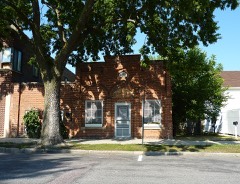
Boesch, Hummel, and Maltzahn Blockbuilding197979001201
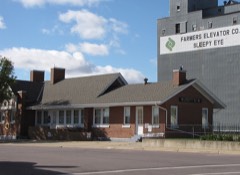
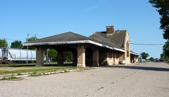
Chicago and North Western Depotbuilding199292000822
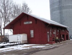
Chicago and North Western Railroad Depotbuilding197979001202
District No. 50 Schoolbuilding2017100000564
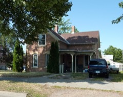
Bernard Fesenmaier Housebuilding197979001203
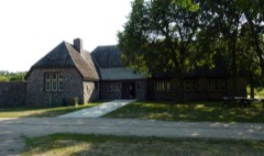
Flandrau State Park CCC/WPA/Rustic Style Historic Resourcesdistrict198989001658
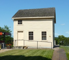
Wanda Gag Childhood Homebuilding197979001204
Grand Hotelbuilding199090000986
Hermann Monumentstructure197373000965
Frederick W. Kiesling Housebuilding197272000674
Kreitinger Garagebuilding197979001219
Lampert Lumber Company Line Yardbuilding197979001196
Liberal Union Hallbuilding197979001198
Gov. John Lind Housebuilding197474001005
Melges Bakerybuilding197474001006
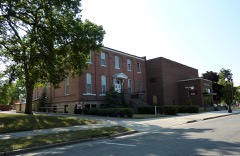
New Ulm Armorybuilding197979001205
New Ulm Commercial Historic Districtdistrict200505001438
New Ulm High Schoolbuilding201515000438
New Ulm Oil Company Service Stationbuilding197979001206
New Ulm Post Officebuilding197070000287
Nora Free Christian Churchbuilding198888001176
Adolph C. Ochs Housebuilding197979001220
Old Main, Dr. Martin Luther Collegebuilding197979001208
August Schell Brewing Companydistrict197474001007
Otto Schell Housebuilding197979001210
Shady Lane Stock Farmbuilding197979001221
Sleepy Eye Milling Companydistrict199191000038
W. W. Smith Housebuilding197979001211
South Broadway Historic Districtdistrict197979001212
South German Street Historic Districtdistrict197979001217
St. Michael's School and Conventbuilding197979001213
Thormodson Barnbuilding197979001199
Turner Hallbuilding197979001215
Way of the Cross, Thesite2020100004756
Winona and St. Peter Freight Depotbuilding197979001216

Wildfire, 2001 to 2020

15 fires

Every wildfire the federal occurrence database records inside this county: 15 of them, burning about 128 acres. None started naturally and 5 were recorded as arson. Each settlement page carries the fires within five miles of it.

Reported cause Fires
Arson/incendiarism5
Missing data/not specified/undetermined3
Debris and open burning3
Recreation and ceremony1
Smoking1
Equipment and vehicle use1
Railroad operations and maintenance1

The five largest, by the area the report gives. Three of them were set deliberately.

DateCause SizeReported by Name on the report
26 October 2014Arson/incendiarism50 acresMinnesota Department of Natural Resourcesnot named
13 November 2016Missing data/not specified/undetermined45 acresMinnesota Department of Natural Resourcesnot named
27 April 2013Missing data/not specified/undetermined23 acresMinnesota Department of Natural Resourcesnot named
7 April 2014Railroad operations and maintenance4.0 acresMinnesota Department of Natural Resourcesnot named
22 April 2020Arson/incendiarism2.5 acresMinnesota Department of Natural Resourcesnot named
1 July 2010Arson/incendiarism1.1 acresMinnesota Department of Natural Resourcesnot named
2 November 2007Equipment and vehicle use1.0 acresMinnesota Department of Natural Resourcesnot named
9 October 2003Debris and open burningunder an acreMinnesota Department of Natural Resourcesnot named

Every settlement page carries the fires within five miles of it - see the settlement index below.

Storms, 1952 to 2026

60 of 314 shown

The NOAA Storm Events Database holds 314 reports for this county, causing 1 death, 25 injuries and about $59,453,500 in recorded property damage. Each settlement page carries the reports that name it.

Kind of event Reports
Thunderstorm Wind139
Hail115
Tornado32
Flood10
Funnel Cloud5
Heavy Rain5
Lightning4
Flash Flood4

The most serious of them, by death, then injury, then recorded damage. The accounts are quoted exactly as the forecast office filed them.

WhenEvent Place namedHarm What the report says
March 1998Tornado (F4)Comfrey1 killed, 16 hurt, $45,000,000Tornado began 7 miles east of Avoca in Murray county, continued through Cottonwood, Brown, extreme Northwest Watonwan, Northwest Blue Earth, and finally lifted off 4 miles east of Courtland in Nicollet county. Total storm track was 67 miles. The tornado ripped through the village of Comfrey destroying a grain elevator and damaging 75% of the town. Much of downtown Comfrey destroyed including the town hall. School heavily damaged. 100 people made homeless. 50 homes destroyed. 130 farmsteads damaged or destroyed in Brown county. 500 dairy cows killed. One man critically injured in collapse of farmstead northwest of the town of Hanska. He died the next day. 35 buildings destroyed or damaged in far Northwest Blue Earth county. Damage estimate estimated. Property damage to extreme northwest Blue Earth county across Cambria township estimated at 2 million. Property damage to extreme northwest Watonwan county estimated at 245 thousand.
June 1952Tornado (F2)not stated5 hurt, $2,500,000no account filed
August 2006Tornado (F0)Searles2 hurt, $200,000The tornado tore across corn and bean fields, and crossed both Highways 15 and 68. It blew two semis off Highway 15, injuring two individuals. A machine shed was destroyed, and minor damage was incurred by some barns and outbuildings.
July 1990Thunderstorm Windnot stated2 hurtno account filed
July 1998Thunderstorm WindNew Ulm$7,000,0004,000 trees blown down. 10 businesses lost portions of their roof. Mobile home destroyed. Maintenance hangar at airport destroyed, damaging several airplanes. 400 ft TV tower blown down. Poultry bldg levelled at fairgrounds. Reception hall lost its roof. Large trees blown down at local cemeteries. The statue of Hermann the German damaged. Estimated 5% of crops or about 50,000 acres in county destroyed. Damage estimate for entire county.
May 2012Thunderstorm WindNew Ulm Arpt$1,000,000A 75 mph wind gust was measured at the New Ulm airport. In addition, several buildings east and northeast of the airport were damaged, with damage to parts of the New Ulm Airport terminal building roof. The buildings that were damaged outside of the airport grounds were a car dealership where 50-60 cars were damaged or destroyed, an international trucking company, a cabinet machine shop and a local department store. Each of these companies had mainly roof damage.
June 2014FloodNew Ulm Arpt$850,000Highway 13 that crosses the Minnesota River near New Ulm was closed due to flood waters.
May 2000HailNew Ulm$500,000More than 100 vehicles at a dealership sustained damage.
July 2018FloodSpringfield$385,000The excessive rainfall across Redwood County continued to flow into Brown County, especially along the Cottonwood River. There were numerous county roads along this river that were impassable during the height of the flooding. Residents of an apartment complex in Springfield, Minnesota were evacuated because of flooding along the Cottonwood River. The same scenario occur in New Ulm, Minnesota where another apartment complex was evacuated.
June 2010Thunderstorm WindEssig$300,000A barn, and two sheds west of New Ulm, Minnesota, were destroyed due to severe straight-line winds.
June 2008Tornado (EF1)Leavenworth$300,000Photographed by storm chaser. The tornado destroyed two barns, a farm shop, five pickup trucks, a semi-tractor, and a farm tractor.
June 1992Tornado (F1)not stated$250,000no account filed
June 1981Tornado (F2)not stated$250,000no account filed
March 2010FloodNew Ulm$160,000Numerous county roads around New Ulm were closed due to flooding. Monetary costs were based on FEMA, State, and Local assistance which includes the following categories; emergency protective measures and road systems and bridges.
June 2014Thunderstorm WindNew Ulm Arpt$100,000A 40 by 60 feet pole barn was leveled near the intersection of Highway 29 and 12, or approximately 2 miles northwest of the New Ulm airport, which measured a wind gust of 56 mph around the same time.
June 2008Tornado (EF0)Sleepy Eye$100,000Photographed by storm chaser. The tornado destroyed a barn and an old shed.
June 2008Tornado (EF1)Essig$100,000Photographed by storm chaser. The tornado destroyed a grain bin along with a few sheds and outbuildings. A pole barn had its roof partially removed.
May 2022Thunderstorm WindNew Ulm$50,000Several trees and power lines blew down, some landed on homes and damaged their roofs around New Ulm.
June 2019Tornado (EF0)Leavenworth$50,000This tornado mostly moved across open fields, but it did strike one farmstead. About one dozen trees were broken and minor structural damage occurred to several outbuildings.
June 2016Thunderstorm WindSpringfield$50,000Numerous trees were blown down north of Springfield, along with a turkey barn that was damaged.
July 2002Thunderstorm WindNew Ulm$40,000Numerous trees down, including one on a car. Barn and shed also downed.
July 1997LightningSpringfield$40,000Lightning strike destroyed a storage shed.
June 2019HailHanska$30,000A fire department spotter reported hail as large as two inches fell for around 15 minutes at Lake Hanska County Park. Nearby, Prairie Grounds Campground was also hit, with one camper totaled and another camper had hail punch holes through its plastic roof vents. A pontoon was also significantly damaged. Some crops in the area were destroyed.
May 2018Thunderstorm WindGodahl$30,000Severe down burst winds caused approximately 30 power poles to be sheared off on the east side of near County Road 115 and 6, southwest of Hanska, Minnesota. It also blew a small boat and car trailer off the road.
June 1983Tornado (F0)not stated$25,000no account filed
July 1971Tornado (F0)not stated$25,000no account filed
June 1965Tornado (F1)not stated$25,000no account filed
July 2002Thunderstorm WindSpringfield$20,000Numerous trees down, including some on vehicles and garages. Corn flattened.
June 1997LightningSleepy Eye$15,000Significant damage to farmhouse.
June 2016Thunderstorm WindLeavenworth$10,000A local TV station forwarded wind damage near Leavenworth where a shed's roof was blown off and some minor tree damage .
August 2016Thunderstorm WindSpringfield$10,000Two train box cars were blown off a track near Springfield.
June 2010Thunderstorm WindNew Ulm$10,000A street light pole was bent over due to severe straight line winds.
September 2021Thunderstorm WindHanska$5,000An outbuilding was blown down near Hanska. A couple wind sensors near the area had a peak wind gust of 45 mph near Hanska, and 53 mph near Madelia.
June 2016Thunderstorm WindSpringfield$5,000Several trees were blown down in Springfield, one landed on a garage and damaged it.
June 2016Thunderstorm WindNew Ulm Arpt$5,000A garage was damaged outside of New Ulm.
July 1995Tornado (F1)Haska$5,000Garage and three sheds destroyed. House shifted off foundation.
May 2022Thunderstorm WindHanska$3,000A roof was torn off a farm outbuilding near Hanska.
July 1965Tornado (F0)not stated$2,500no account filed
September 2021Thunderstorm WindNew Ulm$1,000A large tree was blown down in the city of New Ulm. The regional airport reported a wind gust of 61 mph as the storms moved through the city.
June 1994HailMadelia$500Several funnel clouds spoted south of Sleepy Eye.
June 1994HailNew Ulm$500no account filed
July 1994HailNew Ulm$500no account filed
April 2026HailNew Ulm Arpt-Photo measurement provided via NWS Chat.
May 2025Funnel CloudSleepy Eye-Multiple trained spotters provided photos of funnel cloud 5 miles SE of Sleepy Eye, MN.
June 2025Thunderstorm WindEvan-Tin roofing removed from a shed.
June 2025Thunderstorm WindSleepy Eye-Large tree branch down in Sleepy Eye MN.
June 2025Thunderstorm WindNew Ulm-Thunderstorm winds estimated at 60 mph snapped several large trees snapped at their base in German Park, downed a dead, 2 foot diameter tree along 5th North Street, and downed several trees near the New Ulm Medical Center.
June 2025Thunderstorm WindNew Ulm Arpt-Thunderstorm wind gust of 58 mph measured at AWOS station KULM New Ulm AP.
July 2025Thunderstorm WindGodahl-Thunderstorm wind gust estimated at 70 mph blew over 6 trees on a wind break at a farm on 220th Ave.
July 2025Thunderstorm WindLeavenworth-Several large tree branches snapped at a home west of Leavenworth.
August 2025Heavy RainEvan-Cocorahs station MN-BW-22 Sleepy Eye 7.7 NNW. 72 hour storm total of 5.69 inches.
August 2024Thunderstorm WindNew Ulm-Multiple downed trees blocked roads throughout New Ulm.
August 2024Tornado (EFU)Essig-A storm chaser took video of a tornado and a nearby resident confirmed its specific location. The tornado moved across open fields before dissipating.
August 2024HailEssig-Delayed report of picture from via social media, time estimated from radar.
August 2024HailEssig-Delayed report, time estimated from radar.
June 2024Heavy RainHanska-A total of 3 to 4 inches of rain fell from multiple rounds of thunderstorms. CoCoRaHS observers measured 3.81 inches near Hanska.
June 2024Heavy RainNew Ulm-The storm total was 2.5 inches of rainfall.
October 2023HailSleepy Eye-Reports of golf ball to tennis ball size hail damaged windshields 3 miles west of Sleepy Eye, MN.
October 2023HailLeavenworth-Golf ball to tennis ball sized hail caused damage to house and vehicle 1 mile northwest of Leavenworth, MN.

Mines and quarries

17 recorded

The Survey's mineral resources record lists 17 workings inside this county. 10 still produce and 7 are closed or unrecorded. Each settlement page carries the workings within five miles of it.

Commodity Workings
Clay8
Sand and Gravel, Construction8
Kaolin1

The least common of them first, because a county's hundredth gravel pit says nothing its first ten did not.

Where SiteCommodity StatusRecorded
Ochs Clay-Brown County PitKaolinPast ProducerGibbsite, Illite, Kaolin, Montmorillonite
Acolite PlantClayProducer
Alt PitSand and Gravel, ConstructionProducer
Brown County Clay Deposit No 1ClayOccurrence
Brown County Clay Deposit No 2ClayOccurrence
Brown County Clay Deposit No 3ClayOccurrence
Brown County Clay Deposit No 4ClayOccurrence
Brown County Clay Deposit No 5ClayOccurrence
Brown County Clay Deposit No 6ClayPast Producer
Fisher PitSand and Gravel, ConstructionProducer
Reinhart PitSand and Gravel, ConstructionProducer
Schneider PitSand and Gravel, ConstructionProducer
Schwartz PitSand and Gravel, ConstructionProducer
Shoemacher PitSand and Gravel, ConstructionProducer
Solonek Concrete PitSand and Gravel, ConstructionProducer
Springfield PitClayProducer
Vogel Bros PitSand and Gravel, ConstructionProducer

The townships, in 1916

6,037 words

History of Brown County, Minnesota: Its People, Industries and Institutions (Volume 1) devotes a chapter to each township: its boundaries and streams, who settled it and when, the mills, the schools and the churches. All 6 are reproduced here in full. Each row shows the township's own shape and where it lies in the county, drawn from the Census Bureau's boundary. Which settlements belong to which township is computed from that same boundary, not taken from the book.

Shape and position in the county TownshipSettlements in it LengthSections
Cobden CityCobden654 words1
Comfrey CityComfrey841 words2
Evan CityEvan326 words1
Hanska CityHanska394 words1
New Ulm CityNew Ulm, Traulich Estates3,395 words11
Springfield CitySpringfield427 words1

The county's history books

239,113 words

One book written about this county, cut here where the book itself is cut, at its printed chapters: 16 chapters in all. Every chapter is public domain, machine-read from the scan and reproduced complete. A chapter already given under one of the county's towns is not repeated in this list.

History of Brown County, Minnesota: Its People, Industries and Institutions (Volume 1) (1916)

Every populated place in the county

16

Named settlements recorded in the Geographic Names Information System, each with the topographic sheets covering it. Villages, hamlets and abandoned places alike. Each is shown with the nearest named watercourse or landform and the survey quadrangle it falls on.

Provenance

  • Topographic sheets. USGS Historical Topographic Map Collection, county index, measured from the bulk metadata.
  • Fire insurance maps. Library of Congress Sanborn collection, faceted to this county.
  • Photographs. Each place queried individually against the Library of Congress Prints and Photographs search.
  • Wildfire. Short, Karen C. 2022. Spatial wildfire occurrence data for the United States, 1992-2020 [FPA_FOD_20221014]. 6th Edition. Fort Collins, CO: Forest Service Research Data Archive. https://doi.org/10.2737/RDS-2013-0009.6 Collected with United States Government funding and usable without additional permissions or fees.
  • Mines and quarries. USGS Mineral Resources Data System (MRDS) https://mrdata.usgs.gov/mrds/ A work of the United States government, no copyright under 17 U.S.C. 105.
  • Storms. NOAA National Centers for Environmental Information, Storm Events Database https://www.ncei.noaa.gov/stormevents/ A work of the United States government, no copyright under 17 U.S.C. 105. Narratives are quoted verbatim from the National Weather Service report and are not edited or summarised.