 Block
Excelsior, Minnesota
20 topographic sheets cover this place, the earliest surveyed in 1905 and the latest in 1997. It stands in Excelsior City. It lies in ZIP code area 55331. It lies near Frog Island. The Survey maps it on the Excelsior quadrangle. 2,355 people lived here at the 2020 count. It stands 955 feet above sea level.
On record in Excelsior
Buildings and businesses the archive holds for this place. Each opens its own page, with the source record it came from.
On the National Register 4 records
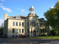 Excelsior Public Schoollisted 1980
 MINNEHAHA (steamboat)listed 2021
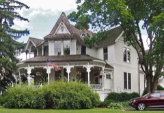 Allemarinda and James Wyer Houselisted 1977
- Excelsior Commercial Historic Districtlisted 2021
Population over time
2 figuresExcelsior grew from 2,188 to 2,355 between 2010 and 2020. These are the recorded population figures Wikidata holds for this place, reached through the Geographic Names Information System number this page is keyed on rather than by name, so they belong to this place and not to another of the same name. Most are census counts, but not all are: an early figure may be a founding or settlement estimate, and an estimate published within five years of a census is left out. The change column is computed, and is left blank where more than 20 years separate a figure from the one before it, because a gap that long is not a change between two counts.
| Year | People | Change |
|---|---|---|
| 2010 | 2,188 | |
| 2020 | 2,355 | +167 (+8%) |
Topographic sheets covering this place
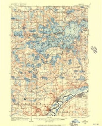
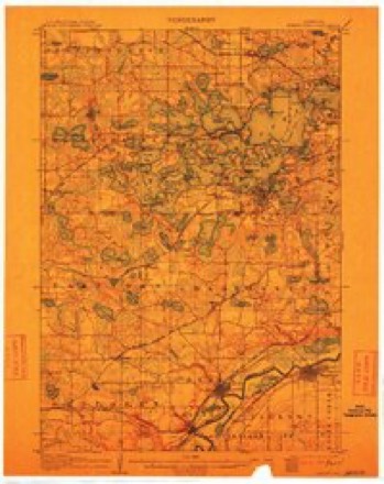
10 surveys from 20 printed sheetsMatched by testing this settlement's coordinate against the published boundary of every sheet in the United States Geological Survey's historical collection. Each opens the scanned sheet at the Survey.
- 1905 USGS Minnetonka quadrangle1:62500
- 1907 USGS Minnetonka quadrangle1:62500, 3 printings
- 1953 USGS Saint Paul quadrangle1:250000, 3 printings
- 1953 USGS St. Paul quadrangle1:250000
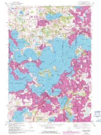
- 1958 USGS Excelsior quadrangle1:24000, 5 printings
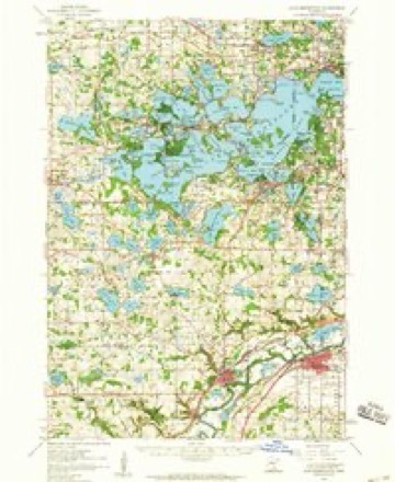
- 1958 USGS Lake Minnetonka quadrangle1:62500, 2 printings
- 1959 USGS Saint Paul quadrangle1:250000
- 1959 USGS St. Paul quadrangle1:250000
- 1985 USGS Saint Paul quadrangle1:100000, 2 printings
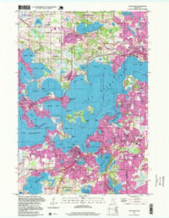
- 1997 USGS Excelsior quadrangle1:24000




In the county-history sources
3,589 words on this townshipHistory of Hennepin County and the City of Minneapolis, Including the Explorers and Pioneers of Minnesota, published 1881 names this settlement in its chapter on Excelsior City. These are the passages that mention it, exactly as the scans read.
Excelsior was the first point of settlement in the township. Here was located the post-oflice, the first stores, shops, etc., forming tlie nucleus around which the early settlers located their claims and made their homes. The village was
Passage source: History of Hennepin County and the City of Minneapolis, Including the Explorers and Pioneers of Minnesota, published 1881.
The " Excelsior House " was built by George Galpin in 1851, and was at that time of small proportions. The original building is now used as a kitchen for the present hotel. John Green purchased the house and made some additions. The ownership then reverted to Galpin, who sold it to a Mr. Beckford. He managed it about four years, since which time it has been owned by the Wait family. The building has been enlarged from time to time, until it now contains room for 150 guests. It is kept open summer and winter.
Passage source: History of Hennepin County and the City of Minneapolis, Including the Explorers and Pioneers of Minnesota, published 1881.
A. D. Burcli, horn in St. Lawrence county. New York, September, 1843. Moved to Michigan in 1870, remained there until 1873. Came to Excelsior, Miniiesola, in 1878. Attended the W'esleyau Seminary in St. Lawrence county, X. Y., graduated in the law department at Ann Arbor, Michigan, in 1869. He followed teaching several years ; the present term is his third one at Excelsior as principal of the graded schools. Married in 1870 to Lotta Johnson, of New York. Two children have l)eeii Ijorn to them.
Passage source: History of Hennepin County and the City of Minneapolis, Including the Explorers and Pioneers of Minnesota, published 1881.
Machine-read from a century-old scan, so expect the errors a machine makes: misspelled names, dropped words, stray characters.
Read the whole chapter on Excelsior City - it names this place 40 more 40 times.
Fires near this place
1 since 2004Regional context, not property-specific evidence. The federal wildfire occurrence database lists 1 fire within 5 miles of Excelsior in 2004, burning under an acre in total. None started naturally. None was recorded as arson. Distance is straight-line from the map coordinates, so a fire counted here may appear on a neighbouring settlement's page as well.
| Reported cause | Fires |
|---|---|
| Missing data/not specified/undetermined | 1 |
The most recent of them, most recent first, with the day each was reported and the service that recorded it.
| Date | Cause | Size | Reported by | Name on the report |
|---|---|---|---|---|
| 28 April 2004 | Missing data/not specified/undetermined | under an acre | Minnesota Department of Natural Resources | not named |
Settlements close enough to share some of these fires:
Storms near this place
7 since 2005Regional context, not property-specific evidence. The National Weather Service names Excelsior in 7 storm reports between 2005 and 2020: 4 thunderstorm wind, 3 hail. No death or injury is recorded in these reports. Each account below is quoted exactly as the forecast office filed it, from the NOAA Storm Events Database, and each date opens the federal record of that event.
| When | Event | Place named | Harm | What the report says |
|---|---|---|---|---|
| July 2018 | Thunderstorm Wind | Excelsior | - | A few trees were blown down in Excelsior. |
| July 2015 | Thunderstorm Wind | Excelsior | - | A large tree branch damaged a roof near Christmas Lake in Excelsior. Power was also out in Excelsior. |
| June 2013 | Thunderstorm Wind | Excelsior | - | Measured at the public safety center. |
| June 2005 | Thunderstorm Wind | Excelsior | - | Trees and power lines were damaged. A picnic table was thrown through a picture window. |
| September 2005 | Hail | Excelsior | - | A trained spotter reported nickel to quarter sized hail covering a deck. |
| September 2020 | Hail | Excelsior | - | no account filed |
| June 2007 | Hail | Excelsior | - | no account filed |
Nearest settlements
The eight closest, with where each one stands in the county. Distances are straight-line, computed from the Geographic Names Information System coordinates.
| Map | Place | Distance | Sheets |
|---|---|---|---|
| Greenwood | 1.1 miles | 20 | |
| Shorewood | 1.2 miles | 20 | |
| Tonka Bay | 1.5 miles | 20 | |
| Crescent Beach | 1.9 miles | 20 | |
| Eureka | 2.0 miles | 20 | |
| Minnetonka Beach | 2.6 miles | 20 | |
| Deephaven | 3.0 miles | 20 | |
| Minnetonka | 3.4 miles | 20 |
Elsewhere
Matched on this settlement's Geographic Names Information System number rather than its name, so it cannot be a different place of the same name in another state.
| Wikipedia article on Excelsior | An encyclopaedic summary. Its text is share-alike, so it is linked here rather than copied. |
| Wikidata item Q2302086 | The structured record the population and elevation above come from. Public domain (CC0). |
Provenance
This settlement is recorded in the Geographic Names Information System as feature 643477. The sheet list is computed by point-in-boundary test against the United States Geological Survey's historical topographic inventory. Both are works of the United States government and carry no copyright under 17 U.S.C. 105.
Wildfire. Short, Karen C. 2022. Spatial wildfire occurrence data for the United States, 1992-2020 [FPA_FOD_20221014]. 6th Edition. Fort Collins, CO: Forest Service Research Data Archive. https://doi.org/10.2737/RDS-2013-0009.6 Collected with United States Government funding and usable without additional permissions or fees.
Storms. NOAA National Centers for Environmental Information, Storm Events Database https://www.ncei.noaa.gov/stormevents/ A work of the United States government, no copyright under 17 U.S.C. 105. Narratives are quoted verbatim from the National Weather Service report and are not edited or summarised.