 Block
Geneva, Minnesota
7 topographic sheets cover this place, the earliest surveyed in 1954 and the latest in 1985. It stands in Geneva Township. It lies in ZIP code area 56035. The Survey maps it on the Ellendale quadrangle. 508 people lived here at the 2020 count. It stands 1,227 feet above sea level.
Population over time
2 figuresGeneva fell from 555 to 508 between 2010 and 2020. These are the recorded population figures Wikidata holds for this place, reached through the Geographic Names Information System number this page is keyed on rather than by name, so they belong to this place and not to another of the same name. Most are census counts, but not all are: an early figure may be a founding or settlement estimate, and an estimate published within five years of a census is left out. The change column is computed, and is left blank where more than 20 years separate a figure from the one before it, because a gap that long is not a change between two counts.
| Year | People | Change |
|---|---|---|
| 2010 | 555 | |
| 2020 | 508 | -47 (-8%) |
Topographic sheets covering this place
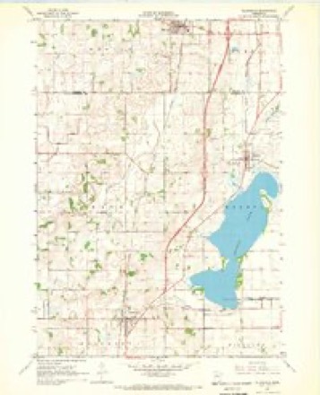
5 surveys from 7 printed sheetsMatched by testing this settlement's coordinate against the published boundary of every sheet in the United States Geological Survey's historical collection. Each opens the scanned sheet at the Survey.
- 1954 USGS Mason City quadrangle1:250000, 2 printings
- 1957 USGS Mason City quadrangle1:250000
- 1958 USGS Mason City quadrangle1:250000
- 1967 USGS Ellendale quadrangle1:24000
- 1985 USGS Albert Lea quadrangle1:100000, 2 printings




In the county-history sources
1,451 words on this townshipHistory of Freeborn County, Minnesota, published 1911 names this settlement in its chapter on Geneva Township. These are the passages that mention it, exactly as the scans read.
This is on the northern tier of townships in the county, the second from Mower county on the east, Newry lying between. Steele couny is on the north, Bath on the west, and Riceland on the south. Like all the other towns in the county, the integrity of the original government survey has been maintained. Most of the sections from 25 to 36 were originally slough land, and covered by college and railroad scrip. The remainder is rolling prairie, with a black sandy loam, which on some of the ridges is mixed with clay and is very productive. Nearly all the timber in town, when first entered for settlement, was on sections 17 and 36. Geneva lake is the only one in town. It is in the western part and occupies parts of six sections. It has an irregular outline, with an area of perhaps three sections, and is three miles long and a little over a mile wide in its widest part.
Passage source: History of Freeborn County, Minnesota, published 1911.
Some of the arrivals of 1858 were : George Osborne, a native of Ohio, who spent a winter here and afterwards lived in Steele county. In about two years he returned to Geneva. He was in the army and afterwards for a time postmaster. He is now dead/ Thomas Hines, of Vermont, settled in section 16. He removed to Faribault county in 1864 and lived there until 1872. Robert Hill, a native of Pennsylvania, pre-empted a place in section 10 and afterwards lived with his son-in-law, Robert P. Farr, until his death, which occurred in 1865.
Passage source: History of Freeborn County, Minnesota, published 1911.
Early Events. The first child born in Geneva township was Irwin Burdick, born September, 1856 ; the second was Anna Schad, born September, 1857, the first girl in Geneva ; and the third child was Eli Goodnature, born in September, 1857. The next two were Henry Eustrom and Harvey Robson, both born in February, 1858, and the next was George Reed, born in April, 1858. Seymour E., son of Eliab and Esther Eggleston, died December 24, 1857. The wife of W. S. Bacon died in the winter of 1857-58. Burdette E., son of Eliab and Esther Eggleston, died November 28, 1857.
Passage source: History of Freeborn County, Minnesota, published 1911.
Machine-read from a century-old scan, so expect the errors a machine makes: misspelled names, dropped words, stray characters.
Read the whole chapter on Geneva Township - it names this place 1 more 1 time.
Storms near this place
11 since 1999Regional context, not property-specific evidence. The National Weather Service names Geneva in 11 storm reports between 1999 and 2024: 9 thunderstorm wind, 1 funnel cloud, 1 tornado. The reports record 3 injuries. Each account below is quoted exactly as the forecast office filed it, from the NOAA Storm Events Database, and each date opens the federal record of that event.
| When | Event | Place named | Harm | What the report says |
|---|---|---|---|---|
| May 2018 | Thunderstorm Wind | Geneva | 3 hurt, $50,000 | A NWS storm survey indicated that a severe downburst wind, with an estimated wind of 80 mph, occurred from near the intersection of 310th Street, and 820th Avenue, |north-northeast for approximately one mile. Several trees were uprooted, with a trailer and a turkey barn that were destroyed near the end of the path. Three injuries occurred, but were not life threatening. Other trees and power lines were blown down in the city of Geneva which is likely associated with another downburst around the same time. |
| June 2009 | Tornado (EF0) | Geneva | $1,000 | Several storm spotters and local law enforcement officials watched a nearly continuous wall cloud and/or funnel cloud move across northern Freeborn County before forming a tornado near Geneva. Several trees and two sheds were damaged on the northeast corner of Interstate 35 and County Road 35, on the west edge of Geneva. Debris was occasionally noted underneath the condensation funnel cloud as it trekked to the east-southeast. There was minor tree damage associated with the tornado on the east side of Geneva, with the last damage just south of the intersection of County Roads 26 and 35. |
| May 2024 | Thunderstorm Wind | Geneva | - | Trees and power lines were knocked down. |
| July 2020 | Thunderstorm Wind | Geneva | - | A tree was blown down. |
| June 2010 | Thunderstorm Wind | Geneva | - | Numerous trees were knocked down associated with the rear flank downdraft that accompanied the tornado that originated just east of Clark's Grove at 1815 LST. |
| June 2007 | Thunderstorm Wind | Geneva | - | Four to six inch diameter branches down. |
| June 2007 | Funnel Cloud | Geneva | - | Funnel cloud tracked by several spotters. |
| August 2006 | Thunderstorm Wind | Geneva | - | Numerous trees down, including some on houses, sheds and vehicles. |
| June 2004 | Thunderstorm Wind | Geneva | - | Trees were downed at a farm on 795th Avenue. |
| June 2004 | Thunderstorm Wind | Geneva | - | A farm off Route 28 sustained significant damage. A storage bin was blown onto a field. Windows were blown out of a hog barn. A farmhouse lost shingles and trees on the property were downed. |
| June 1999 | Thunderstorm Wind | Geneva | - | Large trees blown down. Wind damage also reported in Clarks Grove. Estimated windspeed. |
Nearest settlements
The eight closest, with where each one stands in the county. Distances are straight-line, computed from the Geographic Names Information System coordinates.
| Map | Place | Distance | Sheets |
|---|---|---|---|
| Clarks Grove | 5.2 miles | 7 | |
| Hollandale | 5.5 miles | 7 | |
| Bath | 6.5 miles | 7 | |
| Muckland | 6.8 miles | 9 | |
| Lerdal | 6.9 miles | 10 | |
| Maple Island | 7.0 miles | 7 | |
| South Hollandale | 8.2 miles | 9 | |
| Twin Grove | 9.3 miles | 9 |
Elsewhere
Matched on this settlement's Geographic Names Information System number rather than its name, so it cannot be a different place of the same name in another state.
| Wikipedia article on Geneva | An encyclopaedic summary. Its text is share-alike, so it is linked here rather than copied. |
| Wikidata item Q1924473 | The structured record the population and elevation above come from. Public domain (CC0). |
Provenance
This settlement is recorded in the Geographic Names Information System as feature 644066. The sheet list is computed by point-in-boundary test against the United States Geological Survey's historical topographic inventory. Both are works of the United States government and carry no copyright under 17 U.S.C. 105.
Storms. NOAA National Centers for Environmental Information, Storm Events Database https://www.ncei.noaa.gov/stormevents/ A work of the United States government, no copyright under 17 U.S.C. 105. Narratives are quoted verbatim from the National Weather Service report and are not edited or summarised.