 Block
Bath, Minnesota
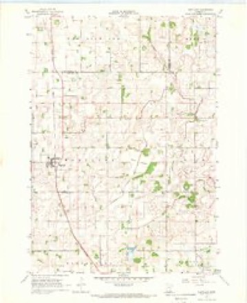
7 topographic sheets cover this place, the earliest surveyed in 1954 and the latest in 1985. It stands in Bath Township. It lies in ZIP code area 56042. The Survey maps it on the Hartland quadrangle.
Topographic sheets covering this place
5 surveys from 7 printed sheetsMatched by testing this settlement's coordinate against the published boundary of every sheet in the United States Geological Survey's historical collection. Each opens the scanned sheet at the Survey.
- 1954 USGS Mason City quadrangle1:250000, 2 printings
- 1957 USGS Mason City quadrangle1:250000
- 1958 USGS Mason City quadrangle1:250000
- 1967 USGS Hartland quadrangle1:24000
- 1985 USGS Albert Lea quadrangle1:100000, 2 printings




In the county-history sources
2,353 words on this townshipHistory of Freeborn County, Minnesota, published 1911 names this settlement in its chapter on Bath Township. These are the passages that mention it, exactly as the scans read.
Bath is the center of the northern tier of towns in Freeborn county. Its contiguous surroundings are as follows: Waseca county on the north ; Geneva township on the east ; Bancroft town¬ ship on the south ; and Hartland township on the west. It con¬ tains thirty-six sections or square miles, comprising the territory of town 104, range 21. In early days the most of the township was covered with a growth of burr oak. This was interspersed with meadow or small patches of prairie land. There is a prairie of about 2,560 acres, located in the southwestern part of the township. The timber has been removed to a great extent, and the rich land been converted into valuable farms. The surface is rolling, and in places the undulation is so abrupt as to be called ridges, which are not subject to cultivation. The soil is a dark sandy loam, underlain with a subsoil of clay. The town is not so well watered as its neighbors, has no stream, and only one lake wholly within its borders. An arm of Geneva lake extends from the town bearing its name into section 25 of Bath, and covers a few acres of land. Lake George is the only body of water wholly within the boundaries, lying in the southern part of section 22. It was named in honor of George Skinner, Jr.
Passage source: History of Freeborn County, Minnesota, published 1911.
Bath township has two villages, Clark's Grove and Bath. A Catholic church and cemetery are located in the western part of section 8. The Advent church is in the eastern part of section 17. The Norwegian Lutheran church and cemetery are in the south¬ western part of section 21. The Danish Baptist church and cemetery are east of Clark's Grove.
Passage source: History of Freeborn County, Minnesota, published 1911.
In the summer of 1857, a party of Norwegians, consisting of Hans Peterson, Ingebret Erickson, and Nels Nelson, came with teams, bringing their families, and settled upon claims. Erickson left in 1880 for the Red River country; Nelson died during the war, in defense of his country. About the same time Richard Fitzgerald, a native of Ireland, came and first located at St. Nicholas, where he put in a crop; but soon after made his way to Bath. Fred W. Calkins came in June, 1857 and died in 1863.
Passage source: History of Freeborn County, Minnesota, published 1911.
Machine-read from a century-old scan, so expect the errors a machine makes: misspelled names, dropped words, stray characters.
Read the whole chapter on Bath Township - it names this place 5 more 5 times.
Storms near this place
2 since 2004Regional context, not property-specific evidence. The National Weather Service names Bath in 2 storm reports between 2004 and 2010: 1 funnel cloud, 1 flood. No death or injury is recorded in these reports. Each account below is quoted exactly as the forecast office filed it, from the NOAA Storm Events Database, and each date opens the federal record of that event.
| When | Event | Place named | Harm | What the report says |
|---|---|---|---|---|
| September 2010 | Flood | Bath | $190,000 | Numerous roads were closed due to excessive rainfall that fell on September 22nd and 23th. |
| June 2004 | Funnel Cloud | Bath | - | A funnel cloud was relayed by HAM radio operators about 5 miles southwest of Ellendale. |
Nearest settlements
The eight closest, with where each one stands in the county. Distances are straight-line, computed from the Geographic Names Information System coordinates.
| Map | Place | Distance | Sheets |
|---|---|---|---|
| Clarks Grove | 5.3 miles | 7 | |
| Hartland | 5.4 miles | 7 | |
| Geneva | 6.5 miles | 7 | |
| Manchester | 7.6 miles | 10 | |
| Bancroft | 8.7 miles | 10 | |
| Lerdal | 9.5 miles | 10 | |
| Freeborn | 10.1 miles | 8 | |
| Hollandale | 10.8 miles | 7 |
Provenance
This settlement is recorded in the Geographic Names Information System as feature 654589. The sheet list is computed by point-in-boundary test against the United States Geological Survey's historical topographic inventory. Both are works of the United States government and carry no copyright under 17 U.S.C. 105.
Storms. NOAA National Centers for Environmental Information, Storm Events Database https://www.ncei.noaa.gov/stormevents/ A work of the United States government, no copyright under 17 U.S.C. 105. Narratives are quoted verbatim from the National Weather Service report and are not edited or summarised.