 Block
Greenleaf, Minnesota
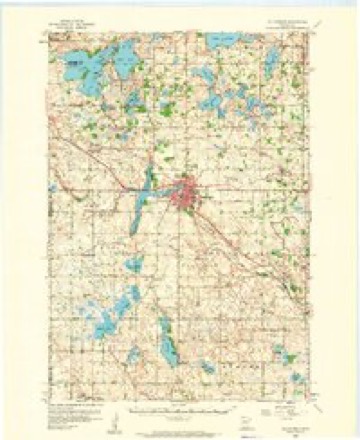
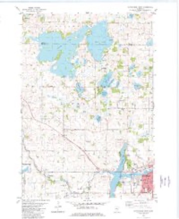
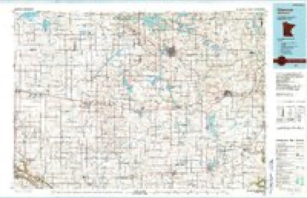
11 topographic sheets cover this place, the earliest surveyed in 1953 and the latest in 1986. It stands in Ellsworth Township. It lies in ZIP code area 55355. The Survey maps it on the Hutchinson West quadrangle.
Topographic sheets covering this place
7 surveys from 11 printed sheetsMatched by testing this settlement's coordinate against the published boundary of every sheet in the United States Geological Survey's historical collection. Each opens the scanned sheet at the Survey.
- 1953 USGS New Ulm quadrangle1:250000, 3 printings
- 1957 USGS New Ulm quadrangle1:250000
- 1958 USGS Hutchinson quadrangle1:62500
- 1958 USGS New Ulm quadrangle1:250000
- 1967 USGS New Ulm quadrangle1:250000
- 1982 USGS Hutchinson West quadrangle1:24000, 2 printings
- 1986 USGS Glencoe quadrangle1:100000, 2 printings




In the county-history sources
1,474 words on this townshipAlbum of History and Biography of Meeker County, Minnesota, published 1888 names this settlement in its chapter on Ellsworth Township. These are the passages that mention it, exactly as the scans read.
Ellsworth township was for years a portion of the town of Greenleaf, but on the 1st of September, 1868, it was organized as a separate civil township, under its present name. At the first election therein, most of the residents took an active part. The present officers are as follows - Supervisors: Eudolph Krussow (chairman), Jonathan Mc- Stotts and D. Barret ; assessor, Ira Gleason ; clerk, N. Y. Taylor; treasurer, Eudolph Leverence ; justices, John Vogelpohl and L. L. Sisson ; constables, D. F. Smith and Wm. Christoph.
Passage source: Album of History and Biography of Meeker County, Minnesota, published 1888.
Tlie village of (xreenleaf was laid out and platted by Dana E. King, in 1859, and the plat filed for record on the 3d of Septemljer of that year. Shortly after this W. H. Greenleaf, A. C. Smith and Bennett M. Brink acquired an interest in the town site by purchase. The village plat was situated upon the southwest quarter of the southwest quarter, the southwest quarter of the southeast quarter, and lots 5 and 6, of section 30, and contained a mill site and water-power.
Passage source: Album of History and Biography of Meeker County, Minnesota, published 1888.
Previous to the laying out of the town, in the fall of 1858, William II. Greenleaf and Dana E. King came here, and ^he former, finding a mill site, went back to Wisconsin, and, purchasing the machinery for a sawmill, returned the same fall with Bennett M. Brink, and the two in company erected the saw-mill and improved the water-power. Around this mill sprang up the little settlement which bore the name of Greenleaf. atter the founder of the leading industry of the place. Dana E. King returned in 1S59, and laid out the town as above mentioned, having preempted the land. In 1859 Judson A. Brink came to the embryo village, and here made his residence until 186-1, when he returned to New York State, from which he had come, where he died of consumption at a later date. Greenleaf and Brink operated the mill from December, 1858, until the spring of 1862, when Judson A. Brink purchased the interest of Mr. Greenleaf, and the two brothers ran the mill in partnership until 1861:. Steam was then put in and its owners continued its operation until three years plater, when they removed the machinery some few miles into the woods. It was after- Avard removed to the village of Dassel.
Passage source: Album of History and Biography of Meeker County, Minnesota, published 1888.
Machine-read from a century-old scan, so expect the errors a machine makes: misspelled names, dropped words, stray characters.
Read the whole chapter on Ellsworth Township - it names this place 5 more 5 times.
Fires near this place
4 since 1997Regional context, not property-specific evidence. The federal wildfire occurrence database lists 4 fires within 5 miles of Greenleaf between 1997 and 2013, burning about 331 acres in total. None started naturally. None was recorded as arson. Distance is straight-line from the map coordinates, so a fire counted here may appear on a neighbouring settlement's page as well.
| Reported cause | Fires |
|---|---|
| Debris and open burning | 2 |
| Missing data/not specified/undetermined | 1 |
| Power generation/transmission/distribution | 1 |
The most recent of them, most recent first, with the day each was reported and the service that recorded it.
| Date | Cause | Size | Reported by | Name on the report |
|---|---|---|---|---|
| 1 May 2013 | Power generation/transmission/distribution | 39 acres | Litchfield Wetland Management District | LAKE HARDEN WF |
| 8 April 2012 | Missing data/not specified/undetermined | 124 acres | Litchfield Wetland Management District | COOMBS WF |
| 29 April 1997 | Debris and open burning | 63 acres | Minnesota Department of Natural Resources | not named |
| 26 April 2001 | Debris and open burning | 105 acres | Minnesota Department of Natural Resources | not named |
Settlements close enough to share some of these fires:
Mines and quarries near this place
3 within 5 milesRegional context, not property-specific evidence. The federal mineral resources record lists 3 workings within 5 miles of Greenleaf: 3 producers. All of them still produce. What was taken out: Sand and Gravel, Construction. Distance is straight-line from the map coordinates, so a quarry counted here may appear on a neighbouring settlement's page as well.
| Where | Site | Commodity | Status | Recorded |
|---|---|---|---|---|
| Smith Pit | Sand and Gravel, Construction | Producer | ||
| Smith Pit and Mill | Sand and Gravel, Construction | Producer | ||
| Smith Pit and Mill | Sand and Gravel, Construction | Producer |
Storms near this place
8 since 1994Regional context, not property-specific evidence. The National Weather Service names Greenleaf in 8 storm reports between 1994 and 2024: 5 thunderstorm wind, 2 hail, 1 tornado. The reports record 1 injury. Each account below is quoted exactly as the forecast office filed it, from the NOAA Storm Events Database, and each date opens the federal record of that event.
| When | Event | Place named | Harm | What the report says |
|---|---|---|---|---|
| June 2024 | Thunderstorm Wind | Greenleaf | 1 hurt | Sheriff's Office reported that a large pole barn had its roof blown off with all sides collapsing, resulting in one injury. |
| September 2013 | Thunderstorm Wind | Greenleaf | - | A large tree was blown down approximately 5 miles south of Litchfield. In addition, a pontoon boat was dislodged from its boat lift on Belle Lake, along the Meeker, McLeod county line. |
| June 2005 | Thunderstorm Wind | Greenleaf | - | Trees were downed near Lake Erie. |
| August 1997 | Thunderstorm Wind | Greenleaf | - | Power lines blown down. Estimated windspeed. |
| July 1997 | Thunderstorm Wind | Greenleaf | - | 15 acres of trees blown down on east side of Lake Willie. Roof torn off shed about one half mile nw of town. Barn destroyed 2 miles nw of Greenleaf. |
| July 1994 | Tornado (F0) | Greenleaf | - | A small tornado touched down breifly near Greenleaf uprooting several trees. |
| April 2021 | Hail | Greenleaf | - | no account filed |
| May 2015 | Hail | Greenleaf | - | no account filed |
Nearest settlements
The eight closest, with where each one stands in the county. Distances are straight-line, computed from the Geographic Names Information System coordinates.
| Map | Place | Distance | Sheets |
|---|---|---|---|
| Cedar Mills | 3.9 miles | 9 | |
| Beckville | 4.8 miles | 10 | |
| Strout | 5.5 miles | 10 | |
| Casey | 5.7 miles | 10 | |
| Corvuso | 7.0 miles | 9 | |
| Jennie | 8.1 miles | 10 | |
| Darwin | 8.3 miles | 10 | |
| Litchfield | 9.2 miles | 10 |
Provenance
This settlement is recorded in the Geographic Names Information System as feature 644445. The sheet list is computed by point-in-boundary test against the United States Geological Survey's historical topographic inventory. Both are works of the United States government and carry no copyright under 17 U.S.C. 105.
Wildfire. Short, Karen C. 2022. Spatial wildfire occurrence data for the United States, 1992-2020 [FPA_FOD_20221014]. 6th Edition. Fort Collins, CO: Forest Service Research Data Archive. https://doi.org/10.2737/RDS-2013-0009.6 Collected with United States Government funding and usable without additional permissions or fees.
Mines and quarries. USGS Mineral Resources Data System (MRDS) https://mrdata.usgs.gov/mrds/ A work of the United States government, no copyright under 17 U.S.C. 105.
Storms. NOAA National Centers for Environmental Information, Storm Events Database https://www.ncei.noaa.gov/stormevents/ A work of the United States government, no copyright under 17 U.S.C. 105. Narratives are quoted verbatim from the National Weather Service report and are not edited or summarised.