 Block
Litchfield, Minnesota
10 topographic sheets cover this place, the earliest surveyed in 1953 and the latest in 1986. It stands in Litchfield City. It lies in ZIP code area 55355. It stands on Jewett Creek. The Survey maps it on the Litchfield North quadrangle. 6,624 people lived here at the 2020 count. It stands 1,129 feet above sea level.
Research this city
On record in Litchfield
Buildings and businesses the archive holds for this place. Each opens its own page, with the source record it came from.
On the National Register 7 records
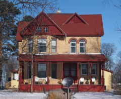 Henry Ames Houselisted 1984
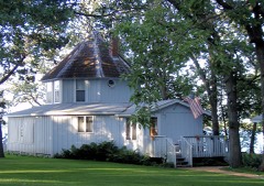 Brightwood Beach Cottagelisted 1978
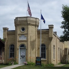 Grand Army of the Republic Halllisted 1975
 Litchfield Opera Houselisted 1984
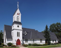 Trinity Episcopal Churchlisted 1975
- Litchfield Commercial Historic Districtlisted 1996
- Ness Lutheran Church and Cemeterylisted 2025
Population over time
2 figuresLitchfield fell from 6,726 to 6,624 between 2010 and 2020. These are the recorded population figures Wikidata holds for this place, reached through the Geographic Names Information System number this page is keyed on rather than by name, so they belong to this place and not to another of the same name. Most are census counts, but not all are: an early figure may be a founding or settlement estimate, and an estimate published within five years of a census is left out. The change column is computed, and is left blank where more than 20 years separate a figure from the one before it, because a gap that long is not a change between two counts.
| Year | People | Change |
|---|---|---|
| 2010 | 6,726 | |
| 2020 | 6,624 | -102 (-2%) |
Topographic sheets covering this place
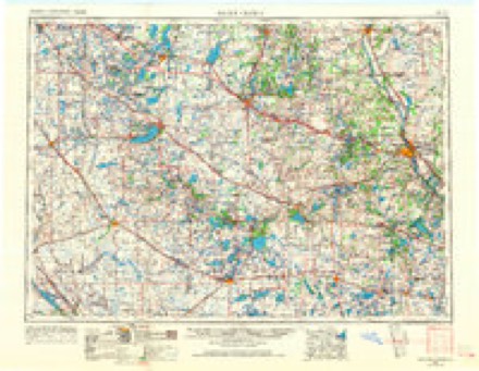
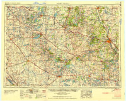
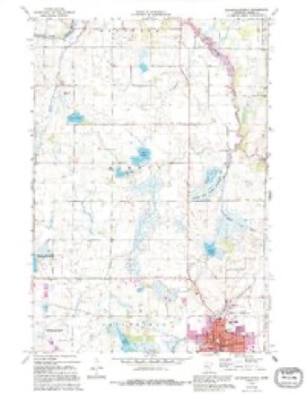
5 surveys from 10 printed sheetsMatched by testing this settlement's coordinate against the published boundary of every sheet in the United States Geological Survey's historical collection. Each opens the scanned sheet at the Survey.
- 1953 USGS Saint Cloud quadrangle1:250000, 3 printings
- 1957 USGS Saint Cloud quadrangle1:250000
- 1958 USGS Saint Cloud quadrangle1:250000
- 1967 USGS Litchfield North quadrangle1:24000, 3 printings
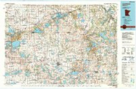
- 1986 USGS Litchfield quadrangle1:100000, 2 printings
In the county-history sources
13,775 words on this townshipAlbum of History and Biography of Meeker County, Minnesota, published 1888 names this settlement in its chapter on Litchfield City. These are the passages that mention it, exactly as the scans read.
The first death in the community occurred in the year 1871, and was that of the little son of M. D. Bowen. About the same time a Swedish settler, while passing to his home west of the city, fell from the trestle bridge of the railroad near the western limits of the village, and broke his neck. Old residents are undecided as to which of these preceded the other, but as the former is the death of a resident of the vilhige it is given prominence.
Passage source: Album of History and Biography of Meeker County, Minnesota, published 1888.
The genei'al merchandise firm of Cairncross & Palm, originated in 1871 with the Nelson Bros. Several changes have been made in the name and style, several parties having oiierated it, among whom were Cairncross A: Brother, who commenced in 1878. In 1881, Alexander Cairncross purchased the interest of his brother, Stewart, and ran the business until January 1, 1885, when, John Palm having acquired an interest, the present firm was formed.
Passage source: Album of History and Biography of Meeker County, Minnesota, published 1888.
V. II. Harris, who is also engaged in the drug business, was the second to open a store of that character in the village, commencing in the fall of 1ST3, under the firm name of Harris & Bell, in the building now occupied by the ])ostolEce. There they remained until IST'.t, when, having erected the second brick store building in the jilace, Mr. Harris removed into it, where he now carries on bu&iii' ss, which he has filled with a full and comp ete stock of first-class goods and is a leader in that line.
Passage source: Album of History and Biography of Meeker County, Minnesota, published 1888.
Machine-read from a century-old scan, so expect the errors a machine makes: misspelled names, dropped words, stray characters.
Read the whole chapter on Litchfield City - it names this place 54 more 54 times.
Fires near this place
3 since 2012Regional context, not property-specific evidence. The federal wildfire occurrence database lists 3 fires within 5 miles of Litchfield between 2012 and 2015, burning about 244 acres in total. None started naturally. None was recorded as arson. Distance is straight-line from the map coordinates, so a fire counted here may appear on a neighbouring settlement's page as well.
| Reported cause | Fires |
|---|---|
| Debris and open burning | 2 |
| Missing data/not specified/undetermined | 1 |
The most recent of them, most recent first, with the day each was reported and the service that recorded it.
| Date | Cause | Size | Reported by | Name on the report |
|---|---|---|---|---|
| 2 May 2015 | Debris and open burning | 217 acres | Litchfield Wetland Management District | STONE LAKE WF |
| 29 November 2012 | Debris and open burning | 26 acres | Minnesota Department of Natural Resources | not named |
| 11 November 2013 | Missing data/not specified/undetermined | 1.0 acres | Litchfield Wetland Management District | LITCHFIELD WF |
Settlements close enough to share some of these fires:
Storms near this place
51 since 1993Regional context, not property-specific evidence. The National Weather Service names Litchfield in 51 storm reports between 1993 and 2025: 27 hail, 19 thunderstorm wind, 2 tornado, 2 funnel cloud. The reports record 3 injuries. Each account below is quoted exactly as the forecast office filed it, from the NOAA Storm Events Database, and each date opens the federal record of that event.
| When | Event | Place named | Harm | What the report says |
|---|---|---|---|---|
| September 2005 | Thunderstorm Wind | Litchfield | 3 hurt | Fire and rescue officials reported that high winds overturned a trailer camper at Lake Ripley Campground. Three people were pined inside and were transported to the hospital after rescue. A woman and a man in the trailer suffered minor injuries and the third victim, a retired police officer, suffered cracked ribs and numbness in his legs. Two other unoccupied campers were overturned nearby and others were damaged. Trees were also downed around town. A wind gust of 55 MPH was recorded at the Litchfield airport at 3:55 PM CDT. |
| July 2025 | Thunderstorm Wind | Litchfield | - | Multiple trees down in Litchfield. |
| July 2023 | Thunderstorm Wind | Litchfield | - | Public works responded to 1 large branch across the road. |
| May 2022 | Thunderstorm Wind | Litchfield | - | The county courthouse sustained roof damage. Numerous trees were uprooted around Litchfield. Time estimated based on radar. |
| June 2017 | Thunderstorm Wind | Litchfield | - | Wind gust reported by RAWS station LFSM5, Litchfield 3S, operated by the U.S. Fish and Wildlife Service. |
| June 2016 | Heavy Rain | Litchfield | - | A rainfall report of 2.76 inches occurred south of Litchfield in less than 6 hours. |
| July 2016 | Tornado (EF2) | Litchfield | - | The tornado near Litchfield was rated an EF-2 with peak winds of 115 mph. It had a maximum width of 100 yards and traveled approximately 3.2 miles. The tornado caused a lot of tree damage, though three single family homes received significant roof damage, and a double wide manufactured home, and garage were flipped and rolled. Another garage and shed were destroyed near Highway 12 on the north side of town. |
| August 2013 | Thunderstorm Wind | Litchfield | - | Several large tree branches were blown down in Litchfield. |
| August 2011 | Thunderstorm Wind | Litchfield | - | A measured wind gust at the Litchfield RAWS site. |
| July 2011 | Thunderstorm Wind | Litchfield | - | A large tree fell near Southside Park in Litchfield. |
| August 2011 | Thunderstorm Wind | Litchfield | - | Several large tree branches were blown down on the east side of Litchfield, Minnesota. |
| July 2008 | Funnel Cloud | Litchfield | - | The funnel cloud dropped briefly out of the parent thunderstorm, then quickly went back up. |
| September 2007 | Thunderstorm Wind | Litchfield | - | Numerous trees were felled, including some 22 inches in diameter. One tree fell on a mobile home in the north side of Litchfield. |
| June 2006 | Hail | Litchfield | - | Hail covered the ground. |
| May 2006 | Hail | Litchfield | - | Hail covered Highway 22. |
| June 2005 | Funnel Cloud | Litchfield | - | The Sheriff's department stated that several motorists reported seeing a funnel cloud. |
| June 2005 | Thunderstorm Wind | Litchfield | - | Trees were downed near Round Lake. |
| June 2005 | Thunderstorm Wind | Litchfield | - | A pontoon boat was flipped and a dock was destroyed along the Lake Ripley shoreline. |
| September 2005 | Hail | Litchfield | - | Quarter to golf ball sized hail was reported by a trained spotter. The county sheriff's office reported that several squad cars sustained hail damage. The windshield on one patrol car was broken by the hail. |
| June 2004 | Thunderstorm Wind | Litchfield | - | A tree was downed. |
| May 2004 | Thunderstorm Wind | Litchfield | - | Two turkey barns were slightly damaged along Route 23 near Long Lake. |
| June 2002 | Hail | Litchfield | - | Ground white. |
| June 2001 | Tornado (F1) | Litchfield | - | Damage survey indicated brief tornado on the west side of Lake Ripley, downing trees and ripping apart sheds and outbuildings. Tornado was accompanied by a large swath of damaging wind. |
| June 2001 | Hail | Litchfield | - | Wind blown hail dented houses, vehicles, and hundreds of structures. |
| July 1999 | Thunderstorm Wind | Litchfield | - | Estimated winds. Several docks and boats flipped on Lake Minnie Belle. |
| June 1999 | Thunderstorm Wind | Litchfield | - | Large branches blown down. Estimated windspeed. |
| July 2025 | Hail | Litchfield | - | no account filed |
| July 2023 | Hail | Litchfield | - | no account filed |
| August 2013 | Hail | Litchfield | - | no account filed |
| May 2012 | Hail | Litchfield | - | no account filed |
| August 2011 | Hail | Litchfield | - | no account filed |
| September 2007 | Hail | Litchfield | - | no account filed |
| April 2007 | Hail | Litchfield | - | no account filed |
| September 2005 | Hail | Litchfield | - | no account filed |
| May 2004 | Hail | Litchfield | - | no account filed |
| June 2004 | Hail | Litchfield | - | no account filed |
| June 2002 | Hail | Litchfield | - | no account filed |
| June 2001 | Hail | Litchfield | - | no account filed |
| June 2001 | Hail | Litchfield | - | no account filed |
| May 2000 | Hail | Litchfield | - | no account filed |
| May 1998 | Hail | Litchfield | - | no account filed |
| May 1998 | Hail | Litchfield | - | no account filed |
| May 1998 | Hail | Litchfield | - | no account filed |
| July 1997 | Thunderstorm Wind | Litchfield | - | no account filed |
| July 1997 | Hail | Litchfield | - | no account filed |
| June 1996 | Hail | Litchfield | - | no account filed |
| June 1996 | Hail | Litchfield | - | no account filed |
| August 1996 | Thunderstorm Wind | Litchfield | - | no account filed |
| June 1994 | Hail | Litchfield | - | no account filed |
| June 1994 | Hail | Litchfield | - | no account filed |
| August 1993 | Thunderstorm Wind | Litchfield | - | no account filed |
Nearest settlements
The eight closest, with where each one stands in the county. Distances are straight-line, computed from the Geographic Names Information System coordinates.
| Map | Place | Distance | Sheets |
|---|---|---|---|
| Beckville | 6.0 miles | 10 | |
| Casey | 6.2 miles | 10 | |
| Forest City | 6.4 miles | 10 | |
| Darwin | 6.6 miles | 10 | |
| Strout | 7.6 miles | 10 | |
| Acton | 7.6 miles | 8 | |
| Grove City | 8.4 miles | 8 | |
| Greenleaf | 9.2 miles | 11 |
Elsewhere
Matched on this settlement's Geographic Names Information System number rather than its name, so it cannot be a different place of the same name in another state.
| Wikipedia article on Litchfield | An encyclopaedic summary. Its text is share-alike, so it is linked here rather than copied. |
| Wikidata item Q1911450 | The structured record the population and elevation above come from. Public domain (CC0). |
Provenance
This settlement is recorded in the Geographic Names Information System as feature 646743. The sheet list is computed by point-in-boundary test against the United States Geological Survey's historical topographic inventory. Both are works of the United States government and carry no copyright under 17 U.S.C. 105.
Wildfire. Short, Karen C. 2022. Spatial wildfire occurrence data for the United States, 1992-2020 [FPA_FOD_20221014]. 6th Edition. Fort Collins, CO: Forest Service Research Data Archive. https://doi.org/10.2737/RDS-2013-0009.6 Collected with United States Government funding and usable without additional permissions or fees.
Storms. NOAA National Centers for Environmental Information, Storm Events Database https://www.ncei.noaa.gov/stormevents/ A work of the United States government, no copyright under 17 U.S.C. 105. Narratives are quoted verbatim from the National Weather Service report and are not edited or summarised.