 Block
Hanska, Minnesota
9 topographic sheets cover this place, the earliest surveyed in 1953 and the latest in 1991. It stands in Hanska City. It lies in ZIP code area 56041. The Survey maps it on the Hanska quadrangle. 382 people lived here at the 2020 count. It stands 1,017 feet above sea level.
On record in Hanska
Buildings and businesses the archive holds for this place. Each opens its own page, with the source record it came from.
On the National Register 4 records
- Bjorneberg Garagelisted 1979
- Liberal Union Halllisted 1979
- Nora Free Christian Churchlisted 1988
- Thormodson Barnlisted 1979
Population over time
2 figuresHanska fell from 402 to 382 between 2010 and 2020. These are the recorded population figures Wikidata holds for this place, reached through the Geographic Names Information System number this page is keyed on rather than by name, so they belong to this place and not to another of the same name. Most are census counts, but not all are: an early figure may be a founding or settlement estimate, and an estimate published within five years of a census is left out. The change column is computed, and is left blank where more than 20 years separate a figure from the one before it, because a gap that long is not a change between two counts.
| Year | People | Change |
|---|---|---|
| 2010 | 402 | |
| 2020 | 382 | -20 (-5%) |
Topographic sheets covering this place
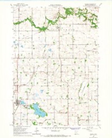
7 surveys from 9 printed sheetsMatched by testing this settlement's coordinate against the published boundary of every sheet in the United States Geological Survey's historical collection. Each opens the scanned sheet at the Survey.
- 1953 USGS New Ulm quadrangle1:250000, 3 printings
- 1957 USGS New Ulm quadrangle1:250000
- 1958 USGS New Ulm quadrangle1:250000
- 1965 USGS Hanska quadrangle1:24000
- 1967 USGS New Ulm quadrangle1:250000
- 1986 USGS New Ulm quadrangle1:100000
- 1991 USGS New Ulm quadrangle1:100000




In the county-history sources
394 words on this townshipHistory of Brown County, Minnesota: Its People, Industries and Institutions (Volume 1), published 1916 names this settlement in its chapter on Hanska City. These are the passages that mention it, exactly as the scans read.
December 3, 1904, will long be remembered in the village of Hanska, for on that day a sweeping fire destroyed much of the village, including the main business portion. The heaviest losses were sustained by Messrs. Nelson, Grothe, Kjorlaug & Company, J. H. Haemze, the latter owning the printing plant of the Herald office. The total loss in the village was about twenty-five thousand dollars.
Passage source: History of Brown County, Minnesota: Its People, Industries and Institutions (Volume 1), published 1916.
In the month of May, 1916, the business interests of Hanska were in the hands of the following men: Autogarage and dealers - Alex. C. Eckle, Hanska Auto Company; banks, Security and State Banks; barber - Theo. Greenholz; blacksmiths - Andrew Johnson; creameries - Hanska and Linden, and the Linden and Cottonwood; drugs, John A. Ringnell ; elevators - New Ulm Roller Mill
Passage source: History of Brown County, Minnesota: Its People, Industries and Institutions (Volume 1), published 1916.
The town hall, known as Liberal Union Hall, is a brick structure one story in height, erected by public subscription, both from the village and country. In this is held all public meetings and the library is also here under the charge of Reverend Norman. It was built in 1914-15.
Passage source: History of Brown County, Minnesota: Its People, Industries and Institutions (Volume 1), published 1916.
Machine-read from a century-old scan, so expect the errors a machine makes: misspelled names, dropped words, stray characters.
Read the whole chapter on Hanska City - it names this place 4 more 4 times.
Storms near this place
20 since 2002Regional context, not property-specific evidence. The National Weather Service names Hanska in 20 storm reports between 2002 and 2026: 9 hail, 8 thunderstorm wind, 1 funnel cloud, 1 tornado. No death or injury is recorded in these reports. Each account below is quoted exactly as the forecast office filed it, from the NOAA Storm Events Database, and each date opens the federal record of that event.
| When | Event | Place named | Harm | What the report says |
|---|---|---|---|---|
| June 2019 | Hail | Hanska | $30,000 | A fire department spotter reported hail as large as two inches fell for around 15 minutes at Lake Hanska County Park. Nearby, Prairie Grounds Campground was also hit, with one camper totaled and another camper had hail punch holes through its plastic roof vents. A pontoon was also significantly damaged. Some crops in the area were destroyed. |
| September 2021 | Thunderstorm Wind | Hanska | $5,000 | An outbuilding was blown down near Hanska. A couple wind sensors near the area had a peak wind gust of 45 mph near Hanska, and 53 mph near Madelia. |
| May 2022 | Thunderstorm Wind | Hanska | $3,000 | A roof was torn off a farm outbuilding near Hanska. |
| June 2024 | Heavy Rain | Hanska | - | A total of 3 to 4 inches of rain fell from multiple rounds of thunderstorms. CoCoRaHS observers measured 3.81 inches near Hanska. |
| December 2021 | Thunderstorm Wind | Hanska | - | A local mesonet weather station measured a wind gusts of 51 knots. |
| August 2021 | Thunderstorm Wind | Hanska | - | Several trees and large branches were broken. A few hundred acres of corn were flattened at County Road 20 and 130th Avenue. An adjacent short damage path was determined to have been associated with a misocyclone, based on the damage pattern, Sentinel satellite imagery, and radar. It was not possible to correlate the crop damage with any radar circulation. |
| June 2015 | Thunderstorm Wind | Hanska | - | Two large trees and several large tree branches were blown down in the southwest part of Hanska. Crops were also damaged in parts of Lake Hanska Township. Power was out in Hanska for 4 hours. |
| May 2014 | Tornado (EF0) | Hanska | - | A tornado touched down in the extreme northeastern corner of Watonwan County before crossing the extreme southeast corner of Brown County. It continued into Blue Earth County. During its time crossing Brown County, it crossed open fields. The tornado was caught on video by a storm chaser when it was in Blue Earth County. |
| May 2012 | Hail | Hanska | - | Several spotters and the emergency manager reported a swath of hail stones from near the Watonwan, Brown county line, northeast to the Brown, Blue Earth county line. The largest hail stones were 1.25 inches in diameter. |
| May 2012 | Hail | Hanska | - | Quarter size hail was observed for a few minutes north of Hanska, Minnesota. |
| June 2005 | Funnel Cloud | Hanska | - | A funnel cloud was reported via HAM radio about 2 miles northeast of Godahl near the intersection of County Road 4 and 132. |
| April 2004 | Thunderstorm Wind | Hanska | - | Siding was ripped off a church tower. The time was estimated. |
| June 2003 | Thunderstorm Wind | Hanska | - | Several trees down. |
| August 2002 | Thunderstorm Wind | Hanska | - | Several trees down, including one on car. Garage door blown in. |
| April 2026 | Hail | Hanska | - | no account filed |
| April 2026 | Hail | Hanska | - | no account filed |
| April 2026 | Hail | Hanska | - | no account filed |
| June 2020 | Hail | Hanska | - | no account filed |
| June 2008 | Hail | Hanska | - | no account filed |
| June 2005 | Hail | Hanska | - | no account filed |
Nearest settlements
The eight closest, with where each one stands in the county. Distances are straight-line, computed from the Geographic Names Information System coordinates.
Elsewhere
Matched on this settlement's Geographic Names Information System number rather than its name, so it cannot be a different place of the same name in another state.
| Wikipedia article on Hanska | An encyclopaedic summary. Its text is share-alike, so it is linked here rather than copied. |
| Wikidata item Q1814966 | The structured record the population and elevation above come from. Public domain (CC0). |
Provenance
This settlement is recorded in the Geographic Names Information System as feature 644639. The sheet list is computed by point-in-boundary test against the United States Geological Survey's historical topographic inventory. Both are works of the United States government and carry no copyright under 17 U.S.C. 105.
Storms. NOAA National Centers for Environmental Information, Storm Events Database https://www.ncei.noaa.gov/stormevents/ A work of the United States government, no copyright under 17 U.S.C. 105. Narratives are quoted verbatim from the National Weather Service report and are not edited or summarised.