 Block
Hayward, Minnesota
9 topographic sheets cover this place, the earliest surveyed in 1954 and the latest in 1985. It stands in Hayward City. It lies in ZIP code area 56043. It stands on Peter Lund Creek. The Survey maps it on the Hayward quadrangle. 252 people lived here at the 2020 count. It stands 1,257 feet above sea level.
On record in Hayward
Buildings and businesses the archive holds for this place. Each opens its own page, with the source record it came from.
On the National Register 1 record
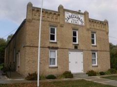 Lodge Zare Zapadu No. 44listed 1986
Population over time
2 figuresHayward grew from 250 to 252 between 2010 and 2020. These are the recorded population figures Wikidata holds for this place, reached through the Geographic Names Information System number this page is keyed on rather than by name, so they belong to this place and not to another of the same name. Most are census counts, but not all are: an early figure may be a founding or settlement estimate, and an estimate published within five years of a census is left out. The change column is computed, and is left blank where more than 20 years separate a figure from the one before it, because a gap that long is not a change between two counts.
| Year | People | Change |
|---|---|---|
| 2010 | 250 | |
| 2020 | 252 | +2 (+1%) |
Topographic sheets covering this place
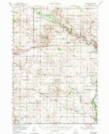
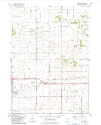
6 surveys from 9 printed sheetsMatched by testing this settlement's coordinate against the published boundary of every sheet in the United States Geological Survey's historical collection. Each opens the scanned sheet at the Survey.
- 1954 USGS Hayward quadrangle1:62500, 2 printings
- 1954 USGS Mason City quadrangle1:250000, 2 printings
- 1957 USGS Mason City quadrangle1:250000
- 1958 USGS Mason City quadrangle1:250000
- 1982 USGS Hayward quadrangle1:24000
- 1985 USGS Albert Lea quadrangle1:100000, 2 printings




In the county-history sources
701 words on this townshipHistory of Freeborn County, Minnesota, published 1911 names this settlement in its chapter on Hayward Township. These are the passages that mention it, exactly as the scans read.
This township, which has also borne the name of Douglass, is the southeast of the six interior towns of the county, and the towns in contact with it are : Riceland on the north, Oakland on the east, Shell Rock on the south, and Albert Lea on the west. It is six miles square, like all the other towns in the county. An arm of Lake Albert Lea, three miles long and a third of a mile wide, lies near the yestern boundary, in a north and south direc¬ tion. A stream called Peter Lunde creek enters the lake in sec¬ tion 7, made up of two branches arising back in the town. The land may be described as prairie, with oak openings and meadow land interspersed, the prairie predominating. The soil as a rule is a black loam, productive of all crops in this latitude. The sub¬ soil is clay and gravel. The town has one village, also known as Hayward.
Passage source: History of Freeborn County, Minnesota, published 1911.
Early Settlement. Oliver Andrews, who came to Shell Rock in 1855, located his claim in Hayward township. His friends, however, were in Shell Rock, and many efforts were made to have his farm remain a part of that township, instead of being included in Hayward. Peter Lunde and Endre Oulbrandson came here in 1856. Peter Lunde had located in Mitchell county, Iowa, in the early fifties. To his home, early in the spring of 1856, came Endre Gulbrandson, a native of Norway, but a resident of Wis¬ consin. Gulbrandson had left his Wisconsin home and brought his family as far as Houston county, Minnesota, where he left them for a time, while he pushed on to Mitchell, where his relative, Peter Lunde, resided. Together these men came to Hayward township and selected claims, later going after their families, who arrived during the middle of the summer. In 1856 William Newlin settled in section 7, William Eddy in section 18, A. T. and Philo Butts in section 20, S. H. Ludlow in section 8, and Freeman Briggs in section 20. The same year came David Hayward, from whom the town is named. He settled on section 6 and remained about two years. Lysander R. Luce came in 1857.
Passage source: History of Freeborn County, Minnesota, published 1911.
Machine-read from a century-old scan, so expect the errors a machine makes: misspelled names, dropped words, stray characters.
Read the whole chapter on Hayward Township - it names this place 2 more 2 times.
Mines and quarries near this place
2 within 5 milesRegional context, not property-specific evidence. The federal mineral resources record lists 2 workings within 5 miles of Hayward: 1 producer, 1 occurrence. 1 still produces. What was taken out: Sand and Gravel, Construction, Limestone, General. Distance is straight-line from the map coordinates, so a quarry counted here may appear on a neighbouring settlement's page as well.
| Where | Site | Commodity | Status | Recorded |
|---|---|---|---|---|
| Freeborn County Marl Bed | Limestone, General | Occurrence | ||
| Ulland Pit | Sand and Gravel, Construction | Producer |
Storms near this place
4 since 1998Regional context, not property-specific evidence. The National Weather Service names Hayward in 4 storm reports between 1998 and 2023: 2 tornado, 1 thunderstorm wind, 1 hail. No death or injury is recorded in these reports. Each account below is quoted exactly as the forecast office filed it, from the NOAA Storm Events Database, and each date opens the federal record of that event.
| When | Event | Place named | Harm | What the report says |
|---|---|---|---|---|
| December 2021 | Tornado (EF0) | Hayward | - | This tornado hit several farmsteads, partially removing the roofs of several outbuildings and a turkey barn. It dented a silo. Trees fell on a number of sheds and vehicles. |
| July 2019 | Thunderstorm Wind | Hayward | - | A trained spotter measured a wind gust of 52 knots. |
| June 1998 | Tornado (F1) | Hayward | - | Barn destroyed. Large power poles knocked down. |
| July 2023 | Hail | Hayward | - | no account filed |
Nearest settlements
The eight closest, with where each one stands in the county. Distances are straight-line, computed from the Geographic Names Information System coordinates.
| Map | Place | Distance | Sheets |
|---|---|---|---|
| Petran | 1.9 miles | 9 | |
| Hollandale Junction | 3.0 miles | 9 | |
| Sigsbee | 3.5 miles | 9 | |
| Twin Grove | 4.7 miles | 9 | |
| Lerdal | 5.2 miles | 10 | |
| South Hollandale | 5.6 miles | 9 | |
| Murtaugh | 5.7 miles | 10 | |
| Glenville | 5.7 miles | 10 |
Elsewhere
Matched on this settlement's Geographic Names Information System number rather than its name, so it cannot be a different place of the same name in another state.
| Wikipedia article on Hayward | An encyclopaedic summary. Its text is share-alike, so it is linked here rather than copied. |
| Wikidata item Q631354 | The structured record the population and elevation above come from. Public domain (CC0). |
Provenance
This settlement is recorded in the Geographic Names Information System as feature 644798. The sheet list is computed by point-in-boundary test against the United States Geological Survey's historical topographic inventory. Both are works of the United States government and carry no copyright under 17 U.S.C. 105.
Mines and quarries. USGS Mineral Resources Data System (MRDS) https://mrdata.usgs.gov/mrds/ A work of the United States government, no copyright under 17 U.S.C. 105.
Storms. NOAA National Centers for Environmental Information, Storm Events Database https://www.ncei.noaa.gov/stormevents/ A work of the United States government, no copyright under 17 U.S.C. 105. Narratives are quoted verbatim from the National Weather Service report and are not edited or summarised.