 Block
Kasota, Minnesota
13 topographic sheets cover this place, the earliest surveyed in 1953 and the latest in 1991. It stands in Kasota City. It lies in ZIP code area 56050. It stands on Shanaska Creek. The Survey maps it on the Saint Peter quadrangle. 714 people lived here at the 2020 count. It stands 807 feet above sea level.
Research this city
On record in Kasota
Buildings and businesses the archive holds for this place. Each opens its own page, with the source record it came from.
On the National Register 4 records
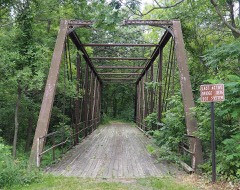 Bridge No. 4846 (1)listed 1981
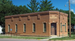 Kasota Township Halllisted 1981
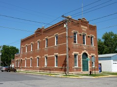 Kasota Village Halllisted 1981
- John R. Andrews Houselisted 1978
Population over time
2 figuresKasota grew from 675 to 714 between 2010 and 2020. These are the recorded population figures Wikidata holds for this place, reached through the Geographic Names Information System number this page is keyed on rather than by name, so they belong to this place and not to another of the same name. Most are census counts, but not all are: an early figure may be a founding or settlement estimate, and an estimate published within five years of a census is left out. The change column is computed, and is left blank where more than 20 years separate a figure from the one before it, because a gap that long is not a change between two counts.
| Year | People | Change |
|---|---|---|
| 2010 | 675 | |
| 2020 | 714 | +39 (+6%) |
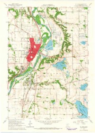
Topographic sheets covering this place
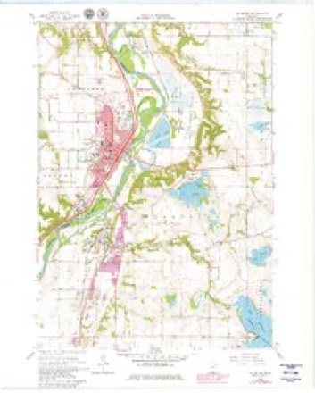
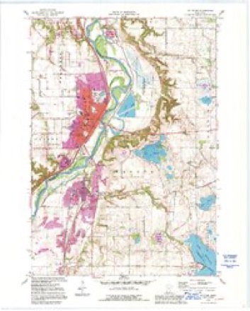
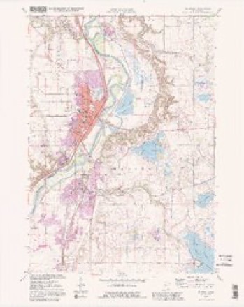
9 surveys from 13 printed sheetsMatched by testing this settlement's coordinate against the published boundary of every sheet in the United States Geological Survey's historical collection. Each opens the scanned sheet at the Survey.
- 1953 USGS Saint Paul quadrangle1:250000, 3 printings
- 1953 USGS St. Paul quadrangle1:250000
- 1959 USGS Saint Paul quadrangle1:250000
- 1959 USGS St. Paul quadrangle1:250000
- 1965 USGS St Peter quadrangle1:24000, 2 printings
- 1965 USGS St. Peter quadrangle1:24000
- 1985 USGS Faribault quadrangle1:100000, 2 printings
- 1991 USGS St Peter quadrangle1:24000
- 1991 USGS St. Peter quadrangle1:24000




Fires near this place
1 since 1996Regional context, not property-specific evidence. The federal wildfire occurrence database lists 1 fire within 5 miles of Kasota in 1996, burning about 290 acres in total. None started naturally. 1 was recorded as arson. Distance is straight-line from the map coordinates, so a fire counted here may appear on a neighbouring settlement's page as well.
| Reported cause | Fires |
|---|---|
| Arson/incendiarism | 1 |
The most recent of them, most recent first, with the day each was reported and the service that recorded it.
| Date | Cause | Size | Reported by | Name on the report |
|---|---|---|---|---|
| 3 November 1996 | Arson/incendiarism | 290 acres | Minnesota Department of Natural Resources | not named |
Settlements close enough to share some of these fires:
Mines and quarries near this place
10 of 13 shownRegional context, not property-specific evidence. The federal mineral resources record lists 13 workings within 5 miles of Kasota: 13 producers. All of them still produce. What was taken out: Sand and Gravel, Construction, Stone, Crushed/Broken, Limestone, Dimension. Distance is straight-line from the map coordinates, so a quarry counted here may appear on a neighbouring settlement's page as well.
| Where | Site | Commodity | Status | Recorded |
|---|---|---|---|---|
| Caroline & Moses Qsuarry | Limestone, Dimension | Producer | ||
| North Quarry | Stone, Crushed/Broken, Limestone, Dimension | Producer | ||
| Ed Swarthout Inc | Stone, Crushed/Broken | Producer | ||
| Ed Swarthout Inc | Stone, Crushed/Broken | Producer | ||
| Henroy Komstz Pit | Stone, Crushed/Broken | Producer | ||
| Lundin Quarry | Stone, Crushed/Broken | Producer | ||
| Blue Earth Co Sand & Gravel Pit | Sand and Gravel, Construction | Producer | ||
| Brown Pit | Sand and Gravel, Construction | Producer | ||
| J V White Pit & Mill | Sand and Gravel, Construction | Producer | ||
| Kasota Pit | Sand and Gravel, Construction | Producer |
Storms near this place
24 since 1998Regional context, not property-specific evidence. The National Weather Service names Kasota in 24 storm reports between 1998 and 2026: 10 thunderstorm wind, 7 hail, 4 flood, 1 tornado. The reports record 1 death and 30 injuries. Each account below is quoted exactly as the forecast office filed it, from the NOAA Storm Events Database, and each date opens the federal record of that event.
| When | Event | Place named | Harm | What the report says |
|---|---|---|---|---|
| August 2006 | Tornado (F3) | Kasota | 1 killed, 30 hurt, $20,000,000 | The F3 tornado that began in Nicollet County at 1630 CST moved into Le Sueur County near the northern city limits of Kasota. Over 100 homes suffered some damage, dozens of homes had major damage, and three were completely leveled. The tornado moved east-northeast for about ten miles in Le Sueur County, then turned and moved east-southeast until dissipation. Hundreds of farm animals were killed, including 200 cows at a large dairy. Approximately five thousand acres of corn and soybeans were estimated to be ruined across the county. A State Farm spokeswoman said the company expected 4,500 homeowner claims and 8,000 auto claims from the storm. Some information provided by the Star Tribune newspaper. A 91 year old man perished in the upper floor of his home when a tree crashed through the roof. |
| June 2014 | Flood | Kasota | $1,100,000 | There were multiple reports of road closures due to high water and debris along the Minnesota River. In the southeast part of Le Sueur County, some residents in the town of Waterville, Minnesota had to evacuate their homes along Lillian Street due to rising waters of the local lake. The city council declared the town a disaster area and had volunteers help them fill sandbags to stop further damage to homes. As lake levels rose, several homes were surrounded by water from the nearby lakes, and a few will be completely destroyed. The city closed four streets and parts of three others due to the flooding. |
| May 2022 | Thunderstorm Wind | Kasota | $50,000 | Scattered trees were blown down from just east of St. Peter to the Cleveland area. |
| June 2016 | Thunderstorm Wind | Kasota | $25,000 | Several six to eight inch diameter trees were blown down across southwest Le Sueur County between the towns of Kasota, St. Peter and Cleveland. One tree landed on a house. Power lines were also blown down which knocked out power to several hundred customers throughout the southwest part of the county. |
| May 2022 | Thunderstorm Wind | Kasota | $15,000 | There was roof damage east of Kasota, on the south side of Lake Emily, along with trees blown down near Kasota. |
| April 2026 | Hail | Kasota | - | Report received via NWS Chat. |
| June 2020 | Heavy Rain | Kasota | - | There was a 18 hour rainfall report near Kasota of 5.94 inches. |
| July 2020 | Flash Flood | Kasota | - | Highway 22 was closed due to flood waters south of Kasota, between County road 140 and 298. Based on the amount of rainfall that occurred in a few hours before midnight, more county roads were probably impassable for short periods of time. |
| March 2019 | Flood | Kasota | - | Numerous roads were closed for several days due to snow melt, and the flood waters that develop from it. Rapidly runoff led to impassable roads, especially along streams and creeks along county roads. |
| August 2018 | Thunderstorm Wind | Kasota | - | Several trees were blown down in Kasota. |
| August 2018 | Thunderstorm Wind | Kasota | - | A power pole was blown down northeast of Kasota. |
| September 2016 | Flood | Kasota | - | Runoff from torrential rainfall that occurred across most of southern Le Sueur County Wednesday night, September 21st, caused numerous roads to remain impassable and closed. |
| September 2010 | Hail | Kasota | - | Several reports of penny, up to ping pong size hail was observed from Kasota, to just east of St. Peter, Minnesota. |
| September 2010 | Flood | Kasota | - | Numerous roads were closed due to excessive rainfall that fell on September 22nd and 23th. The major areal flooding didn't recede until late Saturday when most of the small streams and creeks had crested and only mainstem rivers remained flooded. |
| September 2007 | Thunderstorm Wind | Kasota | - | Tree down on power pole. |
| April 2004 | Thunderstorm Wind | Kasota | - | The roof was partially blown off a tavern. |
| June 2002 | Hail | Kasota | - | Ground white. |
| June 2001 | Thunderstorm Wind | Kasota | - | Trees down. |
| July 2001 | Thunderstorm Wind | Kasota | - | Few trees down. |
| May 2000 | Hail | Kasota | - | The Owatonna People's Press reported that hail piled up like snowdrifts. |
| July 1998 | Thunderstorm Wind | Kasota | - | Trees and power lines down. Estimated windspeed. |
| June 2013 | Hail | Kasota | - | no account filed |
| June 2013 | Hail | Kasota | - | no account filed |
| May 2012 | Hail | Kasota | - | no account filed |
Nearest settlements
The eight closest, with where each one stands in the county. Distances are straight-line, computed from the Geographic Names Information System coordinates.
| Map | Place | Distance | Sheets |
|---|---|---|---|
| Ottawa | 6.3 miles | 12 | |
| Cleveland | 7.1 miles | 10 | |
| Marysburg | 8.6 miles | 13 | |
| Saint Henry | 11.3 miles | 10 | |
| Le Sueur | 11.9 miles | 12 | |
| Kingsway Estates | 13.0 miles | 12 | |
| Greenland | 13.9 miles | 10 | |
| Le Center | 14.1 miles | 10 |
Elsewhere
Matched on this settlement's Geographic Names Information System number rather than its name, so it cannot be a different place of the same name in another state.
| Wikipedia article on Kasota | An encyclopaedic summary. Its text is share-alike, so it is linked here rather than copied. |
| Wikidata item Q1004423 | The structured record the population and elevation above come from. Public domain (CC0). |
Provenance
This settlement is recorded in the Geographic Names Information System as feature 646046. The sheet list is computed by point-in-boundary test against the United States Geological Survey's historical topographic inventory. Both are works of the United States government and carry no copyright under 17 U.S.C. 105.
Wildfire. Short, Karen C. 2022. Spatial wildfire occurrence data for the United States, 1992-2020 [FPA_FOD_20221014]. 6th Edition. Fort Collins, CO: Forest Service Research Data Archive. https://doi.org/10.2737/RDS-2013-0009.6 Collected with United States Government funding and usable without additional permissions or fees.
Mines and quarries. USGS Mineral Resources Data System (MRDS) https://mrdata.usgs.gov/mrds/ A work of the United States government, no copyright under 17 U.S.C. 105.
Storms. NOAA National Centers for Environmental Information, Storm Events Database https://www.ncei.noaa.gov/stormevents/ A work of the United States government, no copyright under 17 U.S.C. 105. Narratives are quoted verbatim from the National Weather Service report and are not edited or summarised.