 Block
La Crescent, Minnesota
14 topographic sheets cover this place, the earliest surveyed in 1930 and the latest in 1991. It stands in La Crescent City. It lies in ZIP code area 55947. It lies near Minnesota Island. The Survey maps it on the La Crescent quadrangle.
On record in La Crescent
Buildings and businesses the archive holds for this place. Each opens its own page, with the source record it came from.
On the National Register 1 record
- Daniel Cameron Houselisted 1982
Topographic sheets covering this place
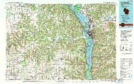
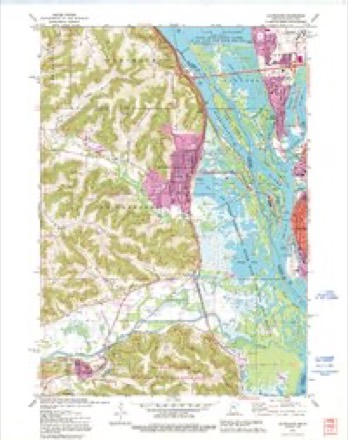
10 surveys from 14 printed sheetsMatched by testing this settlement's coordinate against the published boundary of every sheet in the United States Geological Survey's historical collection. Each opens the scanned sheet at the Survey.
- 1930 USGS La Crescent quadrangle1:62500, 3 printings
- 1956 USGS La Crescent quadrangle1:62500, 2 printings
- 1958 USGS La Crosse quadrangle1:250000, 2 printings
- 1961 USGS La Crosse quadrangle1:250000
- 1965 USGS La Crosse quadrangle1:250000
- 1973 USGS La Crescent quadrangle1:24000
- 1976 USGS La Crosse quadrangle1:250000
- 1984 USGS La Crosse quadrangle1:100000
- 1990 USGS La Crosse quadrangle1:100000
- 1991 USGS La Crescent quadrangle1:24000
In the county-history sources
2,728 words on this townshipHistory of Houston County, Minnesota, published 1919 names this settlement in its chapter on La Crescent Township. These are the passages that mention it, exactly as the scans read.
Situated somewhat back from the Mississippi, from which it is separated by a series of sloughs, marshes and lagoons which teem in luxuriant water foliage and flowering plants, and occupying the gently sloping terraces which terminate on the sunny slopes of picturesque hills, the village is free from floods, and still has all the advantages that can be given by nearness to that great thoroughfare. The dike road which joins the mainland to the La Crosse high wagon bridge, guides through La Crescent, aU the road traffic flowing into La Crosse from southeastern Minnesota and northeastern Iowa, and brings from far east and west the tourists, who find here a convenient crossing place.
Passage source: History of Houston County, Minnesota, published 1919.
To these sweeping terraces came Peter Cameron in 1851, with his dream of a great city. Here, a little later, came the Gillettes, who platted a village. Here in 1856, came the advance guard of the Kentucky Company, whose stockholders likewise had dreams of a great city. Here they platted their future metropolis. Eastern newspapers teemed with its possibilities, great men of the nation vied with each other in buying at fabulous prices lots in this new Utopia. But the wonderful ambitions of the promoters were never realized, and the lot ownership merely remained to harass the tax collectors, and to retard the growth of the town. Indeed it is only in recent years that the titles to the property by resident owners has all been cleared, and now all the land is owned by the La Crescent citizens themselves.
Passage source: History of Houston County, Minnesota, published 1919.
But while these plans for a great metropolis were meeting with failure, there was one dream that was being realized. John S. Harris was a lover of the out-of-doors. He was also a fruit and vegetable fancier. He came to La Crescent in 1856, and while southern promoters were platting and picturing the wonderful lots, in the swamps, on the terraces and up the sides of the hills, he quietly established the Sunnyside Gardens, and started raising fruits and vegetables. He probably did more than any other man to encourage the growing of fruit in the State of Minnesota. And in doing so he brought to La Crescent its present importance. The dream of a great city faded, but his dream of a great fruit and vegetable growing region has more than been fulfilled. Mr. Harris' own son, Frank I. Harris, and his grandson, DeWitt C. Webster, probably ship more berries than anyone else in the State, and there are many others in the same business. The slopes of the hills are covered with fruit trees, the fertile acres of level stretches of the terraces are covered with berry vines and bushes and truck vegetables, and the truck gardens extend far into the sunny valleys and rich ridges. Not only are fruit and fresh vegetables supplied to the cities in large quantities, but a canning factory devoted exclusively to tomatoes, cans the products of the great acreage of that refreshing product.
Passage source: History of Houston County, Minnesota, published 1919.
Machine-read from a century-old scan, so expect the errors a machine makes: misspelled names, dropped words, stray characters.
Read the whole chapter on La Crescent Township - it names this place 9 more 9 times.
Fires near this place
46 since 1992Regional context, not property-specific evidence. The federal wildfire occurrence database lists 46 fires within 5 miles of La Crescent between 1992 and 2020, burning about 53 acres in total. None started naturally. 5 were recorded as arson. Distance is straight-line from the map coordinates, so a fire counted here may appear on a neighbouring settlement's page as well.
| Reported cause | Fires |
|---|---|
| Debris and open burning | 13 |
| Missing data/not specified/undetermined | 12 |
| Equipment and vehicle use | 7 |
| Arson/incendiarism | 5 |
| Recreation and ceremony | 5 |
| Railroad operations and maintenance | 2 |
| Misuse of fire by a minor | 1 |
| Smoking | 1 |
The most recent of them, most recent first, with the day each was reported and the service that recorded it.
| Date | Cause | Size | Reported by | Name on the report |
|---|---|---|---|---|
| 9 September 2003 | Misuse of fire by a minor | under an acre | LaCrosse District, Upper Mississippi National Wildlife Refuge | PAMMEL CREEK FIRE |
| 2 September 2019 | Debris and open burning | under an acre | Wisconsin Department of Natural Resources | 1900058 |
| 27 August 2020 | Missing data/not specified/undetermined | under an acre | Wisconsin Department of Natural Resources | 2004198 |
| 27 August 2020 | Missing data/not specified/undetermined | under an acre | Wisconsin Department of Natural Resources | 2004189 |
| 14 August 2020 | Missing data/not specified/undetermined | under an acre | Wisconsin Department of Natural Resources | 2003958 |
| 5 July 2020 | Arson/incendiarism | under an acre | Wisconsin Department of Natural Resources | 2003248 |
| 31 July 1992 | Debris and open burning | under an acre | Minnesota Department of Natural Resources | not named |
| 29 June 1997 | Arson/incendiarism | under an acre | Minnesota Department of Natural Resources | not named |
Settlements close enough to share some of these fires:
Mines and quarries near this place
4 within 5 milesRegional context, not property-specific evidence. The federal mineral resources record lists 4 workings within 5 miles of La Crescent: 2 producers, 1 past producer, 1 unknown. 2 still produce. What was taken out: Stone, Crushed/Broken, Sand and Gravel, Construction, Stone. Distance is straight-line from the map coordinates, so a quarry counted here may appear on a neighbouring settlement's page as well.
| Where | Site | Commodity | Status | Recorded |
|---|---|---|---|---|
| La Crosse City Quarry | Stone | Unknown | ||
| La Crosse Sand Quarry | Sand and Gravel, Construction | Past Producer | ||
| Dresbach Quarry | Stone, Crushed/Broken | Producer | ||
| Horn Quarry | Stone, Crushed/Broken | Producer |
Storms near this place
19 since 1997Regional context, not property-specific evidence. The National Weather Service names La Crescent in 19 storm reports between 1997 and 2024: 9 thunderstorm wind, 4 flood, 2 flash flood, 2 lightning. The reports record 1 death and 2 injuries. Each account below is quoted exactly as the forecast office filed it, from the NOAA Storm Events Database, and each date opens the federal record of that event.
| When | Event | Place named | Harm | What the report says |
|---|---|---|---|---|
| August 2007 | Flash Flood | La Crescent | 1 killed, 2 hurt, $3,000,000 | A man was killed when he attempted to cross flood waters with two others in his vehicle. The car was washed away on County Road 6 near Pine Creek. His two female companions were rescued but the victim's legs were pinned under a part of the car and rescue workers could not save him. Several rescue workers also became caught in flood waters which swamped at least two rescue boats. This all occurred during the early morning hours of Sunday, August 19th in darkness.||Highway 26 from La Crescent to the Iowa border, Highway 16 from La Crescent to Hokah, and Highway 61 north of La Crescent were all closed by flood waters and damage. |
| August 2014 | Lightning | La Crescent | $1,500,000 | A lightning strike hit a transformer in La Crescent and the resulting damage also took out a nearby substation. Around 3,400 customers were without power until the next day. |
| August 1998 | Thunderstorm Wind | La Crescent | $50,000 | no account filed |
| August 1998 | Flash Flood | La Crescent | $35,000 | no account filed |
| May 2000 | Lightning | La Crescent | $30,000 | no account filed |
| June 1998 | Thunderstorm Wind | La Crescent | $10,000 | no account filed |
| August 1998 | Thunderstorm Wind | La Crescent | $6,000 | no account filed |
| July 2018 | Thunderstorm Wind | La Crescent | $2,000 | Power lines were blown down in La Crescent. |
| June 2016 | Thunderstorm Wind | La Crescent | $2,000 | Several trees were blown down in La Crescent. |
| July 2003 | Thunderstorm Wind | La Crescent | $2,000 | no account filed |
| June 2001 | Hail | La Crescent | $500 | no account filed |
| June 2024 | Flood | La Crescent | - | Significant rainfall throughout June pushed the Mississippi River at La Crescent into flood stage of 641.0 ft on June 25th. The river stage continued to rise through the end of the month while remaining in minor flood stage. |
| April 2023 | Flood | La Crescent | - | Significant upstream runoff from the combination of rainfall and rapidly melting snow pushed the Mississippi River at La Crescent into flood stage on April 17th. A crest of 644.77 ft above sea level occurred on April 26th, 3.77 ft over flood stage. |
| May 2023 | Flood | La Crescent | - | The combination of heavy rainfall and rapidly melting snow resulted in the fourth highest crest on record in La Crescent towards the end of April. Subsequent dry conditions allowed the Mississippi River to slowly recede and drop below minor flood stage in La Crescent on May 5th. |
| October 2013 | Flood | La Crescent | - | Heavy rains caused minor street flooding in La Crescent. |
| July 2013 | Hail | La Crescent | - | Quarter sized hail fell in La Crescent. |
| July 2010 | Thunderstorm Wind | La Crescent | - | A trained spotter estimated a wind gust of 60 miles per hour in the city of La Crescent. |
| June 1997 | Thunderstorm Wind | La Crescent | - | no account filed |
| April 1997 | Thunderstorm Wind | La Crescent | - | no account filed |
Nearest settlements
The eight closest, with where each one stands in the county. Distances are straight-line, computed from the Geographic Names Information System coordinates.
| Map | Place | Distance | Sheets |
|---|---|---|---|
| Shepardson's Park | 0.3 miles | 14 | |
| River Junction | 1.3 miles | 14 | |
| Hokah | 5.2 miles | 14 | |
| Pine Creek | 5.4 miles | 13 | |
| Village Terrace | 5.6 miles | 14 | |
| South Ridge | 6.5 miles | 13 | |
| Brownsville | 9.3 miles | 10 | |
| Houston | 14.7 miles | 10 |
Provenance
This settlement is recorded in the Geographic Names Information System as feature 646292. The sheet list is computed by point-in-boundary test against the United States Geological Survey's historical topographic inventory. Both are works of the United States government and carry no copyright under 17 U.S.C. 105.
Wildfire. Short, Karen C. 2022. Spatial wildfire occurrence data for the United States, 1992-2020 [FPA_FOD_20221014]. 6th Edition. Fort Collins, CO: Forest Service Research Data Archive. https://doi.org/10.2737/RDS-2013-0009.6 Collected with United States Government funding and usable without additional permissions or fees.
Mines and quarries. USGS Mineral Resources Data System (MRDS) https://mrdata.usgs.gov/mrds/ A work of the United States government, no copyright under 17 U.S.C. 105.
Storms. NOAA National Centers for Environmental Information, Storm Events Database https://www.ncei.noaa.gov/stormevents/ A work of the United States government, no copyright under 17 U.S.C. 105. Narratives are quoted verbatim from the National Weather Service report and are not edited or summarised.