 Block
Houston, Minnesota
10 topographic sheets cover this place, the earliest surveyed in 1958 and the latest in 1990. It stands in Houston City. It lies in ZIP code area 55943. The Survey maps it on the Houston quadrangle. 997 people lived here at the 2020 count. It stands 686 feet above sea level.
On record in Houston
Buildings and businesses the archive holds for this place. Each opens its own page, with the source record it came from.
On the National Register 1 record
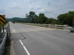 Bridge No. 6679listed 2011
Population over time
2 figuresHouston grew from 979 to 997 between 2010 and 2020. These are the recorded population figures Wikidata holds for this place, reached through the Geographic Names Information System number this page is keyed on rather than by name, so they belong to this place and not to another of the same name. Most are census counts, but not all are: an early figure may be a founding or settlement estimate, and an estimate published within five years of a census is left out. The change column is computed, and is left blank where more than 20 years separate a figure from the one before it, because a gap that long is not a change between two counts.
| Year | People | Change |
|---|---|---|
| 2010 | 979 | |
| 2020 | 997 | +18 (+2%) |
Topographic sheets covering this place
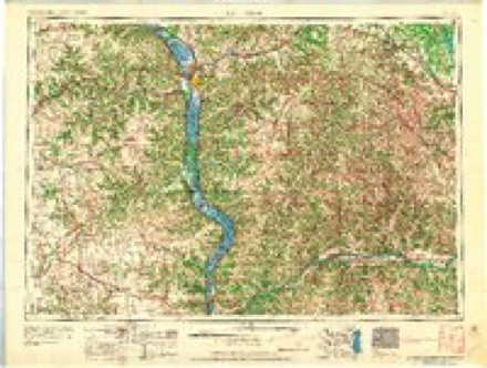
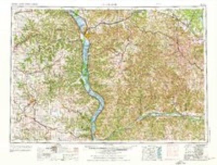
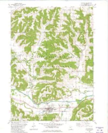
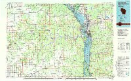
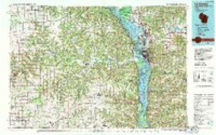
8 surveys from 10 printed sheetsMatched by testing this settlement's coordinate against the published boundary of every sheet in the United States Geological Survey's historical collection. Each opens the scanned sheet at the Survey.
- 1958 USGS Houston quadrangle1:62500, 2 printings
- 1958 USGS La Crosse quadrangle1:250000, 2 printings
- 1961 USGS La Crosse quadrangle1:250000
- 1965 USGS La Crosse quadrangle1:250000
- 1976 USGS La Crosse quadrangle1:250000
- 1980 USGS Houston quadrangle1:24000
- 1984 USGS La Crosse quadrangle1:100000
- 1990 USGS La Crosse quadrangle1:100000
In the county-history sources
3,901 words on this townshipHistory of Houston County, Minnesota, published 1919 names this settlement in its chapter on Houston City. These are the passages that mention it, exactly as the scans read.
The village of Houston was organized April 7, 1874, in accordance with an act of the legislature of the state, approved Feb. 9, 1874. The first officers elected were: H. Rasmussen, president; A. P. Johnson. E. A. Brown and P. Errikson, trustees; D. F. Case, clerk; O. A. Johnson, marshal; I. Abrahamson, treasurer; E. A. Homer, justice of the peace, and G. C. Turner, assessor. At this election D. C. Dyer was moderator; D. C. Sherman, inspector, and P. Downing, election clerk.
Passage source: History of Houston County, Minnesota, published 1919.
Houston's village hall and community center, which is the pride of the village, and of the whole northern part of the county, is the result of an ideal long cherished by many of the leading citizens. The old village hall, as erected some years ago, was built along the lines usually followed in such a building, and was suitable for the ordinary purposes of such a structure. But as the village grew, and modern ideas were introduced, and the community began to take on a more sightly architectural appearance, many of the citizens felt that the time was ripe for the erection of a building which would be a true community center, furnishing not only a protection for the fire apparatus, a meeting place for the council, and an election place, but also an adequate auditorium, suitable for graduations, musicales, theatrical performances and large public gatherings of all sorts. After the usual agitation, the matter was brought to a vote. May 6, 1912, when by a ballot of 73 for to 63 against, the citizens decided to issue bonds to the amount of $4,500. At that time A. T. Rowland was president of the council ; C. J. Swenson, A. P. Omodt and Henry Larson, the trustees ; G. L. Schonlau, the clerk; and these men were all actively concerned in the progress of the work. The architect was I. G. Iverson, to whose credit stand many of the other artistic buildings of the community, and he gave to the work his personal supervision. Captain Samuel B. Mclntire acted as attorney and did much toward bringing the project to a successful conclusion. Martin Nelson, of Rushford, was the contractor; A. T. Rowland installed the heating plant; T. E. Trondson & Son did the painting and decorating ; D. A. Comstock and his father did the plumbing. The Ladies' Civic Club, the Business Men and the Dramatic Company raised $700 for the scenery, seats and piano. The hall was officially opened with a dramatic production by Houston's best local talent.
Passage source: History of Houston County, Minnesota, published 1919.
In the earliest days, the people of Houston obtained their water from the natural waterways. In time wells were dug and cisterns built. Later drilled wells were installed, furnishing the people of the village with an excellent supply. The first efforts toward a public supply were taken on April 23, 1904, when the village voted $5,000 bonds for the installation of a system. The system has since been developed. Still further developments are expected in the future. The service now consists of a White compressed air system of distribution, an ample supply of water being obtained from a flowing well. The pump, having a capacity of 200 gallons a minute, is driven by a gasoline engine. The pumping station is a brick structure, adjoining the village hall, with which it corresponds in exterior finish and decoration. The street system consists of 1,100 feet of six-inch mains, 2,200 feet of four-inch mains, and seven double hydrants.
Passage source: History of Houston County, Minnesota, published 1919.
Machine-read from a century-old scan, so expect the errors a machine makes: misspelled names, dropped words, stray characters.
Read the whole chapter on Houston City - it names this place 15 more 15 times.
Fires near this place
22 since 1995Regional context, not property-specific evidence. The federal wildfire occurrence database lists 22 fires within 5 miles of Houston between 1995 and 2018, burning about 142 acres in total. 1 started naturally. None was recorded as arson. Distance is straight-line from the map coordinates, so a fire counted here may appear on a neighbouring settlement's page as well.
| Reported cause | Fires |
|---|---|
| Debris and open burning | 10 |
| Missing data/not specified/undetermined | 6 |
| Recreation and ceremony | 3 |
| Equipment and vehicle use | 2 |
| Natural | 1 |
The most recent of them, most recent first, with the day each was reported and the service that recorded it.
| Date | Cause | Size | Reported by | Name on the report |
|---|---|---|---|---|
| 4 May 2004 | Recreation and ceremony | under an acre | Minnesota Department of Natural Resources | not named |
| 9 April 2009 | Debris and open burning | under an acre | Minnesota Department of Natural Resources | not named |
| 7 April 2009 | Debris and open burning | under an acre | Minnesota Department of Natural Resources | not named |
| 5 April 2002 | Equipment and vehicle use | under an acre | Minnesota Department of Natural Resources | not named |
| 29 April 2018 | Debris and open burning | 32 acres | Minnesota Department of Natural Resources | not named |
| 26 April 1997 | Debris and open burning | 8.1 acres | Minnesota Department of Natural Resources | not named |
| 24 April 2009 | Natural | under an acre | Minnesota Department of Natural Resources | not named |
| 24 April 2009 | Debris and open burning | under an acre | Minnesota Department of Natural Resources | not named |
Settlements close enough to share some of these fires:
Mines and quarries near this place
1 within 5 milesRegional context, not property-specific evidence. The federal mineral resources record lists 1 working within 5 miles of Houston: 1 producer. All of them still produce. What was taken out: Stone, Crushed/Broken. Distance is straight-line from the map coordinates, so a quarry counted here may appear on a neighbouring settlement's page as well.
| Where | Site | Commodity | Status | Recorded |
|---|---|---|---|---|
| Oak Ridge Quarry | Stone, Crushed/Broken | Producer |
Storms near this place
30 since 1997Regional context, not property-specific evidence. The National Weather Service names Houston in 30 storm reports between 1997 and 2025: 13 hail, 7 flood, 5 thunderstorm wind, 2 flash flood. The reports record 1 death. Each account below is quoted exactly as the forecast office filed it, from the NOAA Storm Events Database, and each date opens the federal record of that event.
| When | Event | Place named | Harm | What the report says |
|---|---|---|---|---|
| August 2007 | Flash Flood | Houston | 1 killed, $600,000 | A 55-year old man was killed near Storer Creek when his mobile home was swept away by flash flooding. The man had been asked to evacuate twice before flood waters swept him and his home away. The normally tranquil trout stream was about 80 yards wide and 7 to 8 feet above nearby bridges. |
| June 2013 | Flash Flood | Houston | $7,100,000 | Very heavy rain caused widespread flash flooding across a good portion of Houston County. Roads around the town of Houston became covered with water and impassable. Rapidly rising water along Riceford Creek caused a campground to be evacuated. A mudslide occurred just outside of Spring Grove. Numerous other roads around the county sustained damage, including County Highway 27 which had a complete section washed out. State Highway 16 east of Houston, State Highway 76 between Caledonia and Houston and County Highway 43 along with numerous other county roads were closed along with at least 20 township roads. In the western part of the county, one vehicle was swept off a road and the driver had to be rescued and at least three campers and a 73 foot mobile home were washed down Crystal Creek. In Hokah, the Root River rise high enough to top the levee requiring a local auto dealership to move about 60 cars to save them from the water. The flooding washed away a gravel road and two walking bridges at Camp Winnebago near Caledonia. |
| August 2007 | Flood | Houston | $1,000,000 | Law enforcement officials reported roads and bridges washed out or still under water. Houston was under mandatory evacuation orders until flood waters receded. Area highways were closed including Highway 26 from Money Creek to Rushford and Highway 9 from Highway 21 to the Winona/Houston County line. |
| August 2007 | Flood | Houston | $750,000 | The Root River at Houston reached a record crest of 18.75 feet on August 19. Flood stage is 15 feet. The town of Houston was completely cutoff by flood waters for awhile. Hundreds of acres of crops along the river were lost when they were inundated by flood waters. |
| September 2021 | Lightning | Houston | $50,000 | A house fire in Houston was started by a lightning strike. Damage to the home was primarily limited to the attic. |
| May 1998 | Hail | Houston | $30,000 | no account filed |
| June 2020 | Thunderstorm Wind | Houston | $15,000 | Three trees fell on a house in Houston. |
| June 1998 | Thunderstorm Wind | Houston | $12,000 | no account filed |
| September 2007 | Thunderstorm Wind | Houston | $5,000 | Trees and power lines were blown down. |
| July 1999 | Hail | Houston | $2,000 | no account filed |
| August 1999 | Hail | Houston | $500 | no account filed |
| July 2025 | Thunderstorm Wind | Houston | - | The public reported numerous trees down 1 mile east-southeast of Houston. |
| May 2024 | Thunderstorm Wind | Houston | - | The public reported a tree down in Houston. |
| October 2023 | Heavy Rain | Houston | - | Volunteer observers reported 0.1 of rainfall from bands of rain that moved through southeast Minnesota on October 6th. During the afternoon of October 6th, a tractor and pickup truck collided along Minnesota Highway 16 and Redding Road in Houston Township resulting in an injured passenger. |
| March 2019 | Flood | Houston | - | Runoff from rain and melting snow along with ice jams pushed the Root River out of its banks in Houston. The river crested over four feet above the flood stage at 19.28 feet on March 15th. This established a crest of record for this site. |
| February 2019 | Flood | Houston | - | An ice jam on the Root River caused flooding to occur in and around Houston. The ice jam formed after temperatures warmed into the 40s during the early part of February. The river crested almost a foot above the flood stage at 15.74 feet. |
| May 2017 | Hail | Houston | - | Half dollar sized hail was reported northwest of Houston. |
| May 2017 | Hail | Houston | - | Quarter sized hail fell in Houston. |
| May 2017 | Hail | Houston | - | Quarter sized hail fell in Houston. |
| September 2016 | Flood | Houston | - | Runoff from heavy rain pushed the Root River out of its banks near Houston. The river crested two feet over the flood stage at 17.01 feet. |
| May 2013 | Flood | Houston | - | Runoff from heavy rains pushed the Root River out of its banks near Houston. The river crested a foot and a half above the flood stage at 16.52 feet. |
| April 2013 | Hail | Houston | - | Quarter sized hail fell southeast of Houston. |
| October 2013 | Heavy Rain | Houston | - | In Houston, 2.31 inches of rain was measured. |
| September 2010 | Flood | Houston | - | Locally heavy rains pushed the Root River at Houston out of its banks on September 23rd. The river gage failed during the flooding and the river is estimated to have returned to within its banks later the same day. The estimated crest was 15.4 feet, which is less than a half foot over the flood stage. |
| June 2008 | Hail | Houston | - | A trained spotter reported golf ball size hail in town. |
| June 1998 | Hail | Houston | - | Dime size hail was reported. |
| April 2011 | Hail | Houston | - | no account filed |
| June 2008 | Hail | Houston | - | no account filed |
| June 2004 | Hail | Houston | - | no account filed |
| June 1997 | Hail | Houston | - | no account filed |
Nearest settlements
The eight closest, with where each one stands in the county. Distances are straight-line, computed from the Geographic Names Information System coordinates.
| Map | Place | Distance | Sheets |
|---|---|---|---|
| Perkins | 4.2 miles | 10 | |
| Money Creek | 4.7 miles | 10 | |
| Sheldon | 6.0 miles | 9 | |
| Schechs Mill | 6.6 miles | 9 | |
| Yucatan | 8.6 miles | 8 | |
| South Ridge | 8.6 miles | 13 | |
| Caledonia | 9.7 miles | 10 | |
| Highland Park Estates | 9.7 miles | 10 |
Elsewhere
Matched on this settlement's Geographic Names Information System number rather than its name, so it cannot be a different place of the same name in another state.
| Wikipedia article on Houston | An encyclopaedic summary. Its text is share-alike, so it is linked here rather than copied. |
| Wikidata item Q2230568 | The structured record the population and elevation above come from. Public domain (CC0). |
Provenance
This settlement is recorded in the Geographic Names Information System as feature 645255. The sheet list is computed by point-in-boundary test against the United States Geological Survey's historical topographic inventory. Both are works of the United States government and carry no copyright under 17 U.S.C. 105.
Wildfire. Short, Karen C. 2022. Spatial wildfire occurrence data for the United States, 1992-2020 [FPA_FOD_20221014]. 6th Edition. Fort Collins, CO: Forest Service Research Data Archive. https://doi.org/10.2737/RDS-2013-0009.6 Collected with United States Government funding and usable without additional permissions or fees.
Mines and quarries. USGS Mineral Resources Data System (MRDS) https://mrdata.usgs.gov/mrds/ A work of the United States government, no copyright under 17 U.S.C. 105.
Storms. NOAA National Centers for Environmental Information, Storm Events Database https://www.ncei.noaa.gov/stormevents/ A work of the United States government, no copyright under 17 U.S.C. 105. Narratives are quoted verbatim from the National Weather Service report and are not edited or summarised.