 Block
Lakefield, Minnesota
9 topographic sheets cover this place, the earliest surveyed in 1954 and the latest in 1985. It stands in Lakefield City. It lies in ZIP code area 56150. The Survey maps it on the Lakefield quadrangle. 1,735 people lived here at the 2020 count. It stands 1,483 feet above sea level.
Population over time
2 figuresLakefield grew from 1,694 to 1,735 between 2010 and 2020. These are the recorded population figures Wikidata holds for this place, reached through the Geographic Names Information System number this page is keyed on rather than by name, so they belong to this place and not to another of the same name. Most are census counts, but not all are: an early figure may be a founding or settlement estimate, and an estimate published within five years of a census is left out. The change column is computed, and is left blank where more than 20 years separate a figure from the one before it, because a gap that long is not a change between two counts.
| Year | People | Change |
|---|---|---|
| 2010 | 1,694 | |
| 2020 | 1,735 | +41 (+2%) |
Topographic sheets covering this place
4 surveys from 9 printed sheetsMatched by testing this settlement's coordinate against the published boundary of every sheet in the United States Geological Survey's historical collection. Each opens the scanned sheet at the Survey.
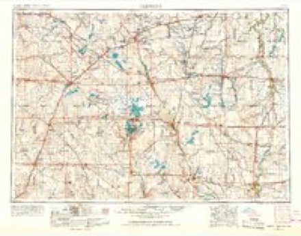
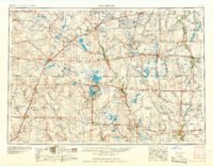
- 1954 USGS Fairmont quadrangle1:250000, 3 printings
- 1958 USGS Fairmont quadrangle1:250000
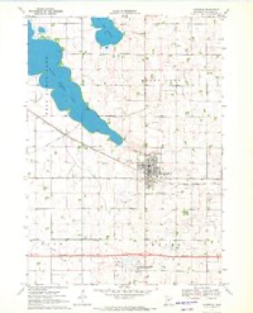
- 1970 USGS Lakefield quadrangle1:24000, 3 printings
- 1985 USGS Worthington quadrangle1:100000, 2 printings
In the county-history sources
5,259 words on this townshipAn Illustrated History of Jackson County, Minnesota, published 1910 names this settlement in its chapter on Lakefield City. These are the passages that mention it, exactly as the scans read.
RANKING second in size, according to the last census, among Jackson county towns is Lakefield. The village is situated in Heron Lake and Hunter townships and is in almost the exact geographical center of the county, its business center being less than one mile from the central point. It is only a short distance from the head of Heron lake, that great expanse of watnr which is noted the country over as a hunters' paradise. Lakefield is on the Soutliern Minnesota division of the Chicago, Milwaukee & St. Paul railroad, and is twelve miles west and north of Jackson. The population in 1905 was 916, but the census of 1910 will undoubtedlv show an increase.
Passage source: An Illustrated History of Jackson County, Minnesota, published 1910.
As regards trade territory^ Lakefield has a stragetic location, drawing its trade from an immense area of exceptionally prosperous country. To the north, northeast, south and southwest there are no towns for many miles, and to LakeiSeld comes the trade from long distances in those directions. The town is compactly built and presents an attractive appearance. It has broad streets, lined with substantial business houses and handsome residences.
Passage source: An Illustrated History of Jackson County, Minnesota, published 1910.
No more beautiful site for a town could be found. It is located on high, rolling ground, of a greater elevation than the surrounding country, exactly on the divide or watershed which separates the two great watercourses of the west - the Mississippi and the Missouri.^ There is plenty of room for the town to grow without taking in a foot of low or swampy ground. All the improvements to be found m Minnesota towns of its size are in Lakefield. It has an excellent waterworks system, electric light plant, good schools and churches.
Passage source: An Illustrated History of Jackson County, Minnesota, published 1910.
Machine-read from a century-old scan, so expect the errors a machine makes: misspelled names, dropped words, stray characters.
Read the whole chapter on Lakefield City - it names this place 28 more 28 times.
Fires near this place
3 since 2004Regional context, not property-specific evidence. The federal wildfire occurrence database lists 3 fires within 5 miles of Lakefield between 2004 and 2020, burning about 155 acres in total. None started naturally. 2 were recorded as arson. Distance is straight-line from the map coordinates, so a fire counted here may appear on a neighbouring settlement's page as well.
| Reported cause | Fires |
|---|---|
| Arson/incendiarism | 2 |
| Missing data/not specified/undetermined | 1 |
The most recent of them, most recent first, with the day each was reported and the service that recorded it.
| Date | Cause | Size | Reported by | Name on the report |
|---|---|---|---|---|
| 7 April 2004 | Missing data/not specified/undetermined | 152 acres | Windom Wetland Management District | BOOT LAKE |
| 13 October 2020 | Arson/incendiarism | 1.0 acres | Minnesota Department of Natural Resources | not named |
| 10 October 2020 | Arson/incendiarism | 2.0 acres | Minnesota Department of Natural Resources | not named |
Storms near this place
59 since 1993Regional context, not property-specific evidence. The National Weather Service names Lakefield in 59 storm reports between 1993 and 2026: 23 hail, 21 thunderstorm wind, 8 tornado, 5 flash flood. No death or injury is recorded in these reports. Each account below is quoted exactly as the forecast office filed it, from the NOAA Storm Events Database, and each date opens the federal record of that event.
| When | Event | Place named | Harm | What the report says |
|---|---|---|---|---|
| August 2000 | Tornado (F1) | Lakefield | $400,000 | A tornado damaged several buildings, including businesses and homes, a grain elevator, and trees as it touched down along highway 86 in Lakefield. |
| August 2000 | Tornado (F1) | Lakefield | $100,000 | A tornado caused extensive damage to a family owned dairy farm. |
| June 1998 | Tornado (F0) | Lakefield | $100,000 | no account filed |
| June 1998 | Hail | Lakefield | $100,000 | no account filed |
| August 2004 | Thunderstorm Wind | Lakefield | $50,000 | Thunderstorm winds destroyed a silo and caused widespread tree damage, including several large trees uprooted or blown down. Some roads were blocked by tree debris. Power lines were blown down, resulting in power outages. |
| August 2000 | Thunderstorm Wind | Lakefield | $50,000 | Downburst winds caused damage to power lines and a grain elevator, and tore singles off roofs. |
| June 2001 | Thunderstorm Wind | Lakefield | $20,000 | Thunderstorm winds destroyed a barn and garage on a farm. |
| April 2001 | Lightning | Lakefield | $20,000 | no account filed |
| May 2012 | Thunderstorm Wind | Lakefield | $5,000 | Thunderstorm winds tore the roof off an open faced hog barn. |
| June 1998 | Thunderstorm Wind | Lakefield | $5,000 | Thunderstorm winds blew over a grain bin. |
| September 2004 | Tornado (F0) | Lakefield | $2,000 | A tornado damaged corn crops , trees, and an outbuilding on a farm. |
| April 2026 | Hail | Lakefield | - | Considerable dime to quarter size hail occurred. |
| April 2026 | Hail | Lakefield | - | Most of the hail was penny to quarter size, but some stones were as large as hen eggs. |
| September 2021 | Thunderstorm Wind | Lakefield | - | Several trees were downed by strong thunderstorm wind gusts. Crop damage is an estimate from insured losses. Information provided by the United States Department of Agriculture. |
| July 2020 | Thunderstorm Wind | Lakefield | - | Wind gusts accompanied hail up to golf ball size. |
| July 2020 | Hail | Lakefield | - | Hail size estimated from photo on social media. |
| June 2019 | Hail | Lakefield | - | Pea to penny size hail. |
| June 2019 | Thunderstorm Wind | Lakefield | - | Tree branches two inches in diameter broken. |
| May 2017 | Thunderstorm Wind | Lakefield | - | Wind Gusts measured by State of Minnesota Department of Transportation Weather Sensor along Interstate 90. |
| June 2016 | Thunderstorm Wind | Lakefield | - | Thunderstorm winds caused tree damage, including a 2 foot diameter tree broken off just above the ground. |
| June 2016 | Thunderstorm Wind | Lakefield | - | Thunderstorm winds caused tree damage, including up to 3 inch diameter limbs blown down. |
| June 2014 | Thunderstorm Wind | Lakefield | - | Thunderstorm winds caused widespread tree damage, including several trees and numerous branches blown down. |
| June 2014 | Thunderstorm Wind | Lakefield | - | Thunderstorm winds caused tree damage, including numerous branches up to 6 inches in diameter blown down. The winds were accompanied by heavy rain. |
| June 2014 | Heavy Rain | Lakefield | - | Rainfall of 2.62 inches was measured. |
| June 2013 | Flash Flood | Lakefield | - | Heavy rain from thunderstorms caused flash flooding of streets in Lakefield. Basements and lower levels of some homes were flooded. |
| May 2012 | Tornado (EF0) | Lakefield | - | A brief tornado caused no reported damage. |
| May 2012 | Flash Flood | Lakefield | - | Heavy rain caused flooding of Minnesota Highway 86. |
| May 2012 | Tornado (EF0) | Lakefield | - | A brief tornado caused no reported damage. |
| May 2012 | Tornado (EF0) | Lakefield | - | A brief tornado caused no reported damage. |
| June 2010 | Thunderstorm Wind | Lakefield | - | Thunderstorm winds caused an unknown amount of tree damage. |
| July 2009 | Flash Flood | Lakefield | - | Heavy rainfall caused brief flash flooding of several intersections. |
| August 2007 | Flash Flood | Lakefield | - | Heavy rainfall of over 3 inches in a short time caused flooding of numerous roads in central and western Jackson County. Roads flooded included Minnesota Highway 86 just south of Interstate 90, several roads in the town of Okabena, and many rural roads. Fields in the area were also flooded. |
| July 2007 | Thunderstorm Wind | Lakefield | - | A thunderstorm gust to 58 mph was measured by road weather equipment. |
| May 2005 | Flash Flood | Lakefield | - | Heavy rain caused widespread street flooding in Lakefield. |
| August 2003 | Thunderstorm Wind | Lakefield | - | Thunderstorm winds caused tree damage, including 2 to 4 inch diameter branches down. |
| June 2001 | Thunderstorm Wind | Lakefield | - | Thunderstorm winds caused tree damage. |
| April 1994 | Tornado (F0) | Lakefield | - | A tornado was spotted southwest of Lakefield and damaged a roof on a building. Several trees were also toppled. |
| May 2022 | Hail | Lakefield | - | no account filed |
| July 2020 | Hail | Lakefield | - | no account filed |
| June 2019 | Hail | Lakefield | - | no account filed |
| July 2019 | Hail | Lakefield | - | no account filed |
| July 2019 | Thunderstorm Wind | Lakefield | - | no account filed |
| July 2018 | Hail | Lakefield | - | no account filed |
| June 2016 | Hail | Lakefield | - | no account filed |
| June 2016 | Hail | Lakefield | - | no account filed |
| June 2014 | Hail | Lakefield | - | no account filed |
| May 2012 | Hail | Lakefield | - | no account filed |
| June 2005 | Hail | Lakefield | - | no account filed |
| May 2005 | Hail | Lakefield | - | no account filed |
| May 2005 | Hail | Lakefield | - | no account filed |
| May 2004 | Hail | Lakefield | - | no account filed |
| August 2004 | Thunderstorm Wind | Lakefield | - | no account filed |
| April 2002 | Thunderstorm Wind | Lakefield | - | no account filed |
| July 2002 | Hail | Lakefield | - | no account filed |
| July 2002 | Hail | Lakefield | - | no account filed |
| June 1998 | Hail | Lakefield | - | no account filed |
| June 1994 | Thunderstorm Wind | Lakefield | - | no account filed |
| July 1994 | Hail | Lakefield | - | no account filed |
| September 1993 | Hail | Lakefield | - | no account filed |
Nearest settlements
The eight closest, with where each one stands in the county. Distances are straight-line, computed from the Geographic Names Information System coordinates.
| Map | Place | Distance | Sheets |
|---|---|---|---|
| Rost | 6.9 miles | 8 | |
| Okabena | 8.8 miles | 8 | |
| Wilder | 10.4 miles | 7 | |
| Jackson | 10.5 miles | 6 | |
| Heron Lake | 11.3 miles | 7 | |
| Spafford | 11.4 miles | 7 | |
| Sioux Valley | 11.6 miles | 7 | |
| Miloma | 12.0 miles | 7 |
Elsewhere
Matched on this settlement's Geographic Names Information System number rather than its name, so it cannot be a different place of the same name in another state.
| Wikipedia article on Lakefield | An encyclopaedic summary. Its text is share-alike, so it is linked here rather than copied. |
| Wikidata item Q1004211 | The structured record the population and elevation above come from. Public domain (CC0). |
Provenance
This settlement is recorded in the Geographic Names Information System as feature 646405. The sheet list is computed by point-in-boundary test against the United States Geological Survey's historical topographic inventory. Both are works of the United States government and carry no copyright under 17 U.S.C. 105.
Wildfire. Short, Karen C. 2022. Spatial wildfire occurrence data for the United States, 1992-2020 [FPA_FOD_20221014]. 6th Edition. Fort Collins, CO: Forest Service Research Data Archive. https://doi.org/10.2737/RDS-2013-0009.6 Collected with United States Government funding and usable without additional permissions or fees.
Storms. NOAA National Centers for Environmental Information, Storm Events Database https://www.ncei.noaa.gov/stormevents/ A work of the United States government, no copyright under 17 U.S.C. 105. Narratives are quoted verbatim from the National Weather Service report and are not edited or summarised.