 Block
Lakeville, Minnesota
12 topographic sheets cover this place, the earliest surveyed in 1953 and the latest in 1985. It stands in Lakeville City. It lies in ZIP code area 55044. The Survey maps it on the Farmington quadrangle. 69,490 people lived here at the 2020 count. It stands 971 feet above sea level.
On record in Lakeville
Buildings and businesses the archive holds for this place. Each opens its own page, with the source record it came from.
On the National Register 1 record
 Emil J. Oberhoffer Houselisted 1979
Population over time
2 figuresLakeville grew from 55,954 to 69,490 between 2010 and 2020. These are the recorded population figures Wikidata holds for this place, reached through the Geographic Names Information System number this page is keyed on rather than by name, so they belong to this place and not to another of the same name. Most are census counts, but not all are: an early figure may be a founding or settlement estimate, and an estimate published within five years of a census is left out. The change column is computed, and is left blank where more than 20 years separate a figure from the one before it, because a gap that long is not a change between two counts.
| Year | People | Change |
|---|---|---|
| 2010 | 55,954 | |
| 2020 | 69,490 | +13,536 (+24%) |
Topographic sheets covering this place
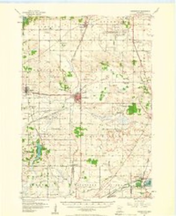
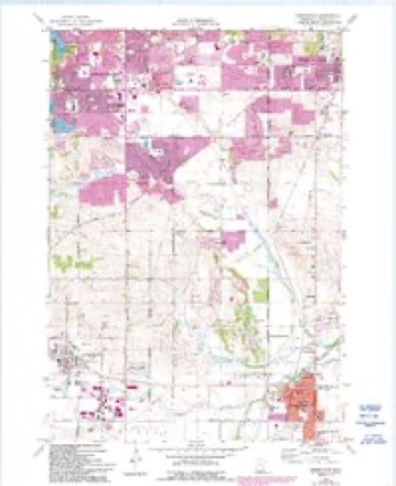
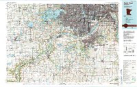
7 surveys from 12 printed sheetsMatched by testing this settlement's coordinate against the published boundary of every sheet in the United States Geological Survey's historical collection. Each opens the scanned sheet at the Survey.
- 1953 USGS Saint Paul quadrangle1:250000, 3 printings
- 1953 USGS St. Paul quadrangle1:250000
- 1957 USGS Farmington quadrangle1:62500, 2 printings
- 1959 USGS Saint Paul quadrangle1:250000
- 1959 USGS St. Paul quadrangle1:250000
- 1974 USGS Farmington quadrangle1:24000, 2 printings
- 1985 USGS Saint Paul quadrangle1:100000, 2 printings




In the county-history sources
6,768 words on this townshipHistory of Dakota County and the City of Hastings, Including the Explorers and Pioneers of Minnesota, published 1881 names this settlement in its chapter on Lakeville City. These are the passages that mention it, exactly as the scans read.
In 1855, Mr. Brackett began to lay the foundations of a town by causing two hundred and fifty acres of land in sections 29 and 30, to be surveyed and platted by Mr. Turpin. He called the place Lakeville on account of its proximity to a pretty little sheet of water. Soon after, he sold a half interest to Charles F. Crehon. When the town was laid out, it embraced within its limits. Mr. Brackett's house. This, then, became the first house in the village of Lakeville. The news soon spread, and men with an eye to business began to be attracted to the new town. Mr. Connelly first appeared on the scene, and opened a general store with a full line of goods, such as were needed by the inhabitants in those days. His place of business was in G. F. Ackley's old log cabin where he remained for a time, and was then succeeded by Jabez Smith. He also soon after sold out to a young man named Perry, who in turn, sold out to Torrey and Bradbury. We know not the reason why each merchant made his stay in the new village so short, whether, because the business did not prove so successful as he expected, or because the spirit of adventure and gain lured him to fresh fields of endeavor.
Passage source: History of Dakota County and the City of Hastings, Including the Explorers and Pioneers of Minnesota, published 1881.
In 1857, Martin Dalton opened a saloon, and J. J. Hartig started a shoemaker's shop. In the same year several settlers built houses, and the town in 1858, was in a flourishing condition. At this time there arose a difficulty in obtaining good titles to the lots on account of the decision of Commissioner Hendricks in regard to the claims of the mail contractors. Although, as previously stated, this was finally decided in Mr. Brackett's favor, and the titles were all made good, yet by this time, the business current had changed its direction, and was setting strongly in favor of Farmington, and it was too late for the village of Lakeville to recover its lost strength.
Passage source: History of Dakota County and the City of Hastings, Including the Explorers and Pioneers of Minnesota, published 1881.
The village held its own pretty bravely until 1869, when the Hastings and Dakota railroad was completed to Lakeville, and the railroad company began to found a village. Purchasing twenty acres of land with twenty acres given to the company by interested persons, a village was formed in the south-west quarter of section 29, and named Fairfield, which was afterwards changed by act of legislature to Lakeville. People following the march of improvement, began to flock in. The first man to take advantage of the new situation, was B. Ackerman, who erected a frame building 22x30 feet, on block 9, and started a general store and hotel. The next building* was erected by Henry Le Due, nearly opposite Ackerman as a general store, while the upper part was used as a dwelling-house. He also erected the first wheat elevator in this part of the county. The village now began to flourish,and most of the business men of the old village seeing in what direction the tide was setting, began to move with it. This with the other causes mentioned occasioned the decay of the old village. At the present time nothing remains to indicate the former presence of any business settlement in the vicinity of Brackett's farm. G. F. Ackley moved next year to the new village and erected a frame building, which he used as a general store. The same year David France moved his blacksmith's shop thither, and was followed by Mr. Weischelbaum, who opened a saloon, and the old village became truly a " deserted village."
Passage source: History of Dakota County and the City of Hastings, Including the Explorers and Pioneers of Minnesota, published 1881.
Machine-read from a century-old scan, so expect the errors a machine makes: misspelled names, dropped words, stray characters.
Read the whole chapter on Lakeville City - it names this place 55 more 55 times.
Fires near this place
1 since 2013Regional context, not property-specific evidence. The federal wildfire occurrence database lists 1 fire within 5 miles of Lakeville in 2013, burning about 8 acres in total. None started naturally. None was recorded as arson. Distance is straight-line from the map coordinates, so a fire counted here may appear on a neighbouring settlement's page as well.
| Reported cause | Fires |
|---|---|
| Equipment and vehicle use | 1 |
The most recent of them, most recent first, with the day each was reported and the service that recorded it.
| Date | Cause | Size | Reported by | Name on the report |
|---|---|---|---|---|
| 27 April 2013 | Equipment and vehicle use | 8.0 acres | Minnesota Valley National Wildlife Refuge | WAGON WHEEL |
Settlements close enough to share some of these fires:
Mines and quarries near this place
4 within 5 milesRegional context, not property-specific evidence. The federal mineral resources record lists 4 workings within 5 miles of Lakeville: 2 producers, 2 unknowns. 2 still produce. What was taken out: Sand and Gravel, Construction. Distance is straight-line from the map coordinates, so a quarry counted here may appear on a neighbouring settlement's page as well.
| Where | Site | Commodity | Status | Recorded |
|---|---|---|---|---|
| Casperson Pit | Sand and Gravel, Construction | Unknown | ||
| Lakeville Pit & Mill | Sand and Gravel, Construction | Producer | ||
| Northwestern Aggregates Pit | Sand and Gravel, Construction | Producer | ||
| Northwestern Sand & Gravel Pit | Sand and Gravel, Construction | Unknown |
Storms near this place
60 of 83 shownRegional context, not property-specific evidence. The National Weather Service names Lakeville in 83 storm reports between 1993 and 2025: 43 hail, 28 thunderstorm wind, 6 heavy rain, 2 tornado. The reports record 3 injuries. Each account below is quoted exactly as the forecast office filed it, from the NOAA Storm Events Database, and each date opens the federal record of that event.
| When | Event | Place named | Harm | What the report says |
|---|---|---|---|---|
| August 2020 | Lightning | Lakeville | 3 hurt, $10,000 | A lightning bolt struck a park shelter where 40 people were attending a birthday party. Three individuals were injured, but with non-life-threatening injuries. |
| May 1996 | Thunderstorm Wind | Lakeville | $4,500,000 | no account filed |
| June 2012 | Thunderstorm Wind | Lakeville | $1,000,000 | Over 100 homes and cars were damaged due to falling debris from winds up to 70 mph around Lakeville. In addition, the Lakeville airport had several planes flipped over. |
| August 2022 | Tornado (EF0) | Lakeville | $500,000 | A NWS Storm Survey concluded that an EF0 tornado touched down near the intersection of Jacquara Avenue and 161st Street West, and moved north-northeast across Crystal Lake, and then lifted near Crystal Beach. Several homes had damage (mainly roof damage) which occurred as multiple large trees were either uprooted or blown down along the tornado's path. The maximum width was 100 yards with a peak wind of 75 mph. |
| July 2015 | Thunderstorm Wind | Lakeville | $100,000 | A severe squall line produced significant tree and power line damage across Dakota County from near the Scott, Dakota County border, through Lakeville, Burnsville, Apple Valley, Rosemount, and to Coates. Numerous large trees and tree limbs were blown down with some power outages. A few private weather stations measured wind speeds of 45 to 55 mph. One private weather station had a measured wind gust of 61 knots in Lakeville. |
| August 2006 | Lightning | Lakeville | $100,000 | Lightning struck a house that was under construction. The fire destroyed the house. |
| August 2016 | Thunderstorm Wind | Lakeville | $15,000 | Several large trees blew down in north Farmington, some that caused damage to homes. There were also pictures on social media of large tree limbs blown down near Lake Marion. |
| May 2014 | Thunderstorm Wind | Lakeville | $10,000 | Large windows were blown in at a local supermarket. |
| July 2011 | Thunderstorm Wind | Lakeville | $10,000 | Several large trees and power lines were blown down near Lakeville, Minnesota. |
| August 2022 | Thunderstorm Wind | Lakeville | $5,000 | Initial downburst caused a few large trees to blown down on Jatos Circle, south of 162nd Street West. The damage was isolated to this area, but a tornado did touch down approximately 1/4 of a mile northeast of this location where the damage was more widespread and concentrated along the tornado's path. |
| September 2021 | Thunderstorm Wind | Lakeville | $500 | A large tree branch was blown down in Lakeville. |
| June 2025 | Hail | Lakeville | - | Hail ranging from half inch to penny sized in Lakeville. |
| September 2021 | Thunderstorm Wind | Lakeville | - | Several trees were uprooted near I-35, south of the old Burnsville Center. |
| June 2020 | Heavy Rain | Lakeville | - | There was a 12 hour rainfall report near Lakeville of 5.40 inches. |
| June 2020 | Heavy Rain | Lakeville | - | There was a 12 hour rainfall report near Burnsville of 5.55 inches. |
| July 2020 | Thunderstorm Wind | Lakeville | - | Several large tree branches were blown down in Apple Valley. |
| July 2019 | Heavy Rain | Lakeville | - | A local observer measured 3.20 inches of rainfall near Lakeville. |
| July 2019 | Thunderstorm Wind | Lakeville | - | A few trees were snapped in Lakeville. |
| July 2018 | Thunderstorm Wind | Lakeville | - | A few trees were blown down near Lakeville. |
| July 2017 | Thunderstorm Wind | Lakeville | - | A trained spotter provided photos of tree damage on Twitter. |
| July 2016 | Thunderstorm Wind | Lakeville | - | A large tree was blown down in Lakeville. |
| August 2016 | Heavy Rain | Lakeville | - | A measured rainfall report of 3.10 inches occurred in Lakeville. |
| August 2016 | Flash Flood | Lakeville | - | One to two feet of flowing water occurred near the intersection of Pennock and Highway 42 in Apple Valley. |
| August 2016 | Heavy Rain | Lakeville | - | A measured rainfall report of 3.15 inches occurred north of Lakeville. |
| August 2016 | Flash Flood | Lakeville | - | A storm spotter observed one to two feet of rushing water near in the intersection of Cedar and Dodd Road in Lakeville. |
| May 2014 | Hail | Lakeville | - | There were several reports of dime to nickel size hail between Apple Valley and Rosemount, with the largest measured at quarter size. |
| May 2014 | Thunderstorm Wind | Lakeville | - | Light poles were blown down north of Lakeville. |
| May 2014 | Thunderstorm Wind | Lakeville | - | A large tree was blown down between Lakeville and Apple Valley. |
| May 2014 | Thunderstorm Wind | Lakeville | - | Several large trees were blown down in the Oak Shores Drive area, east of Buck Hill. |
| July 2014 | Thunderstorm Wind | Lakeville | - | Several large tree limbs, up to 6 inches in diameter, were blown down near Cedar Ave and 160th Street. |
| August 2013 | Hail | Lakeville | - | Hail occurred at County Road 50, and Ipava Avenue in Lakeville. |
| August 2012 | Thunderstorm Wind | Lakeville | - | A few large trees and power lines were blown down around Lakeville. |
| June 2012 | Thunderstorm Wind | Lakeville | - | A fifty foot diameter tree was snapped off at the base. |
| June 2012 | Heavy Rain | Lakeville | - | An observer measured 3.06 inches of rainfall in the last 24 hours. |
| May 2011 | Hail | Lakeville | - | Occurred at the intersection of Interstate 35 and County Road 46. |
| May 2011 | Hail | Lakeville | - | Hail fell at the corner of Cedar Avenue and Dodd Road. |
| July 2008 | Thunderstorm Wind | Lakeville | - | More then 20 trees downed in a residential area of Lakeville near the|intersection of Highview and Co. Road 46. Trees felled were up to 1 foot in diameter. Privacy fences also blown down. |
| August 2007 | Thunderstorm Wind | Lakeville | - | Tree and roof damage South of 160th st. and Flagstaff Avenue intersection. |
| August 2007 | Hail | Lakeville | - | At intersection of County Road 46 and 165th St. |
| August 2007 | Hail | Lakeville | - | At I-35W and County Road 5. |
| October 2006 | Hail | Lakeville | - | Hail occurred at intersection of I-35 and Highway 70. |
| June 2005 | Hail | Lakeville | - | Penny sized hail fell at the intersection of County Road 2 and Interstate 35. |
| June 2005 | Thunderstorm Wind | Lakeville | - | Large trees were downed in a corridor stretching from the southern edge of Lake Marion to the southern half of Lakeville. A few trees fell onto homes, cars, and power lines. City officials reported the loss of 50 boulevard trees and damage to limbs on hundreds of others in town. Seventeen large trees were lost in Aronson and Antlers Park and at the Lakeville Area Arts Center. A 10-foot-tall white fence was blown down. |
| April 2004 | Thunderstorm Wind | Lakeville | - | Two barns lost their roofs, a silo was pushed over, several outbuildings were damaged, and trees were downed. |
| June 2001 | Thunderstorm Wind | Lakeville | - | Construction barrier blown over. |
| September 2001 | Tornado (F0) | Lakeville | - | Tornado touched down just south of Crystal Lake, or just to the east of I-35 and County Road 46. A few trees toppled, patio furniture tossed around. Small amount of siding ripped off house. |
| May 1998 | Thunderstorm Wind | Lakeville | - | Large trees blown down. Structural damage to homes. Estimated windspeed. |
| May 1998 | Thunderstorm Wind | Lakeville | - | 2 foot diameter trees blown down. Estimated windspeed. |
| June 1995 | Hail | Lakeville | - | Winds lifted the roof off of a building |
| August 1993 | Thunderstorm Wind | Lakeville | - | Strong thunderstorm winds blew down a wall of a building at a construction site near Lakeville. |
| August 2025 | Hail | Lakeville | - | no account filed |
| June 2025 | Hail | Lakeville | - | no account filed |
| July 2025 | Hail | Lakeville | - | no account filed |
| July 2023 | Hail | Lakeville | - | no account filed |
| July 2023 | Hail | Lakeville | - | no account filed |
| May 2022 | Hail | Lakeville | - | no account filed |
| June 2021 | Hail | Lakeville | - | no account filed |
| June 2020 | Hail | Lakeville | - | no account filed |
| September 2020 | Hail | Lakeville | - | no account filed |
| June 2019 | Hail | Lakeville | - | no account filed |
Nearest settlements
The eight closest, with where each one stands in the county. Distances are straight-line, computed from the Geographic Names Information System coordinates.
| Map | Place | Distance | Sheets |
|---|---|---|---|
| Antlers Park | 1.5 miles | 12 | |
| Argonne | 3.9 miles | 12 | |
| Eureka Center | 4.5 miles | 11 | |
| Farmington | 5.3 miles | 12 | |
| Deer Park | 5.4 miles | 12 | |
| Apple Valley | 5.8 miles | 12 | |
| Orchard Garden | 5.9 miles | 12 | |
| Burnsville | 8.4 miles | 26 |
Elsewhere
Matched on this settlement's Geographic Names Information System number rather than its name, so it cannot be a different place of the same name in another state.
| Wikipedia article on Lakeville | An encyclopaedic summary. Its text is share-alike, so it is linked here rather than copied. |
| Wikidata item Q983776 | The structured record the population and elevation above come from. Public domain (CC0). |
Provenance
This settlement is recorded in the Geographic Names Information System as feature 646445. The sheet list is computed by point-in-boundary test against the United States Geological Survey's historical topographic inventory. Both are works of the United States government and carry no copyright under 17 U.S.C. 105.
Wildfire. Short, Karen C. 2022. Spatial wildfire occurrence data for the United States, 1992-2020 [FPA_FOD_20221014]. 6th Edition. Fort Collins, CO: Forest Service Research Data Archive. https://doi.org/10.2737/RDS-2013-0009.6 Collected with United States Government funding and usable without additional permissions or fees.
Mines and quarries. USGS Mineral Resources Data System (MRDS) https://mrdata.usgs.gov/mrds/ A work of the United States government, no copyright under 17 U.S.C. 105.
Storms. NOAA National Centers for Environmental Information, Storm Events Database https://www.ncei.noaa.gov/stormevents/ A work of the United States government, no copyright under 17 U.S.C. 105. Narratives are quoted verbatim from the National Weather Service report and are not edited or summarised.