 Block
London, Minnesota
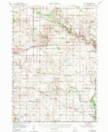
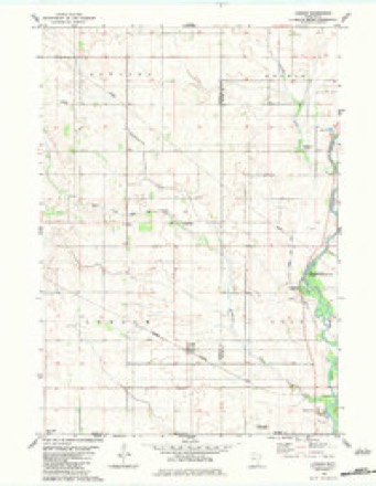
9 topographic sheets cover this place, the earliest surveyed in 1954 and the latest in 1985. It stands in London Township. It lies in ZIP code area 56036. The Survey maps it on the London quadrangle. It stands 1,194 feet above sea level.
Topographic sheets covering this place
6 surveys from 9 printed sheetsMatched by testing this settlement's coordinate against the published boundary of every sheet in the United States Geological Survey's historical collection. Each opens the scanned sheet at the Survey.
- 1954 USGS Hayward quadrangle1:62500, 2 printings
- 1954 USGS Mason City quadrangle1:250000, 2 printings
- 1957 USGS Mason City quadrangle1:250000
- 1958 USGS Mason City quadrangle1:250000
- 1982 USGS London quadrangle1:24000
- 1985 USGS Albert Lea quadrangle1:100000, 2 printings




In the county-history sources
900 words on this townshipHistory of Freeborn County, Minnesota, published 1911 names this settlement in its chapter on London Township. These are the passages that mention it, exactly as the scans read.
This is the southeastern subdivision of Freeborn county, with Mower county bounding it on the east, the state of Iowa on the south, the township of Oakland on the north, and Shell Rock on the west. It is a complete congressional township of thirty-six sections or square miles, and comprising the territory, technically speaking, of township 101, range 19. The greater part of the township is prairie land and is well adapted to tillage and profit¬ able agriculture. The general inclination of the surface is rolling, although it may be said to be more level than any township in Freeborn county. In and about sections 15 and 16 is the most broken, although not enough so to be impractical for cultivation. The soil is a dark loam, rich and productive, and is underlaid with a subsoil of clay. The best farming land in the town is the eastern part. There are few streams and only one lake to water the surface of London. This body of water lies near the center of the town, and is known as Elk lake, covering the greater part of 160 acres in section 21. Two streams flow across the north¬ eastern part of the town, and one traverses the southwest corner.
Passage source: History of Freeborn County, Minnesota, published 1911.
In 1858 James H. Stewart, a native of the Empire state, made his appearance in London and located in section 24. The same year Joseph Chmelik and A. Raymond, Bohemians, arrived and took claims in section 5. Among others of the early settlers in the township were: James Van Winkle, who came in 1861; Henry Lang came in 1862; John Robertson, in 1866; Persons Bump, in 1868; Arthur E. Johnston, and John Manning came in 1879.
Passage source: History of Freeborn County, Minnesota, published 1911.
The Name. London received her name from New London, from which countv in Connecticut came James H. and William N. Goslee. It was originally named Asher and then Lyndon, the name appearing on the county records spelled Lindon. The "New" was dropped from New London, thus giving the town its present designation.
Passage source: History of Freeborn County, Minnesota, published 1911.
Machine-read from a century-old scan, so expect the errors a machine makes: misspelled names, dropped words, stray characters.
Read the whole chapter on London Township - it names this place 1 more 1 time.
Fires near this place
1 since 2011Regional context, not property-specific evidence. The federal wildfire occurrence database lists 1 fire within 5 miles of London in 2011, burning under an acre in total. None started naturally. None was recorded as arson. Distance is straight-line from the map coordinates, so a fire counted here may appear on a neighbouring settlement's page as well.
| Reported cause | Fires |
|---|---|
| Missing data/not specified/undetermined | 1 |
The most recent of them, most recent first, with the day each was reported and the service that recorded it.
| Date | Cause | Size | Reported by | Name on the report |
|---|---|---|---|---|
| 3 April 2011 | Missing data/not specified/undetermined | under an acre | Iowa Department of Natural Resources | 4894 485TH, IA |
Storms near this place
4 since 2008Regional context, not property-specific evidence. The National Weather Service names London in 4 storm reports between 2008 and 2021: 2 tornado, 1 hail, 1 flash flood. No death or injury is recorded in these reports. Each account below is quoted exactly as the forecast office filed it, from the NOAA Storm Events Database, and each date opens the federal record of that event.
| When | Event | Place named | Harm | What the report says |
|---|---|---|---|---|
| December 2021 | Tornado (EF1) | London | - | The tornado hit one farmstead, knocking down trees and causing some damage to outbuildings. At the next farmstead, it destroyed a machine shed. A nearly full grain bin was dented at the top. The house had part of its roof taken off. Near the end of its path, two irrigation pivots were blown over. It was uncertain whether the tornado moved into Mower County, and so the path was not extended into Mower County. |
| December 2021 | Tornado (EF0) | London | - | This tornado developed in Worth County Iowa along 500th Street, initially producing some tree damage (see separate entry from NWS Des Moines). As it crossed into Freeborn County Minnesota, it displaced and destroyed an empty silo on State Line Road. It then destroyed a cattle barn and a pole crashed through a car. The tornado then continued to produce mostly minor tree damage and moved northeast into southwestern Mower County (see separate entry from NWS La Crosse). |
| September 2010 | Flash Flood | London | - | Periods of heavy rainfall developed toward midnight, and continued through most of the early morning hours. Rainfall rates increased to over 1.5 inches per hour, which caused flash flooding in portions of northern and central Freeborn County. Several county roads were inundated by water, and streams and creeks rose rapidly during the morning. |
| July 2008 | Hail | London | - | no account filed |
Nearest settlements
The eight closest, with where each one stands in the county. Distances are straight-line, computed from the Geographic Names Information System coordinates.
| Map | Place | Distance | Sheets |
|---|---|---|---|
| Myrtle | 6.0 miles | 9 | |
| Gordonsville | 10.2 miles | 10 | |
| Oakland | 10.3 miles | 9 | |
| Hollandale Junction | 11.6 miles | 9 | |
| Petran | 11.9 miles | 9 | |
| Glenville | 12.0 miles | 10 | |
| Moscow | 12.6 miles | 9 | |
| Hayward | 12.9 miles | 9 |
Elsewhere
Matched on this settlement's Geographic Names Information System number rather than its name, so it cannot be a different place of the same name in another state.
| Wikipedia article on London | An encyclopaedic summary. Its text is share-alike, so it is linked here rather than copied. |
| Wikidata item Q20657974 | The structured record the population and elevation above come from. Public domain (CC0). |
Provenance
This settlement is recorded in the Geographic Names Information System as feature 647008. The sheet list is computed by point-in-boundary test against the United States Geological Survey's historical topographic inventory. Both are works of the United States government and carry no copyright under 17 U.S.C. 105.
Wildfire. Short, Karen C. 2022. Spatial wildfire occurrence data for the United States, 1992-2020 [FPA_FOD_20221014]. 6th Edition. Fort Collins, CO: Forest Service Research Data Archive. https://doi.org/10.2737/RDS-2013-0009.6 Collected with United States Government funding and usable without additional permissions or fees.
Storms. NOAA National Centers for Environmental Information, Storm Events Database https://www.ncei.noaa.gov/stormevents/ A work of the United States government, no copyright under 17 U.S.C. 105. Narratives are quoted verbatim from the National Weather Service report and are not edited or summarised.