 Block
Medicine Lake, Minnesota
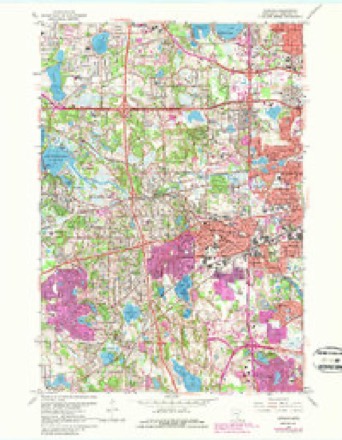
25 topographic sheets cover this place, the earliest surveyed in 1896 and the latest in 1985. It stands in Plymouth City. It lies in ZIP code area 55441. The Survey maps it on the Hopkins quadrangle. 337 people lived here at the 2020 count. It stands 899 feet above sea level.
Population over time
8 figuresMedicine Lake grew from 284 to 337 between 1950 and 2020. These are the recorded population figures Wikidata holds for this place, reached through the Geographic Names Information System number this page is keyed on rather than by name, so they belong to this place and not to another of the same name. Most are census counts, but not all are: an early figure may be a founding or settlement estimate, and an estimate published within five years of a census is left out. The change column is computed, and is left blank where more than 20 years separate a figure from the one before it, because a gap that long is not a change between two counts.
| Year | People | Change |
|---|---|---|
| 1950 | 284 | |
| 1960 | 323 | +39 (+14%) |
| 1970 | 446 | +123 (+38%) |
| 1980 | 419 | -27 (-6%) |
| 1990 | 385 | -34 (-8%) |
| 2000 | 368 | -17 (-4%) |
| 2010 | 371 | +3 (+1%) |
| 2020 | 337 | -34 (-9%) |
Topographic sheets covering this place
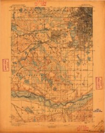
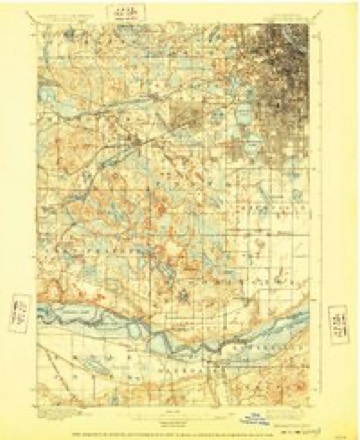
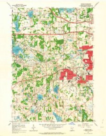
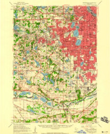
10 surveys from 25 printed sheetsMatched by testing this settlement's coordinate against the published boundary of every sheet in the United States Geological Survey's historical collection. Each opens the scanned sheet at the Survey.
- 1896 USGS Minneapolis quadrangle1:62500
- 1901 USGS Minneapolis quadrangle1:62500, 8 printings
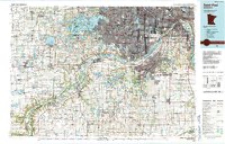
- 1953 USGS Saint Paul quadrangle1:250000, 3 printings
- 1953 USGS St. Paul quadrangle1:250000
- 1954 USGS Hopkins quadrangle1:24000, 2 printings
- 1954 USGS Minneapolis quadrangle1:62500
- 1959 USGS Saint Paul quadrangle1:250000
- 1959 USGS St. Paul quadrangle1:250000
- 1967 USGS Hopkins quadrangle1:24000, 5 printings
- 1985 USGS Saint Paul quadrangle1:100000, 2 printings




In the county-history sources
8,278 words on this townshipHistory of Hennepin County and the City of Minneapolis, Including the Explorers and Pioneers of Minnesota, published 1881 names this settlement in its chapter on Plymouth City. These are the passages that mention it, exactly as the scans read.
Antoine Le Count was the first settler in the town, coming in October, 1853, and locatmg on the east shore of Medicine Lake, on section 24, where he now lives. Antoine Le Count is one of those men whose adventurous life deserves a record that should be preserved for the benefit of the oncoming generations - a I'ecord, counneucing with the primitive history of the Northwest, and extending over the eventful scenes that have been enacted duiing a half century. The writer of this article feels it to be a pleasing duty to give in brief the facts in his possession connected with this adventm'ous traveler, guide, and daring explorer, only regrettmg that the limits allotted to this work will not allow a more detailed account of the man whose history is so closely interwoven with that of the Northwest. And, as the object most sincerely sought for in this work, is to give a succinct and truthful statement of all the facts with which it has to deal, the reader will not do the writer the violence to think that he is reading aught but historic truths, as he follows the history of Antoine Le Count and his father. The latter was a guide in the early days of the Territory , carrying the mail from the Red Kiver country to points south; also carrying with him fancy trinkets and wampum, made by the Indians, taking them to 8t. Louis, and tradmg or selling tliem for horses, or whatever his shrewd mind suggested would pay him to bring back to tlie Hed Hiver country. By this means he a(/cumulated (piite a fortune. Among the early French settlers, he was known by the name ot Le Gros. He took Pierre Bottineau, when he was about twelve >ears old. into his family, and trained him to be the guide that afterward made him famous. Antoine was born on the Minnesota side of the Red Hivei-. near the International bomidary Une, November tith, 1822. In the summer of 1837, he came with his father to Fort Snelling, remaining until September following, when he returned to his home on Red River. His father, in connection with Franklin Steele, made a claim on the east side of the jNIississippi River, at the falls, including Nicollet Island. The followuig June he started for his claim, from Red River, with his family. With tlieni was a gentleman by the name of Thomas Simpson, who was in great haste to get through, and did not wish to take the time necessary to go around by La(' (|ui Parle, and offered Le Count a tempting price to pilot him across the country in as nearly a direct line as possible. Le Count accepted the proposition, and gave Pierre Bottineau charge of the party containuig his family, Pierre Bottineau's, and others, taking besides himself and Mi\ Simpson, his son Autohie, who was nearly seventeen years old, and two others, five in all, and started across. When about a day and a half on their journey, J*Ir. Simpson showed signs of insanity, but did not appear to be dangerous. About smulowu the fourth day out, while they were prejiaring to go into camp, Mr. Simpson seized a double-barrelled shotgim, and, wdthout a moments warning, shot Mr. Le Count and one of the men. Tlie shots followed each other so rapidly that the survivors thought but one shot had lieen tired. Le Count did not die inunediately. hut, knowing his end was near at hand, called his son Antoine to him and told him he was going to die. giving him instructions how, and what direction to take, to reach the train his mother was with, and to nni for his life before Mr. Simpson had time to reload. The hired man had alrea<ly ilisappeared, and yoimg Antoine, with trembling anxiety, watched his opportunity, and made his escape. He had not gone far when he lieard Mr. Simpson calling: "Jim I Jimll"(tlie liired maui; he wanted liim to take him l)ack. In the meantime, .Vntninc had found Jim, and tliey proceeded togetlier. When about a mile from their recent camp, they heard a gun and concluded the unfortunate man had killed himself. (They subsequently found that he had shot at and wounded one of the horses.) Urging their horses to their utmost si)eed, and following the track advised by his father, they struck the train trail of Pierre Bottineau about daylight, having come about tJfly miles. In a short time they were in camp, and told their story. Pierre Bottineau took a party and went back to the scene. When he reached it he found tlie unfortunate Simpson had added his own life to those of Ins two victims, by blowing his head entirely l<> iiieces. The bodies of Le Count and tlie other man. were lirousht back and taken to Red Kiver. and there buried. :Mr. Smipson's )K)dy was left on the spot.
Passage source: History of Hennepin County and the City of Minneapolis, Including the Explorers and Pioneers of Minnesota, published 1881.
At a meeting of the county board April 10th, 1858, for the pm-pose of establishing the boundaries of the townships in the county, the congressional tt)wn of 118-22 was named Plymouth, and the tirst meeting was called under that name, which produced a great deal of dissatisfaction on the part of some of the voters, and aiiother meeting was called for June 21st, 1858, which met at the hotel kept by C. W. Farrington. After considerable discussion a vote was taken, which resulted in favor of Medicine Lake, for the name of the town. The next meeting was held at the school house in district No. 51. April 5th, 1859, and the call was issued under the name of Medicine Lake, and the business transacted luuler that name. The following year, April 3d, 1860, the meeting was held under the name of Plymouth, no ree(u-ds showing when or how the change was effected. The county officials never recognized the name of Medicine Lake, and the name reverted back to that given it by the county board. The name was taken from a village called Plymouth, laid out on the north and west shores of Parker's Lake, in 1856.
Passage source: History of Hennepin County and the City of Minneapolis, Including the Explorers and Pioneers of Minnesota, published 1881.
The first post-offlce established in the town was at Medicine Lake, in the spring of 1850, and Fi-ancis Iluot appointed Postmaster, who held the office about three years, when he was succeeded by his brother Louis. Plymouth Postofflce was established in 1865, and Xalhaniel Day appointed Postmaster, who removed it to his house, on section 15. jSIr. Day died in the winter of 1867, and was succeeded l)y Amos Dickinson, who was followed by James Hough, who held the office until it was discontinued. In 1878 another office was established on section 4, and Fred. Gue.sman appointed Postmaster. This office was also discontinued in the spring of 1880. Parker's Lake I'ost-otlice was estaltlished June 28th, 1871, and J. M. Parker appointed Postmaster. Has held the office to the present time. South Plymouth Post-office was established in 1862, and located on section H3. Mrs. Matilda Clay appointed Postmistress. When the postoffice at AVayzata was re-established, in 1864, South Plymouth was discontinued.
Passage source: History of Hennepin County and the City of Minneapolis, Including the Explorers and Pioneers of Minnesota, published 1881.
Machine-read from a century-old scan, so expect the errors a machine makes: misspelled names, dropped words, stray characters.
Read the whole chapter on Plymouth City - it names this place 5 more 5 times.
Fires near this place
3 since 2000Regional context, not property-specific evidence. The federal wildfire occurrence database lists 3 fires within 5 miles of Medicine Lake between 2000 and 2001, burning about 26 acres in total. None started naturally. 2 were recorded as arson. Distance is straight-line from the map coordinates, so a fire counted here may appear on a neighbouring settlement's page as well.
| Reported cause | Fires |
|---|---|
| Arson/incendiarism | 2 |
| Railroad operations and maintenance | 1 |
The most recent of them, most recent first, with the day each was reported and the service that recorded it.
| Date | Cause | Size | Reported by | Name on the report |
|---|---|---|---|---|
| 4 May 2001 | Railroad operations and maintenance | under an acre | Minnesota Department of Natural Resources | not named |
| 8 April 2000 | Arson/incendiarism | 12 acres | Minnesota Department of Natural Resources | not named |
| 10 April 2000 | Arson/incendiarism | 14 acres | Minnesota Department of Natural Resources | not named |
Settlements close enough to share some of these fires:
Mines and quarries near this place
3 within 5 milesRegional context, not property-specific evidence. The federal mineral resources record lists 3 workings within 5 miles of Medicine Lake: 3 producers. All of them still produce. What was taken out: Sand and Gravel, Construction, Bentonite. Distance is straight-line from the map coordinates, so a quarry counted here may appear on a neighbouring settlement's page as well.
| Where | Site | Commodity | Status | Recorded |
|---|---|---|---|---|
| North Central Aggregate Pit | Bentonite | Producer | ||
| Highway 18 Pit and Mill | Sand and Gravel, Construction | Producer | ||
| Hopkins Plant | Sand and Gravel, Construction | Producer |
Nearest settlements
The eight closest, with where each one stands in the county. Distances are straight-line, computed from the Geographic Names Information System coordinates.
| Map | Place | Distance | Sheets |
|---|---|---|---|
| Mission Farms | 1.7 miles | 21 | |
| Oak Knoll | 1.8 miles | 25 | |
| Plymouth | 2.4 miles | 21 | |
| New Hope | 3.3 miles | 21 | |
| Golden Valley | 3.7 miles | 21 | |
| Crystal | 3.9 miles | 21 | |
| Minnetonka Mills | 4.0 miles | 25 | |
| Glenwood Junction | 4.4 miles | 26 |
Elsewhere
Matched on this settlement's Geographic Names Information System number rather than its name, so it cannot be a different place of the same name in another state.
| Wikipedia article on Medicine Lake | An encyclopaedic summary. Its text is share-alike, so it is linked here rather than copied. |
| Wikidata item Q1916607 | The structured record the population and elevation above come from. Public domain (CC0). |
Provenance
This settlement is recorded in the Geographic Names Information System as feature 647733. The sheet list is computed by point-in-boundary test against the United States Geological Survey's historical topographic inventory. Both are works of the United States government and carry no copyright under 17 U.S.C. 105.
Wildfire. Short, Karen C. 2022. Spatial wildfire occurrence data for the United States, 1992-2020 [FPA_FOD_20221014]. 6th Edition. Fort Collins, CO: Forest Service Research Data Archive. https://doi.org/10.2737/RDS-2013-0009.6 Collected with United States Government funding and usable without additional permissions or fees.
Mines and quarries. USGS Mineral Resources Data System (MRDS) https://mrdata.usgs.gov/mrds/ A work of the United States government, no copyright under 17 U.S.C. 105.