 Block
New Trier, Minnesota
11 topographic sheets cover this place, the earliest surveyed in 1953 and the latest in 1990. It stands in New Trier City. It lies in ZIP code area 55031. The Survey maps it on the Cannon Falls quadrangle. 86 people lived here at the 2020 count. It stands 981 feet above sea level.
On record in New Trier
Buildings and businesses the archive holds for this place. Each opens its own page, with the source record it came from.
On the National Register 1 record
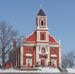 Church of St Mary's-Catholiclisted 1979
Population over time
2 figuresNew Trier fell from 112 to 86 between 2010 and 2020. These are the recorded population figures Wikidata holds for this place, reached through the Geographic Names Information System number this page is keyed on rather than by name, so they belong to this place and not to another of the same name. Most are census counts, but not all are: an early figure may be a founding or settlement estimate, and an estimate published within five years of a census is left out. The change column is computed, and is left blank where more than 20 years separate a figure from the one before it, because a gap that long is not a change between two counts.
| Year | People | Change |
|---|---|---|
| 2010 | 112 | |
| 2020 | 86 | -26 (-23%) |
Topographic sheets covering this place
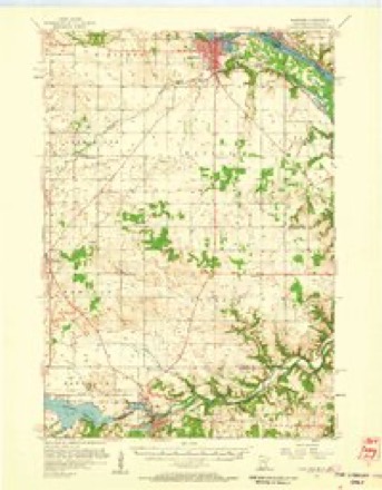
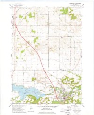
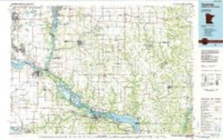
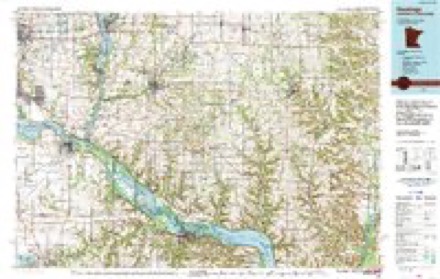
8 surveys from 11 printed sheetsMatched by testing this settlement's coordinate against the published boundary of every sheet in the United States Geological Survey's historical collection. Each opens the scanned sheet at the Survey.
- 1953 USGS Saint Paul quadrangle1:250000, 3 printings
- 1953 USGS St. Paul quadrangle1:250000
- 1957 USGS Hastings quadrangle1:62500, 2 printings
- 1959 USGS Saint Paul quadrangle1:250000
- 1959 USGS St. Paul quadrangle1:250000
- 1974 USGS Cannon Falls quadrangle1:24000
- 1985 USGS Hastings quadrangle1:100000
- 1990 USGS Hastings quadrangle1:100000




In the county-history sources
4,696 words on this townshipHistory of Dakota County and the City of Hastings, Including the Explorers and Pioneers of Minnesota, published 1881 names this settlement in its chapter on New Trier City. These are the passages that mention it, exactly as the scans read.
This village is situated in the north-east part of the township, and has a population of about one hundred and twenty. Father Keller gave it the name in honor of a small city in Germany. The first building put up in the town was the log church in 1856. The next building was a board shanty built in 1863 by Mathias Hubli. In 1865, Peter Mies built the first hotel, called the New Trier house. This was sold in 1867, to John Simmer, who still owns it. In this was kept the first grocery in the place.
Passage source: History of Dakota County and the City of Hastings, Including the Explorers and Pioneers of Minnesota, published 1881.
The first marriage in the township was that of John Kranz and Miss Abbie Stumpf , celebrated in the Catholic church at New Trier, in November, 1857, by Father George Keller. The first birth was that of L. Holden, born August 11th, 1855.
Passage source: History of Dakota County and the City of Hastings, Including the Explorers and Pioneers of Minnesota, published 1881.
Francis Gores was born in Prussia, province of Rhine, in 1826. He was a tiller of the soil in his native place, and in 1855, came to America. Coming to Minnesota, he located at Hampton in 1858, making a claim of one hundred and sixty acres of land, and still retains the eighty acres on which he lives. Mr. Gores held the office of town clerk about seven years, and when New Trier was incorporated, he was appointed postmaster, and held the position eight years. He was instrumental in the erection of the first church in New Trier, Father Keller being its pastor. He is also engaged in the general merchandise business in the town of Hampton. Married Miss Margaret Wolf, a native of Luxemburg. They have five children, Nicholas, Frank, Barbara, Rosa and Susie.
Passage source: History of Dakota County and the City of Hastings, Including the Explorers and Pioneers of Minnesota, published 1881.
Machine-read from a century-old scan, so expect the errors a machine makes: misspelled names, dropped words, stray characters.
Read the whole chapter on New Trier City - it names this place 8 more 8 times.
Fires near this place
2 since 1994Regional context, not property-specific evidence. The federal wildfire occurrence database lists 2 fires within 5 miles of New Trier between 1994 and 2000, burning about 80 acres in total. None started naturally. None was recorded as arson. Distance is straight-line from the map coordinates, so a fire counted here may appear on a neighbouring settlement's page as well.
| Reported cause | Fires |
|---|---|
| Missing data/not specified/undetermined | 2 |
The most recent of them, most recent first, with the day each was reported and the service that recorded it.
| Date | Cause | Size | Reported by | Name on the report |
|---|---|---|---|---|
| 30 October 1994 | Missing data/not specified/undetermined | under an acre | Minnesota Department of Natural Resources | not named |
| 19 October 2000 | Missing data/not specified/undetermined | 80 acres | Minnesota Department of Natural Resources | not named |
Settlements close enough to share some of these fires:
Storms near this place
10 since 2008Regional context, not property-specific evidence. The National Weather Service names New Trier in 10 storm reports between 2008 and 2024: 4 thunderstorm wind, 3 hail, 2 tornado, 1 funnel cloud. No death or injury is recorded in these reports. Each account below is quoted exactly as the forecast office filed it, from the NOAA Storm Events Database, and each date opens the federal record of that event.
| When | Event | Place named | Harm | What the report says |
|---|---|---|---|---|
| August 2009 | Tornado (EF1) | New Trier | $25,000 | A roof was completely torn off a farm house, and several large sheds and outbuildings were destroyed. The tornado tracked through corn fields, from south-southeast to the north-northwest. |
| July 2009 | Thunderstorm Wind | New Trier | $15,000 | A local National Weather Service employee and the local Emergency Manager reported several trees blown down east of New Trier, and a 16' hopper blown over near Miesville. |
| August 2022 | Funnel Cloud | New Trier | - | A storm chaser took video of a funnel cloud. The funnel may have made ground contact, but it was not possible to verify that. No damage was reported. The location was approximated based on the video. |
| September 2018 | Tornado (EF0) | New Trier | - | A NWS storm survey, plus areal footage of drone and satellite data, concluded that an EF0 tornado tracked 4.6 miles from south of Hampton, then east-northeast before it lifted 2 miles east of New Trier. This tornado tracked mainly through corn and soy bean fields, and occasionally damaging a few sheds and outbuildings. The damage was consistent with EF0 damage with maximum wind speeds of 75 mph and a width of 220 yards. |
| July 2010 | Thunderstorm Wind | New Trier | - | Several large tree branches were blown down on Highway 20, southeast of New Trier. |
| July 2008 | Thunderstorm Wind | New Trier | - | Metal shed blown apart and pieces of which wrapped around trees. Garage of home on same property partially collapsed. Two to three foot diameter tree uprooted. |
| July 2008 | Thunderstorm Wind | New Trier | - | Garage, pole barn and farm outbuildings detroyed. |
| August 2008 | Hail | New Trier | - | Hail covered the ground. |
| September 2024 | Hail | New Trier | - | no account filed |
| August 2019 | Hail | New Trier | - | no account filed |
Nearest settlements
The eight closest, with where each one stands in the county. Distances are straight-line, computed from the Geographic Names Information System coordinates.
Elsewhere
Matched on this settlement's Geographic Names Information System number rather than its name, so it cannot be a different place of the same name in another state.
| Wikipedia article on New Trier | An encyclopaedic summary. Its text is share-alike, so it is linked here rather than copied. |
| Wikidata item Q998867 | The structured record the population and elevation above come from. Public domain (CC0). |
Provenance
This settlement is recorded in the Geographic Names Information System as feature 648522. The sheet list is computed by point-in-boundary test against the United States Geological Survey's historical topographic inventory. Both are works of the United States government and carry no copyright under 17 U.S.C. 105.
Wildfire. Short, Karen C. 2022. Spatial wildfire occurrence data for the United States, 1992-2020 [FPA_FOD_20221014]. 6th Edition. Fort Collins, CO: Forest Service Research Data Archive. https://doi.org/10.2737/RDS-2013-0009.6 Collected with United States Government funding and usable without additional permissions or fees.
Storms. NOAA National Centers for Environmental Information, Storm Events Database https://www.ncei.noaa.gov/stormevents/ A work of the United States government, no copyright under 17 U.S.C. 105. Narratives are quoted verbatim from the National Weather Service report and are not edited or summarised.