 Block
Revere, Minnesota
9 topographic sheets cover this place, the earliest surveyed in 1953 and the latest in 1986. It stands in Revere City. It lies in ZIP code area 56166. The Survey maps it on the Lamberton quadrangle. 89 people lived here at the 2020 count. It stands 1,148 feet above sea level.
On record in Revere
Buildings and businesses the archive holds for this place. Each opens its own page, with the source record it came from.
On the National Register 1 record
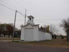 Revere Fire Halllisted 1980
Population over time
2 figuresRevere fell from 95 to 89 between 2010 and 2020. These are the recorded population figures Wikidata holds for this place, reached through the Geographic Names Information System number this page is keyed on rather than by name, so they belong to this place and not to another of the same name. Most are census counts, but not all are: an early figure may be a founding or settlement estimate, and an estimate published within five years of a census is left out. The change column is computed, and is left blank where more than 20 years separate a figure from the one before it, because a gap that long is not a change between two counts.
| Year | People | Change |
|---|---|---|
| 2010 | 95 | |
| 2020 | 89 | -6 (-6%) |
Topographic sheets covering this place
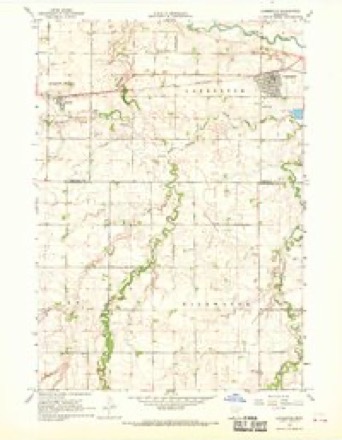
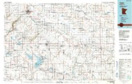
6 surveys from 9 printed sheetsMatched by testing this settlement's coordinate against the published boundary of every sheet in the United States Geological Survey's historical collection. Each opens the scanned sheet at the Survey.
- 1953 USGS New Ulm quadrangle1:250000, 3 printings
- 1957 USGS New Ulm quadrangle1:250000
- 1958 USGS New Ulm quadrangle1:250000
- 1967 USGS Lamberton quadrangle1:24000
- 1967 USGS New Ulm quadrangle1:250000
- 1986 USGS Tracy quadrangle1:100000, 2 printings




In the county-history sources
805 words on this townshipThe History of Redwood County, Minnesota, published 1916 names this settlement in its chapter on Revere City. These are the passages that mention it, exactly as the scans read.
Revere was platted in 1886 and incorporated in 1899-1900. The village had its start when the railroad put into use two box cars, one as a station and the other as a freight house. About 1899 Bingham Brothers built a flat house for the storing of grain. Norman T. Nelson started buying grain. Later Hans Nelson was the buyer. D. S. Cantine started dealing in live stock. The first store was that of Louis J. Rongstad & Co. In this store was the postoffice, with Mr. Rongstad as postmaster. Mr. Rongstad 's partner was A. 0. Anderson, who seems to have been the financial backer.
Passage source: The History of Redwood County, Minnesota, published 1916.
When the Northwestern Gazetteer was issued in 1896, Revere was a thriving point, and these business activities for that year are given: Anderson, Ambrose, shoemaker; Bingham Bros. (H. Nelson, agent), elevator; Cantine, D. S., live stock; Dahl Bros., general store, grain and live stock ; Dahl, 0. H., hotel ; Dahl, H. H., postmaster; Nelson, Hans, grain; Nicholaison, Jens, carpenter; Parsons, W. B. (0. H. Dahl, agt.), elevator; Rasmusson Bros., blacksmiths; Revere Co-operative Creamery Co. (James J. Lawrentzen, manager) ; Young, George H., tanner and glovemaker.
Passage source: The History of Redwood County, Minnesota, published 1916.
In 1898 these business activities are shown in the Gazetteer: Anderson, Ambrose, shoemaker; Bingham Bros. (H. Nelson, agent), elevator; Bridley, A. H., general store; Dahl Bros., general store, grain and live stock ; Engen, J. J., fuel ; Lohre & Munsen, hardware ; McDougal, W. D., railroad, express and telegraph agent; Munsen, Albert, hotel; Nicholaison, Jens, carpenter; Rasmuson Bros. (Emil C. and Louis P.), blacksmiths; Revere Creamery Assn. (H. H. Dahl, manager) ; Parsons Grain Co. (0. H. Dahl, agent), elevator; Schultz, John, hotel and dray line; Standard Lumber Co. (0. H. Dahl, agent), elevator; Turner, F. E., general store ; Weldon, Arthur, confectionery.
Passage source: The History of Redwood County, Minnesota, published 1916.
Machine-read from a century-old scan, so expect the errors a machine makes: misspelled names, dropped words, stray characters.
Read the whole chapter on Revere City - it names this place 2 more 2 times.
Storms near this place
7 since 1995Regional context, not property-specific evidence. The National Weather Service names Revere in 7 storm reports between 1995 and 2025: 3 thunderstorm wind, 2 tornado, 1 hail, 1 funnel cloud. No death or injury is recorded in these reports. Each account below is quoted exactly as the forecast office filed it, from the NOAA Storm Events Database, and each date opens the federal record of that event.
| When | Event | Place named | Harm | What the report says |
|---|---|---|---|---|
| July 1995 | Thunderstorm Wind | Revere | $150,000 | A large grain bin and garage were destroyed. There was tree damage also reported in Lamberton. |
| July 2025 | Funnel Cloud | Revere | - | Trained spotter reported a rotating wall cloud with a brief funnel cloud near Revere along CR 14. |
| June 2017 | Thunderstorm Wind | Revere | - | Power lines were blown down. |
| June 2010 | Tornado (EF1) | Revere | - | A tornado moved southeast across mostly open fields, causing only minor damage at a couple of farmsteads. About 1/2 mile southeast of Highway 14 and Garden Avenue, however, it struck a farmstead, demolishing two sheds, and peeling away a portion of a barn roof. The house sustained minor damage, and the tornado uprooted or broke several dozen trees. The tornado then turned south-southeast and hit one more farmstead, knocking down more trees and causing minor damage to a house. The tornado was recorded on video by storm chasers. |
| April 2004 | Tornado (F0) | Revere | - | A tornado was recorded on video by law enforcement as it crossed Highway 14 east of Revere. The tornado downed trees on either side of the road. The remainder of the tornado's path included open fields where little if any damage occurred. |
| July 2002 | Thunderstorm Wind | Revere | - | Scattered trees and power lines down. Corn flattened. |
| April 2001 | Hail | Revere | - | no account filed |
Nearest settlements
The eight closest, with where each one stands in the county. Distances are straight-line, computed from the Geographic Names Information System coordinates.
Elsewhere
Matched on this settlement's Geographic Names Information System number rather than its name, so it cannot be a different place of the same name in another state.
| Wikipedia article on Revere | An encyclopaedic summary. Its text is share-alike, so it is linked here rather than copied. |
| Wikidata item Q1952959 | The structured record the population and elevation above come from. Public domain (CC0). |
Provenance
This settlement is recorded in the Geographic Names Information System as feature 649950. The sheet list is computed by point-in-boundary test against the United States Geological Survey's historical topographic inventory. Both are works of the United States government and carry no copyright under 17 U.S.C. 105.
Storms. NOAA National Centers for Environmental Information, Storm Events Database https://www.ncei.noaa.gov/stormevents/ A work of the United States government, no copyright under 17 U.S.C. 105. Narratives are quoted verbatim from the National Weather Service report and are not edited or summarised.