 Block
Lamberton, Minnesota
9 topographic sheets cover this place, the earliest surveyed in 1953 and the latest in 1986. It stands in Lamberton Township. It lies in ZIP code area 56152. The Survey maps it on the Lamberton quadrangle. 792 people lived here at the 2020 count. It stands 1,142 feet above sea level.
On record in Lamberton
Buildings and businesses the archive holds for this place. Each opens its own page, with the source record it came from.
On the National Register 2 records
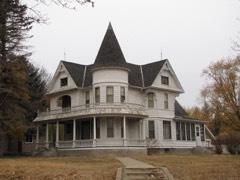 J. A. Anderson Houselisted 1980
 City Blacksmith Shoplisted 1980
Population over time
2 figuresLamberton fell from 824 to 792 between 2010 and 2020. These are the recorded population figures Wikidata holds for this place, reached through the Geographic Names Information System number this page is keyed on rather than by name, so they belong to this place and not to another of the same name. Most are census counts, but not all are: an early figure may be a founding or settlement estimate, and an estimate published within five years of a census is left out. The change column is computed, and is left blank where more than 20 years separate a figure from the one before it, because a gap that long is not a change between two counts.
| Year | People | Change |
|---|---|---|
| 2010 | 824 | |
| 2020 | 792 | -32 (-4%) |
Topographic sheets covering this place
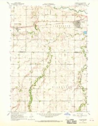
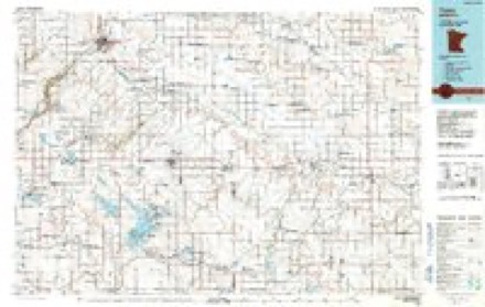
6 surveys from 9 printed sheetsMatched by testing this settlement's coordinate against the published boundary of every sheet in the United States Geological Survey's historical collection. Each opens the scanned sheet at the Survey.
- 1953 USGS New Ulm quadrangle1:250000, 3 printings
- 1957 USGS New Ulm quadrangle1:250000
- 1958 USGS New Ulm quadrangle1:250000
- 1967 USGS Lamberton quadrangle1:24000
- 1967 USGS New Ulm quadrangle1:250000
- 1986 USGS Tracy quadrangle1:100000, 2 printings




In the county-history sources
7,270 words on this townshipThe History of Redwood County, Minnesota, published 1916 names this settlement in its chapter on Lamberton Township. These are the passages that mention it, exactly as the scans read.
Lamberton township is located on the south border of Redwood county, and embraces Congressional township 109-37. It is bounded on the north by Waterbury, on the east by Charlestown, on the south by Cottonwood county, and on the west by North Hero. The Cottonwood river crosses it near the northcentral part, flowing in a southeasterly direction. Two small creeks flow northward into the Cottonwood. The "Winona-Tracy division of the Chicago and Northwestern passes westward through the center of this township. The surface is rolling. The only village is Lamherton. There are three school houses. The predominating nationality is German and American.
Passage source: The History of Redwood County, Minnesota, published 1916.
Beginning with March 2, 1868, the west part of this township was included in Yellow Medicine township, and after Yellow Medicine county was organized March 6, 1871, was considered a part of Redwood Falls township, together with the eastern part, which in the meantime has been considered a part of Redwood Falls township since the organization of Redwood county. When Charlestown was created May 3, 1872, it included the present township of Lamberton. Lamberton township was created by the county commissioners, May 3, 1872.
Passage source: The History of Redwood County, Minnesota, published 1916.
Charlestown township is located in the southeast corner of Redwood county, and embraces Congressional township 109-36. It is bounded on the north by Willow Lake, on the east by Brown county, on the south by Cottonwood county, and on the west by Lamberton. The Cottonwood river flows eastwardlv through its southern part. The surface is rolling prairie. The Sanborn- Vesta branch of the Chicago and North Western crosses it from north to south in a northwesterly direction and the Winona-Tracy division of the Chicago and North Western passes from the southeast corner to the west-central corner. The village of Sanborn is located near the southeast corner. The trading centers are Lamberton and Sanborn in Redwood county, and Springfield in Brown county. There are four schoolhouses. The predominating nationality is German.
Passage source: The History of Redwood County, Minnesota, published 1916.
Machine-read from a century-old scan, so expect the errors a machine makes: misspelled names, dropped words, stray characters.
Read the whole chapter on Lamberton Township - it names this place 23 more 23 times.
Storms near this place
13 since 1997Regional context, not property-specific evidence. The National Weather Service names Lamberton in 13 storm reports between 1997 and 2024: 6 hail, 5 thunderstorm wind, 1 tornado, 1 heavy rain. No death or injury is recorded in these reports. Each account below is quoted exactly as the forecast office filed it, from the NOAA Storm Events Database, and each date opens the federal record of that event.
| When | Event | Place named | Harm | What the report says |
|---|---|---|---|---|
| July 1997 | Hail | Lamberton | $200,000 | Damage estimate for Lamberton and Morgan areas. Grapefruit size hail did considerable damage to crops in Lamberton area. Hail also stripped trees of leaves, broke off tree limbs, shattered windows and put holes in siding. |
| June 2024 | Heavy Rain | Lamberton | - | A total of 2.5 to 3.5 inches of rain fell from multiple rounds of thunderstorms. CoCoRaHS observers measured 3.0 inches in Lucan. |
| October 2023 | Hail | Lamberton | - | Photo provided via social media of hailstone next to a quarter. The size of the hailstone was estimated to be golf ball size. |
| April 2004 | Tornado (F1) | Lamberton | - | The tornado traveled across mainly rural areas where little if any damage occurred. However, one farm 4 miles north of Sanborn sustained significant damage when the tornado struck a large shop made of clay blocks. The building was destroyed and many of the tools inside the building were damaged. Debris from the building was scattered across nearby fields. A metal corn crib was also damaged on the farm. |
| September 2004 | Thunderstorm Wind | Lamberton | - | A 71 MPH wind gust was recorded by an automated weather sensor at a school. |
| August 2000 | Thunderstorm Wind | Lamberton | - | Few trees down, including one on house. |
| July 1999 | Thunderstorm Wind | Lamberton | - | Few trees broken in half. Winds estimated. |
| June 1998 | Thunderstorm Wind | Lamberton | - | Trees blown down. |
| July 1997 | Thunderstorm Wind | Lamberton | - | Several trees blown down. Estimated windspeed. |
| May 2012 | Hail | Lamberton | - | no account filed |
| July 2004 | Hail | Lamberton | - | no account filed |
| April 2001 | Hail | Lamberton | - | no account filed |
| July 1998 | Hail | Lamberton | - | no account filed |
Nearest settlements
The eight closest, with where each one stands in the county. Distances are straight-line, computed from the Geographic Names Information System coordinates.
Elsewhere
Matched on this settlement's Geographic Names Information System number rather than its name, so it cannot be a different place of the same name in another state.
| Wikipedia article on Lamberton | An encyclopaedic summary. Its text is share-alike, so it is linked here rather than copied. |
| Wikidata item Q2230423 | The structured record the population and elevation above come from. Public domain (CC0). |
Provenance
This settlement is recorded in the Geographic Names Information System as feature 646457. The sheet list is computed by point-in-boundary test against the United States Geological Survey's historical topographic inventory. Both are works of the United States government and carry no copyright under 17 U.S.C. 105.
Storms. NOAA National Centers for Environmental Information, Storm Events Database https://www.ncei.noaa.gov/stormevents/ A work of the United States government, no copyright under 17 U.S.C. 105. Narratives are quoted verbatim from the National Weather Service report and are not edited or summarised.