 Block
Sanborn, Minnesota
9 topographic sheets cover this place, the earliest surveyed in 1953 and the latest in 1986. It stands in Sanborn City. It lies in ZIP code area 56083. It stands on Dry Creek. The Survey maps it on the Sanborn quadrangle. 323 people lived here at the 2020 count. It stands 1,099 feet above sea level.
Population over time
2 figuresSanborn fell from 339 to 323 between 2010 and 2020. These are the recorded population figures Wikidata holds for this place, reached through the Geographic Names Information System number this page is keyed on rather than by name, so they belong to this place and not to another of the same name. Most are census counts, but not all are: an early figure may be a founding or settlement estimate, and an estimate published within five years of a census is left out. The change column is computed, and is left blank where more than 20 years separate a figure from the one before it, because a gap that long is not a change between two counts.
| Year | People | Change |
|---|---|---|
| 2010 | 339 | |
| 2020 | 323 | -16 (-5%) |
Topographic sheets covering this place
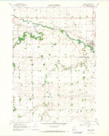
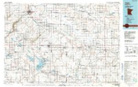
6 surveys from 9 printed sheetsMatched by testing this settlement's coordinate against the published boundary of every sheet in the United States Geological Survey's historical collection. Each opens the scanned sheet at the Survey.
- 1953 USGS New Ulm quadrangle1:250000, 3 printings
- 1957 USGS New Ulm quadrangle1:250000
- 1958 USGS New Ulm quadrangle1:250000
- 1967 USGS New Ulm quadrangle1:250000
- 1967 USGS Sanborn quadrangle1:24000
- 1986 USGS Tracy quadrangle1:100000, 2 printings




In the county-history sources
1,990 words on this townshipThe History of Redwood County, Minnesota, published 1916 names this settlement in its chapter on Sanborn City. These are the passages that mention it, exactly as the scans read.
Sanborn is now a flourishing village of many advantages. Particularly attractive is the public triangle, with its brick pumping station and village jail, its band stand and its stately bell tower. The pumping station is likewise used as a council chamber. In the early days fire protection was furnished by a cistern. In 1914 the present waterworks system was established. In the fall of 1915, electric light service was installed, the power being secured from Lamberton. A strong volunteer fire department, organized many years ago, is in the efficient charge of Dr. M. C. Piper.
Passage source: The History of Redwood County, Minnesota, published 1916.
An interesting feature of the village life is the magnificent building of the Sanborn Improvement Co., a stock organization, which is now on a profitable basis. The lower floor of the building is used as a theater and general meeting place, while the upper floor is fitted up as a lodge hall.
Passage source: The History of Redwood County, Minnesota, published 1916.
southeast quarter of section 26, town 109, range 36. It contained five blocks, three south of the railroad track, and two north. Three of these were whole blocks and the other two were fractional blocks. All the streets were 80 feet wide, except Main street, and a part of River street, which were 66 feet wide. All the alleys were 20 feet wide. Main street extending directly north and south. The northeast and southwest streets, beginning on the west, were: West, North (north of the tract), South (south of the tract) and Dotson. The northwest and southeast streets, beginning at the north, were : John, Yaeger, Leetford and River. The plat of the Winona and St. Peter Land Company's first addition to Sanborn was filed Dec. 26, 1900. The plat of the Winona and St. Peter Land Company, second addition to Sanborn, was filed May 26, 1899. The plat of Yaeger 's first addition to Sanborn was filed May 9, 1900, by John and Margaretha E. Yaeger. The plat of the Winona and St. Peter Land Company's third addition to Sanborn was filed Aug. 11, 1900. The plat of Lehne's addition to Sanborn was filed May 9, 1901. The land was owned by Julius and Mary Lehne. The plat of Wells and Schoeder's first addition to Sanborn was filed Nov. 9, 1888. The land belonged to O. D. and Tena Wells and William Auguste Schoeder. The plat of the Winona and St. Peter Land Company's fifth addition to Sanborn was filed Jan. 4, 1904. Thb plat of Yaeger 's second addition to Sanborn was filed Sept. 5, 1907. The land was owned by John and Margaretha E. Yaeger. The plat of the Winona and St. Peter Land Company's first addition to Sanborn was filed June 20, 1892. The plat of Dammonn's second addition to Sanborn was filed Jan. 16, 1903. The land belonged to John and Marie Dammonn. The plat of Dammonn's addition to Sanborn was filed on May 16, 1894. This land belonged to John and Mary Dammonn.
Passage source: The History of Redwood County, Minnesota, published 1916.
Machine-read from a century-old scan, so expect the errors a machine makes: misspelled names, dropped words, stray characters.
Read the whole chapter on Sanborn City - it names this place 2 more 2 times.
Mines and quarries near this place
1 within 5 milesRegional context, not property-specific evidence. The federal mineral resources record lists 1 working within 5 miles of Sanborn: 1 producer. All of them still produce. What was taken out: Sand and Gravel, Construction. Distance is straight-line from the map coordinates, so a quarry counted here may appear on a neighbouring settlement's page as well.
| Where | Site | Commodity | Status | Recorded |
|---|---|---|---|---|
| Schwartz Pit | Sand and Gravel, Construction | Producer |
Storms near this place
14 since 1996Regional context, not property-specific evidence. The National Weather Service names Sanborn in 14 storm reports between 1996 and 2023: 8 hail, 6 thunderstorm wind. No death or injury is recorded in these reports. Each account below is quoted exactly as the forecast office filed it, from the NOAA Storm Events Database, and each date opens the federal record of that event.
| When | Event | Place named | Harm | What the report says |
|---|---|---|---|---|
| May 2022 | Thunderstorm Wind | Sanborn | $5,000 | A shed and power lines were blown down on the west side of Sanborn. |
| June 2006 | Thunderstorm Wind | Sanborn | - | Four to six inch tree limbs were severed in Sanborn Park. As reported by Sanborn Sentinel newspaper. |
| July 2001 | Thunderstorm Wind | Sanborn | - | Numerous six inch branches down. |
| July 1999 | Thunderstorm Wind | Sanborn | - | Cattle barn and top of silo demolished. Winds estimated. |
| July 1998 | Thunderstorm Wind | Sanborn | - | Roof ripped off bldg. Severe hail damage to areas across southern Redwood county. |
| October 2023 | Hail | Sanborn | - | no account filed |
| May 2022 | Thunderstorm Wind | Sanborn | - | no account filed |
| July 2018 | Hail | Sanborn | - | no account filed |
| June 2017 | Hail | Sanborn | - | no account filed |
| August 2016 | Hail | Sanborn | - | no account filed |
| May 2000 | Hail | Sanborn | - | no account filed |
| June 1999 | Hail | Sanborn | - | no account filed |
| June 1999 | Hail | Sanborn | - | no account filed |
| July 1996 | Hail | Sanborn | - | no account filed |
Nearest settlements
The eight closest, with where each one stands in the county. Distances are straight-line, computed from the Geographic Names Information System coordinates.
Elsewhere
Matched on this settlement's Geographic Names Information System number rather than its name, so it cannot be a different place of the same name in another state.
| Wikipedia article on Sanborn | An encyclopaedic summary. Its text is share-alike, so it is linked here rather than copied. |
| Wikidata item Q974305 | The structured record the population and elevation above come from. Public domain (CC0). |
Provenance
This settlement is recorded in the Geographic Names Information System as feature 651130. The sheet list is computed by point-in-boundary test against the United States Geological Survey's historical topographic inventory. Both are works of the United States government and carry no copyright under 17 U.S.C. 105.
Mines and quarries. USGS Mineral Resources Data System (MRDS) https://mrdata.usgs.gov/mrds/ A work of the United States government, no copyright under 17 U.S.C. 105.
Storms. NOAA National Centers for Environmental Information, Storm Events Database https://www.ncei.noaa.gov/stormevents/ A work of the United States government, no copyright under 17 U.S.C. 105. Narratives are quoted verbatim from the National Weather Service report and are not edited or summarised.