 Block
Stewart, Minnesota
10 topographic sheets cover this place, the earliest surveyed in 1953 and the latest in 1986. It stands in Stewart City. It lies in ZIP code area 55385. The Survey maps it on the Stewart quadrangle. 489 people lived here at the 2020 count. It stands 1,066 feet above sea level.
Population over time
2 figuresStewart fell from 571 to 489 between 2010 and 2020. These are the recorded population figures Wikidata holds for this place, reached through the Geographic Names Information System number this page is keyed on rather than by name, so they belong to this place and not to another of the same name. Most are census counts, but not all are: an early figure may be a founding or settlement estimate, and an estimate published within five years of a census is left out. The change column is computed, and is left blank where more than 20 years separate a figure from the one before it, because a gap that long is not a change between two counts.
| Year | People | Change |
|---|---|---|
| 2010 | 571 | |
| 2020 | 489 | -82 (-14%) |
Topographic sheets covering this place
7 surveys from 10 printed sheetsMatched by testing this settlement's coordinate against the published boundary of every sheet in the United States Geological Survey's historical collection. Each opens the scanned sheet at the Survey.
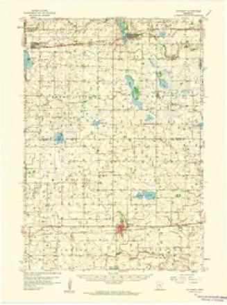
- 1953 USGS New Ulm quadrangle1:250000, 3 printings
- 1957 USGS New Ulm quadrangle1:250000
- 1958 USGS New Ulm quadrangle1:250000
- 1958 USGS Winthrop quadrangle1:62500
- 1967 USGS New Ulm quadrangle1:250000
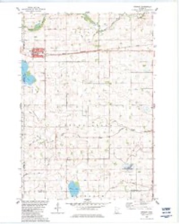
- 1982 USGS Stewart quadrangle1:24000
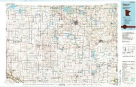
- 1986 USGS Glencoe quadrangle1:100000, 2 printings




In the county-history sources
5,375 words on this townshipHistory of McLeod County, Minnesota, published 1917 names this settlement in its chapter on Stewart City. These are the passages that mention it, exactly as the scans read.
The village of Stewart was founded in 1878, with the advent of the railroad, by Dr. D. A. Stewart, of Winona, and now has a population of about 500, It was incorporated as a village in 1888. Situated in the southwest part of McLeod county, one-half mile from the Renville and Sibley county lines, on the coast line of the Chicago, Milwaukee and St. Paul railway, it is in the center of a prosperous agricultural district where the farm lands are second to none. Wheat, corn, oats, barley, rye, and flax are the staple crops of the surrounding country, alfalfa is raised successfully, garden vegetables, berries and fruits of all kinds grow abundantly, and a large quantity of tame and wild hay is cut every year. Conditions are also exceptionally favorable for dairying and stock raising. In addition to the fine public school, elsewhere mentioned more particularly, the village has a first-class creamery, a telephone exchange, covering the village and surrounding country for many miles, an exclusive produce store, a lumber yard, a firstclass hotel, five grain elevators, a number of good stores, two banks, four churches - Catholic, Lutheran, Methodist and Congregational, with lodges of the Modern Woodmen, Modern Brotherhood, Catholic Foresters, Masons, and Royal Neighbors. 'The nationalities are well mixed, with the German slightly predominating. There is one newspaper, the Tribune, a weekly established in 1896, its present circulation being about 700. Farm land in the surrounding country is worth from $60 to $100 per acre.
Passage source: History of McLeod County, Minnesota, published 1917.
Stewart has a third-class post. office, with four rural free delivery routes, covering an average territory of about ten miles in each direction from town. The first postmaster was James Bordwell, his successors having been R. S. Donaldson, James Bordwell (second term), William J. Bliss, Amos 5. Avery and F. J. Reimers, who now has charge of the office, with Margaret Reimers as assistant. The first two rural routes were started November 2, 1903, the day after the post office was discontinued at Fernando, Route 3 was established January 15, 1905, and Route 4, August 16, 1907. The present carriers are: Route 1, Joseph Hoyt; Route 2, George D. Grinnels; Route 3, Jeremiah E. Headley; Route 4, Henry H. F. Wick. The office has been a money order office from the beginning; the postal savings system was inaugurated January 1, 1912.
Passage source: History of McLeod County, Minnesota, published 1917.
The Stewart fire department was established at the same time as the waterworks and started with one hose-cart and hook and ladder. Since then another hose cart has been added to the equipment, which also includes 1000 feet of hose. The department at present has about 80 members.
Passage source: History of McLeod County, Minnesota, published 1917.
Machine-read from a century-old scan, so expect the errors a machine makes: misspelled names, dropped words, stray characters.
Read the whole chapter on Stewart City - it names this place 17 more 17 times.
Fires near this place
1 since 2009Regional context, not property-specific evidence. The federal wildfire occurrence database lists 1 fire within 5 miles of Stewart in 2009, burning about 180 acres in total. None started naturally. None was recorded as arson. Distance is straight-line from the map coordinates, so a fire counted here may appear on a neighbouring settlement's page as well.
| Reported cause | Fires |
|---|---|
| Missing data/not specified/undetermined | 1 |
The most recent of them, most recent first, with the day each was reported and the service that recorded it.
| Date | Cause | Size | Reported by | Name on the report |
|---|---|---|---|---|
| 15 April 2009 | Missing data/not specified/undetermined | 180 acres | Minnesota Valley National Wildlife Refuge | SHAKOPEE ASSIST |
Settlements close enough to share some of these fires:
Storms near this place
42 since 1997Regional context, not property-specific evidence. The National Weather Service names Stewart in 42 storm reports between 1997 and 2020: 27 hail, 13 thunderstorm wind, 1 flash flood, 1 tornado. No death or injury is recorded in these reports. Each account below is quoted exactly as the forecast office filed it, from the NOAA Storm Events Database, and each date opens the federal record of that event.
| When | Event | Place named | Harm | What the report says |
|---|---|---|---|---|
| July 2011 | Thunderstorm Wind | Stewart | $25,000 | A trained spotter measured a peak wind speed with his anemometer north of Stewart, Minnesota. In addition, local law enforcement officials reported numerous power outages and power lines were blown down from Stewart, eastward to Brownton. |
| June 2019 | Thunderstorm Wind | Stewart | $5,000 | Several power lines and trees were blown down in Stewart, and between Stewart and north of Brownton. |
| July 2020 | Hail | Stewart | - | This is the continued swath of large hail, up to 2 inches in diameter, that occurred in far southwest McLeod County between Stewart and Fernando. |
| June 2017 | Thunderstorm Wind | Stewart | - | The emergency manager reported power lines down in the northeast corner of Stewart. There were 2 power poles that were damaged. Tree damage was confined to the north side of Stewart. Three to four foot diameter trees were downed near 311 Main St in Stewart. |
| August 2016 | Thunderstorm Wind | Stewart | - | Several trees were blown down and power outages occurred around Stewart. |
| July 2015 | Thunderstorm Wind | Stewart | - | A large tree was blown down at Yacht Avenue and 100th Street northeast, north of Stewart. There were additional reports of wind gusts of 45 to 55 mph in Hutchinson as the squall line moved through northern McLeod County. |
| August 2012 | Hail | Stewart | - | Quarter size hail lasted for three minutes from the western part of the town, to near the downtown area of Stewart. |
| August 2012 | Thunderstorm Wind | Stewart | - | There was numerous large tree branches that were blown down in the town of Stewart. |
| June 2012 | Thunderstorm Wind | Stewart | - | Several power lines were blown down causing power outages around Stewart. |
| August 2007 | Thunderstorm Wind | Stewart | - | A few one foot diameter trees toppled. |
| June 2005 | Thunderstorm Wind | Stewart | - | Branches were downed. |
| June 2005 | Thunderstorm Wind | Stewart | - | An 18 inch diameter tree and a few 8 inch diameter tree branches were downed at the intersection of County Road 7 and 110th Street. A tree branch took down power lines on Unit Avenue. |
| September 2005 | Thunderstorm Wind | Stewart | - | A few trees were downed onto power lines. |
| April 2004 | Thunderstorm Wind | Stewart | - | Corn bins were blown over. |
| June 2004 | Hail | Stewart | - | Numerous corn and bean crops were shredded by hail. Some of the worst damage was found in a two to three mile area east of Lake Marion. |
| June 1997 | Thunderstorm Wind | Stewart | - | Gas grill knocked over. Estimated windspeed. |
| October 1997 | Tornado (F0) | Stewart | - | Tree damage. |
| July 2017 | Hail | Stewart | - | no account filed |
| July 2017 | Hail | Stewart | - | no account filed |
| June 2012 | Hail | Stewart | - | no account filed |
| August 2012 | Hail | Stewart | - | no account filed |
| August 2012 | Hail | Stewart | - | no account filed |
| August 2009 | Hail | Stewart | - | no account filed |
| August 2007 | Hail | Stewart | - | no account filed |
| April 2006 | Hail | Stewart | - | no account filed |
| March 2005 | Hail | Stewart | - | no account filed |
| June 2005 | Hail | Stewart | - | no account filed |
| August 2005 | Hail | Stewart | - | no account filed |
| September 2005 | Hail | Stewart | - | no account filed |
| September 2005 | Hail | Stewart | - | no account filed |
| September 2005 | Hail | Stewart | - | no account filed |
| April 2004 | Hail | Stewart | - | no account filed |
| July 2003 | Hail | Stewart | - | no account filed |
| June 2003 | Hail | Stewart | - | no account filed |
| July 2002 | Hail | Stewart | - | no account filed |
| July 2002 | Hail | Stewart | - | no account filed |
| August 2002 | Hail | Stewart | - | no account filed |
| October 1998 | Hail | Stewart | - | no account filed |
| June 1998 | Hail | Stewart | - | no account filed |
| July 1997 | Flash Flood | Stewart | - | no account filed |
| June 1997 | Hail | Stewart | - | no account filed |
| June 1997 | Hail | Stewart | - | no account filed |
Nearest settlements
The eight closest, with where each one stands in the county. Distances are straight-line, computed from the Geographic Names Information System coordinates.
| Map | Place | Distance | Sheets |
|---|---|---|---|
| Fernando | 5.3 miles | 10 | |
| Brownton | 7.2 miles | 10 | |
| West Lynn | 8.6 miles | 10 | |
| Heatwole | 8.8 miles | 10 | |
| Sumter | 11.8 miles | 10 | |
| McDonalds Lakeview Terrace | 11.9 miles | 11 | |
| Hutchinson | 12.8 miles | 11 | |
| Biscay | 13.2 miles | 10 |
Elsewhere
Matched on this settlement's Geographic Names Information System number rather than its name, so it cannot be a different place of the same name in another state.
| Wikipedia article on Stewart | An encyclopaedic summary. Its text is share-alike, so it is linked here rather than copied. |
| Wikidata item Q2227807 | The structured record the population and elevation above come from. Public domain (CC0). |
Provenance
This settlement is recorded in the Geographic Names Information System as feature 652633. The sheet list is computed by point-in-boundary test against the United States Geological Survey's historical topographic inventory. Both are works of the United States government and carry no copyright under 17 U.S.C. 105.
Wildfire. Short, Karen C. 2022. Spatial wildfire occurrence data for the United States, 1992-2020 [FPA_FOD_20221014]. 6th Edition. Fort Collins, CO: Forest Service Research Data Archive. https://doi.org/10.2737/RDS-2013-0009.6 Collected with United States Government funding and usable without additional permissions or fees.
Storms. NOAA National Centers for Environmental Information, Storm Events Database https://www.ncei.noaa.gov/stormevents/ A work of the United States government, no copyright under 17 U.S.C. 105. Narratives are quoted verbatim from the National Weather Service report and are not edited or summarised.