 Block
West Albany, Minnesota
13 topographic sheets cover this place, the earliest surveyed in 1951 and the latest in 1989. It stands in West Albany Township. It lies in ZIP code area 55957. It lies near Hungry Hollow. The Survey maps it on the West Albany quadrangle.
Topographic sheets covering this place
8 surveys from 13 printed sheetsMatched by testing this settlement's coordinate against the published boundary of every sheet in the United States Geological Survey's historical collection. Each opens the scanned sheet at the Survey.
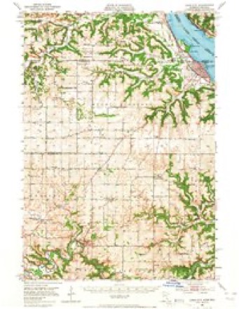
- 1951 USGS Lake City quadrangle1:62500, 3 printings
- 1953 USGS Saint Paul quadrangle1:250000, 3 printings
- 1953 USGS St. Paul quadrangle1:250000
- 1959 USGS Saint Paul quadrangle1:250000
- 1959 USGS St. Paul quadrangle1:250000
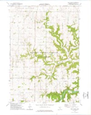
- 1974 USGS West Albany quadrangle1:24000
- 1985 USGS Rochester quadrangle1:100000
- 1989 USGS Rochester quadrangle1:100000, 2 printings




In the county-history sources
4,049 words on this townshipHistory of Wabasha County : Together with Biographical Matter, Statistics, Etc. : Gathered from Matter Furnished by Interviews with Old Settlers, County, Township, and Other Records, and Extracts from Files of Papers, Pamphlets, and Such Other Sources As Have Been Available : Also a History of Winona County, published 1884 names this settlement in its chapter on West Albany Township. These are the passages that mention it, exactly as the scans read.
West Albany township lies nearly in the center of the county, being a full congressional township, and consisting of fine rolling ])rairie, considerably broken in the southern part by eroded valleys and gorges. The streams all lie at a depth of from one to two hundred feet below the surrounding country, affording perfect drainage, and swamps are entirely unknown. Through sections 34, 27, 26, 25 and 36 in the southeastern part, winds the picturesque Zumbi'o, with its limestone clifi's, wooded banks and fertile bottoms, receiving the united waters of several smaller streams, which take their rise in the central, western and southern parts. These deep valleys or canons, which are the result of ages of erosion, appear to have been at one time considerably deeper than at present. The rock strata, which consist of Potsdam limestone, lie at an undiscovered depth below the streams, overlaid by a deposit of sand, clay and loam, which is rapidly increasing, and which indicates a long continued reversal of the process of erosion. The drift, wliich on the prairies overlies the rock to a depth of from live to fiftj' feet, consists of clay, topped by a layer of rich cla}' loam, which twent^'-five years ago nourished a thick growth of buffalo grass and grubs, now supplanted by the products of intelligent industry.
In Jnne, 1855, tlie hitherto undisturbed reign of nature and the Indian, in what is now "West Albany townsliip, was broken by tlie appearance of Samuel Brink, who erected on the southwest quarter of section 21 a two-story log hotel 24x46 feet. A few weeks later John McCollom settled on section 28, accompanied by a Dr. Spafford who left shortly after the death of Mrs. McCullom in August of that year. This was the first visit of " that grim ferryman" that ]3oets write of, - a visit that has too oft been repeated. In the summer of 1855 came also Abram Lyons, followed in the early fall by Leroy, Eugene, and Cornelius McCollom. These settlements were all made in the valley near the future site of the village of West Albany, the first comers being attracted by the supposed superior fertility of the soil and the advantages of water and wood not found on the prairie. In the spring of 1852 Abram Lyons took unto himself a helpmate in the jjerson of Miss Jane McCollom ; this first marriage of the township was blessed by the appearance of a daughter the following spring, Laura Ann Lj^ons, who was the first child born in West Albany.
In the spring of 1857, Lawrence Tracy, of Irish nativity, who had previously settled in what is now Oakwood, moved to West Albany. In the same year came Sylvester and William Applegarth, of Canada ; Henry Schmuser, of Holstien ; Wm. Funk, and some others. In 1858 began the establishment of the Scotch settlement in the northeastern part of the township. In this year came George and William Wilson, William Dufius, Henry Glashen, Geo. and William Perry, Charles Forest, Alexander Thoirs, William Sterling, David Munro, and William Corry ; these have since been followed by many others from Scotland and Racine county, Wisconsin, some also from Canada. Many of these came here poor, but all are now successful farmers, and tlie Scotch settlement will be found a christian, hospitable comraunit}' whei'e peace and pros]:>erity reigns.
Machine-read from a century-old scan, so expect the errors a machine makes: misspelled names, dropped words, stray characters.
Read the whole chapter on West Albany Township - it names this place 11 more 11 times.
Fires near this place
2 since 2010Regional context, not property-specific evidence. The federal wildfire occurrence database lists 2 fires within 5 miles of West Albany between 2010 and 2015, burning about 12 acres in total. None started naturally. None was recorded as arson. Distance is straight-line from the map coordinates, so a fire counted here may appear on a neighbouring settlement's page as well.
| Reported cause | Fires |
|---|---|
| Power generation/transmission/distribution | 1 |
| Debris and open burning | 1 |
The most recent of them, most recent first, with the day each was reported and the service that recorded it.
| Date | Cause | Size | Reported by | Name on the report |
|---|---|---|---|---|
| 15 May 2010 | Power generation/transmission/distribution | 2.5 acres | Minnesota Department of Natural Resources | not named |
| 12 October 2015 | Debris and open burning | 10 acres | Minnesota Department of Natural Resources | not named |
Settlements close enough to share some of these fires:
Mines and quarries near this place
1 within 5 milesRegional context, not property-specific evidence. The federal mineral resources record lists 1 working within 5 miles of West Albany: 1 producer. All of them still produce. What was taken out: Stone, Crushed/Broken. Distance is straight-line from the map coordinates, so a quarry counted here may appear on a neighbouring settlement's page as well.
| Where | Site | Commodity | Status | Recorded |
|---|---|---|---|---|
| Roberson Quarry and Mill | Stone, Crushed/Broken | Producer |
Nearest settlements
The eight closest, with where each one stands in the county. Distances are straight-line, computed from the Geographic Names Information System coordinates.
| Map | Place | Distance | Sheets |
|---|---|---|---|
| Millville | 3.9 miles | 15 | |
| Theilman | 5.0 miles | 15 | |
| Jarrett | 5.3 miles | 15 | |
| Bremen | 6.5 miles | 15 | |
| Oak Center | 7.1 miles | 13 | |
| Hammond | 7.2 miles | 15 | |
| Zumbro Falls | 7.4 miles | 13 | |
| Dumfries | 9.3 miles | 15 |
Provenance
This settlement is recorded in the Geographic Names Information System as feature 655003. The sheet list is computed by point-in-boundary test against the United States Geological Survey's historical topographic inventory. Both are works of the United States government and carry no copyright under 17 U.S.C. 105.
Wildfire. Short, Karen C. 2022. Spatial wildfire occurrence data for the United States, 1992-2020 [FPA_FOD_20221014]. 6th Edition. Fort Collins, CO: Forest Service Research Data Archive. https://doi.org/10.2737/RDS-2013-0009.6 Collected with United States Government funding and usable without additional permissions or fees.
Mines and quarries. USGS Mineral Resources Data System (MRDS) https://mrdata.usgs.gov/mrds/ A work of the United States government, no copyright under 17 U.S.C. 105.