 Block
From the record
One of 192 National Register listings published here for Hennepin County · listed in 2015 · category: Site.
Sources: the National Register database, National Park Service
Listed on the National Register of Historic Places in 2015.
One of 192 National Register listings published here for Hennepin County · listed in 2015 · category: Site.
Sources: the National Register database, National Park Service
Regional context, not property-specific evidence. The federal wildfire occurrence database lists 2 fires within 5 miles of Schmid Farmhouse Ruin between 2000 and 2010, burning about 92 acres in total. None started naturally. 1 was recorded as arson. Distance is straight-line from the map coordinates, so a fire counted here may appear on a neighbouring settlement's page as well.
| Reported cause | Fires |
|---|---|
| Recreation and ceremony | 1 |
| Arson/incendiarism | 1 |
The most recent of them, most recent first, with the day each was reported and the service that recorded it.
| Date | Cause | Size | Reported by | Name on the report |
|---|---|---|---|---|
| 11 April 2010 | Recreation and ceremony | 85 acres | Minnesota Department of Natural Resources | not named |
| 12 October 2000 | Arson/incendiarism | 7.0 acres | Minnesota Department of Natural Resources | not named |
Regional context, not property-specific evidence. The National Weather Service names Minnetrista, the town this property stands in, in 9 storm reports between 1996 and 2019: 5 thunderstorm wind, 2 hail, 2 tornado. No death or injury is recorded in these reports. Each account below is quoted exactly as the forecast office filed it, from the NOAA Storm Events Database, and each date opens the federal record of that event.
| When | Event | Place named | Harm | What the report says |
|---|---|---|---|---|
| August 2009 | Tornado (EF1) | Minnetrista | $1,000,000 | A damage survey determined that an EF1 tornado touched down in the northeast side of Minnetrista, or on the west side of the intersection of County Road 110, and 151. The tornado tracked east-northeast for approximately nine miles to the east side of County Road 101, or at Garland and 25th which is in the southwest portion of Plymouth. Numerous trees were snapped and dozens of other trees fell on homes and vehicles. Boats were tossed and roofs were partially removed from two homes and a business. |
| September 2019 | Tornado (EF1) | Minnetrista | $250,000 | This is the continuation of the Carver County tornado that moved into Hennepin County northeast of Timber Creek Golf Course. The storm survey determined an EF1 tornado occurred in Hennepin County where trees, crops, and a few machine sheds or outbuildings were damaged or blown down. ||The path length in Hennepin County was 2.5 miles, making the tornado total path length of 3.87 miles. The maximum width in Hennepin County was 210 yards, with a maximum wind speed of 90 mph. ||This tornado was also confirmed by the MPX radar in real time given the Tornado Debris Signature sampled by the radar. |
| July 1997 | Thunderstorm Wind | Minnetrista | $88,000 | 27 homes damaged by winds or fallng trees. Neighboring city of Independence also experienced scattered home damage due to down trees and power lines. Estimated windspeed. |
| August 2011 | Thunderstorm Wind | Minnetrista | $50,000 | Several large trees and power lines fell down from near Minnetrista, to two miles west of Mound, then north to near the intersection of County Road 26 and 110, northeast of Minnetrista, Minnesota. |
| June 2017 | Thunderstorm Wind | Minnetrista | - | A 20 inch diameter tree was blown down. |
| June 2017 | Thunderstorm Wind | Minnetrista | - | Four inch tree limbs were blown down. |
| May 2011 | Hail | Minnetrista | - | no account filed |
| September 2000 | Hail | Minnetrista | - | no account filed |
| August 1996 | Thunderstorm Wind | Minnetrista | - | no account filed |
No historic map-sheet match is published for this property yet. That does not mean no map exists. This record needs a coordinate-quality review before it can be joined to a sheet boundary. Browse the county's mapped places while that work is pending.
Other National Register properties close enough to walk or drive between, ordered by distance from this one. Both positions come from the same geocoding pass that matched these properties to their map sheets.
| Photograph | Property | Distance | Listed |
|---|---|---|---|
 | Crane Island Historic District | 0.5 miles | 1991 |
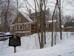 | Peter Gideon Farmhouse | 3.9 miles | 1974 |
 | Thompson Summer House | 4.5 miles | 1998 |
 | MINNEHAHA (steamboat) | 4.7 miles | 2021 |
| Excelsior Commercial Historic District | 5.1 miles | 2021 | |
 | Excelsior Public School | 5.2 miles | 1980 |
| National Archives record | The nomination case file for reference 15000849 in Record Group 79. |
| Hennepin County | All 192 listed properties in this county. |