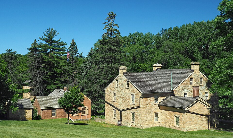
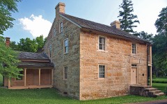
Built in 1836. Listed on the National Register of Historic Places in 1972.
From the record
“The Sibley Historic Site is the site of Henry Hastings Sibley's home, who was the regional manager of the American Fur Company and Minnesota's first governor. It is one of the 26 historical sites that are operated by the Minnesota Historical Society.”
Wikipedia article Sibley Historic Site, CC BY-SA 4.0.
One of 40 National Register listings published here for Dakota County · listed in 1972 · category: Building · built in 1836.
National Register reference number.72000676- the number the National Park Service assigned this property when it was listed, and the key its nomination file is catalogued under at the National Archives.
The ground it stands on
6,024 words
The chapter on Mendota City in Dakota County, published 1868 names Mendota. This is what it says, exactly as the scans read.
Dakota county lies on the east side of the Mississippi river, directly opposite where the St. Croix river empties into it, and where the Mississippi river commences the task of dividing the States of Minnesota and Wisconsin, the great river having till this time passed entirely over Minnesota soil. On the north the Minnesota river divides Dakota from Hennepin county, Scott and Rice counties lying on the west, and Rice and Goodhue on the south. These are the general boundaries, though Dakota county is so irregular in form that it would be difficult to give an exact idea of its shape, without giving a map of the county, in the State, aside from the government troops at Fort SnelHng, was made in this county at Mendota in 1S2'6, by Jean Baptiste Faribault, an Indian trader from Canada. jSTo other settlers arrived for some years. In 1834, H. H. Sibley, afterwards the first governor of the State of Minnesota, located at Mendota, and soon had quite a colony of immigrants established at that point, and in his adventurous pioneer life saw very much of interest, and had many adventures that would of themselves form an interesting volume. We can hardly find room for extended notices, but give some extracts from some ot his writings and his journal, which he has kindly permitted us to copy.
Mr. Sibley was foreman of the first grand jury ever empannelled in what is now the State of Minnesota, which consisted of twenty persons, three only of whom could speak or understand English, the rest being all Frenchmen. The court was held at Mendota, Judge Cooper presiding. His Honor delivered a written charge to the jury, of considerable length, which was profoundly listened to, though not a word was understood by more than three of the jurors.
Regional context, not property-specific
evidence. The
federal wildfire occurrence database
lists 33 fires within 5 miles of Henry H. Sibley House
between 1998 and 2019, burning about 235 acres in total. None started naturally. 3 were recorded as arson.
Distance is straight-line from the map coordinates, so a fire counted
here may appear on a neighbouring settlement's page as well.
Reported cause
Fires
Recreation and ceremony
16
Railroad operations and maintenance
8
Missing data/not specified/undetermined
5
Arson/incendiarism
3
Debris and open burning
1
The most recent of
them, most recent first, with the day each was reported and the service
that recorded it.
Regional context, not property-specific
evidence. The federal mineral resources record lists
3 workings within 5 miles of Henry H. Sibley House: 1 occurrence, 1 producer, 1 past producer.
1 still produces. What was taken out: Clay, Kaolin. Distance is straight-line from the
map coordinates, so a quarry counted here may appear on a neighbouring
settlement's page as well.
Regional context, not property-specific
evidence. The National Weather Service names
Mendota, the town this property stands in, in 5 storm reports between 2012 and 2024: 2 thunderstorm wind, 1 tornado, 1 flash flood, 1 hail.
No death or injury is recorded in these reports. Each account below is quoted exactly as the forecast office
filed it, from the NOAA Storm Events Database, and each date
opens the federal record of that event.
A storm survey revealed that straight line winds of 65 mph were associated with the rear flank downdraft from the tornado that dissipated at the Lost Spur Golf Course. These severe winds blew shingles off a hotel roof and knocked down trees from near Interstate 494 and Pilot Knob Road, northeast to a business community.
A brief EF-0 tornado spun up near Skyline Drive, east of Highway 13, and tracked north-northeast to the Lost Spur Golf Course just south of Interstate 494. The tornado tracked for two blocks in a heavily wooded residential area before moving across a small golf course as it dissipated. Numerous large trees and power lines were blown down along the path of approximately one-half mile.
Several reports of stalled cars along I-35 from Eagan, northeast to West St. Paul. This was noted on Minnesota Department of Transportation Webcams that noted the stalled cars and deep water in the roadway.
No historic map-sheet match is published
for this property yet. That does not mean no map exists. This record needs
a coordinate-quality review before it can be joined to a sheet boundary.
Browse the county's mapped places while that work is
pending.
Listed places nearby
6 within 8 miles
Other National Register properties close
enough to walk or drive between, ordered by distance from this one. Both
positions come from the same geocoding pass that matched these properties
to their map sheets.
Listing record. National Park Service National Register of Historic Places, listed-properties dataset, current to 2026-05-22.
Map join. Address geocoded through the United States Census geocoder, then tested against the published boundary of every sheet in the USGS Historical Topographic Map Collection.
How this page is made. Listing fields come from federal records; map-sheet coverage is a labelled coordinate-to-boundary calculation, not a source-field claim.
Wildfire. Short, Karen C. 2022. Spatial wildfire occurrence data for the United States, 1992-2020 [FPA_FOD_20221014]. 6th Edition. Fort Collins, CO: Forest Service Research Data Archive. https://doi.org/10.2737/RDS-2013-0009.6 Collected with United States Government funding and usable without additional permissions or fees.
Mines and quarries. USGS Mineral Resources Data System (MRDS) https://mrdata.usgs.gov/mrds/ A work of the United States government, no copyright under 17 U.S.C. 105.
Storms. NOAA National Centers for Environmental Information, Storm Events Database https://www.ncei.noaa.gov/stormevents/ A work of the United States government, no copyright under 17 U.S.C. 105. Narratives are quoted verbatim from the National Weather Service report and are not edited or summarised.
 Block