 Block
From the record
One of 28 National Register listings published here for Blue Earth County · listed in 1980 · category: Building.
Sources: the case file at the National Archives · the National Register database, National Park Service
Listed on the National Register of Historic Places in 1980.
One of 28 National Register listings published here for Blue Earth County · listed in 1980 · category: Building.
Sources: the case file at the National Archives · the National Register database, National Park Service
The chapter on Judson Township in History of Blue Earth County and Biographies of Its Leading Citizens, published 1901 names Lake Crystal. This is what it says, exactly as the scans read.
July 11, 1858, a Welsh Calvinistic Methodist Church was organized at the house of Owen Eoberts on the farm now owned by Humphrey J. Eoberts, by Eev. David Davis, assisted by Evan Evans. The charter members were: Mr. and Mrs. Owen Eoberts, Mr. and Mrs. Wm. Bowen, Mr. and Mrs. Wm. C. Williams, Mr. and Mrs. Wm. E. Jones and Mr. and Mrs. Eichard B. Davis. Later the church adopted the name "Jerusalem." The services were held in private houses until the spring of 1865, when a log church was erected. During 1870-1 the present edifice was built, and in March, 1871, Eev. Wm. Jones became its first settled pastor, which position he held until 1891, with an intermission of four and one-half years. Since 1892, the church has been, joined in a circuit with Lake Crystal under the pastorship of Eev. D. Edwards. The legal incorporation of the church occurred at the log building on June 13, 1870, when the following trustees were elected: Owen Eoberts, Jabez Lloyd and John W. Eoberts. Since 1870, until of late years, the Annual Synod or conference of the Welsh Cal. Meth. Churches of this state has been held in connection with this church, usually in June of each year, and at a grove on the farm of Humphrey J. Eoberts.
Passage source: History of Blue Earth County and Biographies of Its Leading Citizens, published 1901.
In 1858, Eev. J. E. Ash' organized a Baptist church in Judson village. Among the members were Eobert Patterson, John Goodwin, Eev. Wm. Williams, Morris Lewis, John Eees, Geo. Smith and others. After Eev. Ash left, the church was ministered to by Eev. Williams and Mr. Miller for a time, but for some years during the Indian trouble it suspended. About 1867, and 1868 it met again in school house No. 6, and on March 15, 1871, incorporated at the house of John Goodwin, when John Eees, Abel Keene and B. P. Muzzy were elected trustees. The church disbanded in Nov., 1882, and a number of the members joined the Baptistchurch of Lake Crystal.
Passage source: History of Blue Earth County and Biographies of Its Leading Citizens, published 1901.
Machine-read from a century-old scan, so expect the errors a machine makes: misspelled names, dropped words, stray characters.
Read the whole chapter on Judson Township - 5,837 words on its settlement, mills, schools and churches.
Regional context, not property-specific evidence. The federal wildfire occurrence database lists 1 fire within 5 miles of Jones-Roberts Farmstead in 2003, burning about 150 acres in total. None started naturally. None was recorded as arson. Distance is straight-line from the map coordinates, so a fire counted here may appear on a neighbouring settlement's page as well.
| Reported cause | Fires |
|---|---|
| Missing data/not specified/undetermined | 1 |
The most recent of them, most recent first, with the day each was reported and the service that recorded it.
| Date | Cause | Size | Reported by | Name on the report |
|---|---|---|---|---|
| 13 April 2003 | Missing data/not specified/undetermined | 150 acres | Minnesota Department of Natural Resources | not named |
Regional context, not property-specific evidence. The federal mineral resources record lists 2 workings within 5 miles of Jones-Roberts Farmstead: 2 producers. All of them still produce. What was taken out: Sand and Gravel, Construction. Distance is straight-line from the map coordinates, so a quarry counted here may appear on a neighbouring settlement's page as well.
| Where | Site | Commodity | Status | Recorded |
|---|---|---|---|---|
| Judson Sand Pit | Sand and Gravel, Construction | Producer | ||
| Zimmerman East Pit and Mill | Sand and Gravel, Construction | Producer |
Regional context, not property-specific evidence. The National Weather Service names Lake Crystal, the town this property stands in, in 52 storm reports between 1995 and 2026: 24 hail, 17 thunderstorm wind, 5 tornado, 3 heavy rain. No death or injury is recorded in these reports. Each account below is quoted exactly as the forecast office filed it, from the NOAA Storm Events Database, and each date opens the federal record of that event.
| When | Event | Place named | Harm | What the report says |
|---|---|---|---|---|
| July 2003 | Tornado (F2) | Lake Crystal | $100,000 | The second tornado from a cyclic tornadic supercell touched down on the western edge of a farmstead. It snapped a dozen trees and demolished a barn and sheds. The roof of a house was peeled away and four vehicles were moved. |
| July 2011 | Thunderstorm Wind | Lake Crystal | $2,500 | A large tree was blown down and caused damage to a trailers roof. |
| June 2001 | Thunderstorm Wind | Lake Crystal | $2,000 | Several 10 inch branches down. One branch fell on truck causing moderate damage. |
| June 2012 | Thunderstorm Wind | Lake Crystal | $250 | Several large tree limbs were blown down, with some damage to bleachers at the city park. |
| August 2025 | Heavy Rain | Lake Crystal | - | Cocorahs station MN-BU-85 Lake Crystal 0.2 NW. 72 hour storm total of 5.19 inches. |
| June 2020 | Hail | Lake Crystal | - | A social media picture of quarter size hail was noted. |
| June 2020 | Hail | Lake Crystal | - | There was a large swath of very large hail, up to 2.5 inches in diameter, that fell from Lake Crystal, southeast toward Garden City, Rapidan, and Good Thunder. There was also vegetation damage that was associated with the hail. |
| May 2018 | Funnel Cloud | Lake Crystal | - | A funnel cloud was photographed near Lake Crystal and relayed by KEYC-TV. The funnel appeared to have been about 1/3 to 1/2 to the ground, but it was not possible to determine whether it ever touched down, and there were no reports of it ever reaching the ground. |
| June 2016 | Flash Flood | Lake Crystal | - | Several sources indicated that torrential rainfall caused roads to flood across parts of northern Blue Earth County during the afternoon of Tuesday, June 14th. Road closures included 1 between Skyline and County Road 90 along the Blue Earth River. There was also major flooding in the city of Mankato which had mudslides along the Minnesota River. |
| June 2016 | Heavy Rain | Lake Crystal | - | A 4 hour rainfall report of 6.50 inches occurred one mile south of Lake Crystal. |
| June 2016 | Heavy Rain | Lake Crystal | - | A 4 hour rainfall report of 5.50 inches occurred 3 miles south of Lake Crystal. |
| August 2016 | Thunderstorm Wind | Lake Crystal | - | Large tree branches were blown down in Lake Crystal along some power outages. |
| September 2014 | Thunderstorm Wind | Lake Crystal | - | Power lines were blown down in Lake Crystal. |
| May 2014 | Hail | Lake Crystal | - | Most of the hail was the size of nickels. |
| June 2010 | Tornado (EF1) | Lake Crystal | - | The tornado produced widespread damage to campers, roofs, docks, and sheds. Numerous trees were broken or uprooted. |
| June 2007 | Hail | Lake Crystal | - | Crops were also reported damaged in the area according to the Mankato Free Press. |
| June 2005 | Tornado (F0) | Lake Crystal | - | A storm chaser witnessed a tornado briefly touch down near Minneopa State Park. Two other storm chasers also confirmed the touchdown from different vantage points. |
| June 2005 | Thunderstorm Wind | Lake Crystal | - | An empty 15,000 bushel grain bin was blown into a barn a few miles south of Lake Crystal. In addition the roof of a hog barn was ripped off and power lines were downed nearby. |
| June 2005 | Hail | Lake Crystal | - | Pea to dime sized hail fell south and east of Lake Crystal. Crop damage was reported. |
| June 2005 | Thunderstorm Wind | Lake Crystal | - | Law enforcement officials reported that a semi tractor trailer was blown over on Highway 60 between Mankato and Lake Crystal. |
| August 2005 | Thunderstorm Wind | Lake Crystal | - | A number of trees were downed, including one which fell onto a city dock at the swimming beach. The time was estimated. |
| April 2004 | Thunderstorm Wind | Lake Crystal | - | A 58 MPH wind gust was recorded by a MNDOT weather sensor. |
| May 2004 | Hail | Lake Crystal | - | Quarter sized hail whitened the ground and removed leaves from the trees. |
| July 2003 | Thunderstorm Wind | Lake Crystal | - | Several trees blown down, including one across a road. |
| July 2003 | Tornado (F0) | Lake Crystal | - | Brief touchdown in a bean field. |
| July 2003 | Tornado (F0) | Lake Crystal | - | Brief touchdown on the extreme eastern edge of town, near the intersection of Kraus Street and Blue Earth Street. Several trees were damaged. The storm which produced this tornado also produced widespread strong wind damage throughout central and western sections of Lake Crystal (see corresponding entry). |
| July 2003 | Thunderstorm Wind | Lake Crystal | - | Based on the NWS damage survey, the vast majority of damage in Lake Crystal this day was due to strong thunderstorm winds, rather than the brief tornado that also touched down (see corresponding entry). Dozens of trees were toppled, some snapped. Many trees fell on sheds, homes and vehicles. |
| August 2000 | Thunderstorm Wind | Lake Crystal | - | Light to moderate damage of approximately 15,000 acres of field corn, but severe damage to 2,000 acres of sweet corn. Scattered trees down, including one on an automobile causing considerable damage. Minor building damage. |
| June 1999 | Thunderstorm Wind | Lake Crystal | - | Trees felled. Estimated Windspeed. |
| July 1998 | Thunderstorm Wind | Lake Crystal | - | Trees blown down. Estimated windspeed. |
| August 1998 | Thunderstorm Wind | Lake Crystal | - | Tree blown down. |
| July 1995 | Thunderstorm Wind | Lake Crystal | - | Large tree limb brought down by strong wind. |
| April 2026 | Hail | Lake Crystal | - | no account filed |
| April 2026 | Hail | Lake Crystal | - | no account filed |
| April 2026 | Hail | Lake Crystal | - | no account filed |
| April 2026 | Hail | Lake Crystal | - | no account filed |
| July 2017 | Hail | Lake Crystal | - | no account filed |
| May 2016 | Hail | Lake Crystal | - | no account filed |
| May 2012 | Hail | Lake Crystal | - | no account filed |
| June 2007 | Hail | Lake Crystal | - | no account filed |
| June 2007 | Hail | Lake Crystal | - | no account filed |
| June 2007 | Hail | Lake Crystal | - | no account filed |
| June 2007 | Hail | Lake Crystal | - | no account filed |
| September 2006 | Hail | Lake Crystal | - | no account filed |
| June 2005 | Hail | Lake Crystal | - | no account filed |
| July 2003 | Hail | Lake Crystal | - | no account filed |
| May 2003 | Funnel Cloud | Lake Crystal | - | no account filed |
| May 2003 | Hail | Lake Crystal | - | no account filed |
| May 2003 | Hail | Lake Crystal | - | no account filed |
| May 2000 | Hail | Lake Crystal | - | no account filed |
| June 1997 | Hail | Lake Crystal | - | no account filed |
| October 1996 | Thunderstorm Wind | Lake Crystal | - | no account filed |
No historic map-sheet match is published for this property yet. That does not mean no map exists. This record needs a coordinate-quality review before it can be joined to a sheet boundary. Browse the county's mapped places while that work is pending.
Other National Register properties close enough to walk or drive between, ordered by distance from this one. Both positions come from the same geocoding pass that matched these properties to their map sheets.
| Photograph | Property | Distance | Listed |
|---|---|---|---|
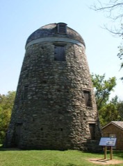 | Seppman Mill | 7.0 miles | 1971 |
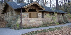 | Minneopa State Park WPA/Rustic Style Historic Resources | 7.2 miles | 1989 |
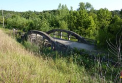 | Marsh Concrete Rainbow Arch Bridge | 7.6 miles | 1980 |
| National Archives record | The nomination case file for reference 80001949 in Record Group 79. |
| Blue Earth County | All 28 listed properties in this county. |