 Block
From the record
One of 23 National Register listings published here for Redwood County · listed in 1980 · category: Building.
Sources: the case file at the National Archives · the National Register database, National Park Service
Listed on the National Register of Historic Places in 1980.
One of 23 National Register listings published here for Redwood County · listed in 1980 · category: Building.
Sources: the case file at the National Archives · the National Register database, National Park Service
The chapter on Redwood Falls City in The History of Redwood County, Minnesota, published 1916 names North Redwood. This is what it says, exactly as the scans read.
Among the beautiful and useful public buildings to which the citizens of Redwood Falls point with pride is the Carnegie library, erected in 1904 at an approximate cost of $10,000. The base of the structure is North Redwood granite, the superstructure being pressed brick. The building is open to the reading public seven days and five evenings each week. It is supported by taxation under the management of nine trustees chosen by the mayor. Elizabeth Connor ably officiates as librarian.
Passage source: The History of Redwood County, Minnesota, published 1916.
Machine-read from a century-old scan, so expect the errors a machine makes: misspelled names, dropped words, stray characters.
Read the whole chapter on Redwood Falls City - 4,866 words on its settlement, mills, schools and churches.
Regional context, not property-specific evidence. The federal wildfire occurrence database lists 1 fire within 5 miles of Honner-Hosken House in 2014, burning about 1 acre in total. None started naturally. 1 was recorded as arson. Distance is straight-line from the map coordinates, so a fire counted here may appear on a neighbouring settlement's page as well.
| Reported cause | Fires |
|---|---|
| Arson/incendiarism | 1 |
The most recent of them, most recent first, with the day each was reported and the service that recorded it.
| Date | Cause | Size | Reported by | Name on the report |
|---|---|---|---|---|
| 6 July 2014 | Arson/incendiarism | 1.0 acres | Minnesota Department of Natural Resources | not named |
Regional context, not property-specific evidence. The federal mineral resources record lists 3 workings within 5 miles of Honner-Hosken House: 2 producers, 1 occurrence. 2 still produce. What was taken out: Kaolin, Clay, Aluminum, Iron, Silica, Titanium, Water, Free. Distance is straight-line from the map coordinates, so a quarry counted here may appear on a neighbouring settlement's page as well.
| Where | Site | Commodity | Status | Recorded |
|---|---|---|---|---|
| Minnesota River Valley Clays | Aluminum, Iron, Silica, Titanium, Water, Free | Occurrence | ||
| Morton Pit | Kaolin | Producer | Gibbsite, Illite, Kaolinite, Montmorillonite, Quartz | |
| Norton Clay Pit | Clay | Producer |
Regional context, not property-specific evidence. The National Weather Service names North Redwood, the town this property stands in, in 1 storm report in 2002: 1 thunderstorm wind. No death or injury is recorded in these reports. Each account below is quoted exactly as the forecast office filed it, from the NOAA Storm Events Database, and each date opens the federal record of that event.
| When | Event | Place named | Harm | What the report says |
|---|---|---|---|---|
| May 2002 | Thunderstorm Wind | North Redwood | - | Empty 27000 pound grain bin blown over. |
No historic map-sheet match is published for this property yet. That does not mean no map exists. This record needs a coordinate-quality review before it can be joined to a sheet boundary. Browse the county's mapped places while that work is pending.
Other National Register properties close enough to walk or drive between, ordered by distance from this one. Both positions come from the same geocoding pass that matched these properties to their map sheets.
| Photograph | Property | Distance | Listed |
|---|---|---|---|
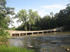 | Ramsey Park Swayback Bridge | 1.7 miles | 1980 |
| Redwood Falls Retaining Wall Roadside Development Project | 1.9 miles | 2012 | |
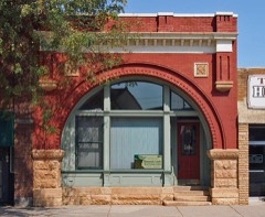 | Bank of Redwood Falls Building | 2.0 miles | 1980 |
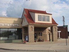 | Scenic City Cooperative Oil Company | 2.1 miles | 1980 |
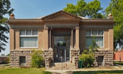 | Redwood Falls Carnegie Library | 2.1 miles | 1980 |
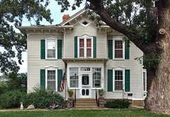 | H. D. Chollar House | 2.2 miles | 1980 |
| National Archives record | The nomination case file for reference 80002138 in Record Group 79. |
| Redwood County | All 23 listed properties in this county. |