 Block
From the record
One of 23 National Register listings published here for Redwood County · listed in 1980 · category: Building.
Sources: the case file at the National Archives · the National Register database, National Park Service
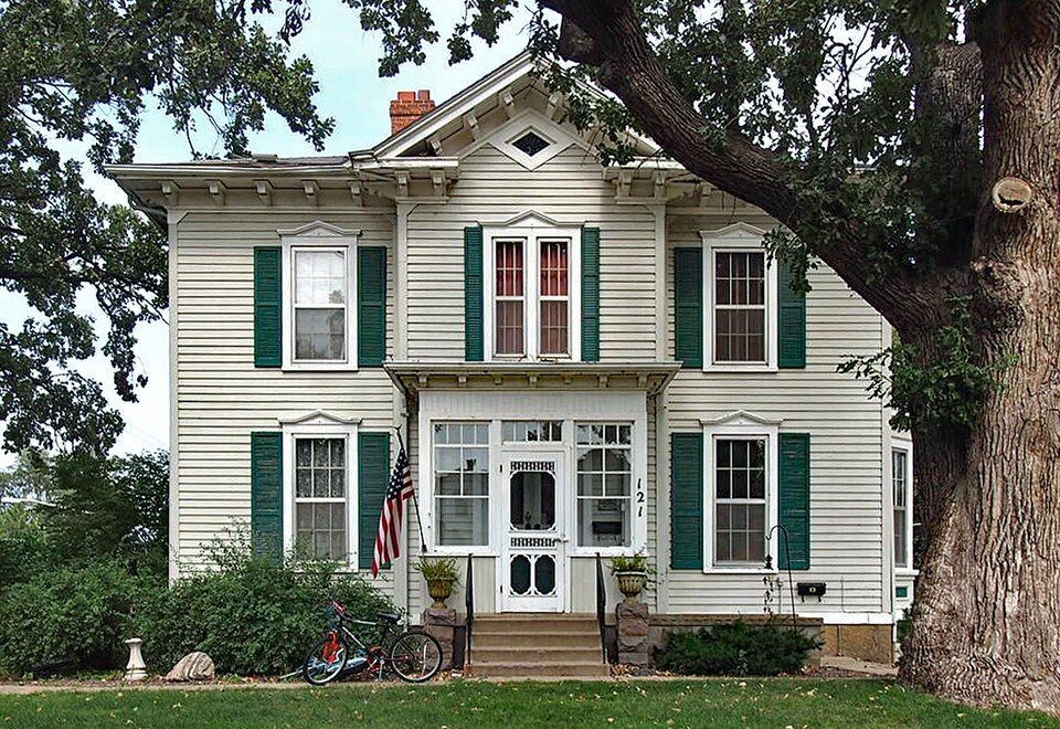
Listed on the National Register of Historic Places in 1980.
One of 23 National Register listings published here for Redwood County · listed in 1980 · category: Building.
Sources: the case file at the National Archives · the National Register database, National Park Service
The chapter on Redwood Falls City in The History of Redwood County, Minnesota, published 1916 names Redwood Falls. This is what it says, exactly as the scans read.
Redwood Falls is picturesquely located on the high banks of the Redwood river, about one mile south of the Minnesota river. It is the terminus of what is now known as the Sleepy Eye-Redwood Falls branch of the Chicago & North Western, but which when built in 1878 was called the Minnesota Valley division of the Winona & St. Peter.
Passage source: The History of Redwood County, Minnesota, published 1916.
The trees set out in the early days give the city the appearance of a settlement set in a beautiful grove, while the nearby parks have given to Redwood Falls the justly deserved title of "The Scenic City." The streets are well kept, the public buildings are unusually sightly, the churches are noted for their splendid architecture, the business houses are modern and progressive, the homes are attractively built and surrounded with lawns and shrubbery. From the earliest days, the city had been noted for its religious and educational activities, and the clean moral atmosphere of its social life.
Passage source: The History of Redwood County, Minnesota, published 1916.
Machine-read from a century-old scan, so expect the errors a machine makes: misspelled names, dropped words, stray characters.
Read the whole chapter on Redwood Falls City - 4,866 words on its settlement, mills, schools and churches.
Regional context, not property-specific evidence. The federal mineral resources record lists 2 workings within 5 miles of H. D. Chollar House: 2 producers. All of them still produce. What was taken out: Kaolin, Clay. Distance is straight-line from the map coordinates, so a quarry counted here may appear on a neighbouring settlement's page as well.
| Where | Site | Commodity | Status | Recorded |
|---|---|---|---|---|
| Morton Pit | Kaolin | Producer | Gibbsite, Illite, Kaolinite, Montmorillonite, Quartz | |
| Norton Clay Pit | Clay | Producer |
Regional context, not property-specific evidence. The National Weather Service names Redwood Falls, the town this property stands in, in 43 storm reports between 1995 and 2020: 17 thunderstorm wind, 17 hail, 3 heavy rain, 2 flash flood. The reports record 1 death. Each account below is quoted exactly as the forecast office filed it, from the NOAA Storm Events Database, and each date opens the federal record of that event.
| When | Event | Place named | Harm | What the report says |
|---|---|---|---|---|
| September 2019 | Flood | Redwood Falls | 1 killed | The local police department reported that an individual had disappeared in the Redwood River near the 100 block of West Bridge Street and was presumed dead from drowning. |
| August 2017 | Flash Flood | Redwood Falls | $350,000 | Very heavy rainfall, and associated flooding led to numerous reports of basement flooding in Redwood Falls, and surrounding communities. Flood waters caused damage to roads and drainage systems. |
| March 2017 | Hail | Redwood Falls | $25,000 | Several reports of large hail occurred from south of Redwood Falls, north-northeast toward the Renville County line. The largest hail stone was 2 inches in diameter. There was damage to local vehicles and vinyl siding due to the hail. |
| May 2012 | Thunderstorm Wind | Redwood Falls | $25,000 | Several trees were blown down, and one half of a barn's roof was blown off. |
| September 2020 | Thunderstorm Wind | Redwood Falls | - | Several trees and power lines were blown down in Redwood Falls. |
| July 2018 | Heavy Rain | Redwood Falls | - | A measured rainfall report of 5.21 inches fell west of Redwood Falls in 24 hours. |
| July 2018 | Heavy Rain | Redwood Falls | - | A measured rainfall report of 8.20 inches fell west of Redwood Falls in 24 hours. |
| August 2017 | Thunderstorm Wind | Redwood Falls | - | Trees and power lines were blown down in Redwood Falls. |
| June 2014 | Heavy Rain | Redwood Falls | - | A local observer had a 12 hour rainfall report of 5.10 inches. |
| August 2012 | Thunderstorm Wind | Redwood Falls | - | A trained spotter measured a wind gust of 67 mph on the west side of Redwood Falls. |
| July 2011 | Thunderstorm Wind | Redwood Falls | - | In addition to the wind gust at the airport, hundreds of trees were reported uprooted throughout the city of Redwood Falls, Minnesota. |
| July 2011 | Thunderstorm Wind | Redwood Falls | - | The wind was measured at the Redwood Valley High School. |
| July 2011 | Thunderstorm Wind | Redwood Falls | - | The wind was measured on a car's anemometer. |
| June 2007 | Hail | Redwood Falls | - | One inch hail report relayed by KMSP-TV. |
| August 2007 | Flash Flood | Redwood Falls | - | Water flooded the intersection of Highway 67 and 68 in the city of Morgan. Water flowed out of ditches along Highway 71 near Redwood Falls. |
| March 2007 | Flood | Redwood Falls | - | Water flooded Ramsey Park, covering a road. |
| June 2006 | Thunderstorm Wind | Redwood Falls | - | Forty to fifty foot tall tree with a diameter larger then two feet felled. In twenty minutes 0.86 inches of rain fell. |
| September 2006 | Thunderstorm Wind | Redwood Falls | - | ASOS located at Redwood Falls airport on the east side of town. |
| July 2003 | Thunderstorm Wind | Redwood Falls | - | Numerous trees and power lines down. |
| August 2002 | Thunderstorm Wind | Redwood Falls | - | Numerous large branches down. Numerous tents blown down at the county fair. |
| September 2020 | Hail | Redwood Falls | - | no account filed |
| September 2020 | Hail | Redwood Falls | - | no account filed |
| September 2020 | Hail | Redwood Falls | - | no account filed |
| March 2017 | Hail | Redwood Falls | - | no account filed |
| June 2016 | Hail | Redwood Falls | - | no account filed |
| June 2016 | Hail | Redwood Falls | - | no account filed |
| August 2012 | Thunderstorm Wind | Redwood Falls | - | no account filed |
| August 2012 | Thunderstorm Wind | Redwood Falls | - | no account filed |
| August 2012 | Thunderstorm Wind | Redwood Falls | - | no account filed |
| June 2012 | Hail | Redwood Falls | - | no account filed |
| July 2011 | Hail | Redwood Falls | - | no account filed |
| July 2011 | Hail | Redwood Falls | - | no account filed |
| July 2011 | Thunderstorm Wind | Redwood Falls | - | no account filed |
| June 2005 | Hail | Redwood Falls | - | no account filed |
| June 2004 | Hail | Redwood Falls | - | no account filed |
| May 2002 | Hail | Redwood Falls | - | no account filed |
| May 2002 | Hail | Redwood Falls | - | no account filed |
| August 2002 | Hail | Redwood Falls | - | no account filed |
| June 1998 | Tornado (F0) | Redwood Falls | - | no account filed |
| June 1996 | Hail | Redwood Falls | - | no account filed |
| August 1996 | Funnel Cloud | Redwood Falls | - | no account filed |
| August 1996 | Thunderstorm Wind | Redwood Falls | - | no account filed |
| June 1995 | Thunderstorm Wind | Redwood Falls | - | no account filed |
No historic map-sheet match is published for this property yet. That does not mean no map exists. This record needs a coordinate-quality review before it can be joined to a sheet boundary. Browse the county's mapped places while that work is pending.
Other National Register properties close enough to walk or drive between, ordered by distance from this one. Both positions come from the same geocoding pass that matched these properties to their map sheets.
| Photograph | Property | Distance | Listed |
|---|---|---|---|
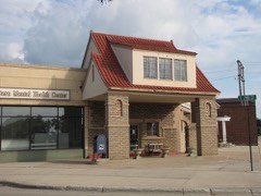 | Scenic City Cooperative Oil Company | 0.1 miles | 1980 |
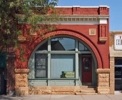 | Bank of Redwood Falls Building | 0.2 miles | 1980 |
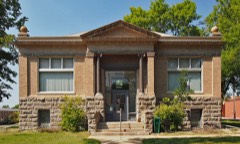 | Redwood Falls Carnegie Library | 0.2 miles | 1980 |
| Redwood Falls Retaining Wall Roadside Development Project | 0.3 miles | 2012 | |
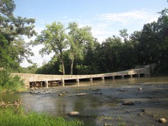 | Ramsey Park Swayback Bridge | 0.8 miles | 1980 |
| Honner-Hosken House | 2.2 miles | 1980 |
| National Archives record | The nomination case file for reference 80002142 in Record Group 79. |
| Redwood County | All 23 listed properties in this county. |