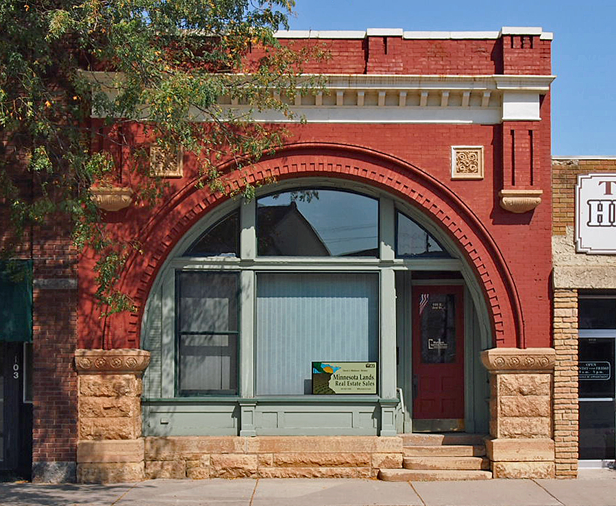
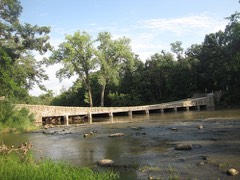
Listed on the National Register of Historic Places in 1980.
From the record
“A history of Redwood Falls would be incomplete without mentioning its incomparable system of waterworks and sewers. The water plant was installed in 1892, and consisted of four miles of 4, 6, 8 and 10-inch mains, a water tower with a capacity of 92,000 gallons, giving a gravity pressure of 47 pounds ; a power building, 40x80. in which are installed one Duplex non-condensing Gordon pump, 2,000,000 gallons capacity, one 80-horsepower Springfield boiler, with foundation and piped for a duplicate set of boiler and pumps, should necessity arise for more power.”
The History of Redwood County, Minnesota (1916). Machine-read text.
One of 23 National Register listings published here for Redwood County · listed in 1980 · category: Building.
National Register reference number.80002141- the number the National Park Service assigned this property when it was listed, and the key its nomination file is catalogued under at the National Archives.
The ground it stands on
4,866 words
The chapter on Redwood Falls City in The History of Redwood County, Minnesota, published 1916 names Redwood Falls. This is what it says, exactly as the scans read.
Redwood Falls is picturesquely located on the high banks of the Redwood river, about one mile south of the Minnesota river. It is the terminus of what is now known as the Sleepy Eye-Redwood Falls branch of the Chicago & North Western, but which when built in 1878 was called the Minnesota Valley division of the Winona & St. Peter.
The trees set out in the early days give the city the appearance of a settlement set in a beautiful grove, while the nearby parks have given to Redwood Falls the justly deserved title of "The Scenic City." The streets are well kept, the public buildings are unusually sightly, the churches are noted for their splendid architecture, the business houses are modern and progressive, the homes are attractively built and surrounded with lawns and shrubbery. From the earliest days, the city had been noted for its religious and educational activities, and the clean moral atmosphere of its social life.
Regional context, not property-specific
evidence. The federal mineral resources record lists
2 workings within 5 miles of Bank of Redwood Falls Building: 2 producers.
All of them still produce. What was taken out: Kaolin, Clay. Distance is straight-line from the
map coordinates, so a quarry counted here may appear on a neighbouring
settlement's page as well.
Regional context, not property-specific
evidence. The National Weather Service names
Redwood Falls, the town this property stands in, in 43 storm reports between 1995 and 2020: 17 thunderstorm wind, 17 hail, 3 heavy rain, 2 flash flood.
The reports record 1 death. Each account below is quoted exactly as the forecast office
filed it, from the NOAA Storm Events Database, and each date
opens the federal record of that event.
The local police department reported that an individual had disappeared in the Redwood River near the 100 block of West Bridge Street and was presumed dead from drowning.
Very heavy rainfall, and associated flooding led to numerous reports of basement flooding in Redwood Falls, and surrounding communities. Flood waters caused damage to roads and drainage systems.
Several reports of large hail occurred from south of Redwood Falls, north-northeast toward the Renville County line. The largest hail stone was 2 inches in diameter. There was damage to local vehicles and vinyl siding due to the hail.
No historic map-sheet match is published
for this property yet. That does not mean no map exists. This record needs
a coordinate-quality review before it can be joined to a sheet boundary.
Browse the county's mapped places while that work is
pending.
Listed places nearby
6 within 8 miles
Other National Register properties close
enough to walk or drive between, ordered by distance from this one. Both
positions come from the same geocoding pass that matched these properties
to their map sheets.
Listing record. National Park Service National Register of Historic Places, listed-properties dataset, current to 2026-05-22.
Map join. Address geocoded through the United States Census geocoder, then tested against the published boundary of every sheet in the USGS Historical Topographic Map Collection.
How this page is made. Listing fields come from federal records; map-sheet coverage is a labelled coordinate-to-boundary calculation, not a source-field claim.
Mines and quarries. USGS Mineral Resources Data System (MRDS) https://mrdata.usgs.gov/mrds/ A work of the United States government, no copyright under 17 U.S.C. 105.
Storms. NOAA National Centers for Environmental Information, Storm Events Database https://www.ncei.noaa.gov/stormevents/ A work of the United States government, no copyright under 17 U.S.C. 105. Narratives are quoted verbatim from the National Weather Service report and are not edited or summarised.
 Block