Block
From the record
21 National Register listings published here.
Sources: the county history on the Internet Archive · the National Register database, National Park Service
36 topographic sheets cover 34 settlements here, and 21 properties are on the National Register of Historic Places.
21 National Register listings published here.
Sources: the county history on the Internet Archive · the National Register database, National Park Service
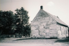
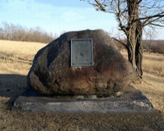
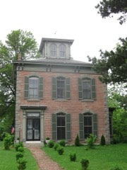
Every property in this county listed on the National Register of Historic Places, with the year it was listed and the federal nomination document.
Every wildfire the federal occurrence database records inside this county: 35 of them, burning about 527 acres. None started naturally and 1 was recorded as arson. Each settlement page carries the fires within five miles of it.
| Reported cause | Fires |
|---|---|
| Debris and open burning | 23 |
| Missing data/not specified/undetermined | 7 |
| Equipment and vehicle use | 3 |
| Misuse of fire by a minor | 1 |
| Arson/incendiarism | 1 |
The five largest, by the area the report gives. One of them was set deliberately.
| Date | Cause | Size | Reported by | Name on the report |
|---|---|---|---|---|
| 5 April 1992 | Debris and open burning | 120 acres | Missouri Department of Conservation | not named |
| 8 April 1992 | Debris and open burning | 82 acres | Missouri Department of Conservation | not named |
| 8 April 1992 | Arson/incendiarism | 70 acres | Missouri Department of Conservation | not named |
| 9 April 2006 | Missing data/not specified/undetermined | 60 acres | Missouri State Fire Marshal's Office | not named |
| 25 March 2014 | Debris and open burning | 30 acres | Missouri Department of Conservation | not named |
| 6 February 1992 | Debris and open burning | 25 acres | Missouri Department of Conservation | not named |
| 28 February 1992 | Debris and open burning | 25 acres | Missouri Department of Conservation | not named |
| 26 April 2019 | Debris and open burning | 21 acres | Missouri Department of Conservation | 179302-00000-04262019-1250 |
Every settlement page carries the fires within five miles of it - see the settlement index below.
The NOAA Storm Events Database holds 294 reports for this county, causing 2 deaths, 7 injuries and about $6,916,750 in recorded property damage. Each settlement page carries the reports that name it.
| Kind of event | Reports |
|---|---|
| Thunderstorm Wind | 133 |
| Hail | 105 |
| Flash Flood | 33 |
| Tornado | 10 |
| Flood | 7 |
| Heavy Rain | 4 |
| Lightning | 1 |
| Funnel Cloud | 1 |
The most serious of them, by death, then injury, then recorded damage. The accounts are quoted exactly as the forecast office filed them.
| When | Event | Place named | Harm | What the report says |
|---|---|---|---|---|
| May 2009 | Tornado (EF2) | Kirksville | 2 killed, 6 hurt, $5,000,000 | An EF2 tornado touched down at 17:09 CST, 2 miles north-northwest of Kirksville. This tornado traveled east over northern portions of Kirksville, before lifting at 17:20 CST, 2 miles west-southwest of the town of Clay. This tornado killed two people and damaged numerous homes in northern Kirksville. Ten homes were destroyed and fifteen others suffered major damage. Up to 186 other buildings and homes had minor to moderate damage. Two dealerships suffered major damage. Several farmsteads suffered damage east of Kirksville. |
| April 2002 | Hail | Novinger | 1 hurt, $15,000 | A man caught outside during the hailstorm received bruises on his arm. |
| May 2002 | Flash Flood | Kirksville | $500,000 | Highway 63 closed in 3 places around Kirksville. Water waist deep in spots. Highway 11 closed in 2 places around Kirksville. |
| September 1993 | Thunderstorm Wind | Kirksville | $500,000 | As many as 40 to 50 large trees were knocked down along with light poles and wires across the city. A radio station reported a wind gust to 67 mph with three house trailers rolled over and heavily damaged. Many homes were damaged from falling trees and limbs until 1600 CST. |
| July 2008 | Flood | Novinger | $300,000 | The Chariton River near Novinger, had its third highest crest on record,|28.44 feet. Several hundred acres of low lying farm land was inundated. Five homes in Novinger suffered total loss. |
| May 2005 | Lightning | Kirksville | $200,000 | Lightning struck a bar in downtown Kirksville with establishment totally destroyed by fire. |
| May 2009 | Tornado (EF1) | Pure Air | $100,000 | An EF1 tornado touched down around 5 miles west of Novinger at 16:43 CST, and paralled Highway 6 as it moved east. The tornado lifted around 2 miles east of Novinger at 16:55 CST. The tornado destroyed a house and out building west of Novinger. On the south side of Novinger, a mobile home was destroyed and power poles and lines were downed. Additional power poles and trees were damaged, before the tornado lifted. |
| June 1998 | Thunderstorm Wind | Kirksville | $50,000 | Severe thunderstorm winds gusted up to 75 MPH in the Kirksville area resulting in uprooted trees and downed power lines. Large trees blew on top of the roofs of houses causing significant damages along the 900 block of Michigan Avenue and the 800 block of South Fifth Street. Ameren Union Electric reported that 7,700 customers lost power during the storm. |
| September 1987 | Tornado (F1) | not stated | $25,000 | no account filed |
| May 1973 | Tornado (F1) | not stated | $25,000 | no account filed |
| May 1960 | Tornado (F2) | not stated | $25,000 | no account filed |
| May 1960 | Tornado (F2) | not stated | $25,000 | no account filed |
| May 2013 | Thunderstorm Wind | Kirksville | $20,000 | Power poles and roof damage were reported across the south side of Kirksville. Numerous trees were also reported down, and a mobile home was blown onto Highway H. Thunderstorm wind gusts were estimated up to 70 mph. |
| August 1998 | Thunderstorm Wind | Sublette | $20,000 | Thunderstorm winds uprooted trees up to 4 inches in diameter and blew over a chicken coop along Route AA near Sublette. Also in Sublette a trailer was blown over by the thunderstorm winds. |
| July 1997 | Thunderstorm Wind | Kirksville | $20,000 | Severe thunderstorm winds knocked down a large tree limb( a foot in diamter) in Kirksville. The large limb blocked North Elson Street. The storm also knocked down a power line and blew a dog pen into the street. |
| July 2011 | Thunderstorm Wind | Kirksville | $15,000 | A roof was blown off, and two walls of a barn were blown down, with thunderstorm wind gusts estimated up to 70 mph. |
| March 2002 | Thunderstorm Wind | Kirksville | $15,000 | Large trees uprooted. Roof blown off a house and garage door blown in. |
| July 2010 | Flash Flood | Kirksville | $10,000 | Numerous roads were reported impassable in Kirksville, due to flooding. One car was reported submerged. |
| April 2001 | Thunderstorm Wind | Kirksville | $10,000 | Law enforcement reported power line down near Kirksville on route P and a door torn off shed. |
| May 2000 | Thunderstorm Wind | Kirksville | $10,000 | Power lines were downed in Kirksville. |
| February 2012 | Thunderstorm Wind | Irk Cannon Mem Arpt | $5,000 | Several large trees were blown down, along Highway E, with damage reported to cars and a home. Powerlines were also down on Highway 63 north of La Plata. Thunderstorm wind gusts were estimated up to 60 mph. |
| March 2009 | Thunderstorm Wind | Gibbs | $5,000 | Numerous power poles were reported down. |
| April 2002 | Hail | Kirksville | $5,000 | Hail caused damage to a roof and three cars. |
| April 1993 | Thunderstorm Wind | Countywide | $5,000 | Several trees were knocked down across southwest and central parts of the county. A wind gust to 58 mph was recorded at the Kirksville Regional Airport. |
| June 2001 | Thunderstorm Wind | Kirksville | $5,000 | no account filed |
| May 1995 | Hail | Shelby's Point | $2,000 | no account filed |
| June 2016 | Thunderstorm Wind | Kirksville | $1,000 | An 8 inch healthy tree was reported down near Kirksville, Missouri. |
| July 2011 | Thunderstorm Wind | Kirksville | $1,000 | A flagpole was blown down and two car windows were blown out. Thunderstorm wind gusts were estimated up to 70 mph. |
| October 2007 | Thunderstorm Wind | Kirksville | $1,000 | Trailer damaged and power poles are down on northwest side of Kirksville. |
| May 2013 | Thunderstorm Wind | Kirksville | $500 | Thunderstorm wind gusts were estimated up to 70 mph. Powerlines were reported down. |
| May 1993 | Hail | Kirksville | $500 | A local television station reported golf ball-size hail in southern Adair County. |
| April 1993 | Thunderstorm Wind | Southwest Portion | $500 | Several trees were knocked down across southwest and central parts of the county. A wind gust to 58 mph was recorded at the Kirksville Regional Airport. |
| September 1965 | Tornado (F0) | not stated | $250 | no account filed |
| July 2025 | Thunderstorm Wind | Pure Air | - | Private weather sensor in southwestern Adair County measured a severe wind gust. |
| August 2024 | Thunderstorm Wind | Novinger | - | Downed trees and wires near Rolling Hills Road. Time estimated from radar and outage report. |
| April 2023 | Thunderstorm Wind | Kirksville | - | A carwash awning was damaged; power poles and large tree limbs were downed in Kirksville. |
| June 2023 | Thunderstorm Wind | Irk Cannon Mem Arpt | - | Kirksville Regional Airport ASOS recorded a 64 mph wind gust. |
| June 2023 | Thunderstorm Wind | Irk Cannon Mem Arpt | - | Measured wind gust of 64 mph at Kirksville Regional Airport. |
| August 2023 | Thunderstorm Wind | Clay | - | A house in eastern Adair County had some external wall and roof removal due to strong winds moving through that area. |
| August 2023 | Flash Flood | Fegley | - | Heavy rain led to flash flooding and numerous water rescues in Kirksville. |
| July 2021 | Flash Flood | Danforth | - | Missouri Department of Transportation reported water over the road along Highway 149. |
| June 2021 | Thunderstorm Wind | Novinger | - | A storm spotter estimated 60 mph wind. |
| June 2021 | Thunderstorm Wind | Irk Cannon Mem Arpt | - | The ASOS in Kirksville reported 71 mph wind. |
| May 2020 | Thunderstorm Wind | Stahl | - | A trained spotter reported 70 mph wind along with quarter sized hail. |
| May 2020 | Hail | Bullion | - | This report came via MPing. |
| April 2019 | Flood | Loeffler | - | Ongoing flooding along the Missouri River continued through the month of April and into May. Several roads were closed near the banks of the Missouri River. This flooding began in mid March and due to upstream releases and continued periods of heavy rain the flooding continued into May. Monetary damages are unknown despite the entry indicating 0 dollars of damages. |
| June 2019 | Thunderstorm Wind | Kirksville | - | Estimated 60 mph winds at this location. |
| June 2019 | Thunderstorm Wind | Kirksville | - | Picture received via Twitter of a Burger King sign destroyed in Kirksville. |
| June 2019 | Thunderstorm Wind | Kirksville | - | Several tree branches were snapped. |
| May 2019 | Flash Flood | Kirksville | - | Water was running over multiple city streets within Kirksville. Route 11 east of Kirksville was closed. |
| August 2018 | Thunderstorm Wind | Willmathsville | - | A 10 inch diameter tree was snapped. |
| June 2018 | Thunderstorm Wind | Kirksville | - | Law enforcement reported 60 mph wind in Kirksville. |
| July 2017 | Thunderstorm Wind | Kirksville | - | A tree was broken in Kirksville. This report was received via social media. |
| June 2017 | Thunderstorm Wind | Kirksville | - | Power poles and power lines were down near Kirksville. |
| October 2017 | Thunderstorm Wind | Millard | - | A few power lines were down and a roof was blown off of a home in Millard. |
| March 2017 | Thunderstorm Wind | Kirksville | - | The ASOS at KIRK in Kirksville recorded a 60 mph wind gust. |
| April 2016 | Hail | Kirksville | - | The hail lasted about 5 minutes. |
| April 2016 | Thunderstorm Wind | Novinger | - | An estimated 60 mph wind gust was reported. |
| April 2016 | Thunderstorm Wind | Kirksville | - | An estimated 60 mph wind was reported. |
| June 2015 | Thunderstorm Wind | Kirksville | - | Trees and power lines were down in Kirksville due to strong winds. |
The Survey's mineral resources record lists 21 workings inside this county. 1 still produces and 20 are closed or unrecorded. Each settlement page carries the workings within five miles of it.
| Commodity | Workings |
|---|---|
| Stone, Crushed/Broken | 10 |
| Sand and Gravel, Construction | 10 |
| Clay | 1 |
The least common of them first, because a county's hundredth gravel pit says nothing its first ten did not.
| Where | Site | Commodity | Status | Recorded |
|---|---|---|---|---|
| Unk | Clay | Past Producer | ||
| Bailey Limestone Quarry # 4 | Stone, Crushed/Broken | Past Producer | ||
| Chariton River Sand Plant | Sand and Gravel, Construction | Past Producer | ||
| Unk | Stone, Crushed/Broken | Past Producer | ||
| Unk | Stone, Crushed/Broken | Past Producer | ||
| Unk | Stone, Crushed/Broken | Past Producer | ||
| Unk | Sand and Gravel, Construction | Past Producer | ||
| Unk | Stone, Crushed/Broken | Past Producer | ||
| Unk | Stone, Crushed/Broken | Past Producer | ||
| Unk | Sand and Gravel, Construction | Past Producer | ||
| Unk | Stone, Crushed/Broken | Past Producer | ||
| Unk | Stone, Crushed/Broken | Past Producer | ||
| Unk | Sand and Gravel, Construction | Past Producer | ||
| Unknown | Sand and Gravel, Construction | Past Producer | ||
| Unknown | Sand and Gravel, Construction | Past Producer | ||
| Unknown | Stone, Crushed/Broken | Producer | ||
| Unknown | Sand and Gravel, Construction | Past Producer | ||
| Unknown | Sand and Gravel, Construction | Past Producer | ||
| Unknown | Stone, Crushed/Broken | Past Producer | ||
| Unknown | Sand and Gravel, Construction | Past Producer | ||
| Unknown | Sand and Gravel, Construction | Past Producer |
One book written about this county, cut here where the book itself is cut, at its printed chapters: 19 chapters in all. Every chapter is public domain, machine-read from the scan and reproduced complete. A chapter already given under one of the county's towns is not repeated in this list.
| Chapter | Length |
|---|---|
| Chapter 1: Indian Mounds | 1,002 words |
| Chapter 2: Early Settlements | 6,931 words |
| Chapter 4: The Creation of the County | 3,622 words |
| Chapter 5: County Organization | 8,385 words |
| Chapter 6: County Politics | 5,613 words |
| Chapter 7: Civil War | 10,631 words |
| Chapter 8: The Churches | 12,599 words |
| Chapter 9: Fraternal, Patriotic and Industrial Orders | 5,132 words |
| Chapter 10: The Public Schools | 7,695 words |
| The Normal School | 10,976 words |
| Chapter 12: Schools of Osteopathy | 9,651 words |
| Chapter 13: The County Press | 3,746 words |
| Chapter 14: Industries | 6,833 words |
| Chapter 15: Transportation Facilities | 6,100 words |
| Chapter 16: The Banks | 2,825 words |
| Chapter 17: Kirksville | 21,048 words in 2 parts |
| Chapter 18: The Other Towns of the County | 6,553 words |
| Chapter 19: In Memoriam | 18,217 words in 2 parts |
| Biographical sketches | 122,921 words in 8 parts |
Named settlements recorded in the Geographic Names Information System, each with the topographic sheets covering it. Villages, hamlets and abandoned places alike. Each is shown with the nearest named watercourse or landform and the survey quadrangle it falls on.
Nineveh township · 63559 · On Hazel Creek · Connelsville quadrangle
10 sheets, 1911 to 1981
Nineveh township · 63559 · On Brush Creek · Connelsville quadrangle
10 sheets, 1911 to 1981
Walnut township · 63501 · On Goose Creek · Gifford quadrangle
11 sheets, 1938 to 1981
No longer a settlement
Liberty township · 63559 · On Billy Creek · Novinger quadrangle
11 sheets, 1938 to 1981
No longer a settlement
Nineveh township · 63559 · On Shuteye Creek · Connelsville quadrangle
10 sheets, 1911 to 1981
Clay township · 63546 · Willmathsville quadrangle
9 sheets, 1903 to 1981
No longer a settlement
The vanished settlements of Adair County: the places named above that are no longer on the map.