 Block
From the record
14 National Register listings published here.
Sources: the National Register database, National Park Service
105 topographic sheets cover 52 settlements here, and 14 properties are on the National Register of Historic Places.
14 National Register listings published here.
Sources: the National Register database, National Park Service
Every property in this county listed on the National Register of Historic Places, with the year it was listed and the federal nomination document.
| Photograph | Property | Type | Listed | Reference |
|---|---|---|---|---|
| Big Bend Rural School | building | 1978 | 78001643 | |
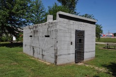 | Cuba City Jail | building | 2014 | 14000880 |
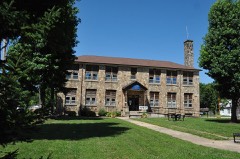 | Cuba High School Annex | building | 2013 | 13000223 |
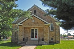 | Cuba Lodge No. 312 A.F. and A.M. | building | 2014 | 14000881 |
 | Dillard Mill Historic District | district | 2015 | 14001157 |
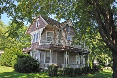 | George B. Hamilton House | building | 2014 | 14000882 |
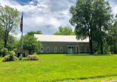 | Maj. Gen. William S. Harney Summer Home | building | 1984 | 84002144 |
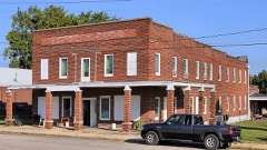 | Hotel Cuba | building | 2014 | 14000883 |
 | John Manson Munro House | building | 2014 | 14000884 |
| Scotia Iron Furnace Stack | structure | 1969 | 69000099 | |
| Shamrock Court | building | 2022 | 100007530 | |
| Snelson-Brinker House | site | 2007 | 07000576 | |
 | Uptown Cuba Historic District | district | 2013 | 13000072 |
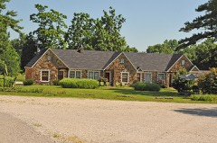 | Wagon Wheel Motel, Cafe and Station | building | 2003 | 03000183 |
Every wildfire the federal occurrence database records inside this county: 609 of them, burning about 10,709 acres. 3 started naturally and 164 were recorded as arson. Each settlement page carries the fires within five miles of it.
| Reported cause | Fires |
|---|---|
| Debris and open burning | 296 |
| Arson/incendiarism | 164 |
| Missing data/not specified/undetermined | 97 |
| Equipment and vehicle use | 16 |
| Recreation and ceremony | 14 |
| Smoking | 10 |
| Power generation/transmission/distribution | 4 |
| Natural | 3 |
| Misuse of fire by a minor | 3 |
| Railroad operations and maintenance | 1 |
| Fireworks | 1 |
The five largest, by the area the report gives. Three of them were set deliberately.
| Date | Cause | Size | Reported by | Name on the report |
|---|---|---|---|---|
| 12 April 1998 | Arson/incendiarism | 740 acres | Missouri Department of Conservation | not named |
| 28 February 1992 | Debris and open burning | 517 acres | Missouri Department of Conservation | not named |
| 28 February 2004 | Debris and open burning | 494 acres | Mark Twain National Forest | SELLERS |
| 12 April 1998 | Arson/incendiarism | 459 acres | Mark Twain National Forest | SHAFT 271 |
| 31 March 2015 | Debris and open burning | 381 acres | Mark Twain National Forest | BEARCLAW |
| 14 March 2005 | Missing data/not specified/undetermined | 274 acres | Mark Twain National Forest | CAMELS HUMP |
| 23 November 2008 | Arson/incendiarism | 242 acres | Mark Twain National Forest | POSSUM |
| 1 March 2012 | Debris and open burning | 217 acres | Mark Twain National Forest | BILL HOLLOW |
Every settlement page carries the fires within five miles of it - see the settlement index below.
The NOAA Storm Events Database holds 353 reports for this county, causing 2 deaths, 7 injuries and about $27,300,550 in recorded property damage. Each settlement page carries the reports that name it.
| Kind of event | Reports |
|---|---|
| Hail | 152 |
| Thunderstorm Wind | 135 |
| Flash Flood | 30 |
| Tornado | 25 |
| Flood | 7 |
| Heavy Rain | 4 |
The most serious of them, by death, then injury, then recorded damage. The accounts are quoted exactly as the forecast office filed them.
| When | Event | Place named | Harm | What the report says |
|---|---|---|---|---|
| July 2012 | Thunderstorm Wind | Cuba | 1 killed, 1 hurt | A microburst caused extensive damage in Cuba. The damage area started less than a quarter of a mile southwest of the intersection of Interstate 44 and Highway 19. In this location, several medium sized trees and large tree limbs fell to the southwest and west. A little further to the south numerous large tree limbs and a few large trees were blown down along and west of Oak Hill Avenue and south of Grove Street. Additional large tree branches and a few large trees fell on Florence Street between Forest Street and Oak Hill Avenue. Most of the branches fell to the south and southwest showing a divergent wind damage pattern. More tree and large limb damage occurred just northeast of the intersection of School Avenue and Forest Street near the grounds of Holy Cross Catholic Church. Another microburst occurred at the intersection of West Washington and North Smith Street. A grocery store lost much of its roof and was displaced into the parking lot south of the store. A fatality occurred in the parking lot where debris from the roof shattered the front window of a car killing the 28 year old woman who was in the vehicle at the time. A person in a nearby car sustained minor injuries from the flying debris as well. Additional minor roof damage occurred at the Cuba post office where some of the roofing material was peeled off. The length of the microburst damage path was approximately three quarters of a mile and about a third of a mile wide. Based on the tree and structural damage, winds associated with the microbursts were estimated between 65 and 75 mph. |
| December 2015 | Flood | Bourbon | 1 killed, $500,000 | Between 5 and 8 inches of rain fell across Crawford County during a 2 day period. All of this rain caused the creeks and rivers to rise. The Meramec River rose above flood stage at Steelville on December 27th. On December 30th, an 81 year old man drove into the flood waters of the Meramec on Highway N at Campbell Bridge, about 5 miles southeast of Bourbon. He apparently got out of his vehicle and drown. The flooding caused major damage to one home and completely destroyed another one. |
| June 2011 | Tornado (EF2) | Keysville | 3 hurt, $150,000 | A tornado touched down about 2.25 miles southeast of Keysville along Highway AA and travelled to the northeast. There was widespread tree damage with trees snapped off at the base. Some of the trees were between a foot and two feet in diameter in this location, where the intensity of damage was rated EF0. Further along the path, about half a mile north of Gray Road, the tornado hit a home. The roof of the home was uplifted and thrown about a quarter of a mile to the north. The north and east side walls were removed and tossed to the northeast between 80 and 120 yards. Some of the 2x4 supports were deposited as much as half to three quarters of a mile to the east northeast. Three of the seven family members sustained minor injuries. Damage at this location was rated EF2. Additional large tree damage was uncovered from just northeast of the damaged home to half a mile east northeast of the home. The tornado continued to cause tree damage before lifting and dissipating near the intersection of 7 Cedars Road and Imperial Woods Lane. The width of the damage path varied between 50 and 80 yards. The overall path length was 2.77 miles and was rated an EF2, with peak wind speeds near 125 mph. |
| November 1988 | Tornado (F1) | not stated | 1 hurt, $25,000,000 | no account filed |
| December 1982 | Tornado (F2) | not stated | 1 hurt, $250,000 | no account filed |
| July 2002 | Flash Flood | Cuba | 1 hurt | A reported 4 inches of rain in about an hour caused flash flooding in Cuba. The Sheriff Department reported the Highway 19 railroad underpass had at least 2 feet of water in it and had to be closed. Another area that flooded had 2 propane tanks break loose and float away. The heavy rain caused problems at the County Fair that had started the day before. The entire evenings planned events had to be cancelled. The roof of the main stage collapsed due to the rain. One man was injured with a broken arm when the roof collapsed. |
| September 1993 | Tornado (F1) | to 1 E | $500,000 | A narrow tornado touched down southwest of Steelville near County Road M and tracked just south of Steelville. Numerous trees were knocked down and homes were slightly damaged. At maximum intensity the side and front of a lumber yard building on the southern edges of Steelville were heavily damaged. Debris from the lumber yard was found nearly 2 miles away. |
| April 1982 | Tornado (F2) | not stated | $250,000 | no account filed |
| April 1974 | Tornado (F2) | not stated | $250,000 | no account filed |
| July 2002 | Thunderstorm Wind | Steelville | $100,000 | no account filed |
| July 1998 | Flash Flood | Countywide | $100,000 | no account filed |
| May 2025 | Tornado (EF1) | Cherryville | $60,000 | A tornado touched down along Hobo Road near Cherryville and moved north-northeast, quickly producing tree damage and destroying a farm outbuilding before dissipating. The peak wind speed was 107 mph and the track was 1.03 miles long and 270 yards wide. |
| April 1994 | Thunderstorm Wind | Cuba | $50,000 | Several power poles, lines, and trees were blown down. A few windows were also blown out in Cuba. Reported by the Cuba Police Department and county sheriff deputies. |
| June 1999 | Thunderstorm Wind | Steelville | $35,000 | no account filed |
| February 2023 | Thunderstorm Wind | Vivian | $5,000 | A number of trees were blown down between Steelville and Anthonies Mill. One tree was blown down onto Highway M southwest of Steelville. Just east of Steelville, three trees were blown down along Long Spring Road. About two miles west of Anthonies Mill, a large tree was blown down onto Highway N. |
| May 2008 | Thunderstorm Wind | Steelville | $5,000 | Local law enforcement reported trees and power lines down. |
| May 2008 | Thunderstorm Wind | Cuba | $5,000 | Local law enforcement reported trees and power lines down. |
| April 1994 | Thunderstorm Wind | Cuba | $5,000 | Weather spotters reported numerous large trees down and uprooted. |
| April 1994 | Thunderstorm Wind | Cuba | $5,000 | Several power poles, lines, and trees were blown down. A few windows were also blown out in Cuba. Reported by the Cuba Police Department and county sheriff deputies. |
| June 1994 | Hail | Cook Station | $5,000 | Golf ball-size hail damaged cars in the Cook Station area. |
| September 1993 | Tornado (F0) | Cook Station | $5,000 | A home sustained damage after a tornado briefly touched down. Many trees in the area were also knocked down or snapped off. |
| September 1993 | Tornado (F0) | Leasburg | $5,000 | A tornado touched down briefly producing wind damage to trees in the Huzzah State Forest. |
| September 1993 | Tornado (F0) | Steelville | $5,000 | A tornado touched down briefly along County Road T damaging a roof of a house and knocking down an area of trees. |
| July 1995 | Thunderstorm Wind | Steeleville | $3,400 | Power lines and poles were blown down in the Cuba area. Several minutes later the county sheriff's department reported several large trees and power lines down in Steeleville. One roof was also heavily damaged. |
| May 2008 | Thunderstorm Wind | Bourbon | $2,000 | Local law enforcement reported trees and power lines down. |
| May 2025 | Thunderstorm Wind | Cuba | $1,000 | Thunderstorm winds downed a powerline on the south side of Cuba. To the southwest, thunderstorm winds damaged and uprooted numerous large trees in Davisville. |
| June 2008 | Flash Flood | Jake Prairie | $1,000 | Two to four inches of rain fell on already saturated soils in northern Crawford county. Numerous secondary roads became flooded including parts of Highway 19 south of Cuba, Highway PP east of Cuba, and Highway N southeast of Bourbon. |
| September 2007 | Flash Flood | Leasburg | $1,000 | Three to four inches of rain fell over a short amount of time on ground that was already saturated from previous rains. The sheriff's department reported that Highway E at Scotia had water over the bridge that crosses Huzzah Creek. The flooding lingered for several hours. |
| June 1999 | Tornado (F0) | Steelville | $1,000 | no account filed |
| June 1995 | Thunderstorm Wind | Steelville | $300 | Power poles and lines were knocked down causing widespread power outages. |
| June 1990 | Tornado (F1) | not stated | $250 | no account filed |
| June 1995 | Thunderstorm Wind | Steelville | $200 | Large trees were blown down and blocked county roads around Steelville. |
| July 1995 | Thunderstorm Wind | Cuba | $200 | Power lines and poles were blown down in the Cuba area. Several minutes later the county sheriff's department reported several large trees and power lines down in Steeleville. One roof was also heavily damaged. |
| June 1995 | Thunderstorm Wind | Cuba | $200 | The county sheriff reported several large trees down and power lines down. |
| April 2026 | Hail | Bourbon | - | A report of 2+ inch hail fell near Bourbon Elementary School. |
| April 2025 | Thunderstorm Wind | Bourbon | - | Thunderstorm winds downed a large tree across a road in town. |
| April 2025 | Tornado (EF0) | Huzzah | - | At 3:13 PM, a tornado began southwest of Berryman, MO in east-central Crawford County, producing damage to trees in the northern half of Mark Twain National Forest. In Crawford County the tornado had a path length of 2.32 miles with a maximum path width of 50 yards. It was rated an EF0. |
| May 2024 | Thunderstorm Wind | Cuba Airstrip Arpt | - | Multiple large trees were reported to be downed due to thunderstorm winds. This includes multiple trees snapped along the upper portion of the trunk and uprooted near Cuba, a tree over the roadway near Roadside Park, a tree over the roadway at the 1200 block of Highway 19, a tree over the roadway along Highway 49 near Dan Halbert Road near Cherryville, and two trees down in Bourbon: one over the roadway at Highway C near Gerth Road and another over the roadway at the 1000 and 1500 blocks of Old Springfield Road. Additional cities in the path of this storm were Steelville and Leasburg. |
| May 2024 | Tornado (EF0) | Hinch | - | A tornado touched down just south of Miller Lane, about half a mile west southwest of intersection with Highway N (4 miles southeast of Bourbon). As it tracked to the northeast it snapped off or blew down numerous trees and tree limbs. It lifted and dissipated around two tenths of a mile northeast of the intersection of Miller Lane and Highway N. Overall, the tornado was rated EF0 with a path length of 0.72 miles and a max path width of 75 yards. No deaths or injuries were reported. |
| May 2024 | Tornado (EF1) | Jake Prairie | - | A tornado touched down on Jakes Prairie Road, about 6.5 miles northwest of Cuba. It uprooted and snapped off several large trees, then it tracked to the east. As it approached Four Mile Road it either uprooted or snapped off several more large trees before lifting and dissipating on Pleasant Valley Road, just west of intersection with Highway 19. Overall, the tornado was rated EF1 with a path length of 2.24 miles and a max path width of 75 yards. No deaths or injuries were reported. |
| November 2024 | Flood | Hinch | - | Heavy rain caused water over Highways 19 and 8 on the east side of Steelville. A trooper also reported that the Meramec River was 4 feet over the road at Campbell Bridge on Highway N. |
| November 2024 | Heavy Rain | Vivian | - | A CoCoRaHS station measured 9.95 inches of storm total rain. |
| August 2023 | Thunderstorm Wind | Indian Hills | - | Thunderstorm winds blew down several trees onto roads across Cuba. |
| July 2023 | Thunderstorm Wind | Bourbon | - | Thunderstorm winds blew down numerous tree limbs. |
| July 2023 | Thunderstorm Wind | Cherryville | - | Numerous reports of trees and tree limbs blown down between Cherryville and Leasburg. Some of the fallen trees blocked roadways. |
| May 2023 | Hail | Bourbon | - | Several posts on Facebook with pictures. |
| May 2022 | Thunderstorm Wind | Leasburg | - | Thunderstorm winds uprooted a large tree. |
| April 2021 | Flash Flood | Jake Prairie | - | Up to three inches of rain fell in a short amount of time onto already saturated soil. This caused flash flooding. In Cuba, the viaduct near the railroad tracks flooded. Also, portions of Highway 19 and Route PP were flooded. Sections of Highway N southeast of Bourbon were impassable. A number of low water crossings and roads in the Leasburg area were flooded and the water was several feet deep in these locations. |
| May 2021 | Thunderstorm Wind | Cuba | - | Thunderstorm winds either uprooted or blew down several trees in Cuba as well as numerous tree limbs. One tree was two feet in diameter. In Leasburg, the winds damaged a fence and tore some vinyl siding off of a structure. |
| June 2020 | Tornado (EF0) | Cuba Airstrip Arpt | - | A brief, weak tornado touched down in the early evening just to the northwest of Cuba, Missouri. The tornado first touched down to the west of Indian Lake, along Lakeshore Drive. The tornado did some minor damage to a roof on the west side of Lakeshore Drive. The worst of the damage occurred to two residences on the east side of Lakeshore Drive, on the west side of Indian Lake. A few trees were uprooted or snapped, and a home lost the majority of its roof. Additionally, a boat dock was completely flipped over. The tornado moved east across the lake, snapping a few other trees and doing some minor roof damage to a home along Indian Hills Drive. The tornado quickly lifted just before it hit Seminole Road. Additional tree damage and some minor house damage (a few shingles and siding peeled off) was noted along DD Highway well to the south and east of the damage near the lake. This damage was deemed to be straight line wind damage, caused by a surge in the rear flank downdraft of the thunderstorm. Overall the tornado was rated EF0 with a path length of 0.76 miles. The max path width was 100 yards. No deaths or injuries were reported with the tornado. |
| May 2020 | Thunderstorm Wind | Cuba | - | Wind equipment at the Cuba EOC recorded a 58 mph wind gust as a line of severe storms moved through town. Also, a small shed was blown into a street and numerous small tree limbs were blown down around town. |
| August 2020 | Thunderstorm Wind | Davisville | - | Thunderstorm winds blew down a large tree onto Highway 49 west of Davisville. |
| July 2020 | Flash Flood | Jake Prairie | - | Up to 4 inches of rain fell in a short amount of time causing flash flooding. Lakeshore Drive around Indian Lake was impassable which cutoff access to parts of the community. Numerous other roads in the area were flooded as well. |
| June 2020 | Thunderstorm Wind | Cuba Airstrip Arpt | - | Tree damage and some minor house damage (a few shingles and siding peeled off) was noted along DD Highway well to the south and east of the tornado damage near Indian Lake. This damage was deemed to be straight line wind damage, caused by a surge in the rear flank downdraft of the thunderstorm. |
| November 2020 | Thunderstorm Wind | Leasburg | - | Thunderstorm winds blew a large tree over onto Saranac Springs Road. |
| March 2019 | Hail | Steelville | - | Via Facebook post with picture. |
| March 2019 | Tornado (EF0) | Butts | - | The tornado began on the south side of the Huzzah River approximately 8 miles east northeast of Steelville where a barn was damaged. The tornado then tracked generally eastward hitting a farmstead at the end of Mullen Road. Most of the damage consisted of downed trees and broken branches. Several outbuildings and two small grain bins were destroyed, along with superficial damage to two homes. The remainder of damage consisted of downed trees and branches as the tornado tracked eastward through the northern edge of Butts, just missing a large outdoor outfitter and recreational area on the Courtois Creek. The tornado ended within a valley east of the intersection of Thunder Valley Road and Christy Mine Road, less than one mile from the Crawford/Washington County line. The tornado was rated EF0 with estimated peak winds of 85 mph. The path length was 5.75 miles with a max path width of 100 yards. No deaths or injuries were reported with this tornado. |
| August 2019 | Thunderstorm Wind | Cuba | - | Thunderstorm winds blew a large tree onto a church in Cuba causing moderate roof and guttering damage. Numerous tree limbs were blown down around town as well. One mile south southwest of Steelville, a tree was blown down and it blocked Keysville Street. |
| August 2019 | Thunderstorm Wind | Berryman | - | Thunderstorm winds blew down a large tree just west of town. |
| August 2019 | Thunderstorm Wind | Cuba | - | Thunderstorm winds blew down a tree on the east side of Cuba. |
The Survey's mineral resources record lists 259 workings inside this county. 3 still produce and 256 are closed or unrecorded. Each settlement page carries the workings within five miles of it.
| Commodity | Workings |
|---|---|
| Iron | 109 |
| Clay | 55 |
| Lead | 28 |
| Stone, Crushed/Broken | 15 |
| Lead, Zinc | 10 |
| Copper | 9 |
| Sulfur-Pyrite | 8 |
| Sand and Gravel, Construction | 6 |
| Barium-Barite | 5 |
| Barium-Barite, Lead, Zinc | 3 |
| Water, Free | 2 |
| Zinc, Lead | 2 |
| Copper, Sulfur-Pyrite | 2 |
| Copper, Lead | 2 |
The least common of them first, because a county's hundredth gravel pit says nothing its first ten did not.
| Where | Site | Commodity | Status | Recorded |
|---|---|---|---|---|
| Bleeding Hill Copper Mines | Lead, Sulfur-Pyrite, Iron, Copper | Past Producer | ||
| Collins Mine | Clay, Iron | Past Producer | ||
| Halbert's Diggings | Iron, Lead | Past Producer | ||
| Harman Mine | Lead, Zinc | Past Producer | ||
| Jumbo Shaft | Lead, Barium-Barite, Zinc | Occurrence | Barite, Galena, Sphalerite | |
| Unknown - Clay | Fire Clay (Refractory) | Past Producer | ||
| Unknown - Iron / Copper / Manganese | Iron, Manganese, Copper | Occurrence | ||
| Unknown - Ls | Stone, Dimension | Past Producer | ||
| Bourbon Deposit | Iron, Water, Free | Prospect | 1931 | |
| Brendel and Gamble Mine | Copper, Lead | Past Producer | ||
| Camels Hump | Iron, Water, Free | Prospect | 1964 | |
| Cole Diggings | Zinc, Lead | Past Producer | 1843 | |
| Grady Brothers Prospect | Copper, Sulfur-Pyrite | Past Producer | ||
| Hinch Hill Mine | Copper, Sulfur-Pyrite | Past Producer | ||
| Mineral Hill Mines | Zinc, Lead | Past Producer | ||
| Unknown - Copper / Lead | Copper, Lead | Past Producer | ||
| Eaton Mine | Barium-Barite, Lead, Zinc | Past Producer | ||
| Jumbo Shaft | Barium-Barite, Lead, Zinc | Past Producer | ||
| Kings Mountain Mines | Barium-Barite, Lead, Zinc | Past Producer | ||
| Eaton Mine | Lead, Barium-Barite | Past Producer | 1890 | |
| Jonas Mine | Barium-Barite | Past Producer | ||
| Unknown - Barite | Barium-Barite | Past Producer | ||
| Unknown - Barite | Barium-Barite | Past Producer | ||
| Unknown - Barite | Barium-Barite | Past Producer | ||
| Meramac River Pit | Sand and Gravel, Construction | Producer | ||
| Unknown - S&G | Sand and Gravel, Construction | Past Producer | ||
| Unknown - S&G | Sand and Gravel, Construction | Past Producer | ||
| Unknown - S&G | Sand and Gravel, Construction | Past Producer | ||
| Unknown - S&G | Sand and Gravel, Construction | Past Producer | ||
| Unknown - S+G | Sand and Gravel, Construction | Past Producer | ||
| Iron Ridge Mine # 1 | Sulfur-Pyrite | Past Producer | ||
| Julian Pickles Prospect | Sulfur-Pyrite | Past Producer | ||
| Knight Prospect | Sulfur-Pyrite | Past Producer | ||
| Mullen Mine | Sulfur-Pyrite | Past Producer | ||
| Pilz Prospect | Sulfur-Pyrite | Past Producer | ||
| Powell Prospect | Sulfur-Pyrite | Past Producer | ||
| Yeary Prospect | Sulfur-Pyrite | Past Producer | ||
| Zane Mine | Sulfur-Pyrite | Past Producer | ||
| Copper Bank Mine | Copper | Past Producer | ||
| Hobo Mine | Iron, Copper | Past Producer | ||
| Unknown - Copper | Copper | Past Producer | ||
| Unknown - Copper | Copper | Past Producer | ||
| Unknown - Copper | Copper | Prospect | ||
| Unknown - Copper | Copper | Prospect | ||
| Unknown - Copper | Copper | Past Producer | ||
| Unknown - Copper | Copper | Past Producer | ||
| Unknown - Copper | Copper | Past Producer | ||
| Arthur Mines | Lead, Zinc | Past Producer | ||
| Darby Mine | Lead, Zinc | Past Producer | ||
| Green's Hill Mine | Lead, Zinc | Past Producer | ||
| Lead Mountain Mine | Lead, Zinc | Past Producer | ||
| Mathews Mines North | Lead, Zinc | Past Producer | ||
| Ransom's Diggings | Lead, Zinc | Past Producer | ||
| Rich Hill Diggings | Lead, Zinc | Past Producer | ||
| Stanford Mine | Lead, Zinc | Past Producer | ||
| Unknown - Lead / Zinc | Lead, Zinc | Past Producer | ||
| Willians Mine | Lead, Zinc | Past Producer | ||
| Brush Creek Quarry | Stone, Crushed/Broken | Producer | ||
| Sullivan Quarry | Stone, Crushed/Broken | Producer | ||
| Unknown - Ls | Stone, Crushed/Broken | Past Producer | ||
| Unknown - Ls | Stone, Crushed/Broken | Past Producer | ||
| Unknown - Ls | Stone, Crushed/Broken | Past Producer | ||
| Unknown - Ls | Stone, Crushed/Broken | Past Producer | ||
| Unknown - Ls | Stone, Crushed/Broken | Past Producer | ||
| Unknown - Ls | Stone, Crushed/Broken | Past Producer | ||
| Unknown - Ls | Stone, Crushed/Broken | Past Producer | ||
| Unknown - Ls | Stone, Crushed/Broken | Past Producer | ||
| Unknown - Ls | Stone, Crushed/Broken | Past Producer | ||
| Unknown - Ls | Stone, Crushed/Broken | Past Producer | ||
| Unknown - Ls | Stone, Crushed/Broken | Past Producer | ||
| Unknown - Ls | Stone, Crushed/Broken | Past Producer | ||
| Unknown - Ss | Stone, Crushed/Broken | Past Producer | ||
| Arthur Mines | Lead | Past Producer | 1863 | |
| Garrison and Trask's Diggings | Lead | Past Producer | ||
| Green's Hill Mine | Lead | Past Producer | 1858 | |
| Hinch's Lead Diggings | Lead | Past Producer | ||
| Matthews Mines | Lead | Past Producer | Galena | |
| McKanes Land | Lead | Past Producer | ||
| Metcalf Diggings | Lead | Past Producer | ||
| Mineral Hill Mines | Lead | Past Producer | ||
| Mineral Hill Mines | Lead | Past Producer | ||
| Mineral Hill Mines | Lead | Past Producer | ||
| Montres Diggings | Lead | Past Producer | ||
| Red Hill Diggings | Lead | Past Producer | ||
| Rutledge Mines | Lead | Past Producer | ||
| Rutledge's Diggings | Lead | Past Producer | ||
| Sappington's Diggings | Lead | Past Producer | ||
| Soulard Mine | Lead | Past Producer | ||
| Stanford Mine | Lead | Past Producer | Galena | |
| Unknown - Lead | Lead | Past Producer | ||
| Unknown - Lead | Lead | Past Producer | ||
| Unknown - Lead | Lead | Past Producer | ||
| Unknown - Lead | Lead | Past Producer | ||
| Unknown - Lead | Lead | Past Producer | ||
| Unknown - Lead | Lead | Past Producer | ||
| Usury | Lead | Past Producer | 1871 | |
| Wein's Diggings | Lead | Past Producer | ||
| Williams Mines | Lead | Past Producer | ||
| A.E.Weyand Pit | Clay | Past Producer | ||
| Bray-Kohrman Pit | Clay | Past Producer | ||
| Carter Pit | Clay | Past Producer | ||
| Caulley Pit | Clay | Past Producer | ||
| Chapman Pit | Clay | Past Producer | ||
| Cox Pit | Clay | Past Producer | ||
| Cox Pit | Clay | Past Producer | ||
| Dawson Bank | Clay | Past Producer | ||
| E. Johnson Pit | Clay | Past Producer | ||
| Elliston Pit | Clay | Past Producer | ||
| Elliston and Barnett Pit | Clay | Past Producer | ||
| Humphrey's Bank | Clay | Past Producer | ||
| John Holt Pit | Clay | Past Producer | ||
| Johnson Pit | Clay | Past Producer | ||
| Lc Taff Bank | Clay | Past Producer | ||
| Neron Farm Pit One | Clay | Past Producer | ||
| Osborne Banks | Clay | Past Producer | ||
| Pauline Chenot Pit | Clay | Past Producer | ||
| Robert's Clay Pit | Clay | Past Producer | ||
| Robert's Pit | Clay | Past Producer | ||
| Rowden Bank | Clay | Past Producer | ||
| Scott Pits | Clay | Past Producer | ||
| Sligo Pit | Clay | Past Producer | ||
| Snyder Pit | Clay | Past Producer | ||
| Taff Clay Pit | Clay | Past Producer | ||
| Unknown - Clay | Clay | Past Producer | ||
| Unknown - Clay | Clay | Past Producer | ||
| Unknown - Clay | Clay | Past Producer | ||
| Unknown - Clay | Clay | Past Producer | ||
| Unknown - Clay | Clay | Past Producer | ||
| Unknown - Clay | Clay | Past Producer | ||
| Unknown - Clay | Clay | Past Producer | ||
| Unknown - Clay | Clay | Past Producer | ||
| Unknown - Clay | Clay | Past Producer | ||
| Unknown - Clay | Clay | Past Producer | ||
| Unknown - Clay | Clay | Past Producer | ||
| Unknown - Clay | Clay | Past Producer | ||
| Unknown - Clay | Clay | Past Producer | ||
| Unknown - Clay | Clay | Past Producer | ||
| Unknown - Clay | Clay | Past Producer | ||
| Unknown - Clay | Clay | Past Producer | ||
| Unknown - Clay | Clay | Past Producer | ||
| Unknown - Clay | Clay | Past Producer | ||
| Unknown - Clay | Clay | Past Producer | ||
| Unknown - Clay | Clay | Past Producer | ||
| Unknown - Clay | Clay | Past Producer | ||
| Unknown - Clay | Clay | Past Producer | ||
| Unknown - Clay | Clay | Past Producer | ||
| Unknown - Clay | Clay | Past Producer | ||
| Unknown - Clay | Clay | Past Producer | ||
| Vaughan Pits | Clay | Past Producer | ||
| Watkins Pit | Clay | Past Producer | ||
| Weger Mine | Clay | Past Producer | ||
| Weyand Pit | Clay | Past Producer | ||
| Whitsett Deposit | Clay | Past Producer | ||
| Benton Creek Mine | Iron | Past Producer | ||
| Bonito Mine | Iron | Past Producer | ||
| Buffum Mine | Iron | Past Producer | Hematite | |
| Buffum Mine | Iron | Past Producer | ||
| Camels Hump | Iron | Occurrence | Hematite, Magnetite | |
| Card Mine | Iron | Past Producer | ||
| Cherry Valley No. 1 and 2 | Iron | Past Producer | 1879 | |
| Cherry Valley Mine Number One | Iron | Past Producer | ||
| Cherry Valley Number Two Mine | Iron | Past Producer | ||
| Christy Mine | Iron | Past Producer | ||
| Clark Mine | Iron | Past Producer | Hematite | |
| Clark Mine #1 | Iron | Past Producer | ||
| Coleman Iron Mine | Iron | Past Producer | 1937 | |
| Cook Bank | Iron | Past Producer | ||
| Cox Mine | Iron | Past Producer | ||
| Craig Mine | Iron | Past Producer | Hematite | |
| Craig Mine | Iron | Past Producer | ||
| Crooked Creek Mine | Iron | Past Producer | ||
| Fanning Mine | Iron | Past Producer | ||
| Ferguson Mine | Iron | Past Producer | ||
| Ferguson Mine | Iron | Past Producer | ||
| Ferling Mine | Iron | Past Producer | ||
| Fort Diggings | Iron | Past Producer | ||
| Griffin Mine | Iron | Past Producer | ||
| Hall Mine | Iron | Past Producer | ||
| Hart Mine | Iron | Past Producer | Hematite | |
| Hart Mine | Iron | Past Producer | ||
| Henny Mine | Iron | Past Producer | ||
| Hibler Bank | Iron | Past Producer | Pyrite | |
| Hibler Bank | Iron | Past Producer | ||
| Horse Field Prospect | Iron | Past Producer | ||
| Iron Ridge Mine Number Two | Iron | Past Producer | ||
| J. Moore Prospect | Iron | Past Producer | ||
| James Mine | Iron | Past Producer | Hematite | |
| James Mine | Iron | Past Producer | ||
| Knox Bank | Iron | Occurrence | Limonite | |
| Knox Bank Mine | Iron | Past Producer | ||
| Koehn Prospect | Iron | Past Producer | ||
| Marsh Mine | Iron | Past Producer | 1910 | |
| Mathews Mines South | Iron | Past Producer | ||
| Mccrasy Mine | Iron | Past Producer | ||
| Mcgary Mine | Iron | Past Producer | Surface | |
| Pease Mine | Iron | Past Producer | ||
| Peetz Bank | Iron | Past Producer | ||
| Peetz Bank | Iron | Past Producer | Surface | |
| Pinnel Mine | Iron | Past Producer | ||
| Pinnel Mine | Iron | Past Producer | ||
| Powell Prospect | Iron | Past Producer | ||
| Ravold Mine | Iron | Past Producer | ||
| Ravold Mine | Iron | Past Producer | ||
| Redpoint Mine | Iron | Past Producer | ||
| Rees Mine | Iron | Past Producer | Surface | |
| Rees Mine | Iron | Past Producer | ||
| Roland Mine | Iron | Past Producer | ||
| Scotia Number One Mine | Iron | Past Producer | ||
| Scotia Number Three Prospect | Iron | Past Producer | ||
| Scotia Number Two Mine | Iron | Past Producer | 1870, 1873 | |
| Seay Mine | Iron | Past Producer | ||
| Smith Mine | Iron | Past Producer | ||
| Steelville Bank Number One | Iron | Past Producer | ||
| Steelville No. 1 and 2 Bank | Iron | Past Producer | Limonite | |
| Taylor Mine | Iron | Past Producer | ||
| Thompson Mine | Iron | Past Producer | ||
| Thompson Mine | Iron | Past Producer | ||
| Unknown - Iron | Iron | Past Producer | ||
| Unknown - Iron | Iron | Past Producer | ||
| Unknown - Iron | Iron | Past Producer | ||
| Unknown - Iron | Iron | Past Producer | ||
| Unknown - Iron | Iron | Past Producer | ||
| Unknown - Iron | Iron | Past Producer | ||
| Unknown - Iron | Iron | Past Producer | ||
| Unknown - Iron | Iron | Past Producer | ||
| Unknown - Iron | Iron | Past Producer | ||
| Unknown - Iron | Iron | Past Producer | ||
| Unknown - Iron | Iron | Past Producer | ||
| Unknown - Iron | Iron | Past Producer | ||
| Unknown - Iron | Iron | Past Producer | ||
| Unknown - Iron | Iron | Past Producer | ||
| Unknown - Iron | Iron | Past Producer | ||
| Unknown - Iron | Iron | Past Producer | ||
| Unknown - Iron | Iron | Prospect | ||
| Unknown - Iron | Iron | Past Producer | ||
| Unknown - Iron | Iron | Past Producer | ||
| Unknown - Iron | Iron | Past Producer | ||
| Unknown - Iron | Iron | Past Producer | ||
| Unknown - Iron | Iron | Past Producer | ||
| Unknown - Iron | Iron | Past Producer | ||
| Unknown - Iron | Iron | Past Producer | ||
| Unknown - Iron | Iron | Past Producer | ||
| Unknown - Iron | Iron | Past Producer | ||
| Unknown - Iron | Iron | Past Producer | ||
| Unknown - Iron | Iron | Past Producer | ||
| Unknown - Iron | Iron | Past Producer | ||
| Unknown - Iron | Iron | Past Producer | ||
| Unknown - Iron | Iron | Past Producer | ||
| Unknown - Iron | Iron | Past Producer | ||
| Unknown - Iron | Iron | Past Producer | ||
| Unknown - Iron | Iron | Past Producer | ||
| Unknown - Iron | Iron | Past Producer | ||
| Unknown - Iron | Iron | Past Producer | ||
| Unknown - Iron | Iron | Past Producer | ||
| Varris Mine | Iron | Past Producer | ||
| Vaughn Bank | Iron | Occurrence | Surface | |
| Vaughn Bank | Iron | Past Producer | ||
| Wilkerson Bank | Iron | Past Producer | ||
| Wilson Mine | Iron | Past Producer |
Named settlements recorded in the Geographic Names Information System, each with the topographic sheets covering it. Villages, hamlets and abandoned places alike. Each is shown with the nearest named watercourse or landform and the survey quadrangle it falls on.
Liberty township · 65535 · On Blairs Creek · Leasburg quadrangle
19 sheets, 1903 to 1985
No longer a settlement
Meramec township · 65565 · On Whittenburg Creek · Steelville quadrangle
22 sheets, 1932 to 1999
Union township · 65449 · On Benton Creek · Indian Springs quadrangle
21 sheets, 1932 to 1989
Osage township · 65565 · On Little Shoal Creek · Davisville quadrangle
20 sheets, 1943 to 1999
Union township · 65449 · On Spring Branch · Cook Station quadrangle
19 sheets, 1932 to 1989
Osage township · 65456 · Near Baker Hollow · Davisville quadrangle
20 sheets, 1943 to 1999
Courtois township · 65565 · On Dans Branch · Berryman quadrangle
23 sheets, 1943 to 1999
Liberty township · 65441 · On Hinch Branch · Onondaga Cave quadrangle
21 sheets, 1903 to 1985
Union township · 65565 · On Kallambah Branch · Indian Springs quadrangle
21 sheets, 1932 to 1989
Union township · 65560 · Near Bates Hollow · Cherryville quadrangle
19 sheets, 1932 to 1989
Meramec township · 65565 · On Whittenburg Creek · Steelville quadrangle
22 sheets, 1932 to 1999
No longer a settlement
Liberty township · 65565 · On Courtois Creek · Onondaga Cave quadrangle
21 sheets, 1903 to 1985
Knobview township · 65565 · On Pruett Creek · Indian Springs quadrangle
21 sheets, 1932 to 1989
Courtois township · 65565 · Near Fort Diggings Hollow · Huzzah quadrangle
21 sheets, 1943 to 1999
Meramec township · 65565 · On Yadkin Creek · Steelville quadrangle
22 sheets, 1932 to 1999
Knobview township · 65453 · On Pruett Creek · Indian Springs quadrangle
21 sheets, 1932 to 1989
Boone township · 63080 · Near Bowman Hollow · Sullivan quadrangle
20 sheets, 1903 to 1985
Meramec township · 65565 · On Whittenburg Creek · Steelville quadrangle
22 sheets, 1932 to 1999
The vanished settlements of Crawford County: the places named above that are no longer on the map.