 Block
From the record
5 National Register listings published here.
Sources: the National Register database, National Park Service
74 topographic sheets cover 33 settlements here, and 5 properties are on the National Register of Historic Places.
5 National Register listings published here.
Sources: the National Register database, National Park Service
Every property in this county listed on the National Register of Historic Places, with the year it was listed and the federal nomination document.
| Photograph | Property | Type | Listed | Reference |
|---|---|---|---|---|
 | Fredericktown Courthouse Square Historic District | district | 2009 | 09000503 |
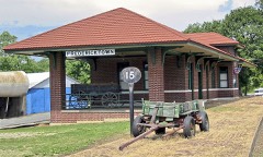 | Fredericktown Missouri Pacific Railroad Depot | building | 2000 | 00000088 |
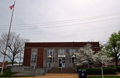 | Fredericktown United States Post Office | building | 2009 | 09000814 |
 | Madison County Courthouse | building | 2000 | 00001548 |
| St. Louis, Iron Mountain and Southern Railroad Depot | building | 2005 | 05001178 |
Every wildfire the federal occurrence database records inside this county: 285 of them, burning about 3,133 acres. 3 started naturally and 17 were recorded as arson. Each settlement page carries the fires within five miles of it.
| Reported cause | Fires |
|---|---|
| Debris and open burning | 157 |
| Missing data/not specified/undetermined | 67 |
| Equipment and vehicle use | 22 |
| Arson/incendiarism | 17 |
| Smoking | 7 |
| Recreation and ceremony | 7 |
| Natural | 3 |
| Other causes | 2 |
| Misuse of fire by a minor | 2 |
| Power generation/transmission/distribution | 1 |
The five largest, by the area the report gives. Two of them were set deliberately.
| Date | Cause | Size | Reported by | Name on the report |
|---|---|---|---|---|
| 2 March 2012 | Natural | 495 acres | Mark Twain National Forest | MARLOW MOUNTAIN |
| 18 April 2004 | Debris and open burning | 239 acres | Mark Twain National Forest | PATTERSON MOUNTAIN |
| 7 April 2007 | Arson/incendiarism | 207 acres | Mark Twain National Forest | TILK HOLLOW |
| 26 March 2007 | Missing data/not specified/undetermined | 112 acres | Missouri Department of Conservation | AMIDON FIRE |
| 13 April 1992 | Smoking | 80 acres | Missouri Department of Conservation | not named |
| 5 November 1999 | Smoking | 76 acres | Mark Twain National Forest | COX SPRINGS |
| 11 March 1995 | Arson/incendiarism | 70 acres | Mark Twain National Forest | O HWY |
| 8 April 2020 | Debris and open burning | 62 acres | Missouri Department of Conservation | 200542-06205-04082020-1236 |
Every settlement page carries the fires within five miles of it - see the settlement index below.
The NOAA Storm Events Database holds 179 reports for this county, causing 2 deaths, 6 injuries and about $7,607,500 in recorded property damage. Each settlement page carries the reports that name it.
| Kind of event | Reports |
|---|---|
| Thunderstorm Wind | 81 |
| Tornado | 36 |
| Hail | 36 |
| Flash Flood | 23 |
| Flood | 2 |
| Heavy Rain | 1 |
The most serious of them, by death, then injury, then recorded damage. The accounts are quoted exactly as the forecast office filed them.
| When | Event | Place named | Harm | What the report says |
|---|---|---|---|---|
| April 1999 | Flash Flood | Countywide | 1 killed, $6,000,000 | no account filed |
| January 2013 | Flood | Higdon | 1 killed | Between one and three inches of rain fell over an extended amount of time onto partially frozen ground causing runoff. Numerous creeks and rivers rose due to the runoff. Several low water crossings were flooded. On Highway V about a mile southeast of where it intersects with Highway F, there is a low water crossing over the Castor River. The river rose and flooded the roadway. A 59 year old man was a passenger in a truck with two other people. The driver of the truck drove through the flooded roadway and the vehicle was swept off the road. All three people got out of the truck. The two women were rescued, but the man was swept downstream and died. His body was recovered the next day about 100 yards downstream. Several other secondary roads and highways were flooded as well, including some streets in Fredericktown. |
| April 2002 | Tornado (F2) | Fredericktown | 3 hurt | A tornado hit Madison County, first causing damage about 9 miles south of Fredericktown along Highway 67. A mobile home was destroyed and a frame house lost its roof. The tornado moved east through a heavily wooded area uprooting and damaging trees. The tornado reached Marquand, a small town of about 400 people, about 4 pm and caused considerable damage. Large trees were uprooted or snapped off and nearly every structure in a 3 to 4 block area was damaged. The Fire Station was completely destroyed as was a restaurant that was next to it. Several other frame buildings lost all or parts of their roofs. A State Emergency Management Agency damage assessment reported that 6 homes were destroyed, 12 homes suffered major damage, and 22 homes had minor damage. There were 3 minor injuries reported. |
| October 2021 | Tornado (EF3) | Oak Grove | 1 hurt | The tornado touched down near the St. Francis River approximately 5.5 miles to the WSW of Fredericktown, MO, where it topped or snapped the trunks of several trees. The tornado continued to the northeast along the river and began impacting homes as it approached Fredericktown. Here the tornado ripped half of the roof off of one home, rolled a manufactured home onto its side, pulled roofing material from another home, and continued to cause considerable tree damage. The tornado widened to about 1/2 mile as it approached MO Highway 72 from the southwest, damaging multiple homes and businesses. A business on the south side of Highway 72 is where the only known injury took place, where an individual was hurt climbing out of the debris after the tornado had exited the area. The tornado strengthened as it moved north of Highway 72, completely destroying a number of homes. It was determined that the frames of these homes were largely only toe-nailed into their foundation, which precluded a higher rating than a low-end EF-3. The tornado then impacted the Black River Electric Co-op. Here the tornado ripped a well-built canopy from between two small warehouses, completely destroyed one of these small warehouses, and then completely destroyed a larger steel warehouse attached to the main office. The steel warehouse was very well constructed, with steel I-beams approximately 1 foot in width, bolted into the concrete foundation roughly every 20 feet. These beams spanned the roof of the structure and supported a thick, crimped sheet metal exterior. This is believed to be where the tornado reached peak intensity, with approximately 150 mph winds. The attached office fared notably better, sustaining mainly roof damage and the loss of several windows. The office was very well constructed, consisting of brick and concrete walls. The tornado then crossed US highway 67 and continued to cause considerable damage. Two newly built self-storage buildings with north facing bay doors were completely destroyed, while a third identical building with south facing doors was damaged, but remained standing. Two more homes were also impacted in this area. The roof was completely ripped from one of these homes, though most of the walls, which were bolted into the concrete foundation, were left standing. Only a few interior walls remained on the second home, though it appeared that the frame of this home was only toe-nailed into the foundation. The poor construction of the second home, and the lack of hurricane clips on the roof of the first, precluded a higher rating than EF-2 in this area. As the tornado continued northeast, it moved through additional residential areas, damaging several more homes and businesses. The tornado may have begun to weaken somewhat at this point, as the walls largely remained standing on most of these buildings. The tornado then began to move into more rural areas to the northeast of Fredericktown, where it caused consistent tree damage for several more miles, ripped most of the roof from one home, and completely destroyed a barn. The tornado may have briefly lifted as it moved into northeastern Madison County before coming back down and causing considerable tree damage along Madison county road 252. Along the Madison/Perry county line, where it moved into WFO Paducah's County Warning Area, the width was about 1/2 of a mile wide with numerous trees snapped and uprooted. The portion of the tornado path in Madison County was rated EF3 overall with a path length of 14.83 miles and a max path width of 880 yards. There was one injury and no deaths in Madison County. Overall, the tornado (Madison/Perry Counties) was rated EF3 with a path length of 18.95 miles and a max path width of 880 yards. There was one injury and no deaths with this tornado. |
| February 2012 | Tornado (EF2) | Jewett | 1 hurt | A tornado touched down on Madison County Road 437 (about half a mile north of intersection with Co. Road 424) at 255 am. At this location part of the roof of an abandoned house was blown off and several windows were blown out. Also, there was lots of tree damage in the area. The damage was rated EF1 in this location. The tornado continued to the east northeast. On Madison County Road 431, about a mile north of the intersection with Highway C, a home was completely blown apart and swept off the foundation. The debris was thrown in different directions. It was not bolted down into the concrete foundation, only nailed, so the EF rating given for this was EF2. All the hardwood trees next to the home were uprooted. The width of the damage path in this location was 200 yards. Further to the east additional tree damage was found on Madison County Road 411 near the intersection with Highway EE. As it travelled to the east northeast, the tornado approached U.S. Highway 67 near Zion. On the west side of U.S. Highway 67, about a third of a mile north of the intersection with Highway JJ, an abandoned single wide mobile home was rolled onto its roof. A bit further north of the mobile home, there was about a 100 yard wide swath of hardwoods that were uprooted on the west side of U.S. Highway 67. All of the damage in this area was rated EF1. Further to the east, about 1.6 miles west northwest of Marquand on Highway A, there was significant roof damage to a large well-constructed barn. There was some evidence of convergent flow in the tree damage nearby. A utility pole was bent over back to the south. Just to the east of the tree damage, about half the roof was lifted off of a business and numerous large oaks were uprooted in the area. Damage width was about 200 yards in this location with a rating of EF1. On Highway F, about two tenths of a mile north of the intersection with Highway A, a large swath of trees was uprooted, with additional sporadic tree damage along the rest of the path before crossing into Bollinger County (WFO Paducahs forecast area) about a mile and a half northeast of Marquand on the south side of Highway A at 320 am. The path length in Madison County was 21.54 miles with a max width of 200 yards and a max rating of EF2. Overall, the tornado was on the ground for 31.88 miles with a max width of 800 yards and a max rating of EF2. |
| September 2006 | Tornado (F2) | Roselle | 1 hurt | The tornado touched down just west of Route K approximately one mile north of Highway 72. As it traveled east, numerous trees and tree limbs were blown down. The tornado moved across U.S. Highway 67 about 4 miles northwest of Fredericktown, knocking down additional trees and tree limbs. The damage path was about 50 yards wide with a damage intensity of F0. As it approached the Fredericktown Municipal Airport, along Copper Mines Road, it began to produce multiple vortices. Two tornadic damage tracks were uncovered across a lake west of Highway OO along County Roads 271 and 272. Over 20 homes, mobile homes and machine sheds sustained varying degrees of damage. Several witnesses observed twin tornadoes merging into one large tornado over this area. The width of the damage path of the northern track was approximately 150 yards wide while the southern damage path was about 100 yards wide. The damage intensity ranged from F1 to F2 in this location. As the large tornado crossed Highway OO, five homes, four mobile homes and several machine sheds sustained varying degrees of damage. The damage path was 300 yards wide and high end F1 intensity. The tornado continued east along County Road 217. Four homes sustained F1 to F2 damage with debris from two of the homes thrown between 50 to 100 yards to the east. Also, numerous trees were either snapped or uprooted in this area. The width of the damage path in this area was about 250 yards. Further east, two tornadic damage tracks were uncovered about half a mile to a mile north of the intersection of County Roads 215 and 217. Four homes sustained varying degrees of damage while one mobile home was completely destroyed. One person was critically injured near the destroyed mobile home. Debris from the mobile home was tossed over 150 yards to the east. The width of the northern damage path was about 150 yards, while the width of the southern track was about 50 yards. The damage was rated high end F1 in this location. Witnesses observed the twin tornadoes merge again into one large funnel as it crossed a second small lake north of County Road 217. Four homes and several machine sheds sustained damage. Also, over a thousand trees around the lake were snapped or uprooted. The damage path was a quarter of a mile wide in this location and was rated F1 to low end F2. The tornado continued eastward into northeast Madison County crossing County Road 219 just south of the Madison/St. Francois County line. Three homes were damaged and three machine sheds were destroyed, as well as thousands of trees snapped or uprooted. The width of the damage path in this area was half a mile and was rated F2. The tornado then crossed into extreme southeastern St. Francois County near Martin Road. |
| December 1982 | Tornado (F2) | not stated | $250,000 | no account filed |
| May 1973 | Tornado (F2) | not stated | $250,000 | no account filed |
| April 1970 | Tornado (F1) | not stated | $250,000 | no account filed |
| April 1968 | Tornado (F2) | not stated | $250,000 | no account filed |
| October 2001 | Thunderstorm Wind | Fredericktown | $200,000 | no account filed |
| August 2022 | Flash Flood | Roselle | $150,000 | Between 6 and 7 inches of rain fell in about a 2 to 3 hour period across northern portions of Madison County. Numerous creeks flooded, including Saline Creek in Fredericktown. Also, several rivers flooded including Little St. Francois River in Fredericktown, which rose 18.6 feet in 5 hours, cresting at 20.49 feet by 715 am. At least 21 people were rescued from the flood waters in and around Fredericktown. One person drove into flood waters on Highway Z on the east side of town and floated into the ditch. They were rescued and sustained no injuries. The flash flooding affected the Holmes Subdivision as well as other homes and businesses along Saline Creek and a creek along South Mine La Motte Avenue. |
| May 2024 | Tornado (EF0) | Millcreek | $50,000 | A tornado touched down 3.8 miles southwest of Fredericktown on County Road 503, uprooting a large tree. The tornado tracked to the northeast towards Fredericktown, crossing over U.S. Highway 67, just south of intersection with Highway 72. On the northwest side of town it caused minor shingle damage to one house and blew down a few more large trees. Then on the north side of town, the tornado it blew a large portion of roof off of an open sided outbuilding, tore off a car port roof on a house and uprooted or snapped off several more large trees. The tornado then lifted and dissipated on Schulte Lane, just west of Highway 72. Overall, the tornado was rated EF0 with a path length of 4.27 miles and max path width of 334 yards. No deaths or injuries were reported. |
| July 2022 | Thunderstorm Wind | Fredericktown | $30,000 | Widespread tree damage was reported between Fredericktown and Marquand. Numerous trees, tree limbs and power lines were blown down. MODOT crews were called to clear tree debris from Highways M, J, W and D. |
| December 1982 | Tornado (F1) | not stated | $25,000 | no account filed |
| April 1972 | Tornado (F2) | not stated | $25,000 | no account filed |
| August 1963 | Tornado (F1) | not stated | $25,000 | no account filed |
| April 1957 | Tornado (F1) | not stated | $25,000 | no account filed |
| April 1999 | Thunderstorm Wind | Fredericktown | $20,000 | no account filed |
| April 1999 | Thunderstorm Wind | Fredericktown | $20,000 | no account filed |
| August 2022 | Thunderstorm Wind | Stringtown | $10,000 | Thunderstorm winds blew over a utility pole causing several power outages across the town. |
| October 2001 | Thunderstorm Wind | Fredericktown | $10,000 | no account filed |
| July 2022 | Thunderstorm Wind | Slabtown | $5,000 | Thunderstorm winds blew down several trees on the north side of Fredericktown. |
| July 2021 | Thunderstorm Wind | Fredericktown | $5,000 | Thunderstorm winds blew down several large trees on the southeast side of Fredericktown to about 3 miles southeast of Fredericktown. |
| April 1963 | Tornado (F0) | not stated | $2,500 | no account filed |
| July 2025 | Flash Flood | Jewett | $1,000 | Fredrock Glampground received 4 inches of rain in 1.5 hours. This resulted in Twelvemile Creek overtopping a private bridge and making portions of the campground inaccessible. Near Saco, a portion of a resident's property were inaccessible due to road washouts. |
| December 2021 | Thunderstorm Wind | Chobb Store | $1,000 | Thunderstorm winds blew down a large tree onto Highway C, about 8 miles south southwest of Fredericktown. |
| April 2008 | Flash Flood | Allbright | $1,000 | Several inches fell in a short amount of time on already saturated soils. Several secondary roads were closed due to flooding. Highway M near Buckhorn and several streets in Fredericktown were affected. |
| September 2007 | Flash Flood | Fredericktown | $1,000 | Two to four inches of rain fell over a short amount of time on ground that was already saturated from previous rains in the past 24 hours. The sheriff's department reported that two low water bridges in town were flooded and the roads were closed. |
| May 1993 | Hail | Fredericktown | $500 | Reported by the county sheriff office. |
| July 1995 | Thunderstorm Wind | Fredericktown | $300 | Large trees and power lines were blown down. |
| May 1995 | Thunderstorm Wind | Fredericktown | $200 | The Missouri Highway Patrol reported several large trees down. |
| March 2026 | Thunderstorm Wind | Buckhorn | - | Thunderstorm winds collapsed an outbuilding at Buckhorn General Baptist Church, downed a tree over a road near Buckhorn, then blew a roof from a mobile home in Marquand. |
| April 2026 | Hail | Faro | - | Report of lots of small hail with a few ping pong sized stones. |
| May 2025 | Thunderstorm Wind | Fredericktown | - | Thunderstorm winds downed tree limbs across Fredericktown. |
| April 2025 | Flash Flood | Cornwall | - | The 911 Call Center reported numerous events in Fredericktown including water over the roadway at Morley St and Villar St, City Lake Road, Buford Boulevard, Highway Z and North Chamber Drive, the 200 block of East College, and North Main Street. Southeast of town, Route F was closed where it meets Route V due to flooding. During the event, up to 7.75 inches of rain fell in Madison County. |
| May 2024 | Hail | Jewett | - | Reports of 1 to 2 inch hail fell in Iron County with the largest stones falling 4 miles southeast of Roselle. The largest community impacted was Fredericktown which received 1 inch hail. |
| May 2024 | Tornado (EF0) | Faro | - | The tornado continued into Madison County where it passed north of Beulah and south of Shelton Ford, only producing minor tree damage prior to dissipating south of Saco. The tornado was rated EF0 in Madison County with a path length of 5.81 miles and a max path width of 50 yards. No deaths or injuries were reported. |
| May 2024 | Tornado (EF0) | Marquand | - | A tornado touched down in Marquand (WFO LSX) where several tree limbs were broken. The tornado traveled southeast into Bollinger County (WFO PAH). The tornado was rated EF0 in Madison County with a path length of 1.08 miles and a max path width of 250 yards. No deaths or injuries were reported. |
| May 2024 | Tornado (EF0) | Jewett | - | The tornado continued to track to the northeast for another 1.53 miles before lifting and dissipating. A few more large trees were uprooted on Highway FF near the intersection with County Road 451. In Madison County, the path length was 1.53 miles with a max path width of 30 yards with a rating of EF0. Overall, the tornado was rated EF1 with a path length of 14.07 miles and a max path width of 150 yards. No deaths or injuries were reported. |
| May 2024 | Tornado (EF0) | Roselle | - | As the tornado moved into Madison County it began to move in a more south southeasterly direction, crossing over Highway 72 once again. It snapped off or uprooted numerous large trees throughout this portion of the tornado. Around 2.1 miles southeast of Roselle, it crossed over Highway 72 one final time and remained to the north of Highway 72 for the remainder of its path. The tornado lifted and dissipated 6.6 miles east southeast of Roselle. In Madison County, the tornado was rated EF0 with a path length of 6.64 miles and a max path width of 75 yards. Overall, the tornado was rated EF1 with a path length of 12.01 miles and a max path width of 150 yards. No deaths or injuries were reported. |
| May 2024 | Thunderstorm Wind | Saco | - | Law enforcement reported trees down on Highway C near Saco and a tree across the road at Highway M in Marquand. |
| June 2024 | Thunderstorm Wind | Marquand | - | Thunderstorm winds downed trees and caused a citywide power outage in Marquand. |
| August 2023 | Thunderstorm Wind | Allbright | - | Thunderstorm winds blew down numerous trees along Highway M, near County Road 310 and County Road 301. Also, there were several power poles broken over the southern portions of Madison County. |
| August 2023 | Thunderstorm Wind | Stringtown | - | Numerous trees, tree limbs and power lines were blown down around Fredericktown. |
| August 2023 | Flash Flood | Marquand | - | Up to four inches of rain fell in a short amount of time causing flash flooding. Numerous roads were flooded including Highway M where it goes over East Fork Big Creek, near County Road 301. |
| August 2023 | Flash Flood | Jewett | - | Up to 6 inches of rain fell in a short amount of time causing flash flooding across the southern half of Madison County. U.S. Highway 67 was flooded in several locations from the Madison/Wayne County line northward to Highway N. Also, Highway C near the intersection with County Road 433 was flooded, about 3 miles northwest of Saco. |
| July 2023 | Thunderstorm Wind | Fredericktown | - | Thunderstorm winds blew down several large tree limbs in Fredericktown, as well as several power lines. About 4 miles southwest of Cherokee Pass, a large tree was blown onto Highway C. |
| August 2023 | Flash Flood | Stringtown | - | Isolated flash flooding occurred across eastern portions of Madison County. One to two inches of rain fell during the evening hours of August 2nd. Then a second round occurred during the early morning hours of August 3rd with an additional 2 to 3 inches. This caused Saline Creek to rise well above it's banks flooding several roads near it, including State Route Z. |
| March 2021 | Thunderstorm Wind | Fredericktown | - | Thunderstorm winds snapped off several trees that were 10 to 12 inches in diameter on the south side of Fredericktown. One of the trees fell against a house causing moderate damage. A roof was torn off of a metal garage as well. |
| October 2021 | Tornado (EFU) | Silver Mine | - | The tornado crossed from Iron into Madison County, about 4.8 miles WSW of Braddy Ford, and continued moving to the northeast. The damage in western Madison County was extensive tree damage as seen on high resolution USGS satellite imagery. Shortly after lifting, around 1.7 miles north northeast of Braddy Ford, the storm that produced this tornado went on to produce the Fredericktown tornado. This portion of the tornado track is rated EFU because it was surveyed from satellite images. The path length is 5.93 miles with a max path width of 50 yards. Overall, the entire tornado (Iron/Madison Counties) was rated EF1 with a path length of 10.23 miles and a max path width of 250 yards. No deaths or injuries. |
| March 2019 | Tornado (EF1) | Marquand | - | A tornado touched down a little over 3 miles west southwest of Marquand, MO, near the intersection of Madison 310 and County Road 311. In this location, several large trees were snapped off, a tv tower antenna was bent, and a portion of the roof of an old barn was blown off. The damage width in this area was about 125 yards wide and rated EF1. The tornado tracked to the northeast, crossing Highway M. As the tornado crossed Highway DD, just south of intersection with Madison 314, hundreds of trees were either snapped off or uprooted. Also, tin from a carport was thrown several hundred yards from where it originated. Damage path width in this location was about 250 yards wide and rated EF1. The tornado continued to the east northeast, with sporadic tree damage, for about another 1.5 miles before lifting and dissipating. Overall the tornado was rated EF1 with a max wind speed of 110 mph. The path length was 4.24 miles with a max path width of 250 yards. No deaths or injuries were reported. |
| August 2019 | Thunderstorm Wind | Stringtown | - | Thunderstorm winds caused some tree damage on the north side of Fredericktown. A large tree was blown down blocking Highway OO and Mine La Motte Avenue. Also, another tree was blown down blocking City Lake Road. |
| August 2019 | Thunderstorm Wind | Fredericktown | - | Thunderstorm winds blew down a large tree in town. |
| December 2018 | Thunderstorm Wind | Castor Station | - | Thunderstorm winds blew down several large trees. |
| April 2017 | Thunderstorm Wind | Fredericktown | - | Thunderstorm winds snapped off a flagpole. |
| February 2017 | Tornado (EF0) | Silver Mine | - | A tornado touched down near Madison County Road 535 just north of intersection with Madison County Road 524 causing EF0 tree damage. It moved east northeast crossing Highway 72 west of Madison County 9534 with minor tree damage noted. It continued northeast to a cemetery where more trees were topped and snapped. Several of the gravestones were either moved or knocked over. The tornado continued northeast across Missouri Highway K causing tree damage and structural damage to a large hay barn. This damage was also rated EF0. The tornado lifted near Madison County Road 529. Overall the tornado was rated EF0 with a path length of 4.44 miles and maximum path width of 50 yards. |
| February 2017 | Thunderstorm Wind | Buckhorn | - | Thunderstorm winds blew down several large trees around town. |
| May 2017 | Thunderstorm Wind | Saco | - | Thunderstorm winds blew down a large tree in town. |
| April 2017 | Flash Flood | Faro | - | Seven to ten inches of rain fell causing widespread flash flooding. Numerous roads were flooded including Highway V between County Road 243 and Route F. Levee along Castor River in Marquand was overtopped. Flooding occurred on the south side of town. Several people were moved to higher ground from a senior center in the area. Also, the intersection of Highways A and M, west of town and the river were closed due to flooding on bridge that goes over the Castor River. About 2 miles south southeast of Marquand, a water rescue had to be performed at a campground off Highway DD. |
The Survey's mineral resources record lists 187 workings inside this county. 1 still produces and 186 are closed or unrecorded. Each settlement page carries the workings within five miles of it.
| Commodity | Workings |
|---|---|
| Lead | 38 |
| Iron | 23 |
| Stone, Crushed/Broken | 23 |
| Lead, Zinc | 15 |
| Cobalt, Copper, Lead, Nickel | 10 |
| Silver | 10 |
| Zinc, Lead | 9 |
| Manganese | 8 |
| Sulfur-Pyrite | 6 |
| Lead, Cobalt, Copper | 5 |
| Copper | 5 |
| Silver, Tungsten | 2 |
| Cobalt, Copper, Lead, Nickel, Zinc | 2 |
| Sand and Gravel, Construction | 2 |
The least common of them first, because a county's hundredth gravel pit says nothing its first ten did not.
| Where | Site | Commodity | Status | Recorded |
|---|---|---|---|---|
| Aubuchen Shafts | Zinc, Cobalt, Copper, Lead, Nickel | Past Producer | ||
| Buckeye Mine | Cobalt, Copper, Iron, Lead, Nickel | Past Producer | ||
| E P Settle Silver Mine | Lead, Silver | Past Producer | ||
| Einstein Mine | Lead, Silver, Tungsten, Zinc | Past Producer | 1855, 1877 | |
| Einstein Mine- Apex Mine | Copper, Lead, Silver, Tin, Tungsten, Zinc | Past Producer | 1855, 1877 | |
| Fox Mine | Cobalt, Lead, Copper, Nickel | Past Producer | Galena | |
| Fredericktown Deposits | Lead, Nickel, Copper, Zinc, Cobalt | Past Producer | REPLACEMENT, DISSEMINATED SULFIDES. | |
| Fredricktown Claim | Cobalt, Nickel, Lead, Gold | Producer | Anglesite, Bornite, Covellite, Galena | |
| Harry Clover Property | Manganese, Gold, Iron, Silver, Tungsten | Past Producer | 1917 | |
| Killian Shaft | Cobalt, Nickel, Lead, Copper | Past Producer | ||
| Koch Shaft | Gold, Sulfur-Pyrite, Silica, Tungsten | Past Producer | ||
| L M Hebener Quarry | Limestone, Dimension | Past Producer | ||
| Madison Mine | Lead, Copper, Cobalt, Nickel, Iron, Silver | Past Producer | Chalcopyrite, Galena, Malachite, Pyrite | |
| Madison Mine | Cobalt, Copper, Lead, Nickel, Sulfur-Pyrite | Past Producer | 1847, 1944 | |
| Martin Mine | Lead, Tungsten, Zinc | Past Producer | ||
| Mine La Motte | Lead, Silver, Copper, Cobalt, Zinc, Nickel | Past Producer | 1720 | |
| Mine La Motte Group | Copper, Lead, Zinc, Cobalt, Nickel | Past Producer | 1720, 1827 | |
| Old Copper Mines | Lead, Copper, Cobalt, Nickel, Iron | Past Producer | Chalcopyrite, Linnaeite, Malachite | |
| Ozark Mine | Zinc, Tungsten, Silver, Lead | Past Producer | ||
| Revelle Prospect | Cobalt, Copper, Lead, Nickel, Silver | Prospect | ||
| Schulte | Copper, Lead, Cobalt | Past Producer | Galena | |
| Shaft Number One | Copper, Zinc, Lead, Cobalt | Past Producer | ||
| Shaft Number Three | Cobalt, Copper, Lead | Past Producer | ||
| Shaft Number Two | Copper, Cobalt, Lead | Past Producer | ||
| Silver Mine | Silver, Zinc, Lead, Tungsten | Past Producer | 1855, 1875 | |
| Unknown - Clay | Clay | Past Producer | ||
| Unknown - Lead-Copper-Nickle-Cobalt | Lead, Nickel, Cobalt, Copper | Past Producer | ||
| Unknown - Lead-Copper-Nickle-Cobalt | Cobalt, Lead, Nickel, Copper | Past Producer | ||
| Unknown - Titanium | Titanium | Past Producer | ||
| Apex Silver Mine - Shaft Number One | Silver, Tungsten | Past Producer | ||
| Martin Mine | Tungsten | Prospect | ||
| Ozark Mine | Tungsten | Past Producer | ||
| Unknown - Lead-Cobalt-Copper-Nickel | Cobalt, Copper, Nickel, Lead | Past Producer | ||
| Unknown - Lead-Copper-Nickle-Cobalt | Cobalt, Copper, Nickel, Lead | Past Producer | ||
| Unknown - Lead.Zinc-Copper.Cobalt | Cobalt, Copper, Lead, Nickel, Zinc | Past Producer | ||
| Unknown - Lead.Zinc.Copper-Cobalt | Cobalt, Copper, Lead, Nickel, Zinc | Past Producer | ||
| Unknown - S+G | Sand and Gravel, Construction | Past Producer | ||
| Unknown - S+G | Sand and Gravel, Construction | Past Producer | ||
| Unknown - Silver.Tungsten | Silver, Tungsten | Prospect | ||
| Buckeye Copper Mines | Copper | Past Producer | ||
| Copper Mine | Copper | Past Producer | ||
| Dr. Robb and Perringer | Lead, Cobalt, Copper | Past Producer | Galena | |
| Hickory Nut No. 1 , 2 , 3 | Lead, Cobalt, Copper | Past Producer | Galena | |
| Hill Prospect | Lead, Cobalt, Copper | Occurrence | Galena | |
| Marshall | Lead, Cobalt, Copper, Iron | Past Producer | ||
| Platina Mine | Copper | Past Producer | ||
| Ruth | Lead, Cobalt, Copper | Past Producer | Galena | |
| Unknown - Copper | Copper | Past Producer | ||
| Unknown - Copper | Copper | Past Producer | ||
| Moyer Prospect | Sulfur-Pyrite | Past Producer | ||
| St Clair Property | Sulfur-Pyrite | Past Producer | ||
| Starkey Mine | Sulfur-Pyrite | Past Producer | ||
| Swift + Co Pyrite Prospect | Sulfur-Pyrite | Past Producer | ||
| Swift + Co Pyrite Prospect | Sulfur-Pyrite | Past Producer | ||
| Buxton Prospect | Manganese | Prospect | ||
| Clover Mine | Manganese | Prospect | ||
| Cook Prospect | Manganese | Prospect | ||
| Elza White Prospect | Manganese | Past Producer | ||
| Manganese Deposits | Manganese | Occurrence | ||
| Otto Senter Mine | Manganese | Past Producer | ||
| Phillips Mine | Manganese | Past Producer | ||
| Unknown - Manganese | Manganese | Past Producer | ||
| Unknown - Lead.Zinc | Zinc, Lead | Past Producer | ||
| Unknown - Lead.Zinc | Zinc, Lead | Past Producer | ||
| Unknown - Lead.Zinc | Zinc, Lead | Past Producer | ||
| Unknown - Lead.Zinc | Zinc, Lead | Past Producer | ||
| Unknown - Lead.Zinc | Zinc, Lead | Past Producer | ||
| Unknown - Lead.Zinc | Zinc, Lead | Past Producer | ||
| Unknown - Lead.Zinc | Zinc, Lead | Past Producer | ||
| Unknown - Lead.Zinc | Zinc, Lead | Past Producer | ||
| Unknown - Lead.Zinc | Zinc, Lead | Past Producer | ||
| Einstein Silver Mine | Silver | Past Producer | ||
| Gabriel Shaft | Silver | Past Producer | ||
| Henson Shaft Number One | Silver | Past Producer | ||
| Henson Shaft Number Two | Cobalt, Copper, Lead, Nickel | Past Producer | ||
| New Discovery Tunnel | Silver | Past Producer | ||
| River Tunnel + Shaft | Silver | Past Producer | ||
| Unknown - Lead-Copper-Nickle-Cobalt | Cobalt, Copper, Lead, Nickel | Past Producer | ||
| Unknown - Lead-Copper-Nickle-Cobalt | Cobalt, Copper, Lead, Nickel | Past Producer | ||
| Unknown - Lead-Copper-Nickle-Cobalt | Cobalt, Copper, Lead, Nickel | Past Producer | ||
| Unknown - Lead-Copper-Nickle-Cobalt | Cobalt, Copper, Lead, Nickel | Past Producer | ||
| Unknown - Lead-Copper-Nickle-Cobalt | Cobalt, Copper, Lead, Nickel | Past Producer | ||
| Unknown - Lead-Copper-Nickle-Cobalt | Cobalt, Copper, Lead, Nickel | Past Producer | ||
| Unknown - Lead.Copper-Nickel.Cobalt | Cobalt, Copper, Lead, Nickel | Past Producer | ||
| Unknown - Lead.Copper.Cobalt.Nickel | Cobalt, Copper, Lead, Nickel | Past Producer | ||
| Unknown - Silver | Silver | Prospect | ||
| Unknown - Silver | Silver | Prospect | ||
| Unknown - Silver | Silver | Prospect | ||
| Unknown - Silver | Silver | Past Producer | ||
| Ware Mine | Cobalt, Copper, Lead, Nickel | Past Producer | ||
| Wood Chute Tunnel | Silver | Past Producer | ||
| Ozark Lead Mine | Lead, Zinc | Past Producer | ||
| Unknown - Lead.Zinc | Lead, Zinc | Past Producer | ||
| Unknown - Lead.Zinc | Lead, Zinc | Past Producer | ||
| Unknown - Lead.Zinc | Lead, Zinc | Past Producer | ||
| Unknown - Lead.Zinc | Lead, Zinc | Past Producer | ||
| Unknown - Lead.Zinc | Lead, Zinc | Past Producer | ||
| Unknown - Lead.Zinc | Lead, Zinc | Past Producer | ||
| Unknown - Lead.Zinc | Lead, Zinc | Past Producer | ||
| Unknown - Lead.Zinc | Lead, Zinc | Past Producer | ||
| Unknown - Lead.Zinc | Lead, Zinc | Past Producer | ||
| Unknown - Lead.Zinc | Lead, Zinc | Past Producer | ||
| Unknown - Lead.Zinc | Lead, Zinc | Past Producer | ||
| Unknown - Lead.Zinc | Lead, Zinc | Past Producer | ||
| Unknown - Lead.Zinc | Lead, Zinc | Past Producer | ||
| Unknown Lead.Zinc | Lead, Zinc | Past Producer | ||
| Allen-Smith Quarry | Stone, Crushed/Broken | Past Producer | ||
| Cedar Bottom Quarry | Stone, Crushed/Broken | Past Producer | ||
| Clay Mine | Iron | Past Producer | 1910 | |
| Cornwall Iron Mine | Iron | Past Producer | ||
| Cornwall Quarry | Stone, Crushed/Broken | Past Producer | ||
| Dresner Quarry | Stone, Crushed/Broken | Past Producer | ||
| Ford Mine | Iron | Past Producer | Marcasite | |
| Ford Mine | Iron | Past Producer | ||
| Forsyth Bank | Iron | Past Producer | 1872 | |
| Forsyth Mine | Iron | Past Producer | ||
| Foster Mine | Iron | Past Producer | 1873 | |
| Foster Mine | Iron | Past Producer | ||
| Gale Quarry | Stone, Crushed/Broken | Past Producer | ||
| Goose Creek Prospect | Iron | Prospect | ||
| Klein Prospect | Iron | Prospect | ||
| Mathews Mountain Bank | Iron | Past Producer | Limonite | |
| Mathews Mountain Bank | Iron | Past Producer | ||
| Mine Lamotte Bank No. 2 | Iron | Past Producer | Surface | |
| Mine Lamotte Bank Number Two | Iron | Past Producer | ||
| Missouri Petroleum Products Quarry | Stone, Crushed/Broken | Past Producer | ||
| Old Miller Place | Iron | Occurrence | Vein | |
| Omaha Quarry | Stone, Crushed/Broken | Past Producer | ||
| Parkin Bank | Iron | Past Producer | 1872 | |
| Parkin Bank | Iron | Past Producer | ||
| Skrainka Quarry | Stone, Crushed/Broken | Past Producer | ||
| Skrainka Quarry | Stone, Crushed/Broken | Past Producer | ||
| Skrainka Quarry | Stone, Crushed/Broken | Past Producer | ||
| Strang + Gillespie Quarry | Stone, Crushed/Broken | Past Producer | ||
| Unknown - Granite | Stone, Crushed/Broken | Past Producer | ||
| Unknown - Granite | Stone, Crushed/Broken | Past Producer | ||
| Unknown - Granite | Stone, Crushed/Broken | Past Producer | ||
| Unknown - Granite | Stone, Crushed/Broken | Past Producer | ||
| Unknown - Granite | Stone, Crushed/Broken | Past Producer | ||
| Unknown - Granite | Stone, Crushed/Broken | Past Producer | ||
| Unknown - Granite | Stone, Crushed/Broken | Past Producer | ||
| Unknown - Granite | Stone, Crushed/Broken | Past Producer | ||
| Unknown - Granite | Stone, Crushed/Broken | Past Producer | ||
| Unknown - Iron | Iron | Past Producer | ||
| Unknown - Iron | Iron | Past Producer | ||
| Unknown - Iron | Iron | Past Producer | ||
| Unknown - Ls | Stone, Crushed/Broken | Past Producer | ||
| Unknown - Ls | Stone, Crushed/Broken | Past Producer | ||
| Valle Bank | Iron | Past Producer | 1872 | |
| Valle Bank | Iron | Past Producer | ||
| Wright-Clouser Quarry | Stone, Crushed/Broken | Past Producer | ||
| Aubuchon Mine | Lead | Occurrence | Galena | |
| Cooper Mines | Lead | Past Producer | ||
| Deep Diggings | Lead | Past Producer | ||
| Doctor Robb Prospect Shaft | Lead | Past Producer | ||
| Fox Mine | Lead | Past Producer | ||
| Golden Vein | Lead | Past Producer | ||
| Gosney Prospect Shaft Number One | Lead | Past Producer | ||
| Hickory Nut Mines | Lead | Past Producer | ||
| Higton | Lead | Past Producer | ||
| Hill Shaft | Lead | Past Producer | ||
| Jack Diggings | Lead | Past Producer | ||
| Marquand Prospects | Lead | Occurrence | Galena | |
| Marshall Mine | Lead | Past Producer | ||
| Matthew Shaft | Lead | Past Producer | ||
| Nifong Prospect Shaft | Lead | Past Producer | ||
| Offset Mine | Lead | Past Producer | ||
| Perringer Prospect Shaft | Lead | Past Producer | ||
| Prairie Diggings | Lead | Past Producer | ||
| Rattlesnake Diggings | Lead | Past Producer | ||
| Ruth Mine | Lead | Past Producer | ||
| Shaft Number Fifteen | Lead | Past Producer | ||
| Shaft Number Five | Lead | Past Producer | ||
| Shaft Number One | Lead | Past Producer | ||
| Shaft Number Seven | Lead | Past Producer | ||
| Shaft Number Six | Lead | Past Producer | ||
| Shaft Number Ten | Lead | Past Producer | ||
| Shaft Number Two | Lead | Past Producer | ||
| Shafts Number Four + Twelve | Lead | Past Producer | ||
| Tucker Mine | Lead | Past Producer | ||
| Unknown - Lead | Lead | Past Producer | ||
| Unknown - Lead | Lead | Past Producer | ||
| Unknown - Lead | Lead | Past Producer | ||
| Unknown - Lead | Lead | Past Producer | ||
| Unknown - Lead | Lead | Past Producer | ||
| Unknown - Lead | Lead | Past Producer | ||
| unnamed | Lead | Past Producer |
Named settlements recorded in the Geographic Names Information System, each with the topographic sheets covering it. Villages, hamlets and abandoned places alike. Each is shown with the nearest named watercourse or landform and the survey quadrangle it falls on.
Big Creek township · 63655 · Near Pugh Hollow · Allbright quadrangle
17 sheets, 1933 to 1989
St. Francois township · 63645 · On Cedar Bottom Creek · Rhodes Mountain quadrangle
19 sheets, 1939 to 2000
No longer a settlement
Big Creek township · 63655 · On Middle Fork Big Creek · Cascade quadrangle
19 sheets, 1930 to 1989
St. Michael township · 63645 · On Village Creek · Fredericktown quadrangle
17 sheets, 1939 to 1989
Central township · 63645 · Near Little Cedar Mountain · Cherokee Pass quadrangle
20 sheets, 1930 to 2000
St. Michael township · 63645 · On Tollar Branch · Fredericktown quadrangle
17 sheets, 1939 to 1989
St. Francois township · 63645 · On Mitchell Creek · Rhodes Mountain quadrangle
19 sheets, 1939 to 2000
Central township · 63645 · Near Cobalt Hollow · Rock Pile Mountain quadrangle
20 sheets, 1930 to 2000
St. Michael township · 63645 · On Tollar Branch · Fredericktown quadrangle
17 sheets, 1939 to 1989
Liberty township · 63645 · On Little Rock Creek · Rock Pile Mountain quadrangle
20 sheets, 1930 to 2000
Liberty township · 63620 · Near Firebaugh Hollow · Des Arc NE quadrangle
20 sheets, 1926 to 2000
St. Michael township · 63645 · On Shays Creek · Fredericktown quadrangle
17 sheets, 1939 to 1989
Polk township · 63645 · Near Evans Mountain · Rhodes Mountain quadrangle
19 sheets, 1939 to 2000
Marquand township · 63655 · Near Dog Trot Hollow · Marquand quadrangle
19 sheets, 1933 to 2000
Liberty township · 63620 · Near Jackson Hollow · Rock Pile Mountain quadrangle
20 sheets, 1930 to 2000
St. Michael township · 63645 · On Mill Creek · Fredericktown quadrangle
17 sheets, 1939 to 1989
Mine La Motte township · 63645 · On Sweetwater Branch · Fredericktown quadrangle
17 sheets, 1939 to 1989
Polk township · 63645 · On Skrainka Creek · Rhodes Mountain quadrangle
19 sheets, 1939 to 2000
Polk township · 63645 · Near McLard Hill · Lake Killarney quadrangle
25 sheets, 1937 to 2000
Liberty township · 63636 · Near Seabaugh Hollow · Coldwater quadrangle
19 sheets, 1930 to 1989
St. Francois township · 63645 · Near Hawkins Knob · Rhodes Mountain quadrangle
19 sheets, 1939 to 2000
Twelvemile township · 63645 · Near Panther Hollow · Cascade quadrangle
19 sheets, 1930 to 1989
Twelvemile township · 63645 · On Twelvemile Creek · Coldwater quadrangle
19 sheets, 1930 to 1989
Central township · 63645 · On Captain Creek · Rock Pile Mountain quadrangle
20 sheets, 1930 to 2000
The vanished settlements of Madison County: the places named above that are no longer on the map.