 Block
From the record
9 National Register listings published here.
Sources: the National Register database, National Park Service
99 topographic sheets cover 36 settlements here, and 9 properties are on the National Register of Historic Places.
9 National Register listings published here.
Sources: the National Register database, National Park Service
Every property in this county listed on the National Register of Historic Places, with the year it was listed and the federal nomination document.
| Photograph | Property | Type | Listed | Reference |
|---|---|---|---|---|
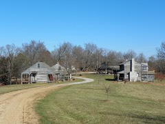 | Christian A. Bergt Farm | building | 1980 | 80002387 |
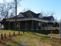 | Concordia Log Cabin College | building | 1978 | 78001671 |
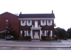 | Doerr-Brown House | building | 1980 | 80002388 |
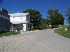 | Eggers and Company General Store | building | 2007 | 07000570 |
| Faherty House | building | 2025 | 100011396 | |
| Mack's Chapel Cemetery | site | 2018 | 100002037 | |
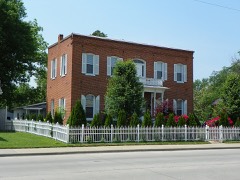 | Shelby-Nicholson-Schindler House | building | 1974 | 74001088 |
 | St. Mary's of the Barrens Historic District | district | 1995 | 95001041 |
 | Tower Rock | site | 1970 | 70000344 |
Every wildfire the federal occurrence database records inside this county: 18 of them, burning about 286 acres. None started naturally and 1 was recorded as arson. Each settlement page carries the fires within five miles of it.
| Reported cause | Fires |
|---|---|
| Debris and open burning | 12 |
| Missing data/not specified/undetermined | 5 |
| Arson/incendiarism | 1 |
The five largest, by the area the report gives. One of them was set deliberately.
| Date | Cause | Size | Reported by | Name on the report |
|---|---|---|---|---|
| 16 February 2011 | Debris and open burning | 120 acres | Missouri Department of Conservation | not named |
| 14 March 1992 | Debris and open burning | 35 acres | Missouri Department of Conservation | not named |
| 25 March 1995 | Debris and open burning | 33 acres | Missouri Department of Conservation | not named |
| 15 March 1994 | Debris and open burning | 26 acres | Missouri Department of Conservation | not named |
| 13 February 2011 | Debris and open burning | 25 acres | Missouri Department of Conservation | not named |
| 15 February 2011 | Missing data/not specified/undetermined | 10 acres | Missouri Department of Conservation | not named |
| 29 August 1995 | Missing data/not specified/undetermined | 8.0 acres | Missouri Department of Conservation | not named |
| 1 March 1992 | Arson/incendiarism | 6.0 acres | Missouri Department of Conservation | not named |
Every settlement page carries the fires within five miles of it - see the settlement index below.
The NOAA Storm Events Database holds 253 reports for this county, causing 4 deaths, 54 injuries and about $111,255,000 in recorded property damage. Each settlement page carries the reports that name it.
| Kind of event | Reports |
|---|---|
| Thunderstorm Wind | 95 |
| Hail | 57 |
| Flood | 32 |
| Flash Flood | 30 |
| Tornado | 27 |
| Funnel Cloud | 5 |
| Heavy Rain | 5 |
| Lightning | 2 |
The most serious of them, by death, then injury, then recorded damage. The accounts are quoted exactly as the forecast office filed them.
| When | Event | Place named | Harm | What the report says |
|---|---|---|---|---|
| March 2006 | Tornado (F3) | Brewer | 2 killed, 10 hurt, $1,000,000 | The tornado entered Perry County from Ste. Genevieve County near Highway NN and just west of the community of Giboney. The tornado moved northeast, crossing Interstate 55 only about one-half mile from the Ste. Genevieve County line. Two fatalities and F3 damage occurred in the vicinity of where the tornado crossed U.S. Route 61. The two fatalities occurred on U.S. 61, where a vehicle was picked up and thrown into a propane tank. The truck in which they were riding was likely picked up, flipped over, and slammed into the ground several times. The coroner stated that the victims died instantly. One of the victims was ejected from the truck, which then struck the top of a large propane tank. Because of the ensuing propane leak, the victim still in the truck could not be removed until the following day, when the propane was off-loaded from the tank. Both of the victims in the vehicle were residents of a mobile home who were trying to flee the tornado. The home from which they fled sustained only minor damage. At least four other people were significantly injured as they were picked up by tornadic winds and hurled 100 yards. Their injuries were compounded by wind-blown debris. Eight victims were admitted to a local hospital to remove debris which penetrated their bodies, and two others were sent to regional hospitals for serious injuries. Three mobile homes were flattened, a brick house had its roof and several walls blown off, and numerous vehicles were tossed around. A total of about a dozen residences were destroyed or severely damaged in Perry County. Perry County was designated a federal disaster area, enabling individual residents to apply for relief. The dashboard camera in a sheriff deputy's patrol car captured the tornado on film as it crossed U.S. 61 at F3 intensity. Peak winds were estimated near 170 MPH. The tornado crossed into Randolph County, Illinois at Old River, near some railroad tracks about 1.5 miles southeast of St. Marys. |
| February 2017 | Tornado (EF4) | Silver Lake | 1 killed, 12 hurt, $8,000,000 | This large and violent tornado touched down about four miles west of Perryville. The tornado quickly became violent, reaching EF-4 intensity and leveling five homes just west of Interstate 55, about 3.5 miles northwest of Perryville. Numerous unoccupied cars from a salvage yard were blown into or over Interstate 55. The lone fatality occurred when a southbound vehicle on Interstate 55 was intercepted by the tornado. The victim's pickup truck was tossed into a field at least 100 yards from the interstate. The coroner reported that the victim was thrown from the vehicle and died at the scene. The passenger in the vehicle was treated for minor injuries at a local hospital. The area of greatest home and property destruction was three miles north of Perryville, in the vicinity of U.S. Highway 61. Maximum wind speeds were estimated near 180 mph in the vicinity of Interstate 55 and also near U.S. Highway 61. The damage path showed multiple vortex characteristics with ground striations and scarring to bare ground. At least 100 homes were damaged or destroyed in Perry County, mostly on the northern outskirts of Perryville. Most persons in the tornado's path took shelter in their basements. All twelve tornado injuries occurred in Perry County, where the tornado was at its strongest. At least one couple was trapped in their basement until rescuers removed debris. As the tornado approached the Mississippi River, multiple ground striations were noted in a farm field, indicative of multiple vortices. The maximum path width was over one-half mile shortly before the tornado crossed the Mississippi River into Randolph County, Illinois. |
| April 1996 | Flash Flood | Perryville | 1 killed, 1 hurt, $10,000 | no account filed |
| December 1967 | Tornado (F3) | not stated | 13 hurt, $25,000,000 | no account filed |
| June 1969 | Tornado (F3) | not stated | 6 hurt, $250,000 | no account filed |
| September 2006 | Tornado (F4) | Perryville | 5 hurt, $7,000,000 | This violent F-4 tornado reached its maximum intensity near the village of Crosstown, where peak winds were estimated near 210 MPH. Along the Perry County portion of the tornado track, 62 homes were destroyed, 17 had major damage, and 23 received minor damage. Ten of the destroyed homes were mobile homes, and seven that sustained major damage were mobile homes. Three churches were destroyed or heavily damaged. Numerous vehicles were tossed. Over 100 utility poles were broken off. Hundreds of trees were broken off or uprooted. The tornado first touched down at County Road 302 near Friedenburg, where F-1 winds destroyed a barn and partially unroofed a two-story house. There were also downed trees, including a few that fell on a house. As the tornado continued northeast across County Road 316 between Crosstown and Friedenburg, it widened to about 100 yards. Scores of trees were broken off or uprooted, and the roof was blown off a house. The tornado strengthened to F-3 intensity as it reached the junction of Highways P and C in Crosstown. The roof was torn off a church, windows were broken, and other structural damage occurred. Nearby, the roof was blown off a two-story brick store that was over 100 years old. An overturned vehicle was in the front yard, and trees were mangled. The width increased to 220 yards. In the center of Crosstown on Highway C, the tornado reached F-4 intensity. This is where a site-built house was levelled. The F-4 damage continued east along County Road 350 in Crosstown, where two more site-built houses were levelled. Only the bolted-down floor of one residence remained. An eyewitness along County Road 350 stated he took shelter in the basement after seeing fog coming directly toward him. His house remained mostly intact, except for the roof and garage. The tornado weakened to F-3 intensity about one to two miles east of Crosstown, where a modular home was destroyed except for the bathroom. A vehicle was tossed in the yard. The weakening trend continued east along County Road 350 to the Mississippi River, where many trees were uprooted and broken off. Some outbuildings were thrown around. The path width decreased to 75 yards as the intensity lowered to F-1. The average path width was 150 yards. There were five injuries requiring medical attention, including one broken arm. Two people were moderately injured when the vehicle they were driving was tossed into a house. Dozens of other residents received minor injuries but did not seek medical attention. Where the tornado crossed the Mississippi River, a barge loaded with coal was pushed to the shoreline. The windows were blown out of the tug boat, and enough coal was blown into the tug boat that it was shovelled out. The tornado crossed the Mississippi River into Jackson County, Illinois. |
| April 2011 | Thunderstorm Wind | Brewer | 2 hurt, $1,000,000 | In Perryville, widespread damage occurred to trees and some buildings. An apartment building formerly used as a nursing home was heavily damaged or destroyed. The roof was blown off, and one of the walls collapsed. One person was injured when a portion of the roof collapsed on him. Two pets were killed. Sixteen families were displaced. Perryville police received 500 other calls during the first hour after the storm. The roof of an economic development building was blown off. Many homes suffered roof damage. Many roads were littered with roof and tree debris. Several city schools were damaged, including the roofs of the senior high school and elementary school gym. Windows were broken in several buildings. Athletic fields and storage sheds were damaged. About 50 utility poles were destroyed. Elsewhere around the county, trees blocked numerous state and county roads. Due to thunderstorm winds, an 18-wheeler rolled over on Interstate 55 northbound at mile marker 133. The driver was freed by rescue crews and transported to a hospital with minor injuries. Traffic was stopped on the interstate for two hours. |
| October 2001 | Thunderstorm Wind | Brewer | 2 hurt, $25,000 | Damaging straight-line winds around 70 MPH affected northwest Perry County, especially the Brewer area. Two injuries occurred when a mobile home was unroofed several miles west of Brewer. Along Interstate 55 near Brewer, two buildings were unroofed. Debris was blown into power lines and onto a car. Numerous trees and power lines were down in Brewer. |
| October 1967 | Tornado (F1) | not stated | 1 hurt, $25,000 | no account filed |
| April 1958 | Tornado (F1) | not stated | 1 hurt, $2,500 | no account filed |
| June 2018 | Thunderstorm Wind | Perryville | 1 hurt, $1,000 | A person was struck and injured by a flying awning at the intersection of Highway 51 and U.S. Highway 61. |
| May 2009 | Thunderstorm Wind | Silver Lake | $50,000,000 | Widespread damaging winds affected most of the county. Hundreds of trees were blown down, roofs were blown off, and signs became airborne. In Perryville, the exterior wall of a tire company collapsed. The entire building was deemed a total loss. Structural damage occurred in many communities, mostly due to falling trees. Among other structures, a machine shed was destroyed in Millheim. Most residents of the county experienced some type of damage, ranging from downed trees to roofs off. Vehicles were smashed by falling trees. At a church, the roof was damaged, and tombstones were toppled at an adjacent cemetery. The glass of the front door was blown out. At another church in Altenburg, a 22,000-pound steeple constructed in 1867 blew down onto the roof. A large portion of the roof was peeled off an apartment complex in Perryville, forcing its evacuation. The roof of the new senior center in Perryville was destroyed. Emergency workers conducted door-to-door checks using vehicles and helicopters. |
| February 1999 | Hail | Silver Lake | $6,000,000 | An extensive hailstorm pounded much of Perry County with hailstones up to 2 inches in diameter, which is slightly bigger than a golf ball. In downtown Perryville, hailstones measuring up to 2 inches in diameter fell for 10 to 12 minutes. Insurance companies estimated damage in excess of 5 million dollars. Windows were broken out of homes and vehicles, skylights were broken, and vinyl siding was damaged. Most of the hail damage in Perryville was on the southern side of town. At the Perry County Sheriff Department, all the police vehicles were dented, and a skylight in the main cell block broke. All 200 vehicles at an auto dealership near I-55 and Route 51 received damage, including some broken windshields. |
| March 2025 | Tornado (EF2) | Millheim | $5,000,000 | An EF-1 tornado touched down southwest of Precinct in Bollinger County and moved northeast to the Perry County line near Highway KK. It proceeded northeast toward the east side of Perryville, damaging trees and a few barns along the way. In Perryville, it did EF-2 damage to a few homes. It also damaged three buildings in the Perryville Middle and High School complex. It knocked in the exterior walls on the top floor of one building and did extensive roof damage to two other buildings. Two nearby houses had a large portion of the roof structure removed. As it headed northeast out of town and toward the Mississippi River, it did significant roof damage to a few more homes, damaged several barns and more trees. The estimated peak wind was 135 mph. The tornado continued northeast into Randolph County Illinois just north of Rockwood. The total path length of the tornado was 33.5 miles. |
| April 1996 | Tornado (F3) | Perryville | $5,000,000 | no account filed |
| May 2014 | Thunderstorm Wind | Brewer | $500,000 | Thunderstorm winds estimated near 95 mph uprooted or snapped hundreds of trees. Thousands of large limbs were down. About 25 to 30 houses received roof damage. The roof was completely blown off a two-story house. The chimney was torn off a house. Numerous outbuildings and small sheds were destroyed. Trees and a small barn were blown across U.S. Highway 61. The damage area was about 7 to 8 miles long and two and one-half miles wide. |
| May 2017 | Flood | Altenburg | $250,000 | There was major flooding along the Mississippi River early in the month. Extensive flooding of low-lying agricultural land and county roads in the flood plain was observed. A voluntary evacuation was declared for the community of Lithium. The Red Cross opened a temporary shelter in Brewer. Several roads were closed, including the Route 51 Mississippi River bridge to Chester, IL. Highway E near Menfro was closed. Most of the other roads were rural county roads. A main railway was closed due to water over the tracks. Residents of the small community of Wittenburg along the river were forced to evacuate or use boats to reach their property. Most houses along the river have been abandoned after being repeatedly flooded over the years. |
| January 2016 | Flood | Altenburg | $250,000 | Mississippi River levels continued their climb from December, and record or near-record flooding occurred early in the month. The river gage downriver at Cape Girardeau crested at a new record of 48.86 feet on the 1st. However, the river gage upriver at Chester in Randolph County did not break a record. Efforts were made to fortify the Bois Brule Levee to protect area homes and businesses. The National Guard worked around the clock to ensure the security of residents. The Highway 51 bridge to Chester, Illinois was closed. Several roads were closed, including Highway E near Menfro. Most of the other roads were rural county roads. A main railway was closed due to water over the tracks. Barge traffic was restricted on the river due to strong currents. |
| December 1957 | Tornado (F2) | not stated | $250,000 | no account filed |
| October 2021 | Tornado (EF2) | Barks | $200,000 | This long-track tornado crossed into southwest Perry County from Madison County. Along the Madison/Perry county line, the width was about half of a mile wide, with numerous trees snapped and uprooted. The tornado then moved nearly parallel to County Road 738. Here several houses and a hunting lodge sustained minor damage, mainly to roofs and posts of a porch. One barn and a small shed were destroyed, along with numerous uprooted and snapped trees. The tornado continued on to produce tree damage on Highway 730, where it was only a few hundred yards wide and dissipated shortly thereafter. Peak winds in the Perry County portion of the path were near 112 mph, putting it barely into the EF-2 category. However, the tornado peaked at EF-3 intensity earlier in its life cycle. |
| March 2008 | Flood | Perryville | $150,000 | Major flooding occurred across the county as a result of widespread heavy rainfall. A couple of water rescues were conducted on Route B due to vehicles getting stranded in floodwater. U.S. Highway 61 was closed at the Cape Girardeau County border. Apple Creek reached the bottom of the bridge. Numerous county roads were flooded. Several mudslides occurred on Highway 51 near McBride. Numerous people around the county were stranded in their homes or cut off from returning to them. Near Biehle, an elderly man was rescued from his home by firefighters. Widespread standing water was observed in Perryville due to overflowing sewers. A few streets were closed in Perryville. |
| September 2006 | Tornado (F2) | Silver Lake | $150,000 | The tornado entered Perry County from the extreme southeast corner of St. Francois County. The tornado was at its strongest along and north of County Road 738, shortly after entering Perry County. In this area, the damage path was about 400 yards wide, and peak winds were estimated near 120 MPH. A farm building was levelled, roofs were torn off houses, and dozens of acres of trees were flattened. The tornado weakened to F-1 intensity as it crossed Highway BB, where nearly 100 trees were uprooted and roofs were partially damaged. The path width was estimated around 200 yards at Highway BB. As the tornado continued east across County Road 730, a barn was destroyed, and dozens of trees were down. The path width was about 100 yards when the tornado reached Lake Perry, close to where it lifted along Highway T. At a campground on Lake Perry, recreational vehicles were overturned and damaged by falling trees. The path ended southwest of Silver Lake at Highway T. The average path width was 200 yards. In total, hundreds of acres of timber were flattened, several barns were destroyed, and others were severely damaged. Shingles and decking were ripped off several homes. The parent supercell that produced this tornado later produced a separate F-4 tornado in eastern parts of Perry County. |
| May 1996 | Flash Flood | Menfro | $100,000 | no account filed |
| April 2006 | Thunderstorm Wind | Countywide | $80,000 | Scattered trees and power lines were blown down across the county. Near Biehle, one tree hit a gasoline tank with about 30 gallons of fuel in it. A more concentrated area of damage occurred near the Perryville airport, where a couple of citizens reported seeing a tornado. No confirmation of the tornado could be obtained. The private hangars at the airport were slightly damaged, and the roof was taken off a nearby residence. The damaging winds proceded northeast across a farm, destroying a number of barns and a grain silo. Elsewhere in the county, several utility poles were snapped off. Just south of Longtown, a camper trailer was turned on its side. In Perryville, a large tree fell through a carport. Road crews removed debris from roadways into the following day. |
| April 2022 | Thunderstorm Wind | Menfro | $60,000 | A barn was leveled, and a building roof was damaged. Farm equipment was damaged. Power lines were down. This wind damage was associated with the same supercell that produced large hail, wind damage, and a brief tornado in the northwest and north central parts of Perry County. |
| May 2011 | Flood | Altenburg | $50,000 | Major flooding continued from April along the Mississippi River. Several roads were closed, including Highway E near Menfro. Most of the other roads were rural county roads. A main railway was closed due to water over the tracks. |
| April 1994 | Tornado (F0) | Frohna | $50,000 | A tornado touched down briefly between Frohna and Altenburg lifting the roof off a lumber yard building. Structural damage was also reported to a local cable company building. |
| April 1994 | Thunderstorm Wind | Crosstown | $50,000 | The county sheriff reported numerous large trees down and some roof damage to homes across eastern parts of the county. |
| April 2022 | Tornado (EF0) | Brewer | $30,000 | A weak tornado briefly touched down on County Road 806 within a larger area of straight-line winds. The evidence of the weak tornado was based on the orientation of the damage. This included uprooted trees oriented to the southeast, along with lofted tin from a nearby damaged machine shed and a large two-by-four impaled into the ground. The tornado also destroyed a 30-by-50 foot machine shed near some other tree damage in the vicinity. The home next to this machine shed sustained damage to its soffit and gutters. The siding was damaged by debris. Power lines were down. A trained spotter reported seeing a funnel cloud. Peak winds were estimated near 85 mph. |
| July 2014 | Thunderstorm Wind | Perryville | $30,000 | Trees were blown down in the western part of the county. Three semi tractor-trailers were overturned along Interstate 55 south of Perryville. |
| July 2006 | Thunderstorm Wind | Friedenburg | $30,000 | Some trees were snapped or uprooted, and many limbs were broken. Some outbuildings and homes received roof damage. One home had a door blown in. A weak tornado occurred at the end of the damage path. |
| May 2011 | Flood | Altenburg | $30,000 | no account filed |
| April 2022 | Thunderstorm Wind | Brewer | $25,000 | An small area of damaging straight-line winds occurred on the west side of Interstate 55 on County Road 806. The wind damage area was about 0.4 mile wide and included many large downed trees and tree branches. There was also some shingle damage and a roof torn off a barn. A small EF-0 tornado was embedded within this damage area. |
| August 2010 | Thunderstorm Wind | Perryville | $25,000 | Tree limbs and power lines were blown down. A tree limb caused power lines to fall across city-owned vehicles at a city fire station. A downed tree completely blocked a city street. Several trees were damaged on the courthouse lawn. A tree fell across a wire and broke off a pole near the courthouse. |
| June 2007 | Thunderstorm Wind | Longtown | $25,000 | Winds tore part of the roof from a house located on U.S. Highway 61. Around 10,000 dollars damage occurred to the house. An antenna was wrapped around an air conditioning unit. Numerous trees were blown down in the area. |
| February 1999 | Thunderstorm Wind | Farrar | $25,000 | Severe thunderstorm winds uprooted large trees and knocked a shed off its foundation. |
| April 1998 | Flash Flood | Perryville | $25,000 | Thunderstorms repeatedly moved over the county, causing torrential downpours that flooded roads. Some road closures were reported. |
| May 1974 | Tornado (F2) | not stated | $25,000 | no account filed |
| April 1971 | Tornado (F1) | not stated | $25,000 | no account filed |
| December 1967 | Tornado (F1) | not stated | $25,000 | no account filed |
| March 1961 | Tornado (F2) | not stated | $25,000 | no account filed |
| December 1957 | Tornado (F2) | not stated | $25,000 | no account filed |
| March 1956 | Tornado (F1) | not stated | $25,000 | no account filed |
| June 2019 | Flood | Altenburg | $20,000 | Major flooding occurred along the Mississippi River, inundating thousands of acres of cropland and closing numerous roads. Portions of Highways A, C, and E were closed. |
| April 2017 | Flood | Mc Bride | $20,000 | The overnight flash flooding transitioned to a longer duration flooding situation. Eight residences were evacuated as a result of flooding from the morning heavy rain. |
| April 1999 | Thunderstorm Wind | Brewer | $20,000 | In Perryville, garage doors were blown in and damaged. Stop signs were bent, and a "for sale" sign was blown across a road. Tree tops were knocked out of trees. Near Brewer, several trees were knocked over, and a garage was heavily damaged. |
| April 1998 | Flash Flood | Countywide | $20,000 | More thunderstorms with very heavy rain caused some road closures due to flooding. |
| June 1996 | Thunderstorm Wind | Perryville | $20,000 | no account filed |
| May 2016 | Thunderstorm Wind | Perryville | $15,000 | Two large trees were uprooted. Numerous small to medium sized tree limbs were broken. There was minor damage to roof-covering material. The damage was along U.S. Highway 61 on the north side of Perryville. |
| July 2006 | Tornado (F0) | Friedenburg | $15,000 | At the southeast corner of an area of straight-line wind damage, a weak tornado briefly developed. Hay bales were tossed into a bean field. Downed trees and tree limbs were tossed in different directions. A porch overhang on a house was lifted enough to dislodge the support columns. Damage to siding and shingles occurred. Peak winds were estimated near 70 MPH. |
| June 2002 | Thunderstorm Wind | Perryville | $12,000 | Winds estimated near 60 MPH blew out the showroom window of a car dealership on Highway 51. A nearby outbuilding was blown onto a pickup truck. Numerous large tree limbs were down throughout town. |
| October 2021 | Tornado (EF1) | Yount | $10,000 | This short-lived tornado occurred in sparsely populated country near the tiny community of Yount. The tornado crossed Highway J three times, snapping and uprooting trees along its path. |
| April 2020 | Thunderstorm Wind | Frohna | $10,000 | Several tree tops were broken off in Frohna and Altenburg. Live ten-inch tree trunks were snapped. Trampolines were moved. Power outages occurred on the west side of Altenburg. |
| April 2017 | Flash Flood | Mc Bride | $10,000 | Highway 51 was closed at McBride Hill due to a mudslide. Portions of State Highways A, C, E, and M were also closed across the southern and eastern parts of the county. A co-operative observer measured a 24-hour total of 4.59 inches at the Perryville water plant. |
| June 2015 | Flash Flood | Perryville | $10,000 | A mudslide occurred on U.S. Highway 51 just north of the Perryville city limits. |
| June 2015 | Flood | Wittenburg | $10,000 | Major flooding occurred along the Mississippi River. Residents of the small community of Wittenberg along the river were forced to evacuate or use boats to reach their property. Most houses along the river have been abandoned after being repeatedly flooded over the years. Railroad tracks near Wittenberg were undermined by heavy rains draining into the river, but the tracks were not damaged. The flooding continued into July. |
| July 2015 | Flood | Wittenburg | $10,000 | Major flooding continued along the Mississippi River from June into mid-July. Residents of the small community of Wittenburg along the river were forced to evacuate or use boats to reach their property. Most houses along the river have been abandoned after being repeatedly flooded over the years. Railroad tracks near Wittenburg were undermined by heavy rains draining into the river. |
| August 2012 | Thunderstorm Wind | Biehle | $10,000 | A section of roof was blown off a large machine shed. |
| January 2008 | Thunderstorm Wind | Altenburg | $10,000 | A large open-front machine shed was destroyed. Trees were topped off. |
| June 1998 | Thunderstorm Wind | Perryville | $10,000 | A wind gust to 63 MPH was measured in Perryville. Trees were blown down, including a few that fell on vehicles. |
The Survey's mineral resources record lists 37 workings inside this county. 2 still produce and 35 are closed or unrecorded. Each settlement page carries the workings within five miles of it.
| Commodity | Workings |
|---|---|
| Stone, Crushed/Broken | 13 |
| Lead | 12 |
| Zinc | 6 |
| Sand and Gravel, Construction | 5 |
| Iron | 4 |
| Clay | 3 |
| Lead, Zinc | 1 |
| Manganese | 1 |
The least common of them first, because a county's hundredth gravel pit says nothing its first ten did not.
| Where | Site | Commodity | Status | Recorded |
|---|---|---|---|---|
| Umber Mine | Iron, Manganese | Past Producer | ||
| Unknown | Iron, Lead, Zinc | Prospect | ||
| Silver Lake Mine | Clay | Past Producer | ||
| Unknown | Clay | Past Producer | ||
| Unknown | Clay | Past Producer | ||
| Gerler Bank | Iron | Past Producer | ||
| Unknown | Iron | Past Producer | ||
| Orths Pit & Plant | Sand and Gravel, Construction | Producer | ||
| Unknown | Sand and Gravel, Construction | Past Producer | ||
| Unknown | Sand and Gravel, Construction | Past Producer | ||
| Unknown | Sand and Gravel, Construction | Past Producer | ||
| Unknown | Sand and Gravel, Construction | Past Producer | ||
| Higdon Mine | Lead, Zinc | Unknown | ||
| Mccormick Mine | Lead, Zinc | Past Producer | ||
| Ponder Diggings | Lead, Zinc | Past Producer | ||
| Ponder Shaft | Lead, Zinc | Past Producer | ||
| Shaft #2 | Lead, Zinc | Past Producer | ||
| Shaft #3 | Lead, Zinc | Past Producer | ||
| Burnt Mill Property | Lead | Past Producer | ||
| George Davis Land | Lead | Past Producer | ||
| Higdon | Lead | Occurrence | Underground | |
| Horn S Diggings | Lead | Past Producer | ||
| Planena Mines | Lead | Past Producer | ||
| Rozier & Wilkinsons Diggings | Lead | Past Producer | ||
| Gibbar Bros Quarry | Stone, Crushed/Broken | Past Producer | ||
| Perry County Stone Co. Quarry/Plant | Stone, Crushed/Broken | Producer | ||
| Sereno Quarry | Stone, Crushed/Broken | Past Producer | ||
| Unknown | Stone, Crushed/Broken | Past Producer | ||
| Unknown | Stone, Crushed/Broken | Past Producer | ||
| Unknown | Stone, Crushed/Broken | Past Producer | ||
| Unknown | Stone, Crushed/Broken | Past Producer | ||
| Unknown | Stone, Crushed/Broken | Past Producer | ||
| Unknown | Stone, Crushed/Broken | Past Producer | ||
| Unknown | Stone, Crushed/Broken | Past Producer | ||
| Unknown | Stone, Crushed/Broken | Past Producer | ||
| Unknown | Stone, Crushed/Broken | Past Producer | ||
| Unknown | Stone, Crushed/Broken | Past Producer |
Named settlements recorded in the Geographic Names Information System, each with the topographic sheets covering it. Villages, hamlets and abandoned places alike. Each is shown with the nearest named watercourse or landform and the survey quadrangle it falls on.
Bois Brule township · 63775 · Near Puckett Island · Belgique quadrangle
22 sheets, 1915 to 1993
Union township · 63775 · Near Bedwell Hollow · Perryville East quadrangle
18 sheets, 1923 to 1987
Bois Brule township · 63775 · Near Bois Brule · Chester quadrangle
23 sheets, 1915 to 1987
St. Marys township · 63775 · Near Thompson Hollow · Parker Lake quadrangle
20 sheets, 1910 to 2000
Central township · 63775 · On Sandy Branch · Perryville West quadrangle
18 sheets, 1923 to 1987
Brazeau township · 63748 · Near Sawmill Hollow · Altenburg quadrangle
28 sheets, 1918 to 1994
Union township · 63775 · Near Bedwell Hollow · Perryville East quadrangle
18 sheets, 1923 to 1987
Bois Brule township · 63775 · On Bois Brule Creek · Rockwood quadrangle
23 sheets, 1916 to 1994
Brazeau township · 63748 · On Clines Branch · Altenburg quadrangle
28 sheets, 1918 to 1994
Central township · 63775 · On Tyler Branch · Perryville East quadrangle
18 sheets, 1923 to 1987
St. Marys township · 63775 · On Nations Creek · Perryville West quadrangle
18 sheets, 1923 to 1987
Brazeau township · 63748 · Near Boone Hill Hollow · Altenburg quadrangle
28 sheets, 1918 to 1994
Brazeau township · 63748 · On Brazeau Creek · Altenburg quadrangle
28 sheets, 1918 to 1994