Block
From the record
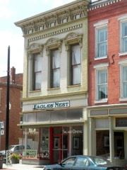
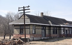
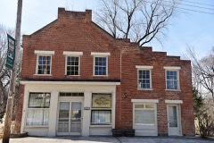
21 National Register listings published here, 1 of them a National Historic Landmark.
Sources: the county history on the Internet Archive · the National Register database, National Park Service
73 topographic sheets cover 35 settlements here, and 21 properties are on the National Register of Historic Places.
21 National Register listings published here, 1 of them a National Historic Landmark.
Sources: the county history on the Internet Archive · the National Register database, National Park Service
Every property in this county listed on the National Register of Historic Places, with the year it was listed and the federal nomination document.
Every wildfire the federal occurrence database records inside this county: 84 of them, burning about 1,866 acres. 3 started naturally and 13 were recorded as arson. Each settlement page carries the fires within five miles of it.
| Reported cause | Fires |
|---|---|
| Debris and open burning | 43 |
| Missing data/not specified/undetermined | 16 |
| Arson/incendiarism | 13 |
| Natural | 3 |
| Recreation and ceremony | 3 |
| Equipment and vehicle use | 3 |
| Smoking | 2 |
| Railroad operations and maintenance | 1 |
The five largest, by the area the report gives. Two of them were set deliberately.
| Date | Cause | Size | Reported by | Name on the report |
|---|---|---|---|---|
| 7 February 1992 | Debris and open burning | 1,050 acres | Missouri Department of Conservation | not named |
| 18 April 1994 | Arson/incendiarism | 140 acres | Missouri Department of Conservation | not named |
| 30 March 2006 | Missing data/not specified/undetermined | 100 acres | Great Rivers National Wildlife Refuge | NATURE TRAIL WILDFIRE |
| 5 November 1999 | Arson/incendiarism | 65 acres | Missouri Department of Conservation | not named |
| 15 February 1997 | Debris and open burning | 50 acres | Missouri Department of Conservation | not named |
| 1 November 2000 | Natural | 40 acres | Great Rivers National Wildlife Refuge | ABC |
| 21 April 2018 | Equipment and vehicle use | 35 acres | Missouri Department of Conservation | 176681-08215-04212018-1147 |
| 8 March 1997 | Smoking | 30 acres | Missouri Department of Conservation | not named |
Every settlement page carries the fires within five miles of it - see the settlement index below.
The NOAA Storm Events Database holds 285 reports for this county, causing 1 death, 2 injuries and about $966,530 in recorded property damage. Each settlement page carries the reports that name it.
| Kind of event | Reports |
|---|---|
| Thunderstorm Wind | 141 |
| Hail | 94 |
| Tornado | 24 |
| Flash Flood | 14 |
| Flood | 9 |
| Funnel Cloud | 2 |
| Lightning | 1 |
The most serious of them, by death, then injury, then recorded damage. The accounts are quoted exactly as the forecast office filed them.
| When | Event | Place named | Harm | What the report says |
|---|---|---|---|---|
| July 2010 | Flash Flood | Busch | 1 killed | Up to five inches of rain fell in a short amount of time causing flash flooding. Numerous roads were flooded including Highway 79 north of Louisiana, U.S. Highways 54 and 61 in spots, and Highway UU northeast of Bowling Green. Also, one woman drowned when she slipped at a low-water crossing and became trapped in a culvert. It occurred at a popular swimming area call The Slabs on Pike County Road 252 along Buffalo Creek, about five miles south of Louisana. She had been swimming in the rain-swollen creek with her son and his friend. The boys were uninjured in the incident. In Louisiana, several streets downtown were flooded for a time due to a creek flooding out of its banks. Several businesses and homes sustained flooding damage. |
| July 1992 | Thunderstorm Wind | not stated | 2 hurt | no account filed |
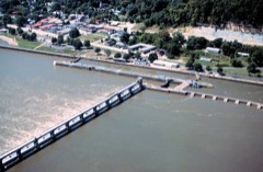
| June 2008 | Flood | Hope | $285,000 | The Mississippi River at Louisiana crested at 26.96 feet on 6/23/2008. This is the third highest crest ever recorded. The Highway 54 bridge had to be closed due to flooding on the Illinois side. Highway 79 was also closed in town. Eighteen homes and eight businesses were flooded but many others were saved by sand bagging efforts. A boil order was in effect for a while due to a water main break. The Mississippi River at Clarksville crested at 36.70 feet on 6/24/2008. This is the third highest crest ever recorded. A huge sand bagging effort saved much of the downtown area, but 10 homes were still flooded. Fifteen homes lost water service due to a water line break. Damage to public infrastructure was estimated at $285,000. The Farm Service Agency estimated agricultural losses in the County to be about $11.2 million. |
| June 1970 | Tornado (F1) | not stated | $250,000 | no account filed |
| February 1999 | Tornado (F2) | Annada | $200,000 | no account filed |
| June 2008 | Flash Flood | Annada | $100,000 | A levee broke just north of Highway M in Lincoln county and near Kickapoo Road. It flooded portions of the Elsberry Levee District in extreme southeastern Pike county east of Highway 79 and from Annada southward. |
| June 1970 | Tornado (F2) | not stated | $25,000 | no account filed |
| August 2006 | Thunderstorm Wind | Louisiana | $20,000 | Storm spotters reported a couple of trees down. One large tree on Georgia Street fell on a house causing moderate damage to the roof. |
| April 2025 | Tornado (EF0) | Spencerburg | $15,000 | A brief tornado tracked northeast near Highway E, 2 miles northeast of the community of Spencerburg where it caused significant damage to an outbuilding and a few trees. The tornado was rated EF-0 with a path length of 0.34 miles and a maximum path width of 25 yards. |
| April 2013 | Flood | Busch | $15,000 | The Mississippi River rose to major flood levels along the border of Pike County. The river crested on the 22nd but remained above flood stage into May. The City of Clarksville, with the help of the Missouri National Guard and many volunteers, was able to build a sandbag wall to protect the downtown business district. Thus damage was limited to some flooded roads, a few outbuilding in the flood plain, and agricultural lowlands. |
| June 2022 | Thunderstorm Wind | Louisiana | $10,000 | Numerous tree limbs were blown down across the county, especially in New Hartford, Bowling Green and Louisiana. Some of the tree limbs took down power lines. One large tree limb landed on a house in Bowling Green causing minor roof damage. |
| September 2021 | Thunderstorm Wind | Bowling Green | $10,000 | Thunderstorm winds blew a tree down onto an unoccupied car causing moderate damage. |
| August 2004 | Lightning | Bowling Green | $10,000 | Lightning struck the television tower on a home in the Bowling Green area ultimately setting the home's deck and some siding on fire. Damage was estimated at $10,000. |
| December 2021 | Thunderstorm Wind | Ashburn | $5,000 | Four large trees were blown down onto Highway 79 near the intersection with Route TT. |
| May 2013 | Flood | Hope | $5,000 | The Mississippi River remained in flood through May along the border of Pike County. The river started at major flood levels, dropped some into the middle of the month, then rose again to major levels at the end of May. The town most affected was Clarksville. Sandbagging efforts by the National Guard and volunteers were successful in keeping the downtown area mostly dry. |
| June 2013 | Flood | Hope | $5,000 | The Mississippi River started June in flood and hit major flood levels cresting on the 1st. The river fell the rest of the month but remained in flood into July. Damage was mainly limited to some flooded roads and flooded farmland. Residents of Clarksville once again used the National Guard and volunteers to build a sandbag wall to keep the downtown business district dry. |
| April 1994 | Thunderstorm Wind | New Hartford | $5,000 | Ham radio spotters reported telephone poles down between Middletown and New Hartford in southwest Pike County. |
| May 1973 | Tornado (F1) | not stated | $2,500 | no account filed |
| June 2000 | Thunderstorm Wind | Louisiana | $2,000 | Storm spotters reported trees down in town. One home was damaged by a downed tree. |
| October 2021 | Thunderstorm Wind | Stark | $1,000 | Thunderstorm winds blew down a large tree in the spotter's yard. |
| June 1994 | Thunderstorm Wind | Frankford | $500 | Large trees were blown along Highway 61 in extreme north Pike County. |
| April 1995 | Thunderstorm Wind | Ashley | $200 | The county sheriff reported several large trees and limbs down. |
| July 1995 | Thunderstorm Wind | Frankford | $200 | Power lines and poles were blown down. |
| April 1995 | Thunderstorm Wind | New Hartford | $100 | The county sheriff reported several large trees and limbs down. |
| June 1962 | Tornado (F0) | not stated | $30 | no account filed |
| April 2026 | Thunderstorm Wind | Paynesville | - | Thunderstorm winds damaged the siding and roof of a single family home. A large tree was also split in half, but the center of the tree was rotted and half of the tree was leafless. |
| April 2025 | Thunderstorm Wind | Curryville | - | Thunderstorm winds caused damage to sheds on a property. They also caused damage to a support column and the wall of a home. |
| June 2025 | Tornado (EF1) | Kissenger | - | An EF-1 tornado moved through parts of eastern Pike County, MO south of Clarksville, damaged a few homes and trees from 10:55 AM to 10:58 AM CDT. The most severe damage was to a 70 year old home where most of the roof was caved in. Here, a 9 year old boy sheltered in a bathtub during the tornado and was unharmed. The tornado was rated EF-1 with a path length of 2.96 miles and a maximum path width of 100 yards. |
| July 2025 | Thunderstorm Wind | Louisiana | - | Thunderstorm winds knocked down a tree onto Highway NN. |
| May 2024 | Thunderstorm Wind | Eolia | - | Thunderstorm winds uprooted a tree across Highway D. There were multiple trees down on Highway D outside of Eolia. |
| March 2024 | Thunderstorm Wind | Cyrene | - | Thunderstorm winds blew down several power poles in an area from U.S. Highway 61 and the intersection of Highway F and County Road 263. |
| June 2024 | Thunderstorm Wind | Vera | - | Law enforcement reported one tree down near County Road 272 and Highway 54. |
| May 2023 | Hail | Frankford | - | A wide swath of large hail, up to two inches in diameter, fell across northern portions of Pike County. |
| June 2023 | Thunderstorm Wind | Bowling Green | - | Thunderstorm winds blew down several trees, power lines and numerous tree limbs over the eastern portions of Pike County, especially in Bowling Green, Louisiana and Clarksville areas. |
| August 2023 | Thunderstorm Wind | Bowling Green | - | Large trees covered roadways as a result of thunderstorm wind gusts. The line of storms intensified as it passed over Bowling Green. |
| August 2023 | Thunderstorm Wind | Louisiana | - | A trained spotter submitted photos of a large 8-10 inch tree limb down at their residence. The spotter noted a large evergreen was down near the Dollar General and multiple smaller limbs less than 4 inches in diameter were down throughout town. This occurred as the leading edge of the line of storms surged as it passed over town. |
| June 2021 | Hail | Frankford | - | A swath of one inch hail fell between Frankford and Bowling Green. |
| June 2021 | Thunderstorm Wind | St Clement | - | Thunderstorm winds blew down several power lines across a road in Saint Clement. |
| June 2021 | Thunderstorm Wind | Louisiana | - | Thunderstorm winds blew down numerous large tree limbs around town. |
| May 2020 | Thunderstorm Wind | Louisiana | - | Thunderstorm winds blew down a large tree onto Highway 79 about two miles east southeast of Louisiana. |
| June 2019 | Thunderstorm Wind | Frankford | - | Thunderstorm winds blew down several trees on the north side of town. |
| June 2019 | Thunderstorm Wind | Annada | - | Thunderstorm winds blew down a tree onto a mobile home causing major damage. No injuries were reported. |
| May 2019 | Thunderstorm Wind | New Hartford | - | Thunderstorm winds blew down numerous large tree limbs. |
| May 2019 | Thunderstorm Wind | Curryville | - | Thunderstorm winds flipped over an irrigation rig in a field. |
| May 2019 | Thunderstorm Wind | Reading | - | Thunderstorm winds blew down numerous tree limbs. |
| May 2019 | Flash Flood | Frankford | - | Up to three inches of rain fell in a short amount of time causing flash flooding. Numerous roads were flooded including Highway 79 just north of intersection with Mud Lick Prairie Road. |
| June 2018 | Thunderstorm Wind | Calumet | - | Thunderstorm winds blew down a power line about 3 miles north of Eolia. In Bowling Green, a tree was blown down as well as a stop sign. |
| May 2018 | Thunderstorm Wind | Louisiana | - | Thunderstorm winds blew down several large trees along Main Street in Louisiana. |
| May 2018 | Thunderstorm Wind | Cyrene | - | Thunderstorm winds blew down a power pole and power lines 2 miles northeast of Cyrene. |
| May 2018 | Thunderstorm Wind | Clarksville | - | Thunderstorm winds blew down several power lines as well as trees. The trees were blown down onto Highway W on south side of Clarksville. |
| August 2018 | Thunderstorm Wind | Ashley | - | Thunderstorm winds blew down several large trees and numerous tree limbs. |
| August 2018 | Thunderstorm Wind | Cyrene | - | Thunderstorm winds blew down several trees and tree limbs. |
| July 2018 | Thunderstorm Wind | St Clement | - | Thunderstorm winds blew down several large tree limbs around town as well as a power pole. |
| July 2018 | Thunderstorm Wind | Ashburn | - | Thunderstorm winds snapped off several large trees at the Dupont Reservation Conservation Area. Further southeast, numerous large tree limbs were snapped off in Louisiana. Also in Louisiana, a couple of trees were snapped off or uprooted, power lines blown down and a park pavilion sustained damage. |
| August 2018 | Thunderstorm Wind | Eolia | - | Thunderstorm winds blew down several trees and numerous tree limbs around Eolia. One tree fell onto a house causing moderate damage. |
| July 2017 | Thunderstorm Wind | Louisiana | - | Thunderstorm winds blew down a 100 foot tall, 6 foot diameter tree down onto a house. It caused major damage to the home. Six people were in the home at the time, but no one sustained any injuries. |
| March 2017 | Thunderstorm Wind | Frankford | - | Thunderstorm winds overturned a 16 foot above ground pool that still had about a foot of water in it. |
| April 2017 | Flash Flood | Annada | - | Between 3 and 6 inches of rain fell causing widespread flash flooding. Numerous roads were flooded including Highway 79 just northwest of Louisiana. |
| October 2017 | Thunderstorm Wind | Cyrene | - | Thunderstorm winds blew down several trees between Cyrene and Louisiana. In Louisiana, two large trees fell onto two unoccupied vehicles, destroying them. |
| June 2015 | Tornado (EF0) | Eolia | - | A tornado touched down about a mile and a quarter west of Eolia and traveled to the east, lifting and dissipating half a mile west of Eolia. The only damage found along the path was broken tree branches and some patterns in the vegetation. The damage was rated EF0 with a path length of 0.65 miles and a max path width of 40 yards. |
The Survey's mineral resources record lists 43 workings inside this county. 8 still produce and 35 are closed or unrecorded. Each settlement page carries the workings within five miles of it.
| Commodity | Workings |
|---|---|
| Stone, Crushed/Broken | 37 |
| Sand and Gravel, Construction | 5 |
| Clay | 1 |
The least common of them first, because a county's hundredth gravel pit says nothing its first ten did not.
| Where | Site | Commodity | Status | Recorded |
|---|---|---|---|---|
| Unknown | Clay | Past Producer | ||
| Unknown | Sand and Gravel, Construction | Past Producer | ||
| Unknown | Sand and Gravel, Construction | Past Producer | ||
| Unknown | Sand and Gravel, Construction | Past Producer | ||
| Unknown | Sand and Gravel, Construction | Past Producer | ||
| Unknown | Sand and Gravel, Construction | Past Producer | ||
| Central Stone Company Quarry | Stone, Crushed/Broken | Producer | ||
| Clifford Quarry | Stone, Crushed/Broken | Past Producer | ||
| Curryville Quarry-Central Stone #7 | Stone, Crushed/Broken | Producer | ||
| Galloway Quarry # 1 and Mill | Stone, Crushed/Broken | Producer | ||
| Galloway Quarry & Plant | Stone, Crushed/Broken | Producer | ||
| Holiday Quarry | Stone, Crushed/Broken | Past Producer | ||
| Hume Quarry | Stone, Crushed/Broken | Producer | ||
| Magnesium Mining Quarry & Plant | Stone, Crushed/Broken | Producer | ||
| Marblehead Quarry | Stone, Crushed/Broken | Past Producer | ||
| Me:Sss Quarrry #1 & Plant | Stone, Crushed/Broken | Producer | ||
| N392229 | Stone, Crushed/Broken | Producer | ||
| Noix Farm Mine | Stone, Crushed/Broken | Past Producer | ||
| Oakwood Quarry | Stone, Crushed/Broken | Past Producer | ||
| Old Holiday Quarry | Stone, Crushed/Broken | Past Producer | ||
| Pratt Quarry | Stone, Crushed/Broken | Past Producer | ||
| Ray Quarry | Stone, Crushed/Broken | Past Producer | ||
| Roberts Quarry | Stone, Crushed/Broken | Past Producer | ||
| Unknown | Stone, Crushed/Broken | Past Producer | ||
| Unknown | Stone, Crushed/Broken | Past Producer | ||
| Unknown | Stone, Crushed/Broken | Past Producer | ||
| Unknown | Stone, Crushed/Broken | Past Producer | ||
| Unknown | Stone, Crushed/Broken | Past Producer | ||
| Unknown | Stone, Crushed/Broken | Past Producer | ||
| Unknown | Stone, Crushed/Broken | Past Producer | ||
| Unknown | Stone, Crushed/Broken | Past Producer | ||
| Unknown | Stone, Crushed/Broken | Past Producer | ||
| Unknown | Stone, Crushed/Broken | Past Producer | ||
| Unknown | Stone, Crushed/Broken | Past Producer | ||
| Unknown | Stone, Crushed/Broken | Past Producer | ||
| Unknown | Stone, Crushed/Broken | Past Producer | ||
| Unknown | Stone, Crushed/Broken | Past Producer | ||
| Unknown | Stone, Crushed/Broken | Past Producer | ||
| Unknown | Stone, Crushed/Broken | Past Producer | ||
| Unknown | Stone, Crushed/Broken | Past Producer | ||
| Unknown | Stone, Crushed/Broken | Past Producer | ||
| Unknown | Stone, Crushed/Broken | Past Producer | ||
| Unknown | Stone, Crushed/Broken | Past Producer |
One book written about this county, cut here where the book itself is cut, at its printed chapters: 1 chapter in all. Every chapter is public domain, machine-read from the scan and reproduced complete. A chapter already given under one of the county's towns is not repeated in this list.
| Chapter | Length |
|---|---|
| The whole text | 191,297 words in 13 parts |
Named settlements recorded in the Geographic Names Information System, each with the topographic sheets covering it. Villages, hamlets and abandoned places alike. Each is shown with the nearest named watercourse or landform and the survey quadrangle it falls on.
Salt River township · 63433 · Near Goose Gap Hollow · Ashburn quadrangle
14 sheets, 1931 to 1993
Calumet township · 63336 · Near The Pinnacle · Clarksville quadrangle
17 sheets, 1930 to 1993
Peno township · 63441 · On Little Peno Creek · Frankford quadrangle
17 sheets, 1890 to 1986
Buffalo township · 63336 · On Little Calumet Creek · Pleasant Hill West quadrangle
17 sheets, 1930 to 1993
Salt River township · 63433 · On Gilbert Chute · Ashburn quadrangle
14 sheets, 1931 to 1993
Indian township · 63339 · On Brush Branch · Curryville quadrangle
17 sheets, 1890 to 1986
Hartford township · 63359 · On Moore Branch · New Hartford quadrangle
16 sheets, 1890 to 1986
Calumet township · 63336 · Near Owens Knob · Clarksville quadrangle
17 sheets, 1930 to 1993
Calumet township · 63336 · On Oneil Creek · Pleasant Hill West quadrangle
17 sheets, 1930 to 1993
Calumet township · 63330 · On Guinns Creek · Annada quadrangle
16 sheets, 1930 to 1993
No longer a settlement
The vanished settlements of Pike County: the places named above that are no longer on the map.