 Block
Buckner, Missouri
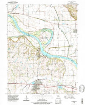
20 topographic sheets cover this place, the earliest surveyed in 1894 and the latest in 1990. It stands in Fort Osage Township. It lies in ZIP code area 64016. The Survey maps it on the Buckner quadrangle. 2,945 people lived here at the 2020 count. It stands 751 feet above sea level.
Population over time
2 figuresBuckner fell from 3,076 to 2,945 between 2010 and 2020. These are the recorded population figures Wikidata holds for this place, reached through the Geographic Names Information System number this page is keyed on rather than by name, so they belong to this place and not to another of the same name. Most are census counts, but not all are: an early figure may be a founding or settlement estimate, and an estimate published within five years of a census is left out. The change column is computed, and is left blank where more than 20 years separate a figure from the one before it, because a gap that long is not a change between two counts.
| Year | People | Change |
|---|---|---|
| 2010 | 3,076 | |
| 2020 | 2,945 | -131 (-4%) |
Topographic sheets covering this place
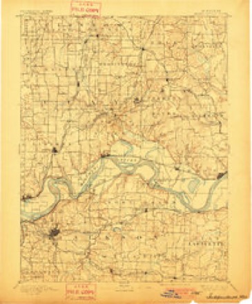
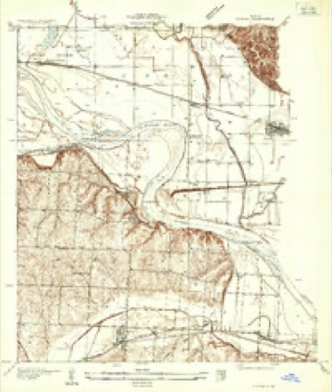
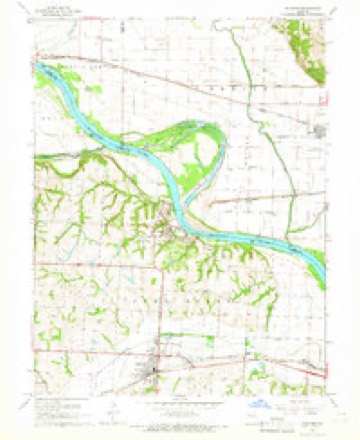
9 surveys from 20 printed sheetsMatched by testing this settlement's coordinate against the published boundary of every sheet in the United States Geological Survey's historical collection. Each opens the scanned sheet at the Survey.
- 1894 USGS Independence quadrangle1:125000, 5 printings
- 1935 USGS Buckner quadrangle1:24000, 2 printings
- 1950 USGS Kansas City quadrangle1:250000
- 1954 USGS Kansas City quadrangle1:250000
- 1956 USGS Kansas City quadrangle1:250000, 4 printings
- 1960 USGS Kansas City quadrangle1:250000, 3 printings
- 1965 USGS Buckner quadrangle1:24000, 2 printings
- 1983 USGS Kansas City quadrangle1:100000
- 1990 USGS Buckner quadrangle1:24000




In the county-history sources
3,445 words on this townshipThe History of Jackson County, Missouri, Containing a History of the County, Its Cities, Towns, Etc., Biographical Sketches of Its Citizens, Jackson County in the Late War... History of Missouri, Map of Jackson County .., published 1881 names this settlement in its chapter on Fort Osage Township. These are the passages that mention it, exactly as the scans read.
This growing town, named in honor of Mr. Buckner, who lived on a hill not far distant, is situated fifteen miles east of Independence, near the center of Fort Osage township. It was laid out by Thomas Monroe, in the spring of 1875, on the Kansas City & Eastern Railroad. The present population is 80. The first house built on the present site of Buckner was by John T. Cobb, in which he kept a general country store. This was in the year 187 1. He continued in business here till 1877, and then removed to Independence, and soon after to Blue Springs, where he is engaged in merchandising. The next store in Buckner was built by R. Wallace & Co., in the spring of 1877. It was a brick house, in which they are still engaged in a general merchandising. The religious people are building a church for Union services, under the control of the Methodists. The church will cost $700.
Passage source: The History of Jackson County, Missouri, Containing a History of the County, Its Cities, Towns, Etc., Biographical Sketches of Its Citizens, Jackson County in the Late War... History of Missouri, Map of Jackson County .., published 1881.
It is supposed, and there is most satisfactory evidence, that the Missouri River once came through this valley, and pursued about the same course as is now pursued by Fire Prairie Creek. The bayou, or portion of the river which flowed here, came into the land at or near the mouth of Little Blue, and contmuing in a southerly direction, along the course of Little Blue, to near the southeast corner of Tp. 50, R. 31, thence east near the present site of Lake City, and thence following the course of Fire Prairie Creek, uniting again with the main current in Lafayette county. Large cottonwood trees have been found in the sand and earth twenty feet below the surface, about one-half mile northwest of Buckner station. When boring a well near the same place, cockle burs, in a good state of preservation, have been taken out eighteen or twenty feet below the surface ; also, butternut hulls were found at the same depth. Other wells dug in the ancient bed of the great river, show layers of river sand in the exact position left by the flowing current. All things show most conclusively that- nearly all of the Six Mile District was once an island in the Missouri River - the main branch on the north side, where it now flows past Sibley, and the south branch taking the course above mentioned.
Passage source: The History of Jackson County, Missouri, Containing a History of the County, Its Cities, Towns, Etc., Biographical Sketches of Its Citizens, Jackson County in the Late War... History of Missouri, Map of Jackson County .., published 1881.
Buckner is situated on a broad and level plain, averaging two miles wide north and south, and following the course of Fire Prairie Creek east and west. This valley is extremely fertile, and the alluvial deposit produces crops of corn, wheat, potatoes, and other products in great abundance. The Narrow Gauge Railroad, running from Lexington to Kansas City, was built through Fort Osage township in the fall of 1875, and finished in the spring of 1876. The road was first called the " Wyandotte, Kansas City & Northwestern," and in 1877 its name was changed to the " Kansas City & Eastern," and in 1880 the Missouri Pacific Railroad Company bought it, and now it is called the " Missouri Pacific, Kansas City & Eastern Division, Narrow Gauge Railroad."
Passage source: The History of Jackson County, Missouri, Containing a History of the County, Its Cities, Towns, Etc., Biographical Sketches of Its Citizens, Jackson County in the Late War... History of Missouri, Map of Jackson County .., published 1881.
Machine-read from a century-old scan, so expect the errors a machine makes: misspelled names, dropped words, stray characters.
Read the whole chapter on Fort Osage Township - it names this place 1 more 1 time.
Fires near this place
26 since 1992Regional context, not property-specific evidence. The federal wildfire occurrence database lists 26 fires within 5 miles of Buckner between 1992 and 2020, burning about 85 acres in total. None started naturally. None was recorded as arson. Distance is straight-line from the map coordinates, so a fire counted here may appear on a neighbouring settlement's page as well.
| Reported cause | Fires |
|---|---|
| Debris and open burning | 15 |
| Missing data/not specified/undetermined | 6 |
| Equipment and vehicle use | 3 |
| Smoking | 1 |
| Recreation and ceremony | 1 |
The most recent of them, most recent first, with the day each was reported and the service that recorded it.
| Date | Cause | Size | Reported by | Name on the report |
|---|---|---|---|---|
| 30 April 1992 | Debris and open burning | 3.0 acres | Missouri Department of Conservation | not named |
| 30 April 1992 | Debris and open burning | 5.0 acres | Missouri Department of Conservation | not named |
| 30 April 1992 | Debris and open burning | 12 acres | Missouri Department of Conservation | not named |
| 30 April 1992 | Debris and open burning | 2.0 acres | Missouri Department of Conservation | not named |
| 30 April 1992 | Debris and open burning | 1.0 acres | Missouri Department of Conservation | not named |
| 30 April 1992 | Debris and open burning | 1.0 acres | Missouri Department of Conservation | not named |
| 30 April 1992 | Debris and open burning | 1.0 acres | Missouri Department of Conservation | not named |
| 23 April 2018 | Debris and open burning | 4.3 acres | Missouri Department of Conservation | 176663-04828-04232018-1634 |
Settlements close enough to share some of these fires:
Mines and quarries near this place
10 of 12 shownRegional context, not property-specific evidence. The federal mineral resources record lists 12 workings within 5 miles of Buckner: 12 past producers. None of them still produces. What was taken out: Stone, Crushed/Broken, Sand and Gravel, Construction. Distance is straight-line from the map coordinates, so a quarry counted here may appear on a neighbouring settlement's page as well.
| Where | Site | Commodity | Status | Recorded |
|---|---|---|---|---|
| Unknown-Sand and Gravel | Sand and Gravel, Construction | Past Producer | ||
| Buckner Mine | Stone, Crushed/Broken | Past Producer | ||
| Hutchins Quarry | Stone, Crushed/Broken | Past Producer | ||
| Iowa Point Quarry | Stone, Crushed/Broken | Past Producer | ||
| Parkville Quarry | Stone, Crushed/Broken | Past Producer | ||
| Unknown-Ls | Stone, Crushed/Broken | Past Producer | ||
| Unknown-Ls | Stone, Crushed/Broken | Past Producer | ||
| Unknown-Ls | Stone, Crushed/Broken | Past Producer | ||
| Unknown-Ls | Stone, Crushed/Broken | Past Producer | ||
| Waldron Quarry | Stone, Crushed/Broken | Past Producer |
Storms near this place
19 since 1998Regional context, not property-specific evidence. The National Weather Service names Buckner in 19 storm reports between 1998 and 2025: 8 hail, 8 thunderstorm wind, 2 flash flood, 1 tornado. No death or injury is recorded in these reports. Each account below is quoted exactly as the forecast office filed it, from the NOAA Storm Events Database, and each date opens the federal record of that event.
| When | Event | Place named | Harm | What the report says |
|---|---|---|---|---|
| March 2006 | Hail | Buckner | $25,000 | no account filed |
| June 2025 | Thunderstorm Wind | Buckner | - | Downed wires and power outages near Central Street in the Buckner area. |
| July 2025 | Thunderstorm Wind | Buckner | - | Social media report of minor damage and downed limbs at a property in Buckner. |
| July 2024 | Thunderstorm Wind | Buckner | - | Mping report of 3 inch tree limbs downed in Buckner. |
| May 2024 | Thunderstorm Wind | Buckner | - | Social media report and photo of tree damage at a property in Buckner. |
| September 2023 | Hail | Buckner | - | Half dollar sized hail was reported in Buckner. |
| June 2022 | Thunderstorm Wind | Buckner | - | Several large tree limbs and power poles were down from strong thunderstorm wind. |
| May 2018 | Thunderstorm Wind | Buckner | - | A storm chaser reported 59 mph wind along with the quarter sized hail. |
| June 2016 | Thunderstorm Wind | Buckner | - | This report was received via social media. Trees were uprooted and down near Buckner, Missouri. |
| May 2016 | Hail | Buckner | - | This report was gathered via social media. |
| May 2015 | Tornado (EF1) | Buckner | - | Ahead of the advancing QLCS a supercell formed and produced a tornado in northern Jackson County. It formed just southwest of Sibley, Missouri and barely missed the main part of the city just to the west. Although it remained mostly in rural parts of Jackson County it did impact some outbuildings and did plenty of tree damage to areas just west of Sibley. The tornado then moved across the Missouri River, into Ray County where it dissipated northwest of Orrick. |
| June 2014 | Thunderstorm Wind | Buckner | - | Numerous tree limbs and several power lines were reported to be down from strong winds. |
| June 2005 | Flash Flood | Buckner | - | Reber road closed due to flooding. |
| August 2004 | Flash Flood | Buckner | - | Water over 24 Highway. |
| April 1998 | Hail | Buckner | - | Dime-size hail was reported at Buckner and Sibley as a severe thunderstorm tracked along the Missouri River. |
| May 2018 | Hail | Buckner | - | no account filed |
| June 2016 | Hail | Buckner | - | no account filed |
| May 2005 | Hail | Buckner | - | no account filed |
| June 2004 | Hail | Buckner | - | no account filed |
Nearest settlements
The eight closest, with where each one stands in the county. Distances are straight-line, computed from the Geographic Names Information System coordinates.
Elsewhere
Matched on this settlement's Geographic Names Information System number rather than its name, so it cannot be a different place of the same name in another state.
| Wikipedia article on Buckner | An encyclopaedic summary. Its text is share-alike, so it is linked here rather than copied. |
| Wikidata item Q952833 | The structured record the population and elevation above come from. Public domain (CC0). |
Provenance
This settlement is recorded in the Geographic Names Information System as feature 735540. The sheet list is computed by point-in-boundary test against the United States Geological Survey's historical topographic inventory. Both are works of the United States government and carry no copyright under 17 U.S.C. 105.
Wildfire. Short, Karen C. 2022. Spatial wildfire occurrence data for the United States, 1992-2020 [FPA_FOD_20221014]. 6th Edition. Fort Collins, CO: Forest Service Research Data Archive. https://doi.org/10.2737/RDS-2013-0009.6 Collected with United States Government funding and usable without additional permissions or fees.
Mines and quarries. USGS Mineral Resources Data System (MRDS) https://mrdata.usgs.gov/mrds/ A work of the United States government, no copyright under 17 U.S.C. 105.
Storms. NOAA National Centers for Environmental Information, Storm Events Database https://www.ncei.noaa.gov/stormevents/ A work of the United States government, no copyright under 17 U.S.C. 105. Narratives are quoted verbatim from the National Weather Service report and are not edited or summarised.