 Block
Burfordville, Missouri
18 topographic sheets cover this place, the earliest surveyed in 1933 and the latest in 1987. It stands in Kinder Township. It lies in ZIP code area 63739. It stands on Schroder Branch. The Survey maps it on the Burfordville quadrangle.
On record in Burfordville
Buildings and businesses the archive holds for this place. Each opens its own page, with the source record it came from.
On the National Register 2 records
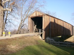 Burfordville Covered Bridgelisted 1970
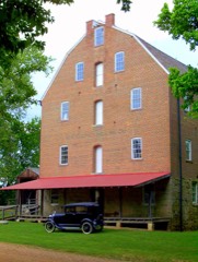 Burfordville Milllisted 1971
Topographic sheets covering this place
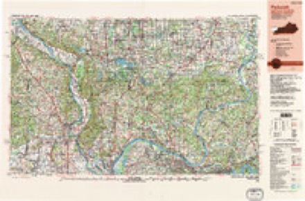
11 surveys from 18 printed sheetsMatched by testing this settlement's coordinate against the published boundary of every sheet in the United States Geological Survey's historical collection. Each opens the scanned sheet at the Survey.
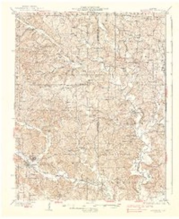
- 1933 USGS Marble Hill quadrangle1:62500, 3 printings
- 1937 USGS Marble Hill quadrangle1:62500, 2 printings
- 1949 USGS Paducah quadrangle1:250000, 2 printings
- 1950 USGS Paducah quadrangle1:250000
- 1954 USGS Paducah quadrangle1:250000, 2 printings
- 1961 USGS Paducah quadrangle1:250000, 2 printings
- 1964 USGS Paducah quadrangle1:250000, 2 printings
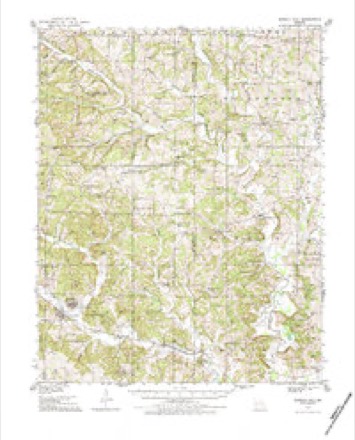
- 1980 USGS Burfordville quadrangle1:24000
- 1984 USGS Cape Girardeau quadrangle1:100000
- 1986 USGS Cape Girardeau quadrangle1:100000
- 1987 USGS Paducah quadrangle1:250000
Fires near this place
7 since 1997Regional context, not property-specific evidence. The federal wildfire occurrence database lists 7 fires within 5 miles of Burfordville between 1997 and 2020, burning about 35 acres in total. None started naturally. None was recorded as arson. Distance is straight-line from the map coordinates, so a fire counted here may appear on a neighbouring settlement's page as well.
| Reported cause | Fires |
|---|---|
| Missing data/not specified/undetermined | 3 |
| Equipment and vehicle use | 2 |
| Debris and open burning | 2 |
The most recent of them, most recent first, with the day each was reported and the service that recorded it.
| Date | Cause | Size | Reported by | Name on the report |
|---|---|---|---|---|
| 16 September 2019 | Equipment and vehicle use | under an acre | Missouri Department of Conservation | 179194-01617-09162019-1108 |
| 16 September 2019 | Missing data/not specified/undetermined | under an acre | Missouri Department of Conservation | 179143-01617-09162019-1057 |
| 31 May 1997 | Debris and open burning | 2.0 acres | Missouri Department of Conservation | not named |
| 3 April 2019 | Missing data/not specified/undetermined | under an acre | Missouri Department of Conservation | 179074-01624-04032019-0005 |
| 5 October 2020 | Equipment and vehicle use | under an acre | Missouri Department of Conservation | 230868-01617-10052020-1440 |
| 6 January 2019 | Missing data/not specified/undetermined | under an acre | Missouri Department of Conservation | 179070-01624-01062019-0005 |
| 1 January 2020 | Debris and open burning | 32 acres | Missouri Department of Conservation | 190042-01617-01012020-1620 |
Settlements close enough to share some of these fires:
Mines and quarries near this place
3 within 5 milesRegional context, not property-specific evidence. The federal mineral resources record lists 3 workings within 5 miles of Burfordville: 2 past producers, 1 prospect. None of them still produces. What was taken out: Stone, Crushed/Broken, Clay, Zinc. Distance is straight-line from the map coordinates, so a quarry counted here may appear on a neighbouring settlement's page as well.
| Where | Site | Commodity | Status | Recorded |
|---|---|---|---|---|
| Thomas Quarry | Stone, Crushed/Broken | Past Producer | ||
| Unknown Clay | Clay | Past Producer | ||
| Unknown Zinc | Zinc | Prospect |
Storms near this place
7 since 1998Regional context, not property-specific evidence. The National Weather Service names Burfordville in 7 storm reports between 1998 and 2025: 2 tornado, 1 flood, 1 funnel cloud, 1 hail. No death or injury is recorded in these reports. Each account below is quoted exactly as the forecast office filed it, from the NOAA Storm Events Database, and each date opens the federal record of that event.
| When | Event | Place named | Harm | What the report says |
|---|---|---|---|---|
| May 2025 | Tornado (EF2) | Burfordville | $175,000 | An EF2 tornado, with max winds of 125mph, touched down about 1.5 miles east of Burfordville in Cape Girardeau County. It tracked east for about 1.4 miles before lifting 3 miles east of Burfordville. The worst damage occurred along County Road 363 where a home suffered significant roof damage. Further east along County Road 343 there was an outbuilding with significant damage along with a mobile home that had minor damage. Several trees were uprooted along the path as well. Debris was lofted far enough to be spotted near the intersection of MO-72 and County Road 335. |
| April 2017 | Flash Flood | Burfordville | $50,000 | Flash flooding of the Whitewater Creek affected the community of Burfordville. Floodwaters from the creek damaged several homes and two vehicles. A motorist attempting to pass through the flooding ended up stranded in a flooded ditch. The vehicle was partially submerged, but nobody was injured. |
| February 1998 | Flood | Burfordville | $5,000 | Persistent moderate to locally heavy rain during the previous night brought rainfall totals to around 2 inches in 8 hours. Since the ground was already saturated, the runoff raised small stream levels very rapidly. The Whitewater River overflowed across County Road 351 near Burfordville. A station wagon stalled as it attempted to cross the flooded roadway. No injuries were reported. |
| May 2019 | Thunderstorm Wind | Burfordville | $1,000 | A tree was uprooted. A National Weather Service storm survey estimated peak winds were near 75 mph. |
| April 2004 | Funnel Cloud | Burfordville | - | Numerous funnel clouds were reported along the path of a supercell thunderstorm that tracked northeast across Cape Girardeau County. |
| May 2003 | Tornado (F1) | Burfordville | - | An old farmhouse was partially destroyed, with the kitchen still standing but the rest of the house flattened. A nearby barn was destroyed. Numerous trees were blown down. |
| July 2012 | Hail | Burfordville | - | no account filed |
Nearest settlements
The eight closest, with where each one stands in the county. Distances are straight-line, computed from the Geographic Names Information System coordinates.
| Map | Place | Distance | Sheets |
|---|---|---|---|
| Gravel Hill | 1.9 miles | 18 | |
| Tilsit | 4.3 miles | 19 | |
| Reynolds Ford | 4.4 miles | 18 | |
| Millersville | 4.5 miles | 18 | |
| Hartle Ford | 5.1 miles | 18 | |
| Houck | 5.5 miles | 19 | |
| Crump | 6.2 miles | 18 | |
| Kurreville | 7.5 miles | 18 |
Provenance
This settlement is recorded in the Geographic Names Information System as feature 715068. The sheet list is computed by point-in-boundary test against the United States Geological Survey's historical topographic inventory. Both are works of the United States government and carry no copyright under 17 U.S.C. 105.
Wildfire. Short, Karen C. 2022. Spatial wildfire occurrence data for the United States, 1992-2020 [FPA_FOD_20221014]. 6th Edition. Fort Collins, CO: Forest Service Research Data Archive. https://doi.org/10.2737/RDS-2013-0009.6 Collected with United States Government funding and usable without additional permissions or fees.
Mines and quarries. USGS Mineral Resources Data System (MRDS) https://mrdata.usgs.gov/mrds/ A work of the United States government, no copyright under 17 U.S.C. 105.
Storms. NOAA National Centers for Environmental Information, Storm Events Database https://www.ncei.noaa.gov/stormevents/ A work of the United States government, no copyright under 17 U.S.C. 105. Narratives are quoted verbatim from the National Weather Service report and are not edited or summarised.