Block
From the record
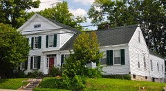
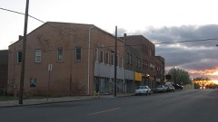
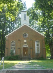
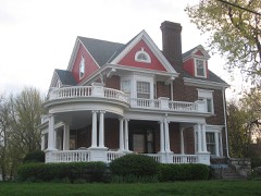
63 National Register listings published here.
Sources: the National Register database, National Park Service
91 topographic sheets cover 54 settlements here, and 63 properties are on the National Register of Historic Places.
63 National Register listings published here.
Sources: the National Register database, National Park Service
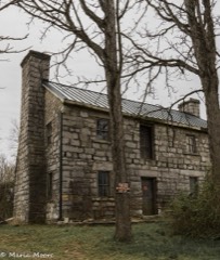
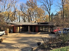
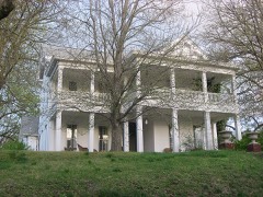
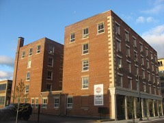
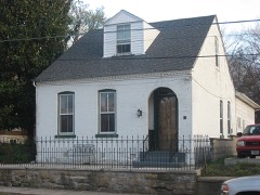
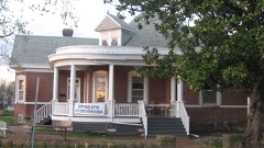
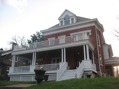
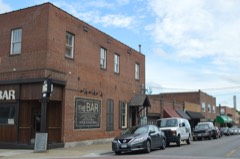
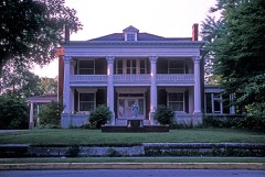
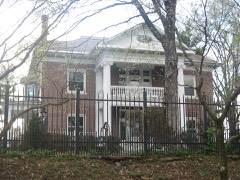
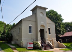
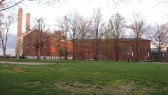
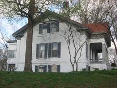
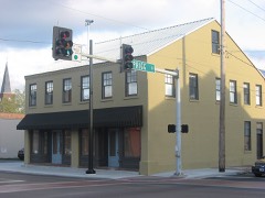
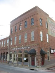
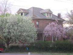
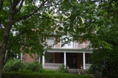
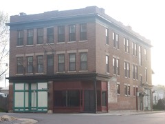
Every property in this county listed on the National Register of Historic Places, with the year it was listed and the federal nomination document.
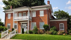
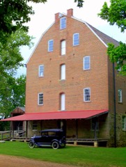
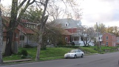
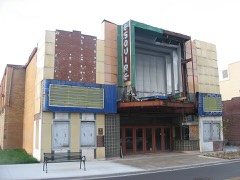
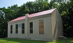
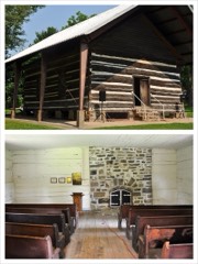
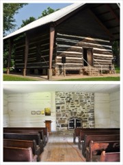
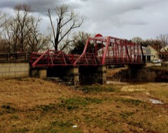
Cape Girardeau County has 1 covered bridge on the National Register. Each is a listed structure with a federal nomination on file.
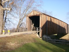 | Burfordville Covered Bridge | Listed 1970 |
Every wildfire the federal occurrence database records inside this county: 49 of them, burning about 114 acres. 2 started naturally and none was recorded as arson. Each settlement page carries the fires within five miles of it.
| Reported cause | Fires |
|---|---|
| Debris and open burning | 28 |
| Missing data/not specified/undetermined | 13 |
| Equipment and vehicle use | 4 |
| Recreation and ceremony | 2 |
| Natural | 2 |
The five largest, by the area the report gives. None of them was recorded as arson.
| Date | Cause | Size | Reported by | Name on the report |
|---|---|---|---|---|
| 1 January 2020 | Debris and open burning | 32 acres | Missouri Department of Conservation | 190042-01617-01012020-1620 |
| 20 July 1996 | Debris and open burning | 15 acres | Missouri Department of Conservation | not named |
| 8 April 1992 | Debris and open burning | 10 acres | Missouri Department of Conservation | not named |
| 7 January 2018 | Debris and open burning | 5.3 acres | Missouri Department of Conservation | 177844-01617-01072018-0306 |
| 2 March 1992 | Debris and open burning | 5.0 acres | Missouri Department of Conservation | not named |
| 21 April 2018 | Debris and open burning | 3.1 acres | Missouri Department of Conservation | 177846-01617-04212018-1357 |
| 20 July 1996 | Debris and open burning | 3.0 acres | Missouri Department of Conservation | not named |
| 20 March 1995 | Debris and open burning | 3.0 acres | Missouri Department of Conservation | not named |
Every settlement page carries the fires within five miles of it - see the settlement index below.
The NOAA Storm Events Database holds 627 reports for this county, causing 1 death, 13 injuries and about $35,085,500 in recorded property damage. Each settlement page carries the reports that name it.
| Kind of event | Reports |
|---|---|
| Thunderstorm Wind | 222 |
| Hail | 145 |
| Flood | 106 |
| Flash Flood | 53 |
| Tornado | 49 |
| Heavy Rain | 27 |
| Funnel Cloud | 15 |
| Lightning | 9 |
| Dust Devil | 1 |
The most serious of them, by death, then injury, then recorded damage. The accounts are quoted exactly as the forecast office filed them.
| When | Event | Place named | Harm | What the report says |
|---|---|---|---|---|
| April 1963 | Tornado (F2) | not stated | 1 killed, 3 hurt, $25,000 | no account filed |
| January 2000 | Thunderstorm Wind | Dutchtown | 3 hurt, $250,000 | Thunderstorm winds estimated between 90 and 100 MPH affected a small area about one-half mile wide and two miles long. The hardest hit areas were along Highway 74 west of Interstate 55, and in the 1200 block of South Kingshighway in Cape Girardeau. On Highway 74, two mobile homes were destroyed, and four others were badly damaged. A man was inside one of the mobile homes, but he escaped with only minor injuries. Two permanent homes were damaged. The roof of a trucking company at the Interstate 55 exit to Highway 74 was torn off, and a shop area of the business was destroyed. The roof was blown off the business office of a quarry on South Kingshighway. A woman in the quarry office received cuts and scratches. A section of Highway 74 west of I-55 was closed most of the day due to downed power lines. About 5,600 homes in Cape Girardeau County lost power due to the storm. |
| May 2003 | Tornado (F3) | Jackson | 2 hurt, $12,000,000 | The tornado touched down at the intersection of Highway 34 and Business Loop I-55 in Jackson, then moved northeast across downtown Jackson and the Bent Creek Golf Course. The damage path ended about 300 yards short of Interstate 55. Several trees blocked Interstate 55 near Jackson. Peak tornado winds were estimated near 180 MPH. The police and fire headquarters building was near the beginning of the damage path. The roof was blown off the building and windows were blown out, allowing rain to flood the building and cause extensive damage. The hazardous materials trailer and communications van were overturned. City police and fire operations were moved to alternate quarters. Streets were blocked by flipped cars and downed trees and power lines. Numerous large trees were snapped or uprooted. The roofs and some walls were torn off many buildings and homes, as well as a school in downtown Jackson. About 200 structures in Jackson received at least some degree of damage. Approximately 22 homes were destroyed, 43 received major damage, and 140 received minor damage. Of those, six were mobile homes and four were apartment buildings. Three businesses were destroyed, including a bakery. Four other businesses had major damage, including a storage company and a woodworking business. Two injured persons were treated and released from a local hospital. One family safely took shelter in their basement while baseball size hail battered the kitchen floor of their unroofed home, and a small sports car landed in their living room. Twenty gas leaks caused by the tornado were repaired within 6 hours. Power was restored to all but 30 homes within 48 hours. |
| June 1995 | Thunderstorm Wind | Countywide | 2 hurt, $200,000 | In the city of Cape Girardeau, thunderstorm winds blew out storefront windows and downed at least 30 trees. Some of the trees landed on houses and cars. West of the city, a tree landed on a car, injuring two people. Power was out for two to three days in sections of Cape Girardeau. Because of continued flooding of the Mississippi River, some of the power restoration work was done by boat. The Cape Girardeau Airport was closed for 18 hours due to power outages. A Cessna plane at the airport was damaged when a hangar door blew in. There were numerous accidents caused by the storms, partly as a result of street flooding. |
| December 1957 | Tornado (F2) | not stated | 1 hurt, $250,000 | no account filed |
| April 1955 | Tornado (F2) | not stated | 1 hurt, $250,000 | no account filed |
| February 2012 | Tornado (EF2) | Oak Ridge | 1 hurt, $150,000 | Thousands of trees were snapped or uprooted, and several houses were damaged. The houses that were damaged suffered primarily partial roof loss. The houses were located in Oak Ridge and Pocahontas. One man was injured when a roof collapsed on him. Numerous barns and grain bins were destroyed. Many power lines were blown down. The average path width was 250 yards. Peak winds were estimated near 115 mph. The tornado path continued across the Mississippi River into Union County, Illinois. |
| January 2016 | Flood | Hines Lndg | $3,000,000 | Mississippi River levels continued their climb from December, and record flooding occurred early in the month. At the Cape Girardeau river gage, the river crested at a new record of 48.86 feet on the evening of New Year's Day. The old record was 48.49 feet, which was set in August of 1993. Records at Cape Girardeau go back at least a century. The 2016 crest would likely have been higher if there had not been a levee break in Alexander County, Illinois. Flood stage at Cape Girardeau is 32 feet. The estimated acreage that was flooded was 24,000 acres, of which 17,000 was cropland. Much of the flooded acreage was in the diversion channel floodplain, which extends from Allenville east to Dutchtown and Scott City. Numerous roads were flooded, including Highway 74. Dozens of residences were inaccessible due to flooding. A number of businesses and homes were flooded, including about twenty homes and eight businesses in the city of Cape Girardeau. These homes and businesses were mainly in the Red Star neighborhood of Cape Girardeau and on the south side of the city near Highway 74. Firefighters rescued a man and his dog from one of the homes. A voluntary evacuation advisory was issued for the community of Allenville, which was completely surrounded by water. Flood walls and levees protect most of the city of Cape Girardeau. These structures held up during this record flood. To protect a concrete plant outside the levee system, crews built a 1,200 to 1,500-foot levee in a short period of time. |
| May 2009 | Thunderstorm Wind | Oak Ridge | $3,000,000 | Widespread damaging winds affected northern parts of the county. Over 1,000 trees were blown down, along with power lines. Many roads were blocked. The trees fell on homes, vehicles, and power lines. Power poles were snapped. Extended power outages lasting up to several days were reported. Barns and sheds were blown down. Just west of Oak Ridge, 259 trees were blown down on a single farm. The house and a garage on the farm received holes in their roofs. Windows were blown out of at least one house in Oak Ridge. Towns that experienced the worst damage were north of Jackson, including Daisy and Pocahontas. Several trees were blown down in Jackson, including one that landed on a car. |
| March 2008 | Flood | Daisy | $2,800,000 | Historic flooding occurred after 12 to 14 inches of rain fell in 48 hours. Widespread flooding of creeks and roads occurred. A dramatic water rescue was conducted on Highway 34 at the Byrd Creek Bridge, where a pickup truck was swept off the road. A passing driver made a risky attempt to pull the driver to safety. Nobody was injured. At least four vehicles in other areas around the county became stranded in floodwaters, requiring emergency personnel to conduct water rescues. The county emergency management director estimated that 200 homes and 13 businesses were evacuated. Evacuation shelters were opened in the county. The villages of Allenville and Delta were under voluntary evacuation orders. Access to Allenville was restricted by deputy sheriffs. A Coast Guard helicopter and boat assisted in search and rescue operations. Residents on a couple of streets in Cape Girardeau were asked to evacuate due to the potential failure of an earthen dam. Mudslides closed several streets. In Dutchtown, water rose over the top of the Hubble Creek levee. Some residents were ordered to evacuate, and major roads leading into town were closed. Throughout the county, a number of vehicles and buildings were flooded, including a school. More than 50 county roads were severely affected by the flood, including washouts of culverts and roadways. The Cape Girardeau airport shut down operations to all but emergency helicopters because of flooded runways. Countywide, at least 184 homes were damaged and one was destroyed. Eleven businesses were damaged. |
| May 1981 | Tornado (F2) | not stated | $2,500,000 | no account filed |
| May 2011 | Flood | Gulf Jct | $1,000,000 | Major flooding that began in April continued along the Mississippi River. At Cape Girardeau, the river crested at 46.28 feet on May 2. This was the fourth highest crest on record, surpassed only by the floods of 1993 and 1995. The activation of the New Madrid Floodway by the U.S. Army Corps of Engineers spared Cape Girardeau County from an even higher crest. With the detonation of the Mississippi River levee at Birds Point, Missouri, the river began to drop. Floodwaters backed up creeks and diversion channels across southern parts of Cape Girardeau County, threatening areas along Highway 74 out to Dutchtown. A combination of Mississippi River backwater and headwater from small tributaries such as the Whitewater River caused problems as far inland as Delta and Allenville. Crews built an emergency levee along Highway 74 near Highway 25 to protect Dutchtown. Highways 74 and 25 were closed. Water rose two to three feet high on the levee. Voluntary evacuations were requested in the Allenville area, where water blocked all roads into town. A couple of houses were flooded in Allenville, where at least one water rescue was conducted. Countywide, more than 30 county roads were closed. The Red Cross opened a shelter for flood victims. In Cape Girardeau, several homes and a couple of businesses were sandbagged in an area known as the Red Star neighborhood. More than 15 streets were closed by flooding in the city on both the north and south sides of town. |
| January 2020 | Tornado (EF2) | Jackson | $750,000 | The tornado touched down just south of U.S. Highway 61, where trees and small outbuildings were damaged. The tornado crossed Highway 61 and produced damage to several businesses. Windows were broken out, and damage occurred to roofs. One business was destroyed. A tire store was heavily damaged as the tornado was at its peak intensity. The back was wall was blown out, and much of the roof was destroyed and thrown several hundred yards. Light concrete and styrofoam blew onto Interstate 55, which was closed for a brief time until cleanup was complete. East of Interstate 55, several barns and outbuildings were damaged or destroyed. Numerous trees were uprooted or snapped along the way. The path may have extended farther east of State Route 177 near the Mississippi River, but flooding prevented surveying. Peak winds were estimated near 125 mph near U.S. Highway 61. |
| May 2017 | Flood | Gulf Jct | $500,000 | Major flooding occurred along the Mississippi River early in the month. At the Cape Girardeau river gage, the river crested at 45.99 feet on the 6th. Flood stage is 32 feet. This flood crest was only a few inches below the major flood crest in the spring of 2011, but it was nearly three feet below the record set in 2016. The river remained above flood stage for the entire month. There was extensive flooding of low-lying areas of Cape Girardeau County, including dozens of roads, thousands of acres of agricultural land, and some homes and businesses. About 14,000 acres of cropland were flooded, along with another 7,000 acres of land not used for crops. Floodwaters backed up creeks and a diversion channel across southern parts of Cape Girardeau County, threatening areas along Highway 74 out to Dutchtown. A combination of Mississippi River backwater and headwater from small tributaries such as the Whitewater River caused problems as far inland as Delta and Allenville. Highways 74 and 25 were closed. Voluntary evacuations were requested in the Allenville area, where water blocked all roads into town. A couple of houses were flooded in Allenville. Countywide, more than 30 county and state roads were closed, including Highway 177 at the Cape Girardeau city limits. The Red Cross opened a shelter for flood victims. In Cape Girardeau, several homes and a couple of businesses were sandbagged in an area known as the Red Star neighborhood. More than 15 streets were closed by flooding in the city on both the north and south sides of town. Flood mitigation buyouts have resulted in considerably less property damage than the major floods of the 1990's. |
| November 1993 | Tornado (F0) | Delta | $500,000 | A tornado touched down briefly causing light damage to at least 27 homes and several other buildings, including a hardware store, a nearby school, and farm elevators. Several cars were also damaged and utility poles knocked down. Damage was reported a 0.5 mile west of Delta and again to the east of the community. Reported by Cape Girardeau county officials and local newspapers. |
| May 2002 | Flash Flood | Countywide | $300,000 | no account filed |
| January 2013 | Tornado (EF1) | Delta | $250,000 | Lots of shingles were blown off homes. One home sustained major damage, with pieces of a neighbor's roof embedded into the sides of the house. The roof was ripped off a convenience store. A semi and trailer were overturned along Highway 25. A total of ten buildings were damaged, including five businesses, two residences, one church, and two barns. Most of the damage was minor roof damage, except for the one home and one business. Trees were blown down, along with at least one power pole. All of the damaged structures were in the community of Delta. Peak winds were estimated near 100 mph. The average path width was 75 yards. |
| April 2006 | Hail | Fruitland | $250,000 | Golf ball size hail fell at Jackson and northwest of Cape Girardeau near County Road 618. Quarter size hail fell in Cape Girardeau at Interstate 55 and Kings Highway. In Fruitland, hail was 1.5 inches in diameter. All 80 vehicles on a car lot in Jackson were damaged, with 10 to 15 dents in each car. The rear windows of several cars were smashed out. |
| February 1991 | Tornado (F1) | not stated | $250,000 | no account filed |
| March 1971 | Tornado (F2) | not stated | $250,000 | no account filed |
| December 1957 | Tornado (F2) | not stated | $250,000 | no account filed |
| March 2017 | Thunderstorm Wind | Marquette | $220,000 | A microburst containing peak winds estimated near 85 mph tracked across the southern edge of the city of Cape Girardeau, roughly along and parallel to the Southern Expressway. Several fences were blown down. Shingles and siding were blown off at least a dozen homes. Dozens of trees or tree limbs were blown down. A large tree fell on a house, causing major damage. The microburst tracked across the Mississippi River into Illinois. |
| May 2025 | Tornado (EF1) | Cape Girardeau | $200,000 | An EF1 tornado touched down initially at the Cape Splash Aquatic Center, where it did some damage to overhead umbrella structures and a few trees. It continued east across Kingshighway St and into neighborhoods of northern Cape Girardeau. Numerous trees were damaged including some that were snapped or uprooted. Several homes experienced minor roof or siding damage. The tornado appeared to lift along or just east of Oak Hill Street. Peak winds were 95 mph and max width was 150 yards. |
| June 2019 | Flood | Gulf Jct | $200,000 | The peak of a very prolonged river flood occurred about mid month. At the Cape Girardeau river gage, the river crested at 46.36 feet on the 10th. This was the 5th highest flood crest on record at Cape Girardeau, just slightly above the May 2011 flood but two feet below the Great Flood of 1993. The river rose above flood stage in mid March and stayed above flood stage into the summer. The crests in April and May were not as high as the June crest. There was extensive flooding of low-lying farmland and woods. About 21,000 total acres were flooded, of which 14,000 acres were cropland. Over a dozen county roads were closed in the county. The Red Star neighborhood of Cape Girardeau was flooded. Flooding of the diversion channel floodplain affected areas as far west as Dutchtown and Allenville. Shelters were opened for flood evacuees. Highway 74 was closed, including the on and off ramps from Interstate 55 at exit 93. Facilities at riverfront parks were closed, including the campground and boat ramp at Trail of Tears State Park. Railroad tracks through the county were shut down. The Army Corps of Engineers activated teams to conduct routine inspections of floodwalls and levees. |
| April 2014 | Thunderstorm Wind | Marquette | $200,000 | A microburst blew seven recreational vehicle trailers around, including one that was rotated a complete revolution before landing on a boat. Another rv was blown approximately 50 feet, rolled over and demolished. The damage occurred at the RV park about a mile north of the Cape Girardeau Regional Airport. The RV park was on the west side of Interstate 55 at exit 93. A pole barn next to the RV park was destroyed, with all its walls blown in or out. Dozens of trees and large tree limbs were broken. One house lost approximately 20 percent of its shingles. The damage area was relatively concentrated, about one mile long and 800 yards wide. Peak winds were estimated near 95 mph. |
| June 2013 | Flash Flood | Cape Girardeau | $200,000 | Flash flooding occurred at numerous major intersections throughout the city. Numerous vehicles were stranded on flooded streets, including at least one that floated away. A vehicle with several occupants nosedived into a creek. All the occupants were rescued safely. A total of 16 to 20 emergency responses were for flooded vehicles. One man was swept into a ditch but was unharmed. The Westerior/Silver Spring area was hardest hit by the flash flooding. An arena was flooded. At least several homes sustained some water damage. Rainfall rates were measured at nearly one inch per 30 minutes. Slow-moving thunderstorms trained northward across the city. |
| November 2005 | Flash Flood | Countywide | $200,000 | Local streams flooded, trapping a woman in her car. The woman was trapped west of Jackson on Highway 72 due to flooding of Byrds Creek. The vehicle was swept off the roadway. Firefighters used ropes and swift water rescue gear to reach the victim, who was then removed from the car with the help of a ladder truck. Numerous roads were closed, including State Highways 72 and 34. County roads sustained heavy damage from the flooding, especially roads along the Whitewater River and Byrds Creek. In Jackson, low water bridges were underwater. Rainwater flooded the storage area under the band room at Jackson High School. From the overnight and early morning thunderstorms, a co-operative observer in Jackson measured 5.97 inches. The emergency management center reported 5.8 inches fell in Jackson. |
| May 2025 | Tornado (EF2) | Burfordville | $175,000 | An EF2 tornado, with max winds of 125mph, touched down about 1.5 miles east of Burfordville in Cape Girardeau County. It tracked east for about 1.4 miles before lifting 3 miles east of Burfordville. The worst damage occurred along County Road 363 where a home suffered significant roof damage. Further east along County Road 343 there was an outbuilding with significant damage along with a mobile home that had minor damage. Several trees were uprooted along the path as well. Debris was lofted far enough to be spotted near the intersection of MO-72 and County Road 335. |
| October 2013 | Thunderstorm Wind | Cape Girardeau | $150,000 | A National Weather Service damage survey indicated winds up to 95 mph occurred in a microburst over the south side of the city of Cape Girardeau. Dozens of trees, tree limbs, and some power lines were blown down. Downed trees closed a major intersection. There was mostly minor damage to several homes, including loss of shingles. The metal roof of a commercial building was peeled back. Traffic was slowed on Interstate 55 due to tree debris. A tractor-trailer rig was rolled over on Interstate 55 near the 96 mile marker. Except for a few downed branches, all of the damage was south of the downtown area and Shawnee Parkway (Highways 34 and 74). The average path width was a mile and one-quarter. The path length was 3.5 miles. |
| October 2007 | Thunderstorm Wind | Cape Girardeau | $150,000 | Numerous trees were blown down from just south of Delta to the Cape Girardeau city limits. At least one tree fell against a house, and a tree limb fell on a roof. A trained spotter estimated a 60 mph wind gust 1 mile northeast of Cape Girardeau. In the city of Cape Girardeau, numerous trees and power lines were down in the northwest section of the city. Trees landed on sheds, garages, and a vehicle. Cleanup was expected to take several days. About 6,400 customers in Cape Girardeau were without power at the peak of the outage. |
| May 1999 | Thunderstorm Wind | Randles | $150,000 | Damaging winds, estimated near 70 MPH, affected southern parts of Cape Girardeau County. Near Randles, a mobile home was unroofed and numerous trees were down. In Cape Girardeau, the dome roof of an indoor municipal pool was shredded, and the roof of an armory was torn off. Numerous trees and power lines were down. At the Cape Girardeau Regional Airport, automated equipment measured a gust to 62 MPH. A utility company reported 22,500 customers in the Cape Girardeau area lost power, some for up to 24 hours. A large portion of the utility company's roof was blown off, blocking the entrance to the building. Roofing from a newly remodeled apartment building was blown across a street. About two dozen trees were blown down on the campus of Southeast Missouri State University. A few miles south of Jackson, a fire official witnessed a "gustnado" about 20 feet wide. A gustnado is a tornado-like vortex that forms along the leading edge of a thunderstorm gust front. |
| October 2013 | Tornado (EF1) | Dutchtown | $130,000 | Numerous trees were uprooted or snapped. A house was shifted slightly off its foundation, and the roof was lifted and shifted slightly. At least two other houses received roof damage from fallen trees and power lines. A barn was levelled, and several others sustained roof damage. Peak winds were estimated near 105 mph. |
| April 2024 | Thunderstorm Wind | Gordonville | $100,000 | A microburst with estimated peak winds of 85 mph caused sporadic wind damage on the west side of Cape Girardeau, MO, during the early morning hours of April 2, 2024. Dozens of trees were uprooted or suffered damage to large tree limbs. A few homes also had shingle, siding, or facia damage. One home on W Highland Dr had more than half of the roof removed while a home on Woodbine Pl suffered roof damage after a tree fell on it. The microburst started just east of the path of an EF-0 tornado along County Road 318. Crossing over Interstate 55, damage continued into the west side of Cape Girardeau. The microburst was about 3.25 miles long and about 400 yards in width for the main damage swath, with isolated tree damage to the north. |
| June 2019 | Thunderstorm Wind | Jackson | $100,000 | Widespread damaging winds accompanied a line of thunderstorms across much of Cape Girardeau County. Numerous trees and tree limbs were blown down. Bricks were blown from an apartment building in Jackson, and heavy tree damage occurred in the area. In Allenville, multiple trees and tree limbs were down. Siding was peeled off. In Cape Girardeau, windows were blown out of a store and some cars, along with roof and shingle damage. Near Delta, significant shingle damage occurred at a house. |
| June 2013 | Flood | (Cgi)Cape Girardeau | $100,000 | Major flooding occurred on the Mississippi River in the Cape Girardeau area. There was extensive flooding of low-lying agricultural land, riverside parks, and river access roads. Floodwaters backed up creeks and diversion channels across southern parts of Cape Girardeau County, threatening areas along Highway 74 out to Dutchtown. Crews built an emergency levee along Highway 74 near Highway 25 to protect Dutchtown. Highways 74 and 25 were closed. Many homes in Cape Girardeau County were affected, and evacuations were required. Most of the affected houses were in rural areas of Cape Girardeau County along tributary creeks that were swollen by Mississippi River backwater. The city of Cape Girardeau is protected by floodwalls and levees. Over 100,000 acres of farmland were flooded. Numerous roads were closed. Many farmers had not yet planted due to the prolonged spring flooding, so crop losses were minimal. The river crested at 44.53 feet on the Cape Girardeau river gage on the evening of the 6th. This was the 8th highest crest on record, about 1.8 feet lower than the flood of 2011. Flood stage is 32 feet. |
| February 2012 | Tornado (EF2) | Kurreville | $100,000 | The tornado crossed into Cape Girardeau County from Bollinger County just north of where Missouri Highway 72 crosses the county line. Many large trees were snapped or uprooted with indications of a multi-vortex damage pattern. Three homes had most of their windows blown out with one having part of it's roof blown off. An attached garage was uplifted and tossed over 100 yards. The roofs on 2 mobile homes were partially ripped off. The average path width was 100 yards. The peak wind speed was 115 mph. |
| May 2011 | Thunderstorm Wind | New Wells | $100,000 | An area of straight-line winds occurred up to two miles to the south and east of a brief tornado that touched down on County Road 513. From the community of New Wells to the Perry County line, over a dozen trees were snapped or uprooted. About a dozen barns were unroofed or damaged, and another barn was destroyed. A shed partially collapsed on a vehicle. A small shed was blown off a trailer. Shingles were blown off a few houses. |
| April 2011 | Thunderstorm Wind | Daisy | $100,000 | Numerous trees and power lines, along with some outbuildings, were blown down. A barn was blown over near the intersection of Highways B and AA. Many roads were blocked and impassable. A trailer was destroyed on Highway E about a mile west of Interstate 55. |
| April 2011 | Hail | Cape Girardeau | $100,000 | Ping-pong to tennis-ball size hail was reported across the city, including the downtown area. Vehicles were dented. |
| April 2011 | Flood | Gulf Jct | $100,000 | Major flooding was in progress on the Mississippi River by the end of the month. The river continued rising into early May. Floodwaters backed up creeks and diversion channels across southern parts of Cape Girardeau County, threatening areas along Highway 74 out to Dutchtown. A combination of Mississippi River backwater and headwater from small tributaries such as the Whitewater River caused problems as far inland as Delta and Allenville. Crews built an emergency levee along Highway 74 near Highway 25 to protect Dutchtown. Highways 74 and 25 were closed. Water rose two to three feet high on the levee, but the levee held. A small levee south of the emergency levee washed out, flooding several homes. Voluntary evacuations were requested in the Allenville area, where water blocked all roads into town. A couple of houses were flooded in Allenville. Countywide, more than 30 county roads were closed. A large portion of Route EE was closed near Delta. The Delta Fire Department conducted three water rescues. The Red Cross opened a shelter for flood victims. In Cape Girardeau, several homes and a couple of businesses were sandbagged in an area known as the Red Star neighborhood. More than 15 streets were closed by flooding in the city on both the north and south sides of town. |
| August 2006 | Flash Flood | Countywide | $100,000 | Rainfall from 2 to 6 inches inundated most of the county. Most of this rainfall occurred within a few hours. At Jackson, a co-operative observer measured 5.70 inches. About 90 residents, mostly in Cape Girardeau, reported flooded basements. Water reportedly entered a few homes in Jackson. In Cape Girardeau and Jackson, many people were evacuated from stranded vehicles. The Cape Girardeau fire department responded to 10 calls from stranded motorists. Numerous streets were flooded. Flooding of major thoroughfares took place, and a flood emergency was declared along and west of Interstate 55 from Cape Girardeau to Jackson. Many roadways were barricaded. Arena Park and other low-lying areas near creeks were flooded. Up to two feet of water was observed on Missouri Route C just west of Gordonville. |
| May 1995 | Thunderstorm Wind | Cape Girardeau | $100,000 | The siding was blown off a house. Numerous large trees were blown down, some onto houses. |
| April 2011 | Thunderstorm Wind | Cape Girardeau | $90,000 | There was major roof damage to a high school on the city limits. The hvac unit was blown off the roof. A 30-by-120 foot section of roof was peeled off down to the rafters. |
| February 2019 | Thunderstorm Wind | Whitewater | $80,000 | A National Weather Service damage survey found sporadic straight-line wind damage across the southern part of the county. Peak estimated winds were 80 mph. The path length was 15 miles and the maximum width was 1.5 miles. One open storage barn was destroyed, and other nearby barns sustained roof damage. A former school building received minor roof damage. A few homes sustained shingle and roof damage. Numerous trees were uprooted or snapped. |
| January 2013 | Tornado (EF1) | Jackson | $80,000 | This EF-1 tornado tracked south of Jackson. The average path width was 50 yards. Peak winds were estimated near 95 mph. Trees were blown down, shingles were blown off several roofs, including a church. Outbuildings were destroyed. Two barns were partially destroyed, with their second floors removed. Much of the damage was along County Road 316. |
| January 2008 | Tornado (EF1) | Oriole | $75,000 | The tornado touched down along Highway 177, where a hay barn was destroyed and one storage building sustained major damage. One house was damaged when it was struck by large portions of the hay barn. Another house sustained extensive shingle damage. Utility poles were snapped. A large 5000 gallon steel fuel tank converted for use as a culvert was moved. Witnesses within a few miles of the tornado reported a funnel cloud. Due to the hilly and wooded nature of the terrain, the observers may not have seen contact with the ground. The tornado crossed the Trail of Tears State Park, where numerous large trees were snapped or uprooted. Many of these trees were oak trees that were not in leaf during this mid-winter tornado. The downed trees in the park blocked in a couple of hikers. The average path width was about 150 yards. Peak winds were estimated near 95 mph. The tornado proceeded across the Mississippi River into Union County, Illinois. |
| August 2006 | Thunderstorm Wind | Fruitland | $75,000 | Widespread damage to trees and power lines occurred in Jackson and Cape Girardeau, especially in northeast sections of Cape Girardeau. Numerous power outages affected about 3,000 customers. Red Cross officials activated response plans, providing ice and water to numerous residents. Hundreds of residents remained without power through most of the following day. Three homes suffered major damage, mainly due to trees falling across them. A chimney was torn off one house. Streets were closed due to numerous downed trees and power lines. Siding was blown off a house in Fruitland, and a trampoline was thrown several hundred yards. |
| March 2009 | Tornado (EF1) | Crump | $70,000 | The tornado entered Cape Girardeau County from Bollinger County. Almost all the shingles were blown off a house. Two barns were destroyed. The debris landed on a car and truck. The doors were blown out of a third barn. A carport was damaged. Steel siding was driven into trees. Trees were snapped. Peak winds were estimated near 80 mph. |
| May 1995 | Tornado | Randles to | $70,000 | A tornado skipped along an eight mile path from ten miles southwest to two miles south of Cape Girardeau. This path was roughly along the border between Scott and Cape Girardeau Counties. The tornado, witnessed by numerous spotters, destroyed outbuildings and barns. The funnel lifted before crossing the Mississippi River, and it was not known to have touched down in Illinois. |
| April 2015 | Tornado (EF0) | Jackson | $60,000 | Approximately a dozen homes lost shingles. Minor damage to gutters and fascia occurred. One home sustained a broken window impacted by a shingle. Several mainly small trees and tree limbs were down. Maximum winds were estimated near 85 mph. |
| April 2011 | Thunderstorm Wind | Fruitland | $60,000 | At a subdivision off Highway 177 northeast of Fruitland, a half dozen trees were uprooted from a flowing creek bed. One tree fell across a home, causing structural damage. Shingles were ripped off the west side of a roof. A privacy fence was blown down, with pieces of fence blown 50 yards into a small building. A covered boat slip was destroyed. The path width was about 50 yards. In Fruitland, numerous branches were blown down. A set of columns on a front porch was taken down by falling tree limbs. A couple of trees were uprooted. |
| August 2009 | Thunderstorm Wind | Cape Girardeau | $60,000 | Numerous trees and power lines were blown down, blocking roads and damaging houses. A trained spotter estimated gusts around 60 mph. Power outages affected more than 5,000 customers in the county. |
| January 2008 | Thunderstorm Wind | Dutchtown | $60,000 | Just east of Dutchtown on Highway 74, a 40 by 60 foot pole barn was flattened. A few nearby houses lost numerous shingles. Other barns and sheds in the area lost sections of roofing. A few trees were uprooted, and fences were damaged. The large door of a new machine shed was blown in. Peak winds were estimated near 80 mph. |
| June 2024 | Thunderstorm Wind | Jackson | $50,000 | Numerous trees and power lines were downed by thunderstorm winds in Jackson and Cape Girardeau. |
| July 2023 | Flash Flood | Marquette | $50,000 | Significant flash flooding occurred in the city of Cape Girardeau. A sport utility vehicle was swept off a roadway and into a creek. The vehicle came to rest against a pile of debris in the creek in Arena Park. The occupants safely escaped with no injuries. Elsewhere in Cape Girardeau, emergency crews responded to a water rescue when a sport utility vehicle became stalled in floodwaters. The driver was safely carried to safety. There was also some flooding in Jackson, but no major impacts were reported there. The co-operative observer at Jackson measured 5.11 inches for the total rainfall on the 18th and 19th. Most of this rainfall occurred during the flash flood on the morning of the 19th. |
| June 2020 | Flash Flood | Cape Girardeau | $50,000 | Widespread street flooding occurred in Cape Girardeau. In some low-lying areas, the water was three feet deep. Water was above the tire levels on parked cars. A nursing home was nearly inundated. A rainfall amount of 3.25 inches was measured at Southeast Missouri State University. |
| May 2019 | Flood | Gulf Jct | $50,000 | After rising above flood stage in mid-March, the Mississippi River remained above flood stage through the remainder of the spring. At the Cape Girardeau river gage, the river crested at 43.81 feet on May 8. However, the river started rising again late in the month. The May flood crest was well into the major flooding category, which starts at 42 feet. There was considerable flooding of low-lying farmland and woods. About 18,000 acres were flooded, which included at least 11,000 acres of cropland. Highway 177 was closed at the northern city limits of Cape Girardeau. Over a dozen county roads were inundated and closed in Cape Girardeau County. These roads were closed near the river, as well as along some tributary creeks extending well away from the river to Allenville and Dutchtown. Near and east of Dutchtown, Highway 74 was covered with about a foot of backwater from flooding of the Mississippi River diversion channel. Most residents of Dutchtown accepted a government buyout of their property, leaving only a few permanent residents behind. Facilities at riverfront parks were closed, including the campground and boat ramp at Trail of Tears State Park. Railroad tracks through the county were shut down. Across the county, flood risk reduction measures that were taken after major floods since the 1990's helped mitigate damage. Personnel from the U.S. Army Corps of Engineers assessed the effectiveness of these measures, which included trenches and relief wells. The Corps of Engineers conducted daily inspections of levees for seepage and other problems. The flood gates were closed in downtown Cape Girardeau. Since crop planting was not possible in areas that had been flooded all spring, direct crop losses were not high. |
| April 2017 | Flash Flood | Burfordville | $50,000 | Flash flooding of the Whitewater Creek affected the community of Burfordville. Floodwaters from the creek damaged several homes and two vehicles. A motorist attempting to pass through the flooding ended up stranded in a flooded ditch. The vehicle was partially submerged, but nobody was injured. |
| July 2015 | Flood | Gulf Jct | $50,000 | Major flooding continued along the Mississippi River. At the Cape Girardeau river gage, the river crested at 43.08 feet on the night of the 2nd. Flood stage is 32 feet. About 18,000 acres were flooded, which included 11,000 acres of cropland. Crop losses were estimated in the millions of dollars. Three floodgates were closed in the Cape Girardeau floodwall. The combination of the floodwall and pumping stations prevents downtown Cape Girardeau from flooding during major floods. Highway 177 was closed at the northern city limits of Cape Girardeau. About a dozen county roads were closed and impassable, including County Roads 525 and 535. Facilities at riverfront parks were closed, including the campground and boat ramp at Trail of Tears State Park. Railroad tracks through the county were shut down. Near and east of Dutchtown, Highway 74 was covered with six inches of backwater from flooding of the Mississippi River diversion channel. Most residents of Dutchtown have accepted a government buyout of their property, leaving only a few permanent residents behind. Across the county, flood risk reduction measures that were installed after the massive flood of 2011 helped mitigate damage. Personnel from the U.S. Army Corps of Engineers were assessing the effectiveness of these measures, which included trenches and relief wells. The Corps of Engineers conducted daily inspections of levees for seepage and other problems. The flooding continued into August. |
| April 2013 | Flood | Cape Girardeau | $50,000 | Major flooding occurred along the Mississippi River in the Cape Girardeau area. The river crested at Cape Girardeau very near 42 feet, which is the threshold for major flooding. Many homes in the Cape Girardeau area were affected, and evacuations were required. Over 100,000 acres were flooded. Numerous roads were closed. Most of the affected houses were in rural areas of Cape Girardeau County along tributary creeks that were swollen by Mississippi River backwater. The city of Cape Girardeau is protected by floodwalls and levees. The community of Dutchtown, located along a diversion channel, was threatened by backwater flooding. Volunteers at a staging area filled about 7,000 sandbags to construct a temporary levee on Highway 74 to protect Dutchtown. Dutchtown was flooded severely in the historic flood of 2011. The Mississippi River flooding continued into early May. |
The Survey's mineral resources record lists 54 workings inside this county. 11 still produce and 43 are closed or unrecorded. Each settlement page carries the workings within five miles of it.
| Commodity | Workings |
|---|---|
| Stone, Crushed/Broken | 34 |
| Clay | 9 |
| Sand and Gravel, Construction | 7 |
| Silica | 2 |
| Zinc | 1 |
| Iron | 1 |
The least common of them first, because a county's hundredth gravel pit says nothing its first ten did not.
| Where | Site | Commodity | Status | Recorded |
|---|---|---|---|---|
| Unknown Zinc | Zinc | Prospect | ||
| Weiss Bank | Iron | Prospect | ||
| Silica Mine | Silica | Past Producer | ||
| Unknown Silica | Silica | Past Producer | ||
| Cape Giradeau Sand Co Plant | Sand and Gravel, Construction | Producer | ||
| Dredge # 5 | Sand and Gravel, Construction | Producer | ||
| Unknown S&G | Sand and Gravel, Construction | Past Producer | ||
| Unknown S&G | Sand and Gravel, Construction | Past Producer | ||
| Unknown S&G | Sand and Gravel, Construction | Past Producer | ||
| Unknown S&G | Sand and Gravel, Construction | Past Producer | ||
| Unknown S&G | Sand and Gravel, Construction | Past Producer | ||
| Ceramo Clay Pit | Clay | Producer | ||
| Ceramo Co Inc Plant | Clay | Producer | ||
| English Clay Pits | Clay | Past Producer | ||
| Kasten Clay Products Pit & Plant | Clay | Producer | ||
| Marquette Clay Pit | Clay | Producer | ||
| Unknown Clay | Clay | Past Producer | ||
| Unknown Clay | Clay | Past Producer | ||
| Unknown Clay | Clay | Past Producer | ||
| Unknown Clay | Clay | Past Producer | ||
| Arnold Geisler Quarry | Stone, Crushed/Broken | Past Producer | ||
| Arnold Quarry | Stone, Crushed/Broken | Past Producer | ||
| Federal Mine | Stone, Crushed/Broken | Producer | ||
| Houck Stadium Quarry | Stone, Crushed/Broken | Past Producer | ||
| Jackson Quarry | Stone, Crushed/Broken | Past Producer | ||
| Kestarson Quarry | Stone, Crushed/Broken | Past Producer | ||
| Marquette Quarry and Mill | Stone, Crushed/Broken | Producer | ||
| Neelys Landing Quarry and Plant | Stone, Crushed/Broken | Producer | ||
| Oglesby Quarry | Stone, Crushed/Broken | Past Producer | ||
| Old Appelton Quarry and Plant | Stone, Crushed/Broken | Producer | ||
| Southeast Mo Stone Co Quarry & Plnt | Stone, Crushed/Broken | Producer | ||
| Thomas Quarry | Stone, Crushed/Broken | Past Producer | ||
| Unknown Ls | Stone, Crushed/Broken | Past Producer | ||
| Unknown Ls | Stone, Crushed/Broken | Past Producer | ||
| Unknown Ls | Stone, Crushed/Broken | Past Producer | ||
| Unknown Ls | Stone, Crushed/Broken | Past Producer | ||
| Unknown Ls | Stone, Crushed/Broken | Past Producer | ||
| Unknown Ls | Stone, Crushed/Broken | Past Producer | ||
| Unknown Ls | Stone, Crushed/Broken | Past Producer | ||
| Unknown Ls | Stone, Crushed/Broken | Past Producer | ||
| Unknown Ls | Stone, Crushed/Broken | Past Producer | ||
| Unknown Ls | Stone, Crushed/Broken | Past Producer | ||
| Unknown Ls | Stone, Crushed/Broken | Past Producer | ||
| Unknown Ls | Stone, Crushed/Broken | Past Producer | ||
| Unknown Ls | Stone, Crushed/Broken | Past Producer | ||
| Unknown Ls | Stone, Crushed/Broken | Past Producer | ||
| Unknown Ls | Stone, Crushed/Broken | Past Producer | ||
| Unknown Ls | Stone, Crushed/Broken | Past Producer | ||
| Unknown Ls | Stone, Crushed/Broken | Past Producer | ||
| Unknown Ls | Stone, Crushed/Broken | Past Producer | ||
| Unknown Ls | Stone, Crushed/Broken | Past Producer | ||
| Unknown Ls | Stone, Crushed/Broken | Past Producer | ||
| Unknown Ls | Stone, Crushed/Broken | Past Producer | ||
| Unknown Ls | Stone, Crushed/Broken | Past Producer |
Named settlements recorded in the Geographic Names Information System, each with the topographic sheets covering it. Villages, hamlets and abandoned places alike. Each is shown with the nearest named watercourse or landform and the survey quadrangle it falls on.
Apple Creek township · 63769 · On Little Apple Creek · Oak Ridge quadrangle
24 sheets, 1918 to 1987
Apple Creek township · 63747 · On Sandy Creek · Friedheim quadrangle
18 sheets, 1923 to 1987
Kinder township · 63739 · On Schroder Branch · Burfordville quadrangle
18 sheets, 1933 to 1987
Cape Girardeau township · 63701 · On Sloan Creek · Cape Girardeau quadrangle
21 sheets, 1922 to 1993
Apple Creek township · 63769 · Oak Ridge quadrangle
24 sheets, 1918 to 1987
No longer a settlement
Cape Girardeau township · 63703 · On Cape La Croix Creek · Cape Girardeau quadrangle
21 sheets, 1922 to 1993
Apple Creek township · 63775 · On Froggy Branch · Friedheim quadrangle
18 sheets, 1923 to 1987
Hubble township · 63745 · On Hubble Creek · Gordonville quadrangle
19 sheets, 1922 to 1987
Cape Girardeau township · 63701 · On Ranney Creek · Cape Girardeau quadrangle
21 sheets, 1922 to 1993
No longer a settlement
Whitewater township · 63766 · On Dry Creek · Millersville quadrangle
18 sheets, 1933 to 1987
Welch township · 63740 · On Hickory Ridge · Whitewater quadrangle
18 sheets, 1934 to 1987
Apple Creek township · 63775 · On Allie Creek · Friedheim quadrangle
18 sheets, 1923 to 1987
Shawnee township · 63755 · On Apple Creek · Neelys Landing quadrangle
26 sheets, 1918 to 1993
Apple Creek township · 63769 · On Little Apple Creek · Friedheim quadrangle
18 sheets, 1923 to 1987
No longer a settlement
Whitewater township · 63766 · On Sandy Branch · Millersville quadrangle
18 sheets, 1933 to 1987
Shawnee township · 63755 · On Lovejoy Creek · Neelys Landing quadrangle
26 sheets, 1918 to 1993
Whitewater township · 63766 · On Caney Fork · Millersville quadrangle
18 sheets, 1933 to 1987
Shawnee township · 63755 · Near Sheppard Point · Ware quadrangle
25 sheets, 1920 to 1993
Cape Girardeau township · 63780 · On Ranney Creek · Scott City quadrangle
21 sheets, 1934 to 1993
Shawnee township · 63755 · On Neelys Creek · Neelys Landing quadrangle
26 sheets, 1918 to 1993
Shawnee township · 63732 · On Blue Shawnee Creek · Neelys Landing quadrangle
26 sheets, 1918 to 1993
Randol township · 63701 · On Duskin Creek · Cape Girardeau NE quadrangle
20 sheets, 1922 to 1993
Whitewater township · 63766 · On Dry Creek · Millersville quadrangle
18 sheets, 1933 to 1987
Liberty township · 63785 · Whitewater quadrangle
18 sheets, 1934 to 1987
No longer a settlement
Hubble township · 63785 · On Crooked Creek · Whitewater quadrangle
18 sheets, 1934 to 1987
The vanished settlements of Cape Girardeau County: the places named above that are no longer on the map.