 Block
Jackson, Missouri
19 topographic sheets cover this place, the earliest surveyed in 1922 and the latest in 1987. It stands in Byrd Township. It lies in ZIP code area 63755. The Survey maps it on the Jackson quadrangle. 15,481 people lived here at the 2020 count. It stands 463 feet above sea level.
On record in Jackson
Buildings and businesses the archive holds for this place. Each opens its own page, with the source record it came from.
On the National Register 7 records
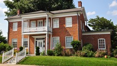 Bennett-Tobler-Pace-Oliver Houselisted 1985
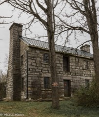 Abraham Byrd Houselisted 2007
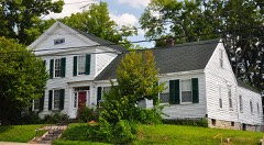 Frizel-Welling Houselisted 1999
 Jackson Uptown Commercial Historic Districtlisted 2006
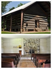 McKendree Chapellisted 1987
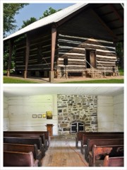 Mckendree Chapel (Boundary Increase)listed 2006
- Big Hill Farmstead Historic Districtlisted 1999
Population over time
2 figuresJackson grew from 13,758 to 15,481 between 2010 and 2020. These are the recorded population figures Wikidata holds for this place, reached through the Geographic Names Information System number this page is keyed on rather than by name, so they belong to this place and not to another of the same name. Most are census counts, but not all are: an early figure may be a founding or settlement estimate, and an estimate published within five years of a census is left out. The change column is computed, and is left blank where more than 20 years separate a figure from the one before it, because a gap that long is not a change between two counts.
| Year | People | Change |
|---|---|---|
| 2010 | 13,758 | |
| 2020 | 15,481 | +1,723 (+13%) |
Topographic sheets covering this place
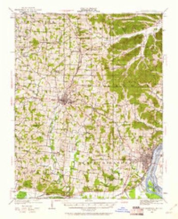
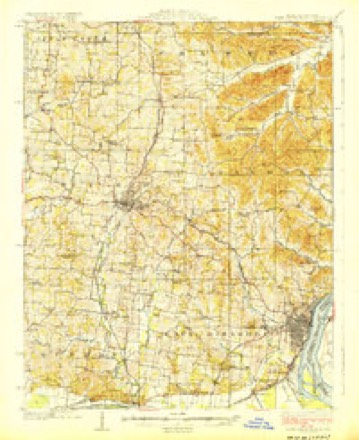
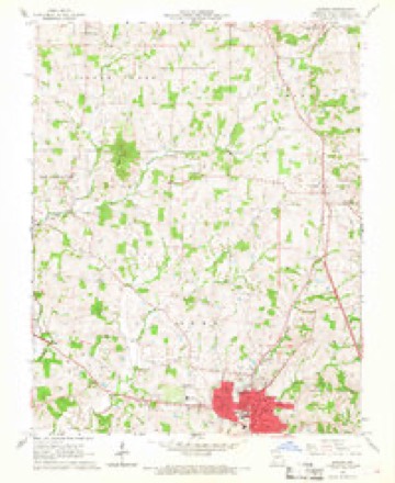
11 surveys from 19 printed sheetsMatched by testing this settlement's coordinate against the published boundary of every sheet in the United States Geological Survey's historical collection. Each opens the scanned sheet at the Survey.
- 1922 USGS Cape Girardeau quadrangle1:62500, 3 printings
- 1924 USGS Cape Girardeau quadrangle1:62500, 2 printings
- 1949 USGS Paducah quadrangle1:250000, 2 printings
- 1950 USGS Paducah quadrangle1:250000
- 1954 USGS Paducah quadrangle1:250000, 2 printings
- 1961 USGS Paducah quadrangle1:250000, 2 printings
- 1964 USGS Paducah quadrangle1:250000, 2 printings
- 1966 USGS Jackson quadrangle1:24000, 2 printings
- 1984 USGS Cape Girardeau quadrangle1:100000
- 1986 USGS Cape Girardeau quadrangle1:100000
- 1987 USGS Paducah quadrangle1:250000
Fires near this place
20 since 1995Regional context, not property-specific evidence. The federal wildfire occurrence database lists 20 fires within 5 miles of Jackson between 1995 and 2020, burning about 57 acres in total. None started naturally. None was recorded as arson. Distance is straight-line from the map coordinates, so a fire counted here may appear on a neighbouring settlement's page as well.
| Reported cause | Fires |
|---|---|
| Debris and open burning | 13 |
| Missing data/not specified/undetermined | 4 |
| Equipment and vehicle use | 2 |
| Recreation and ceremony | 1 |
The most recent of them, most recent first, with the day each was reported and the service that recorded it.
| Date | Cause | Size | Reported by | Name on the report |
|---|---|---|---|---|
| 27 September 1996 | Debris and open burning | 1.0 acres | Missouri Department of Conservation | not named |
| 27 September 1996 | Debris and open burning | 1.0 acres | Missouri Department of Conservation | not named |
| 27 September 1996 | Debris and open burning | 1.0 acres | Missouri Department of Conservation | not named |
| 27 September 1996 | Missing data/not specified/undetermined | 1.0 acres | Missouri Department of Conservation | not named |
| 27 September 1996 | Missing data/not specified/undetermined | 1.0 acres | Missouri Department of Conservation | not named |
| 16 September 2019 | Equipment and vehicle use | 1.1 acres | Missouri Department of Conservation | 179144-01617-09162019-1108 |
| 11 September 2020 | Debris and open burning | under an acre | Missouri Department of Conservation | 230867-01617-09112020-1605 |
| 2 June 2019 | Missing data/not specified/undetermined | under an acre | Missouri Department of Conservation | 179048-01617-06022019-0001 |
Settlements close enough to share some of these fires:
Mines and quarries near this place
10 of 15 shownRegional context, not property-specific evidence. The federal mineral resources record lists 15 workings within 5 miles of Jackson: 13 past producers, 2 producers. 2 still produce. What was taken out: Clay, Stone, Crushed/Broken, Sand and Gravel, Construction, Silica. Distance is straight-line from the map coordinates, so a quarry counted here may appear on a neighbouring settlement's page as well.
| Where | Site | Commodity | Status | Recorded |
|---|---|---|---|---|
| Silica Mine | Silica | Past Producer | ||
| Unknown S&G | Sand and Gravel, Construction | Past Producer | ||
| Kestarson Quarry | Stone, Crushed/Broken | Past Producer | ||
| Unknown Ls | Stone, Crushed/Broken | Past Producer | ||
| Unknown Ls | Stone, Crushed/Broken | Past Producer | ||
| Unknown Ls | Stone, Crushed/Broken | Past Producer | ||
| Unknown Ls | Stone, Crushed/Broken | Past Producer | ||
| Ceramo Clay Pit | Clay | Producer | ||
| English Clay Pits | Clay | Past Producer | ||
| Kasten Clay Products Pit & Plant | Clay | Producer |
Storms near this place
60 of 84 shownRegional context, not property-specific evidence. The National Weather Service names Jackson in 84 storm reports between 1994 and 2025: 27 thunderstorm wind, 24 hail, 14 flash flood, 4 lightning. The reports record 2 injuries. Each account below is quoted exactly as the forecast office filed it, from the NOAA Storm Events Database, and each date opens the federal record of that event.
| When | Event | Place named | Harm | What the report says |
|---|---|---|---|---|
| May 2003 | Tornado (F3) | Jackson | 2 hurt, $12,000,000 | The tornado touched down at the intersection of Highway 34 and Business Loop I-55 in Jackson, then moved northeast across downtown Jackson and the Bent Creek Golf Course. The damage path ended about 300 yards short of Interstate 55. Several trees blocked Interstate 55 near Jackson. Peak tornado winds were estimated near 180 MPH. The police and fire headquarters building was near the beginning of the damage path. The roof was blown off the building and windows were blown out, allowing rain to flood the building and cause extensive damage. The hazardous materials trailer and communications van were overturned. City police and fire operations were moved to alternate quarters. Streets were blocked by flipped cars and downed trees and power lines. Numerous large trees were snapped or uprooted. The roofs and some walls were torn off many buildings and homes, as well as a school in downtown Jackson. About 200 structures in Jackson received at least some degree of damage. Approximately 22 homes were destroyed, 43 received major damage, and 140 received minor damage. Of those, six were mobile homes and four were apartment buildings. Three businesses were destroyed, including a bakery. Four other businesses had major damage, including a storage company and a woodworking business. Two injured persons were treated and released from a local hospital. One family safely took shelter in their basement while baseball size hail battered the kitchen floor of their unroofed home, and a small sports car landed in their living room. Twenty gas leaks caused by the tornado were repaired within 6 hours. Power was restored to all but 30 homes within 48 hours. |
| January 2020 | Tornado (EF2) | Jackson | $750,000 | The tornado touched down just south of U.S. Highway 61, where trees and small outbuildings were damaged. The tornado crossed Highway 61 and produced damage to several businesses. Windows were broken out, and damage occurred to roofs. One business was destroyed. A tire store was heavily damaged as the tornado was at its peak intensity. The back was wall was blown out, and much of the roof was destroyed and thrown several hundred yards. Light concrete and styrofoam blew onto Interstate 55, which was closed for a brief time until cleanup was complete. East of Interstate 55, several barns and outbuildings were damaged or destroyed. Numerous trees were uprooted or snapped along the way. The path may have extended farther east of State Route 177 near the Mississippi River, but flooding prevented surveying. Peak winds were estimated near 125 mph near U.S. Highway 61. |
| June 2019 | Thunderstorm Wind | Jackson | $100,000 | Widespread damaging winds accompanied a line of thunderstorms across much of Cape Girardeau County. Numerous trees and tree limbs were blown down. Bricks were blown from an apartment building in Jackson, and heavy tree damage occurred in the area. In Allenville, multiple trees and tree limbs were down. Siding was peeled off. In Cape Girardeau, windows were blown out of a store and some cars, along with roof and shingle damage. Near Delta, significant shingle damage occurred at a house. |
| January 2013 | Tornado (EF1) | Jackson | $80,000 | This EF-1 tornado tracked south of Jackson. The average path width was 50 yards. Peak winds were estimated near 95 mph. Trees were blown down, shingles were blown off several roofs, including a church. Outbuildings were destroyed. Two barns were partially destroyed, with their second floors removed. Much of the damage was along County Road 316. |
| April 2015 | Tornado (EF0) | Jackson | $60,000 | Approximately a dozen homes lost shingles. Minor damage to gutters and fascia occurred. One home sustained a broken window impacted by a shingle. Several mainly small trees and tree limbs were down. Maximum winds were estimated near 85 mph. |
| June 2024 | Thunderstorm Wind | Jackson | $50,000 | Numerous trees and power lines were downed by thunderstorm winds in Jackson and Cape Girardeau. |
| April 2005 | Flash Flood | Jackson | $50,000 | Flash flooding of creeks and roads occurred as a result of a nearly stationary severe thunderstorm. In Jackson, Hubble Creek inundated numerous roads and most of the city park. Floodwaters swept debris onto tennis courts and overflowed a footbridge. On Main Street in the city, a vehicle became stranded in high water. The street was closed. Water was over U.S. Highway 61 between Jackson and Fruitland. A couple of intersections on Highway W were flooded. State roads 605, 603, and 601 in Fruitland were flooded. The preliminary rainfall total from the co-operative observer in Jackson was 2.20 inches, most of which fell within an hour. |
| May 1994 | Thunderstorm Wind | Jackson | $50,000 | High wind gusts damaged several mobile homes and highway signs. Reported by several local newspapers. |
| January 1996 | Thunderstorm Wind | Jackson | $50,000 | no account filed |
| May 1995 | Thunderstorm Wind | Jackson | $25,000 | no account filed |
| September 2019 | Flash Flood | Jackson | $20,000 | A pick up truck was swept 1/2 mile downstream on Hubble Creek from Downtown Park and became hung up on a bridge embankment. A man was then swept about 200 feet further downstream and grabbed onto some limbs. The vehicle sank, and the man refused medical treatment after being rescued by local law enforcement personnel. |
| July 2006 | Thunderstorm Wind | Jackson | $20,000 | Numerous trees were blown down, some of which fell on power lines. A tree fell at a residence, damaging the porch and a 27-foot travel trailer parked outside. |
| April 2024 | Thunderstorm Wind | Jackson | $15,000 | Downburst winds from a line of thunderstorms moving eastward brought multiple trees down onto powerlines. |
| March 2025 | Thunderstorm Wind | Jackson | $10,000 | A power pole was blown down across East Jackson Street in Jackson. |
| August 2025 | Thunderstorm Wind | Jackson | $10,000 | A few trees were downed between Jackson and Cape Girardeau, along with numerous tree branches. In rural areas short-lived visibility issues developed due to blowing dust. |
| June 2018 | Thunderstorm Wind | Jackson | $10,000 | Trees were blown down, causing several power outages. |
| August 2014 | Lightning | Jackson | $10,000 | Several trees and large branches were down due to numerous lightning strikes. |
| March 2012 | Hail | Jackson | $10,000 | Tennis ball size hail was reported. |
| July 2009 | Thunderstorm Wind | Jackson | $10,000 | Several trees were blown down, including a very large tree that took out a utility pole. Power was disrupted to 620 electric customers. |
| July 2005 | Flash Flood | Jackson | $10,000 | Flooding of Hubble Creek closed several streets and stranded several motorists. A couple of cars were caught in water on Main Street. Three other cars were trapped in flooding on U.S. Highway 61. One motorist was assisted by police. Water was over Jackson Boulevard. The flash flooding was due to thunderstorms with radar-estimated rainfall rates of nearly two inches per hour. |
| June 1997 | Flash Flood | Jackson | $10,000 | no account filed |
| November 2001 | Thunderstorm Wind | Jackson | $8,000 | Strong winds snapped eight utility poles on Highway 61. Signs and trees in the area were damaged. A police car was struck by wires falling from the downed poles. No injuries were reported. |
| July 2004 | Thunderstorm Wind | Jackson | $6,000 | About a mile north of Jackson, a barn sustained significant wind damage, with roofing debris blown across the property of a farm. A house on the farm received minor damage to its facade. A few trees were down in Millersville. A tree fell onto a car on Highway 61 in Jackson. |
| May 2017 | Thunderstorm Wind | Jackson | $5,000 | Large tree limbs and branches were blown down in Jackson. In the far eastern part of the county near Trail of Tears State Park, a large tree was blown across the road and large limbs were down. |
| July 2012 | Thunderstorm Wind | Jackson | $5,000 | Windows were blown out downtown. |
| April 2011 | Thunderstorm Wind | Jackson | $5,000 | Tree limbs were blown down in various places. |
| February 2011 | Lightning | Jackson | $5,000 | Lightning struck a large transformer, knocking out power to about three-quarters of the city. |
| May 2009 | Thunderstorm Wind | Jackson | $5,000 | There was roof damage to a single residence. A window in the front door was cracked. Debris was blown in all directions from the residence. |
| July 2008 | Lightning | Jackson | $5,000 | Multiple houses were struck by lightning. About one third of the residents in the city were without power due to lightning strikes. |
| June 2001 | Thunderstorm Wind | Jackson | $5,000 | Along Interstate 55 near Jackson, a parked semi-trailer was overturned by thunderstorm winds, and a billboard was damaged. The damage was reportedly near the 99-mile marker of the interstate. A carport was blown over in that general area. |
| January 1998 | Flood | Jackson | $5,000 | Heavy thunderstorms that moved across the region dumped over an inch of rain on parts of Cape Girardeau County. A few of the streets that were flooded in Cape Girardeau were North Main, Third, and Rand. Water was also observed running across some roads in the northern part of Cape Girardeau County and near Delta to the south. |
| May 1996 | Thunderstorm Wind | Jackson | $5,000 | no account filed |
| November 2005 | Thunderstorm Wind | Jackson | $4,000 | The roof of a new multi-purpose building at the high school in Jackson was slightly damaged. The roof of a store in downtown Jackson was peeled back. The store roof may have been weakened in the May 6, 2003 Jackson tornado. |
| May 2004 | Thunderstorm Wind | Jackson | $4,000 | A tree and a tree limb were blown down. The tree fell on a building. |
| June 2001 | Hail | Jackson | $4,000 | Golf ball size hail was reported along Interstate 55 near Jackson. Near the junction of Highway 61 and Interstate 55, carports were dented. |
| July 2015 | Thunderstorm Wind | Jackson | $3,000 | A large tree was blown across a road in the northeast part of the city of Cape Girardeau. In Jackson, a tree was blown down onto a house. |
| April 2003 | Lightning | Jackson | $2,000 | Lightning struck the power lines supplying the Jackson police and fire headquarters. The communications and computer capabilities of the public safety departments were negatively impacted. |
| April 2003 | Flash Flood | Jackson | $2,000 | no account filed |
| June 2018 | Thunderstorm Wind | Jackson | $1,000 | A large tree was down. |
| June 1994 | Thunderstorm Wind | Jackson | $500 | Trees and power lines were blown down in the Jackson and Gordonville areas. This storm later produced 0.75-inch diameter hail near the intersection of County Roads F and OO. |
| May 2025 | Thunderstorm Wind | Jackson | - | Multiple trees and branches were downed in Jackson with the strongest portion of the storm crossing the southeast side of town. |
| February 2024 | Hail | Jackson | - | Media relayed multiple reports of hail from a storm tracking southeastward through Cape Girardeau County. 1 inch hail was reported SW of Jackson and SSW of Cape Girardeau. |
| July 2024 | Flash Flood | Jackson | - | Several inches of water covered the right lane of US Hwy 61 in Jackson. Radar estimated rainfall of an inch in an hour occurred from 1345-1445CST. |
| July 2021 | Flood | Jackson | - | Minor flooding of streams and creeks occurred. A trained spotter measured 3.2 inches of rain in 90 minutes at the junction of U.S. Highway 61 and Y Highway. |
| May 2019 | Funnel Cloud | Jackson | - | A funnel cloud was seen from the northeast side of Jackson. |
| June 2019 | Hail | Jackson | - | Golf ball hail was reported on Interstate 55 at mile marker 102. |
| August 2016 | Flash Flood | Jackson | - | Hubble Creek was out of its banks and over at least one road in Jackson. A trained spotter in Jackson measured 4.5 inches of rain in about 4 hours in the morning. Additional heavy rain fell in the afternoon. A 24-hour total measurement of 7.60 inches was observed along the Mississippi River east of Jackson. |
| March 2015 | Hail | Jackson | - | Quarter-size hail was reported in the Jackson area. |
| December 2015 | Heavy Rain | Jackson | - | The storm-total rainfall since the 26th was 6.9 inches. Of that total, 1.9 inches fell during the past 14 hours. |
| August 2014 | Hail | Jackson | - | Hen-egg size hail was observed in the community. |
| June 2013 | Funnel Cloud | Jackson | - | A rotating funnel cloud and wall cloud moved south-southeast across central Cape Girardeau County, passing across the Jackson area. The funnel cloud was videotaped and photographed by at least a few people. Trained spotters and emergency management personnel did not observe any touchdowns. |
| January 2013 | Funnel Cloud | Jackson | - | A funnel cloud was reported near exit 99 along Interstate 55. |
| July 2012 | Hail | Jackson | - | The report was from just west of Jackson on Highway 72. The hail was mostly dime-size, but a few were walnut-size. |
| March 2012 | Hail | Jackson | - | Golf ball size hail and 50 mph wind was reported. |
| December 2009 | Flood | Jackson | - | To the north of State Highway UU, County Routes 351 and 350 were impassable due to flooding from the Whitewater River. |
| September 2009 | Flash Flood | Jackson | - | An emergency management official reported measuring 2.5 inches of rain in Jackson within a couple hours. Urban street flooding occurred, with one to two feet of water in downtown Jackson. In Cape Girardeau, minor street flooding was reported downtown, with noticeably worse flooding on the west side of the city. |
| April 2008 | Hail | Jackson | - | Nickel to walnut size hail covered the ground in Jackson. Penny size hail was reported between Jackson and Burfordville. |
| April 2008 | Flash Flood | Jackson | - | Water was over the roadway on U.S. Highway 61 on the northern edge of Jackson. The road was not closed. South of Delta, Highway P was closed due to two feet of water over it. Highway EE was closed between Delta and Chaffee. A spotter in Cape Girardeau reported one inch of rain in 45 minutes. |
| August 2008 | Heavy Rain | Jackson | - | Water was over the intersection of K Highway and U.S. Route 61. Other traffic problems were reported on some Cape Girardeau streets. A side street was covered with about 10 inches of water, but the street remained passable. In Cape Girardeau, a spotter measured 5.75 inches of rain in about 15 hours. Near Jackson, 2.82 inches of rain fell in six hours. The heavy rainfall was the result of showers and thunderstorms that trained over the county for several hours. |
| April 2007 | Dust Devil | Jackson | - | A dust devil was photographed at the junction of Highways 72 and 34. A number of small objects and debris were carried in the circulation. The dust devil moved from a parking lot across a barn yard, passing over a fence and close to the barn. It then went over a hill and out of sight. |
Nearest settlements
The eight closest, with where each one stands in the county. Distances are straight-line, computed from the Geographic Names Information System coordinates.
| Map | Place | Distance | Sheets |
|---|---|---|---|
| Fruitland | 4.8 miles | 19 | |
| Gordonville | 5.0 miles | 19 | |
| Tilsit | 5.4 miles | 19 | |
| Brookside | 5.5 miles | 19 | |
| Sawyer | 6.0 miles | 19 | |
| Leemon | 7.0 miles | 20 | |
| Houck | 7.1 miles | 19 | |
| Burfordville | 7.5 miles | 18 |
Elsewhere
Matched on this settlement's Geographic Names Information System number rather than its name, so it cannot be a different place of the same name in another state.
| Wikipedia article on Jackson | An encyclopaedic summary. Its text is share-alike, so it is linked here rather than copied. |
| Wikidata item Q959843 | The structured record the population and elevation above come from. Public domain (CC0). |
Provenance
This settlement is recorded in the Geographic Names Information System as feature 720202. The sheet list is computed by point-in-boundary test against the United States Geological Survey's historical topographic inventory. Both are works of the United States government and carry no copyright under 17 U.S.C. 105.
Wildfire. Short, Karen C. 2022. Spatial wildfire occurrence data for the United States, 1992-2020 [FPA_FOD_20221014]. 6th Edition. Fort Collins, CO: Forest Service Research Data Archive. https://doi.org/10.2737/RDS-2013-0009.6 Collected with United States Government funding and usable without additional permissions or fees.
Mines and quarries. USGS Mineral Resources Data System (MRDS) https://mrdata.usgs.gov/mrds/ A work of the United States government, no copyright under 17 U.S.C. 105.
Storms. NOAA National Centers for Environmental Information, Storm Events Database https://www.ncei.noaa.gov/stormevents/ A work of the United States government, no copyright under 17 U.S.C. 105. Narratives are quoted verbatim from the National Weather Service report and are not edited or summarised.