 Block
Cambridge, Missouri
15 topographic sheets cover this place, the earliest surveyed in 1890 and the latest in 1985. It stands in Cambridge Township. It lies in ZIP code area 65330. It stands on Bear Creek. The Survey maps it on the Cambridge quadrangle.
Topographic sheets covering this place
7 surveys from 15 printed sheetsMatched by testing this settlement's coordinate against the published boundary of every sheet in the United States Geological Survey's historical collection. Each opens the scanned sheet at the Survey.
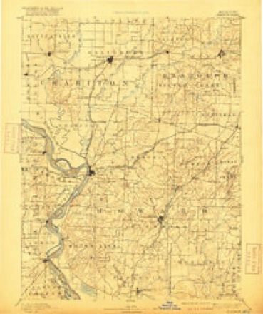
- 1890 USGS Glasgow quadrangle1:125000, 5 printings
- 1953 USGS Moberly quadrangle1:250000
- 1954 USGS Moberly quadrangle1:250000, 3 printings
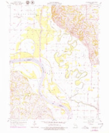
- 1956 USGS Cambridge quadrangle1:24000, 2 printings
- 1957 USGS Moberly quadrangle1:250000
- 1960 USGS Moberly quadrangle1:250000
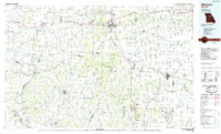
- 1985 USGS Moberly quadrangle1:100000, 2 printings




In the county-history sources
2,184 words on this townshipHistory of Saline County, Missouri, Carefully Written and Compiled from the Most Authentic Official and Private Sources ... with a Condensed History of Missouri; the State Constitution; a Military Record of Its Volunteers in Either Army of the Great Civil War ... Biographical Sketches of Prominent Men .., published 1881 names this settlement in its chapter on Cambridge Township. These are the passages that mention it, exactly as the scans read.
As has been stated, the town of Cambridge was at one time a place of considerable importance, but the building of the Chicago & Alton railroad, or rather its location, away from the town, and the building of Slater and Gilliam have greatly damaged its prosperity. Houses have been moved to Slater, and business men have followed them.
This church was originally at Old Jefferson, about three miles up the river from Cambridge. It was first organized in August, 1837. The first members were Robert and Mary Martyr, Winston and Frances Loving, Robert C. and America Land, Charlotte B. Land, John A. Hicks, Mary A. Wooldridge. The church was built in 1840 or 1841, and dedicated the same year by Rev. J. R. Bennett. It was a frame, and cost $700 or $800. The pastors of this church, until its removal to Cam- bridge, were George Bewley, B. R. Johnson, Hugh Dodds, W. P. Nichols, J. K. Lacy, and W. W. Jones. In 1854 a new house of worship was erected at Cambridge, being dedicated in the winter of 1854, by Rev. Mr. Mitchell. This also was a frame and cost about ^2,000. To this church the congregation removed and in it thereafter worshipped. The pastors have been Wm. Protsman, - Peterson, Wm. S. Brown, Wm. Compton, Geo. Savage, - Wharton, - Wallace, Gervis Smith, Luther Pulliam, McAllister, Berryman, Garden, A. M. Rader, Dr. Camp, Spencer Hogan, F. A. Taylor. Present membership, 150.
When the town was first laid out lumber was hauled from Arrow Rock, fifteen miles away, and from Cambridge, eight miles. There was a great scarcity of water. A good spring not far from town supplied many families and Mr. Baker furnished considerable.
Machine-read from a century-old scan, so expect the errors a machine makes: misspelled names, dropped words, stray characters.
Read the whole chapter on Cambridge Township - it names this place 1 more 1 time.
Fires near this place
4 since 1999Regional context, not property-specific evidence. The federal wildfire occurrence database lists 4 fires within 5 miles of Cambridge between 1999 and 2017, burning about 46 acres in total. None started naturally. None was recorded as arson. Distance is straight-line from the map coordinates, so a fire counted here may appear on a neighbouring settlement's page as well.
| Reported cause | Fires |
|---|---|
| Debris and open burning | 2 |
| Equipment and vehicle use | 1 |
| Smoking | 1 |
The most recent of them, most recent first, with the day each was reported and the service that recorded it.
| Date | Cause | Size | Reported by | Name on the report |
|---|---|---|---|---|
| 4 March 1999 | Smoking | 3.0 acres | Missouri Department of Conservation | not named |
| 16 March 1999 | Debris and open burning | 30 acres | Missouri Department of Conservation | not named |
| 25 November 2017 | Debris and open burning | 1.0 acres | Missouri Department of Conservation | not named |
| 14 November 1999 | Equipment and vehicle use | 12 acres | Missouri Department of Conservation | not named |
Settlements close enough to share some of these fires:
Mines and quarries near this place
10 of 13 shownRegional context, not property-specific evidence. The federal mineral resources record lists 13 workings within 5 miles of Cambridge: 12 past producers, 1 producer. 1 still produces. What was taken out: Stone, Crushed/Broken, Sand and Gravel, Construction, Stone, Crushed/Broken, Sand and Gravel, Construction. Distance is straight-line from the map coordinates, so a quarry counted here may appear on a neighbouring settlement's page as well.
| Where | Site | Commodity | Status | Recorded |
|---|---|---|---|---|
| Unknown - Ls-S+G | Stone, Crushed/Broken, Sand and Gravel, Construction | Past Producer | ||
| Gilliam Rock Quarry and Mill | Stone, Crushed/Broken | Producer | ||
| Unknown - Ls | Stone, Crushed/Broken | Past Producer | ||
| Unknown - Ls | Stone, Crushed/Broken | Past Producer | ||
| Unknown - Ls | Stone, Crushed/Broken | Past Producer | ||
| Unknown - Ls | Stone, Crushed/Broken | Past Producer | ||
| Unknown - Ls | Stone, Crushed/Broken | Past Producer | ||
| Unknown - S+G | Sand and Gravel, Construction | Past Producer | ||
| Unknown - S+G | Sand and Gravel, Construction | Past Producer | ||
| Unknown - S+G | Sand and Gravel, Construction | Past Producer |
Storms near this place
1 since 2007Regional context, not property-specific evidence. The National Weather Service names Cambridge in 1 storm report in 2007: 1 flood. No death or injury is recorded in these reports. Each account below is quoted exactly as the forecast office filed it, from the NOAA Storm Events Database, and each date opens the federal record of that event.
| When | Event | Place named | Harm | What the report says |
|---|---|---|---|---|
| May 2007 | Flood | Cambridge | - | The Missouri River at Glasgow crested at 34.25 feet, or 9.25 feet above flood stage. |
Nearest settlements
The eight closest, with where each one stands in the county. Distances are straight-line, computed from the Geographic Names Information System coordinates.
| Map | Place | Distance | Sheets |
|---|---|---|---|
| Gilliam | 3.4 miles | 18 | |
| New Frankfort | 4.5 miles | 16 | |
| West Glasgow | 4.8 miles | 16 | |
| Slater | 6.9 miles | 18 | |
| Saline City | 8.1 miles | 16 | |
| Orearville | 8.9 miles | 18 | |
| Sharon | 10.2 miles | 16 | |
| Norton | 10.7 miles | 19 |
Provenance
This settlement is recorded in the Geographic Names Information System as feature 715226. The sheet list is computed by point-in-boundary test against the United States Geological Survey's historical topographic inventory. Both are works of the United States government and carry no copyright under 17 U.S.C. 105.
Wildfire. Short, Karen C. 2022. Spatial wildfire occurrence data for the United States, 1992-2020 [FPA_FOD_20221014]. 6th Edition. Fort Collins, CO: Forest Service Research Data Archive. https://doi.org/10.2737/RDS-2013-0009.6 Collected with United States Government funding and usable without additional permissions or fees.
Mines and quarries. USGS Mineral Resources Data System (MRDS) https://mrdata.usgs.gov/mrds/ A work of the United States government, no copyright under 17 U.S.C. 105.
Storms. NOAA National Centers for Environmental Information, Storm Events Database https://www.ncei.noaa.gov/stormevents/ A work of the United States government, no copyright under 17 U.S.C. 105. Narratives are quoted verbatim from the National Weather Service report and are not edited or summarised.