 Block
Columbia, Missouri
29 topographic sheets cover this place, the earliest surveyed in 1886 and the latest in 1982. It stands in Missouri Township. It lies in ZIP code area 65201. It stands on Goose Creek. The Survey maps it on the Columbia quadrangle. 126,254 people lived here at the 2020 count. It stands 758 feet above sea level.
Research this city
On record in Columbia
Buildings and businesses the archive holds for this place. Each opens its own page, with the source record it came from.
On the National Register 12 of 42 shown
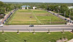 Sanborn Field and Soil Erosion PlotsNational Historic Landmark · listed 1966
 Ballenger Buildinglisted 2004
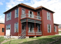 John W. Boone Houselisted 1980
 Central Dairy Buildinglisted 2005
 Coca-Cola Bottling Company Buildinglisted 2006
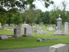 Columbia Cemeterylisted 2007
 Columbia National Guard Armorylisted 1993
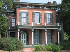 Sanford F. Conley Houselisted 1973
 Fred Douglass Schoollisted 1980
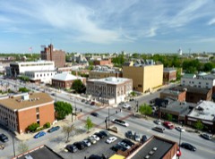 Downtown Columbia Historic Districtlisted 2006
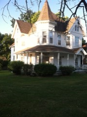 East Campus Neighborhood Historic Districtlisted 1996
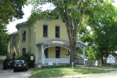 Samuel H. and Isabel Smith Elkins Houselisted 1996
Population over time
3 figuresColumbia grew from 130 to 126,254 between 1823 and 2020. These are the recorded population figures Wikidata holds for this place, reached through the Geographic Names Information System number this page is keyed on rather than by name, so they belong to this place and not to another of the same name. Most are census counts, but not all are: an early figure may be a founding or settlement estimate, and an estimate published within five years of a census is left out. The change column is computed, and is left blank where more than 20 years separate a figure from the one before it, because a gap that long is not a change between two counts.
| Year | People | Change |
|---|---|---|
| 1823 | 130 | |
| 2010 | 108,500 | |
| 2020 | 126,254 | +17,754 (+16%) |
Topographic sheets covering this place
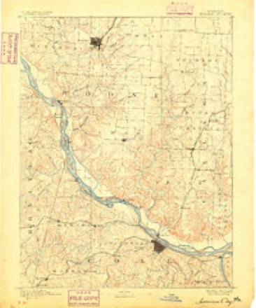
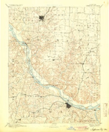
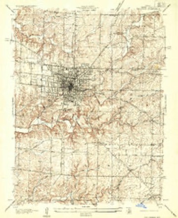
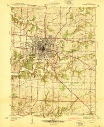
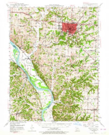
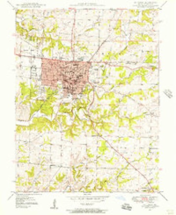
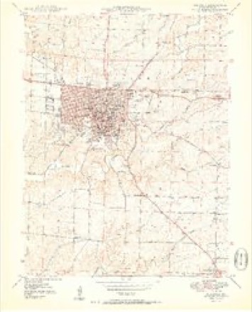
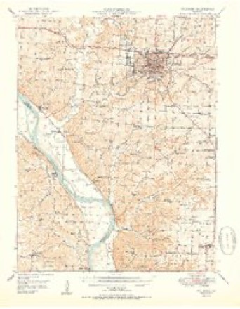
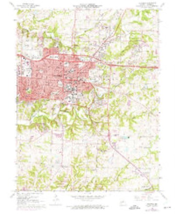
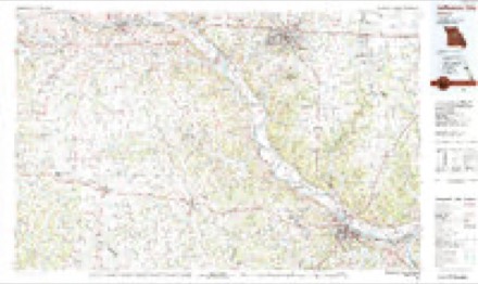
15 surveys from 29 printed sheetsMatched by testing this settlement's coordinate against the published boundary of every sheet in the United States Geological Survey's historical collection. Each opens the scanned sheet at the Survey.
- 1886 USGS Jefferson City quadrangle1:125000
- 1894 USGS Jefferson City quadrangle1:125000, 4 printings
- 1935 USGS Columbia quadrangle1:24000
- 1940 USGS Columbia quadrangle1:24000
- 1947 USGS Jefferson City quadrangle1:250000
- 1948 USGS Columbia quadrangle1:62500, 2 printings
- 1948 USGS Columbia quadrangle1:24000, 2 printings
- 1950 USGS Columbia quadrangle1:24000, 2 printings
- 1950 USGS Columbia quadrangle1:62500, 2 printings
- 1954 USGS Jefferson City quadrangle1:250000, 2 printings
- 1955 USGS Jefferson City quadrangle1:250000, 4 printings
- 1958 USGS Jefferson City quadrangle1:250000
- 1959 USGS Jefferson City quadrangle1:250000
- 1967 USGS Columbia quadrangle1:24000, 4 printings
- 1982 USGS Jefferson City quadrangle1:100000





What happened here
An account from the chapter on Missouri township. The inset identifies its exact source book and publication year.
Cholera In Rocheport
In 1849 cholera again visited Rocheport. Several cases occurred. Alexander Graver,^ the driver of the stage from Rocheport to Columbia, came near being buried alive. He was attacked with cholera and to all appearances died. His coffin had been prepared and full prep- aratioiis made for his burial, when a Dr.
In the county-history sources
37,381 words on this townshipHistory of Boone County, Missouri. Written and Comp. from the Most Authentic Official and Private Sources; Including a History of Its Townships, Towns, and Villages. Together with a Condensed History of Missouri; the City of St. Louis ... Biographical Sketches and Portraits of Prominent Citizens .., published 1882 names this settlement in its chapter on Missouri Township. These are the passages that mention it, exactly as the scans read.
The first post-office in the township (and probably the first in the oounty) was established at Thrall's prairie in 1819,^ and named Lexington. Probably Oliver Parker was the first postmaster, although this distinction is claimed by Mr. Lientz for Dr. Geo. B. Wilcox. Others assert that Parker was the first and Wilcox the second. In 1828 this post-office was removed to the house of Wm. Lientz. The name was changed by Col. Thos. H. Benton from Lexington to Booneton. Mr. Lientz was appointed postmaster. In 1832 the office was removed to Rocheport. When first established the mail was brought to Lexington from St. Charles on horseback. Mr. Lientz lived on the old Columbia and Franklin road.
The- first road through the township was the old St. Charles road, running from St. Charles to Old Franklin, in Howard county. It was known for years as the St. Charles and Franklin road. The road was much travelled at an early day, it being the principal thoroughfare leading from St. Louis and St. Charles to the Upper Missouri country. In 1830^ the first public conveyances, a line of stage coaches, were put upon this road, it is said, by George Sexton, Esq. The line ran from St. Louis to Old Franklin. Mr. Sexton also estab- lished the first stage line from Rocheport to Fayette. Prior to theestablishment of Sexton's stao-e line the mails were carried on horseback. In Angust, 1821, the county court established a road " to run from Columbia to intersect the St. Charles road at or near Augustus Thrall's field." John Gray was appointed the commissioner to lay out this road.
Mr. Denham lived four miles east of Rocheport, on his farm. He was a well-to-do citizen and owned a number of slaves. At the outbreak of the war he went to Boonville as a member of the Missouri State Guard, but returned home in a few days and took no further active or open part in the strife. In the fall of 1864 he had collected some guns and ammunition which he had hidden in a vacant house on his premises, and which, it was charged, were intended for use by the bushwhackers. Mr. Denham's negroes informed the Federals on their master, and a squad was sent out from Columbia to arrest him. Mr. Denham was arrested, his premises searched, the guns and ammunition found, and then the party started away. A Mr. Boggs, who accompanied the Federals as a guide, and who now resides in Terrapin Neck, states that Denham was well mounted, and not long after the party had started, and while near Walnut Grove church, he put spurs to his horse and tried to escape. The Federals gave chase and fired on him and killed him. It was charged that the Federals induced Mr. D. to try to escape in order that they might have an excuse for shooting him. The body was buried in Walnut Grove Cemetery. The Federals who did the shooting are believed to have belonged to the 42d Mo. Infantry, a detachment of which regiment was stationed at Columbia at the time commanded by Lt. Col. Stauber.
Machine-read from a century-old scan, so expect the errors a machine makes: misspelled names, dropped words, stray characters.
Read the whole chapter on Missouri Township - it names this place 59 more 59 times.
Fires near this place
1 since 2005Regional context, not property-specific evidence. The federal wildfire occurrence database lists 1 fire within 5 miles of Columbia in 2005, burning under an acre in total. None started naturally. None was recorded as arson. Distance is straight-line from the map coordinates, so a fire counted here may appear on a neighbouring settlement's page as well.
| Reported cause | Fires |
|---|---|
| Smoking | 1 |
The most recent of them, most recent first, with the day each was reported and the service that recorded it.
| Date | Cause | Size | Reported by | Name on the report |
|---|---|---|---|---|
| 13 March 2005 | Smoking | under an acre | Missouri State Fire Marshal's Office | not named |
Settlements close enough to share some of these fires:
Mines and quarries near this place
10 of 21 shownRegional context, not property-specific evidence. The federal mineral resources record lists 21 workings within 5 miles of Columbia: 16 past producers, 4 producers, 1 unknown. 4 still produce. What was taken out: Stone, Crushed/Broken, Fire Clay (Refractory), Clay. Distance is straight-line from the map coordinates, so a quarry counted here may appear on a neighbouring settlement's page as well.
| Where | Site | Commodity | Status | Recorded |
|---|---|---|---|---|
| Columbia Brick & Tile Clay Pit-Plnt | Clay | Producer | ||
| Unknown - Clay | Fire Clay (Refractory) | Unknown | ||
| Unknown - Clay | Fire Clay (Refractory) | Past Producer | ||
| Unknown - Clay | Fire Clay (Refractory) | Past Producer | ||
| Unknown - Clay | Fire Clay (Refractory) | Past Producer | ||
| Boone Quarry | Stone, Crushed/Broken | Producer | ||
| Boone Quarry - Plant | Stone, Crushed/Broken | Producer | ||
| City Quarry and Plant | Stone, Crushed/Broken | Producer | ||
| Garrett City Quarry | Stone, Crushed/Broken | Past Producer | ||
| Nichols Bros. Ls. Quarry | Stone, Crushed/Broken | Past Producer |
Storms near this place
60 of 209 shownRegional context, not property-specific evidence. The National Weather Service names Columbia in 209 storm reports between 1994 and 2026: 125 hail, 64 thunderstorm wind, 9 lightning, 7 flash flood. The reports record 19 injuries. Each account below is quoted exactly as the forecast office filed it, from the NOAA Storm Events Database, and each date opens the federal record of that event.
| When | Event | Place named | Harm | What the report says |
|---|---|---|---|---|
| November 1998 | Tornado (F3) | Columbia | 16 hurt, $6,000,000 | no account filed |
| July 2011 | Lightning | Columbia | 1 hurt | Lightning struck a cell phone that a 39 year old woman was using at Cosmo Park on the northside of Columbia. She was taken to a local hospital to be checked out. She only had some initial numbness in her arm. She was treated and released the next morning. |
| May 2002 | Thunderstorm Wind | Columbia | 1 hurt | Boone County Emergency Management reported that thunderstorm wind gusts caused damage on the north side of Columbia at a RV park and at the County Fairgrounds. A large county-owned airplane hanger that had been converted to storage space and another storage building were destroyed. Two campers at the Cottonwood RV Park were blow over by the wind. One woman received a minor cut on her foot. |
| July 1999 | Thunderstorm Wind | Columbia | 1 hurt | no account filed |
| July 2007 | Lightning | Columbia | $150,000 | A lighting strike around 3:00 pm CDT caused a fire at the Creative Photo Photography Studio at 2201 Old Highway 63. Five employees and a dog were able to escape unharmed. The fire is believed to have started in the attic. Damage was estimated at $150,000. |
| May 2008 | Lightning | Columbia | $100,000 | Lighting struck a house on May 30. This strike apparently caused a smoldering fire that erupted the next day. The fire caused an estimated $100,000 in damage. |
| July 1998 | Lightning | Columbia | $80,000 | no account filed |
| July 2002 | Thunderstorm Wind | Columbia | $50,000 | no account filed |
| May 1996 | Thunderstorm Wind | Columbia | $50,000 | no account filed |
| May 2007 | Flash Flood | Columbia | $45,000 | Heavy rain from several strong to severe thunderstorms caused flash flooding in the Columbia area. Akeman Bridge and Brown School Road were reported flooded. Several roads in a subdivision off of Oakland Road were flooded with up to 2 feet of water. Several cars in Columbia were stranded in flooded roads. Firefighters was called to rescue stranded motorists on East Texas Avenue and Blackfoot Road. |
| June 2005 | Lightning | Columbia | $30,000 | An early morning lighting strike started a fire at a home on Glenn Wesley Court resulting in at least $30,000 in damage. |
| August 2006 | Lightning | Columbia | $25,000 | Five radio stations were knocked off the air when lighting struck a Cumulus Broadcasting transmitter tower. Control boards in the studios, computers, and magnetic door locks in the building were also damaged by the strike. |
| August 2004 | Lightning | Columbia | $15,000 | Lightning struck a home on Richland Road and caused a fire in the second floor. Damage was estimated from 10 to 15 thousand dollars. |
| May 2024 | Thunderstorm Wind | Columbia | $5,000 | Thunderstorm winds downed a large tree which pulled live power lines on a home in Columbia. |
| June 1994 | Hail | Columbia | $5,000 | County officials reported large hail with one report of golf ball size hail from a police officer. The hail lasted for 10 minutes. |
| June 1994 | Thunderstorm Wind | Columbia | $5,000 | Strong winds shattered several windows at Boone Hospital Center. |
| June 1994 | Thunderstorm Wind | Columbia | $5,000 | The NWS office at the Columbia Regional Airport recorded a wind gust of 78 mph. Large trees were blown down damaging two houses. Trees were also blown down across Backbone Road and Eagle Ridge Road. |
| April 1994 | Hail | Columbia | $5,000 | no account filed |
| April 1995 | Hail | Columbia | $2,000 | Hail started out around dime-size but increased to one-inch diameter at 2049 CST and then reached golf ball-size damaging numerous cars. Hail was reported until 2100 CST decreasing to one-inch in diameter east of Columbia. |
| March 1998 | Thunderstorm Wind | Columbia | $2,000 | no account filed |
| June 1995 | Thunderstorm Wind | Columbia | $1,500 | Wind gusts reached 60 mph and broke several power poles near and north of Interstate 70. More than 5,000 people were without power for nearly six hours. Large trees were also toppled. |
| July 1995 | Thunderstorm Wind | Columbia | $1,400 | Siding was blown off a home in Columbia with numerous large trees down across west and southern sections of the city. In the Ashland area, a roof of a small shed was blown off and several large trees were blown down. |
| May 1995 | Thunderstorm Wind | Columbia | $600 | A barn was demolished in the Rocheport area with debris spread out 200 yards wide. Several large trees, approaching three feet in diameter, were also snapped off from near Rocheport to west of Columbia. Reported by the Columbia Emergency Operations Center. |
| April 2025 | Thunderstorm Wind | Columbia | - | Thunderstorm winds caused tree damage of varying degrees from downed limbs to uprooted trees. |
| April 2025 | Thunderstorm Wind | Columbia | - | Thunderstorm winds caused roof damage to the Parkade Baptist Church in Columbia. |
| April 2025 | Thunderstorm Wind | Columbia | - | A member of the public reported wind gusts estimated to be 65 mph. |
| March 2023 | Hail | Columbia | - | Two severe storms moved through the Columbia metro area dropping large hail up to two inches in diameter over a 25 minute period. Numerous vehicles sustained dents as well as broken windows. Also, numerous homes and businesses had minor to moderate siding damage. |
| June 2021 | Thunderstorm Wind | Columbia | - | Thunderstorm winds blew down numerous power lines, tree limbs and trees through out town. A large tree was blown down at the intersection of Washington Avenue and Dysart Street. On the northeast side of town a tree was blown down onto a mobile home causing considerable damage. No injuries were reported. |
| June 2019 | Thunderstorm Wind | Columbia | - | Thunderstorm winds blew down a 6 inch diameter tree on the south side of Columbia onto a nearby roadway. |
| March 2017 | Thunderstorm Wind | Columbia | - | Thunderstorm winds blew off portions of a roof on a strip mall at the intersection of Providence Road and Vandiver Drive. |
| June 2017 | Thunderstorm Wind | Columbia | - | Thunderstorm winds blew down a large tree in Columbia. |
| August 2017 | Thunderstorm Wind | Columbia | - | Thunderstorm winds blew down a tree onto a house on the southeast side of town. It caused moderate roof damage. |
| July 2016 | Thunderstorm Wind | Columbia | - | Thunderstorm winds blew down numerous trees, tree limbs and power lines throughout town. |
| July 2015 | Thunderstorm Wind | Columbia | - | Thunderstorm winds broke a couple of skylights on a business on the south side of Columbia. The store had water problems due to the broken skylights. |
| July 2014 | Thunderstorm Wind | Columbia | - | A line of severe thunderstorms moved through Columbia and tracked southeast through rest of county. A 67 mph wind gust was measured at University of Missouri Jefferson Farm and Gardens just southeast of town on East New Haven Road. Also, the ASOS at Columbia Regional Airport measured a 58 mph wind gust. Numerous trees, power lines and tree limbs were blown down, especially on the southern sections of Columbia. A couple of the fallen trees blocked roads in the area. |
| June 2014 | Thunderstorm Wind | Columbia | - | Thunderstorm winds blew down several trees and numerous tree limbs around Columbia. Also, two miles south of Ashland part of the roof of a barn was blown off. |
| March 2014 | Thunderstorm Wind | Columbia | - | Thunderstorm winds blew down several large trees around town. |
| April 2013 | Hail | Columbia | - | Large hail fell across Columbia with the largest stones as big as baseballs. |
| May 2013 | Hail | Columbia | - | Large hail fell in a swath from the northeast side of Columbia to Murry. Some of the large hail caused minor damage to a few vehicles. |
| March 2012 | Hail | Columbia | - | There were several reports of one inch hail on the north side of Columbia. |
| June 2012 | Thunderstorm Wind | Columbia | - | Thunderstorm winds caused isolated damage on the west side of Columbia. A large tree fell onto a house causing roof damage. Also, a retractable awning on a nearby house was snapped in half. |
| September 2012 | Hail | Columbia | - | A swath of large hail fell across the northern portions of Columbia, along Interstate 70. The biggest hailstones were baseball size. |
| June 2011 | Thunderstorm Wind | Columbia | - | Thunderstorm winds blew down several trees on the west side of town. |
| June 2011 | Thunderstorm Wind | Columbia | - | Thunderstorm wind blew down two trees onto a house, causing moderate damage. |
| April 2011 | Thunderstorm Wind | Columbia | - | Thunderstorm winds blew down several trees on the southwest side of town. Some fell onto power lines knocking them down. |
| May 2010 | Hail | Columbia | - | A swath of large hail fell across Columbia ranging in size from an inch to one and three quarters of an inch in diameter. |
| July 2010 | Thunderstorm Wind | Columbia | - | Thunderstorm winds blew down some power lines on the north side of town and an agricultural weather station southeast of town measured a 58 MPH wind gust. |
| January 2008 | Hail | Columbia | - | Nickel to quarter size hail reported over several locations in town...including at the intersection of College Avenue and Business Loop 70 and on the University of Missouri campus. |
| May 2008 | Hail | Columbia | - | Storm spotters reported nickel size hail just south of Columbia. |
| May 2007 | Thunderstorm Wind | Columbia | - | A large tree was reported down on Morning Glory Drive. |
| August 2007 | Thunderstorm Wind | Columbia | - | Numerous tree limbs and power lines were blown down throughout town. One car sustained major damage when the thunderstorm winds split a y-shaped tree and it fell onto a telephone line. This pulled down the telephone pole and it landed on the vehicle. |
| June 2006 | Hail | Columbia | - | One inch hail was reported at Smiley Road just north of I-70. |
| June 2006 | Hail | Columbia | - | Large hail fell for 15 minutes in and around the city of Columbia. |
| April 2005 | Hail | Columbia | - | The Columbia EOC reported 3/4 inch hail in Columbia. |
| April 2005 | Thunderstorm Wind | Columbia | - | Boone County EMA reported 2-5 inch tree limbs and power lines down near the University of Missouri campus. |
| May 2005 | Flash Flood | Columbia | - | Heavy rain from several severe thunderstorms caused flash flooding in Columbia. I-70 had to be closed on the west side of town due to a foot of water over the road. Several streets in town became impassable due to high water. A section of Brown School Road was washed out by flood water. |
| May 2005 | Hail | Columbia | - | Storm spotters reported golfball size hail south of Columbia. |
| May 2005 | Hail | Columbia | - | Local law enforcement reported 1 inch hail. |
| May 2005 | Hail | Columbia | - | A storm spotter reported 3/4 inch hail. |
| May 2005 | Hail | Columbia | - | Emergency management officials reported 3/4 inch hail. |
Nearest settlements
The eight closest, with where each one stands in the county. Distances are straight-line, computed from the Geographic Names Information System coordinates.
| Map | Place | Distance | Sheets |
|---|---|---|---|
| Smithton (historical) | 0.2 miles | 29 | |
| Moores Switch | 1.6 miles | 29 | |
| Turner | 4.2 miles | 22 | |
| Prathersville | 4.6 miles | 19 | |
| Switzler | 5.1 miles | 19 | |
| Harg | 5.7 miles | 22 | |
| Pierpont | 6.3 miles | 21 | |
| Stephens | 6.4 miles | 19 |
Elsewhere
Matched on this settlement's Geographic Names Information System number rather than its name, so it cannot be a different place of the same name in another state.
| Wikipedia article on Columbia | An encyclopaedic summary. Its text is share-alike, so it is linked here rather than copied. |
| Wikidata item Q59670 | The structured record the population and elevation above come from. Public domain (CC0). |
Provenance
This settlement is recorded in the Geographic Names Information System as feature 716133. The sheet list is computed by point-in-boundary test against the United States Geological Survey's historical topographic inventory. Both are works of the United States government and carry no copyright under 17 U.S.C. 105.
Wildfire. Short, Karen C. 2022. Spatial wildfire occurrence data for the United States, 1992-2020 [FPA_FOD_20221014]. 6th Edition. Fort Collins, CO: Forest Service Research Data Archive. https://doi.org/10.2737/RDS-2013-0009.6 Collected with United States Government funding and usable without additional permissions or fees.
Mines and quarries. USGS Mineral Resources Data System (MRDS) https://mrdata.usgs.gov/mrds/ A work of the United States government, no copyright under 17 U.S.C. 105.
Storms. NOAA National Centers for Environmental Information, Storm Events Database https://www.ncei.noaa.gov/stormevents/ A work of the United States government, no copyright under 17 U.S.C. 105. Narratives are quoted verbatim from the National Weather Service report and are not edited or summarised.