 Block
Hickory Creek, Missouri
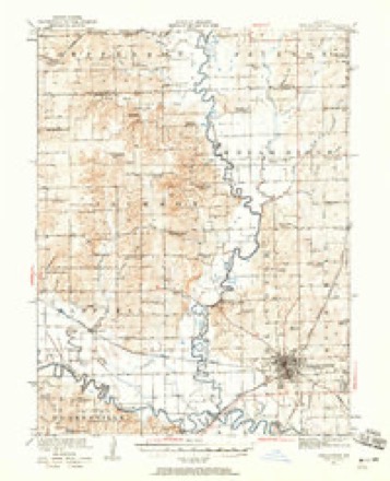
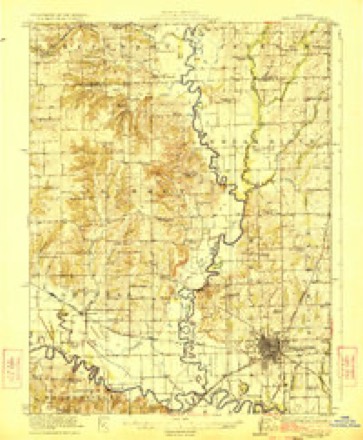
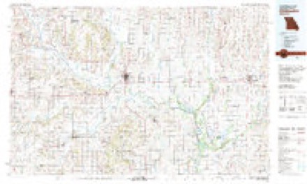
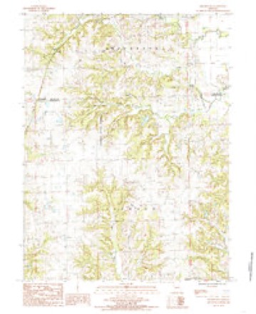
12 topographic sheets cover this place, the earliest surveyed in 1921 and the latest in 1984. It stands in Jefferson Township. It lies in ZIP code area 64683. The Survey maps it on the Shearwood quadrangle.
Topographic sheets covering this place
8 surveys from 12 printed sheetsMatched by testing this settlement's coordinate against the published boundary of every sheet in the United States Geological Survey's historical collection. Each opens the scanned sheet at the Survey.
- 1921 USGS Chillicothe quadrangle1:62500, 2 printings
- 1923 USGS Chillicothe quadrangle1:62500, 2 printings
- 1953 USGS Moberly quadrangle1:250000
- 1954 USGS Moberly quadrangle1:250000, 3 printings
- 1957 USGS Moberly quadrangle1:250000
- 1960 USGS Moberly quadrangle1:250000
- 1981 USGS Chillicothe quadrangle1:100000
- 1984 USGS Shearwood quadrangle1:24000




In the county-history sources
5,415 words on this townshipThe History of Grundy County, Missouri : an Encyclopedia of Useful Information, and a Compendium of Actual Facts. It Contains a Condensed History of the State of Missouri and Its Chief Cities ... ; Its Pioneer Record, War History, Resources, Biographical Sketches, published 1881 names this settlement in its chapter on Jefferson Township. These are the passages that mention it, exactly as the scans read.
The present boundary lines of Jefferson township are Madison township on the north. Grand River separating it from Jackson on the east, Livingston county on the south, and Daviess county on tlie w^est. It is the fourth township in the county in regard to population, having within its limits, according to the census of 1880, one thousand, one hundred and eighty-nine inhabitants, or a net gain of three hundred and fifteen in ten years. The township is watered by the Grand River on its eastern border, and Hickory Creek which traverses the township diagonally from the northwest corner, to the Grand River.
Passage source: The History of Grundy County, Missouri : an Encyclopedia of Useful Information, and a Compendium of Actual Facts. It Contains a Condensed History of the State of Missouri and Its Chief Cities ... ; Its Pioneer Record, War History, Resources, Biographical Sketches, published 1881.
Station agent of the Chicago, Rock Island & Pacific Railway, at Hickory Creek. The subject of this sketch was born in Livingston county", Missouri, May 23, 1855. When he was about four years of age his parents moved to Grundy county, and here he was reared and educated. In the fall of 1874, he went to Arkansas where he remained two years, then went to Texas, remaining until 1881, wlien he returned to Grundy county and accepted the poistion he now holds, and which he has filled acceptably.
Passage source: The History of Grundy County, Missouri : an Encyclopedia of Useful Information, and a Compendium of Actual Facts. It Contains a Condensed History of the State of Missouri and Its Chief Cities ... ; Its Pioneer Record, War History, Resources, Biographical Sketches, published 1881.
Was born January 1, 1856, in Sheridan county, Missouri. His parents moved to Grundy county when he was about fifteen years old, and he has been a resident of the county since that time. He has followed mercantile pursuits in connection with stock dealing and farming. In 1881 he was appointed postmaster of Hickory Creek, which office he now holds. Mr. Whorton has been twice married; first to Miss S. A. Neft', of Grundy county, by whom he had three children: Thomas, Jerry, and Eddie. Mrs. Whorton died September 22, 1873. January 22, 1876, he married Miss B. E. Bratton, of the same county. By this union they have three children; viz., Henry C, Wetzal and Glancy.
Passage source: The History of Grundy County, Missouri : an Encyclopedia of Useful Information, and a Compendium of Actual Facts. It Contains a Condensed History of the State of Missouri and Its Chief Cities ... ; Its Pioneer Record, War History, Resources, Biographical Sketches, published 1881.
Machine-read from a century-old scan, so expect the errors a machine makes: misspelled names, dropped words, stray characters.
Fires near this place
1 since 1992Regional context, not property-specific evidence. The federal wildfire occurrence database lists 1 fire within 5 miles of Hickory Creek in 1992, burning about 5 acres in total. None started naturally. None was recorded as arson. Distance is straight-line from the map coordinates, so a fire counted here may appear on a neighbouring settlement's page as well.
| Reported cause | Fires |
|---|---|
| Smoking | 1 |
The most recent of them, most recent first, with the day each was reported and the service that recorded it.
| Date | Cause | Size | Reported by | Name on the report |
|---|---|---|---|---|
| 19 January 1992 | Smoking | 5.0 acres | Missouri Department of Conservation | not named |
Mines and quarries near this place
10 of 12 shownRegional context, not property-specific evidence. The federal mineral resources record lists 12 workings within 5 miles of Hickory Creek: 12 past producers. None of them still produces. What was taken out: Stone, Crushed/Broken, Sand and Gravel, Construction, Zinc, Silver, Copper. Distance is straight-line from the map coordinates, so a quarry counted here may appear on a neighbouring settlement's page as well.
| Where | Site | Commodity | Status | Recorded |
|---|---|---|---|---|
| Jefferson Twp Quarry | Stone, Crushed/Broken, Zinc, Silver, Copper | Past Producer | ||
| Unk | Sand and Gravel, Construction | Past Producer | ||
| Unk | Sand and Gravel, Construction | Past Producer | ||
| Unk | Sand and Gravel, Construction | Past Producer | ||
| Unk | Sand and Gravel, Construction | Past Producer | ||
| Unk | Sand and Gravel, Construction | Past Producer | ||
| Cole Quarry | Stone, Crushed/Broken | Past Producer | ||
| Jackson Twp Quarry | Stone, Crushed/Broken | Past Producer | ||
| Jefferson Twp Quarry | Stone, Crushed/Broken | Past Producer | ||
| Unk | Stone, Crushed/Broken | Past Producer |
Storms near this place
13 since 2002Regional context, not property-specific evidence. The National Weather Service names Hickory Creek in 13 storm reports between 2002 and 2023: 4 thunderstorm wind, 4 hail, 3 flood, 2 flash flood. No death or injury is recorded in these reports. Each account below is quoted exactly as the forecast office filed it, from the NOAA Storm Events Database, and each date opens the federal record of that event.
| When | Event | Place named | Harm | What the report says |
|---|---|---|---|---|
| May 2023 | Hail | Hickory Creek | - | Baseball size hail was reported about 5 miles south of Trenton. |
| June 2019 | Thunderstorm Wind | Hickory Creek | - | A report of 60 mph wind was received. |
| June 2018 | Thunderstorm Wind | Hickory Creek | - | This was a delayed report of 2 to 3 inch tree limbs down. |
| July 2017 | Flash Flood | Hickory Creek | - | Highway F and W in southern Grundy County were closed due to high water. |
| July 2017 | Flood | Hickory Creek | - | Missouri Highway F flooded. |
| July 2017 | Flood | Hickory Creek | - | Missouri W was flooded near Wolf Creek. |
| April 2017 | Flood | Hickory Creek | - | State Route W was closed due to flooding along Hickory Creek. |
| June 2011 | Thunderstorm Wind | Hickory Creek | - | Part of a tree was blown down. Thunderstorm wind gusts were estimated up to 60 mph. |
| June 2008 | Flash Flood | Hickory Creek | - | Highway 65 was closed south of Trenton due to high water. |
| June 2021 | Hail | Hickory Creek | - | no account filed |
| June 2011 | Hail | Hickory Creek | - | no account filed |
| June 2011 | Hail | Hickory Creek | - | no account filed |
| August 2002 | Thunderstorm Wind | Hickory Creek | - | no account filed |
Nearest settlements
The eight closest, with where each one stands in the county. Distances are straight-line, computed from the Geographic Names Information System coordinates.
Provenance
This settlement is recorded in the Geographic Names Information System as feature 740928. The sheet list is computed by point-in-boundary test against the United States Geological Survey's historical topographic inventory. Both are works of the United States government and carry no copyright under 17 U.S.C. 105.
Wildfire. Short, Karen C. 2022. Spatial wildfire occurrence data for the United States, 1992-2020 [FPA_FOD_20221014]. 6th Edition. Fort Collins, CO: Forest Service Research Data Archive. https://doi.org/10.2737/RDS-2013-0009.6 Collected with United States Government funding and usable without additional permissions or fees.
Mines and quarries. USGS Mineral Resources Data System (MRDS) https://mrdata.usgs.gov/mrds/ A work of the United States government, no copyright under 17 U.S.C. 105.
Storms. NOAA National Centers for Environmental Information, Storm Events Database https://www.ncei.noaa.gov/stormevents/ A work of the United States government, no copyright under 17 U.S.C. 105. Narratives are quoted verbatim from the National Weather Service report and are not edited or summarised.