 Block
Joplin, Missouri
19 topographic sheets cover this place, the earliest surveyed in 1886 and the latest in 1991. It stands in Joplin Township. It lies in ZIP code area 64801. The Survey maps it on the Joplin West quadrangle. 51,762 people lived here at the 2020 count. It stands 1,004 feet above sea level.
Research this city
On record in Joplin
Buildings and businesses the archive holds for this place. Each opens its own page, with the source record it came from.
On the National Register 12 of 29 shown
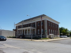 Elks Club Lodge #501listed 1985
 Fox Theaterlisted 1990
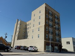 Gentry Apartmentslisted 2006
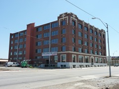 Inter-State Grocer Company Buildinglisted 2008
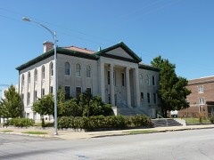 Joplin Carnegie Librarylisted 1979
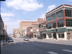 Joplin Downtown Historic Districtlisted 2008
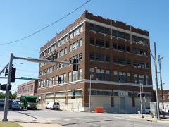 Joplin Supply Companylisted 2007
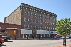 Main and Eight Streets Historic Districtlisted 2011
 Newman Brothers Buildinglisted 1990
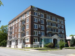 Olivia Apartmentslisted 2008
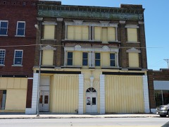 Rains Brothers Buildinglisted 1990
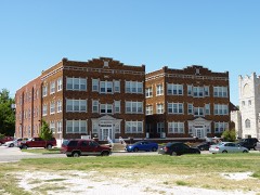 Ridgway Apartmentslisted 2006
Population over time
2 figuresJoplin grew from 50,150 to 51,762 between 2010 and 2020. These are the recorded population figures Wikidata holds for this place, reached through the Geographic Names Information System number this page is keyed on rather than by name, so they belong to this place and not to another of the same name. Most are census counts, but not all are: an early figure may be a founding or settlement estimate, and an estimate published within five years of a census is left out. The change column is computed, and is left blank where more than 20 years separate a figure from the one before it, because a gap that long is not a change between two counts.
| Year | People | Change |
|---|---|---|
| 2010 | 50,150 | |
| 2020 | 51,762 | +1,612 (+3%) |
Topographic sheets covering this place
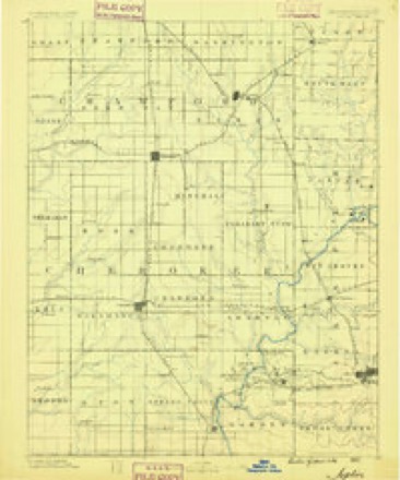
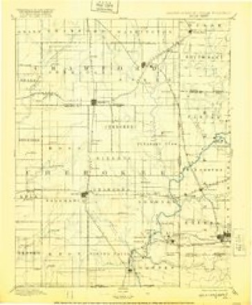
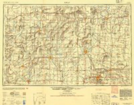
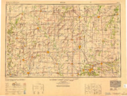
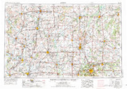
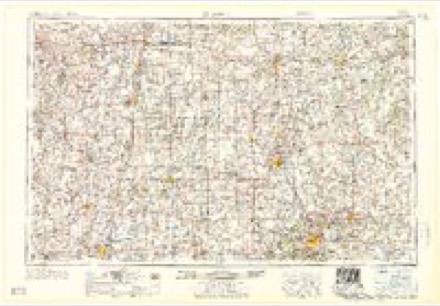
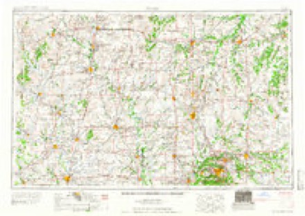
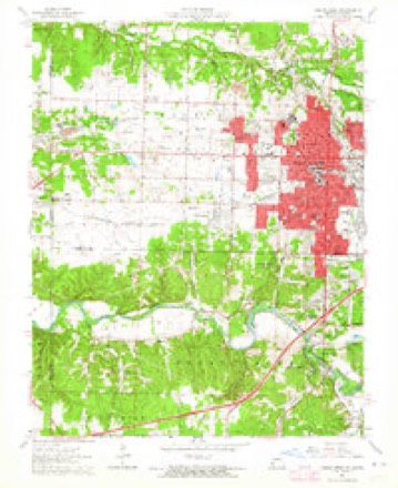
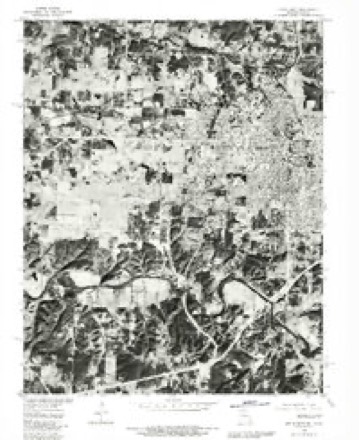
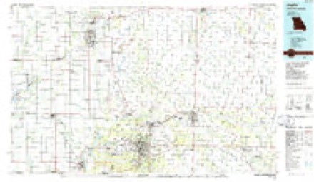
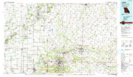
11 surveys from 19 printed sheetsMatched by testing this settlement's coordinate against the published boundary of every sheet in the United States Geological Survey's historical collection. Each opens the scanned sheet at the Survey.
- 1886 USGS Joplin quadrangle1:125000
- 1894 USGS Joplin quadrangle1:125000, 6 printings
- 1947 USGS Joplin quadrangle1:250000
- 1949 USGS Joplin quadrangle1:250000
- 1954 USGS Joplin quadrangle1:250000, 3 printings
- 1958 USGS Joplin quadrangle1:250000
- 1959 USGS Joplin quadrangle1:250000
- 1962 USGS Joplin West quadrangle1:24000, 2 printings
- 1980 USGS Joplin West quadrangle1:24000
- 1986 USGS Joplin quadrangle1:100000
- 1991 USGS Joplin quadrangle1:100000
In the county-history sources
80,318 words on this townshipThe History of Jasper County, Missouri : Including a Condensed History of the State, a Complete History of Carthage and Joplin, Other Towns and Townships : Together with Numerous Portraits of Prominent Men : Cuts of Elegant Residences and Public Buildings : a Sectional Map of the County : Biographical Sketches of Many Enterprising Farmers, Merchants, Mechanics, Professional, and Business Men : the Constitution of the State : an Abstract of Laws : an Elaborate History of Jasper County - Its Topography, Natural History, Pioneers, Organization, Political History, Courts and Bar, Religious, Educational, Medical, Agricultural, Mining, and Horticultural, Its Commercial and Business Interests, Etc, published 1883 names this settlement in its chapter on Joplin Township. These are the passages that mention it, exactly as the scans read.
In attempting a pen picture of the great " lead metropolis," and a portrayal of the various features which have given her place among the most important municipalities of the land, the writer is by no means sanguine of success. The enormity of the task is only recognized after weeks of diligent researcli. .loplin is yet in her infancy, although an extraordinary vigorous growth lias crowded into the few years of lier existence achievements of which cities of far greater pretensions might well be proud. Behold her, the " wonder of the West," a splendid city, covering an area of two square miles, containing upwards of eight thousand inhabitants, and all the adjuncts of first class modern civilization, grown up in little more than a decade of years. Joplin stands to-day the center of all the greatest lead and zinc regions in the world. A business center because it is a railroad center, having railroads in all directions except due south, where one is principally graded and will doubtless soon be in operation. A manufacturing center because here are established numerous lead and zinc works, white lead works (the most extensive, and in fact the only one of the kind in the world), foundries and machine shops, woolen mills, cornice works, carriage and wagon works, paint and oil mills, etc., etc. A financial center, because of inexhaustible mineral resources, wholesale houses, banks, etc. Twelve years ago the present site of Joplin was an uninviting waste of prairie, cut by water-courses, with here and there a clump of bushes or solitary tree. The only evidences of civilization were the log cabins of John C. Cox and the Rev. Mr. Joplin, two of the pioneer settlers of Jasper county. Of course there were others in neighboring parts, but not in this immediate vicinity. To-day a metropolitan city of almost fabulous wealth nestles on the scene as if by magic. To-day forty-nine miles of streets are traversed by myriads of busy beings lost in the activities of life. To-day the ring of bells, the shrill scream of whistles, the clank of hammers, the hum of machinery, and the rattle of vehicles over graveled ways, "join in one grand, harmonious chorus to the sons of toil. To-day fine, broad streets, over eleven miles of which are macadamized, substantial two and three story brick business houses and dwellings, lead and zinc works, white lead works, foundries and machine shops, churches, schools, daily and weekly newspapers, flour, and woolen mills, cigar manufactories, wagon and carriage works, railroads, telegraph lines, telephones, gas-works, water-works, a fire department, a street railway, hotels, banks, and numerous other elements, included under the term of modern improvements, give evidence of what can be accomplished by men of broad ideas, liberality, and genuine pluck. The population is steadily on the increase, and the work of building up and enlarging the town with more buildings, streets, public buildings, manufactories, and educational institutions, is still going on with unabated vigor. During the first years the growth of the city was that of a mining camp and frontier town. Much energy was misdirected and misspent. Plans were hastily laid and carried out with a view only to transient needs; but now the upbuilding is entirely different; the people see, and are profited by, the mistakes of the past, and all is done carefully, solidly, with intelligence, and commendable liberality.
Not only is the city progressive, but the surrounding villages are imbued with the same spirit of progression. As the grand oak sends its roots far reaching in all directions for necessary nutrition, so Joplin claims them as
Galena, Empire City, Thurman, Webb City, Carterville, Oronogo, Smithfield, Carl Junction, and Blende City, are, strictly speaking, little more than suburban towns, each paying royalty to the great city around which they cluster, and upon which they are in great part dependent.
Machine-read from a century-old scan, so expect the errors a machine makes: misspelled names, dropped words, stray characters.
Read the whole chapter on Joplin Township - it names this place 231 more 231 times.
Fires near this place
58 since 1992Regional context, not property-specific evidence. The federal wildfire occurrence database lists 58 fires within 5 miles of Joplin between 1992 and 2020, burning about 94 acres in total. 1 started naturally. 2 were recorded as arson. Distance is straight-line from the map coordinates, so a fire counted here may appear on a neighbouring settlement's page as well.
| Reported cause | Fires |
|---|---|
| Debris and open burning | 27 |
| Missing data/not specified/undetermined | 25 |
| Arson/incendiarism | 2 |
| Recreation and ceremony | 2 |
| Natural | 1 |
| Equipment and vehicle use | 1 |
The most recent of them, most recent first, with the day each was reported and the service that recorded it.
| Date | Cause | Size | Reported by | Name on the report |
|---|---|---|---|---|
| 22 September 2000 | Debris and open burning | 5.0 acres | Missouri Department of Conservation | not named |
| 17 September 2000 | Debris and open burning | 3.0 acres | Missouri Department of Conservation | not named |
| 6 August 1996 | Missing data/not specified/undetermined | 2.0 acres | Missouri Department of Conservation | not named |
| 30 August 2000 | Debris and open burning | 3.0 acres | Missouri Department of Conservation | not named |
| 24 August 2014 | Debris and open burning | 1.0 acres | Missouri Department of Conservation | not named |
| 17 August 2018 | Natural | under an acre | Missouri Department of Conservation | 177462-07341-08172018-1253 |
| 24 July 2019 | Missing data/not specified/undetermined | under an acre | Missouri Department of Conservation | 179008-07341-07242019-1600 |
| 18 July 2013 | Missing data/not specified/undetermined | 1.0 acres | Missouri Department of Conservation | not named |
Settlements close enough to share some of these fires:
Mines and quarries near this place
10 of 1,267 shownRegional context, not property-specific evidence. The federal mineral resources record lists 1,267 workings within 5 miles of Joplin: 1,262 past producers, 3 producers, 1 unknown, 1 occurrence. 3 still produce. What was taken out: Lead, Zinc, Zinc, Lead, Zinc, Stone, Crushed/Broken. Distance is straight-line from the map coordinates, so a quarry counted here may appear on a neighbouring settlement's page as well.
| Where | Site | Commodity | Status | Recorded |
|---|---|---|---|---|
| Kirshmann-Jeffries Quarry | Stone, Crushed/Broken, Marble, Dimension | Past Producer | ||
| Sucker Flats Pit | Clay | Past Producer | ||
| Independent Gravel Co | Sand and Gravel, Construction | Producer | ||
| Mattes Bros. Chat Plant | Sand and Gravel, Construction | Producer | ||
| Unknown - Zn/Pb | Zinc, Lead | Past Producer | ||
| Unknown - Zn/Pb | Zinc, Lead | Past Producer | ||
| Unknown - Zn/Pb | Zinc, Lead | Past Producer | ||
| Griesmer Quarry | Stone, Crushed/Broken | Past Producer | ||
| Joplin Stone Co. Mill | Stone, Crushed/Broken | Producer | ||
| Opossum Hollow Quarry | Stone, Crushed/Broken | Past Producer |
Storms near this place
60 of 161 shownRegional context, not property-specific evidence. The National Weather Service names Joplin in 161 storm reports between 1993 and 2026: 60 thunderstorm wind, 50 hail, 28 flash flood, 7 lightning. The reports record 2 deaths and 24 injuries. Each account below is quoted exactly as the forecast office filed it, from the NOAA Storm Events Database, and each date opens the federal record of that event.
| When | Event | Place named | Harm | What the report says |
|---|---|---|---|---|
| May 2011 | Lightning | Joplin | 1 killed, 1 hurt | Emergency management officials relayed to the NWS that two law enforcement officers were struck by lightning while aiding in the recovery efforts from the EF-5 tornado in Joplin. Both officers were injured and taken to the hospital. One of the officers later died on June 2nd at the hospital from injuries he suffered from the lightning strike. |
| June 1996 | Lightning | Joplin | 1 killed | no account filed |
| April 1996 | Tornado (F1) | Joplin | 12 hurt, $12,000,000 | no account filed |
| April 2001 | Thunderstorm Wind | Joplin | 10 hurt, $1,000,000 | no account filed |
| July 2002 | Lightning | Joplin | 1 hurt | no account filed |
| April 1996 | Tornado (F1) | Joplin | $1,000,000 | no account filed |
| August 1999 | Thunderstorm Wind | Joplin | $500,000 | no account filed |
| June 1999 | Tornado (F1) | Joplin | $220,000 | no account filed |
| May 2024 | Tornado (EF1) | Joplin | $160,000 | NWS storm survey found a EF-1 tornado with an intermittent damage path across the southeast and east side of Joplin into Duquesne. Maximum winds were estimated at 95 mph. Numerous tree limb damage and uprooted trees along with powerline damage were reported. |
| June 2013 | Lightning | Joplin | $100,000 | Two house fires were started due to lightning strikes. |
| May 2002 | Thunderstorm Wind | Joplin | $100,000 | no account filed |
| September 2014 | Lightning | Joplin | $50,000 | A damaging lightning strike hit a large tree on the Ozark Community College campus early Thursday morning. It broke 18 windows in three different dorms on campus. One car was damage by falling tree debris and the phone system in the dorm was severely damaged. Time was estimated by witnesses. |
| May 2008 | Thunderstorm Wind | Joplin | $50,000 | A roof of a hotel was partially ripped off from severe thunderstorm wind gusts. Several trees within the city of Joplin were also damaged. |
| April 1993 | Thunderstorm Wind | Joplin | $50,000 | Wind gusts to 67 mph were reported at various areas of Joplin as thunderstorms moved through the area. One gust was recorded at the Joplin Regional Airport. Numerous roofs were damaged. |
| April 1993 | Thunderstorm Wind | Joplin | $50,000 | Wind gusts to 67 mph were reported at various areas of Joplin as thunderstorms moved through the area. One gust was recorded at the Joplin Regional Airport. Numerous roofs were damaged. |
| April 2019 | Hail | Joplin | $40,000 | Golf ball sized hail was reported. Minor damage to roofs and some cars occurred. |
| June 2005 | Hail | Joplin | $40,000 | This storm is a continuation of the Cherokee County supercell that spawned two brief tornadoes. Jasper County was mainly impacted by golf ball size hail from this storm. The storm entered the extreme southwest portion of the county prior to moving into northwest Newton County. A three mile swath of hail was observed by several amateur radio operators. |
| July 2010 | Lightning | Joplin | $30,000 | A home caught on fire from a lightning strike in the city of Joplin. |
| July 1995 | Thunderstorm Wind | Joplin | $30,000 | Severe thunderstorms repeatedly moved throught the Joplin area downing trees and power lines. |
| September 2012 | Thunderstorm Wind | Joplin | $25,000 | The courthouse had minor roof damage. Roof construction was rolled rood over styrofoam insulation. |
| January 2008 | Thunderstorm Wind | Joplin | $20,000 | Straight line winds associated with a severe thunderstorm rolled 3 small trailers at a mobile home park on to their sides. |
| August 2006 | Thunderstorm Wind | Joplin | $15,000 | Thunderstorm winds downed trees and power lines in the city of Joplin. |
| May 2004 | Thunderstorm Wind | Joplin | $15,000 | Downburst winds produced intermittent damage in a 30 yard wide area near the intersection of 15th and Rangeline. Damage occurred to the roof and several sheds of a lumber store. Minor damage occurred at Wal-Mart along with several shattered car windows. |
| April 1998 | Hail | Joplin | $15,000 | Numerous reports of quarter to half dollar size hail were received from areas just north of Joplin, in the Webb City area. Hail dented many cars. |
| June 1996 | Flash Flood | Joplin | $15,000 | no account filed |
| May 2019 | Flash Flood | Joplin | $12,000 | A car was flooded up to the roof. |
| April 2026 | Thunderstorm Wind | Joplin | $10,000 | A tree fell on power lines knocking out power to several homes. |
| May 2024 | Thunderstorm Wind | Joplin | $10,000 | Report of a handful of power lines and trees down across the Joplin area. |
| September 2023 | Thunderstorm Wind | Joplin | $10,000 | A metal outbuilding suffered minor damage. |
| July 2019 | Thunderstorm Wind | Joplin | $10,000 | Power lines and large limbs were reported down by the fire department. |
| October 2014 | Lightning | Joplin | $10,000 | Several lightning strikes damaged transformers in downtown Joplin which caused power outages. |
| August 2012 | Thunderstorm Wind | Joplin | $10,000 | Law enforcement reported several power lines down and power outages around the city. |
| September 2012 | Thunderstorm Wind | Joplin | $10,000 | A wall of a car dealership was destroyed and blown down. |
| July 2005 | Thunderstorm Wind | Joplin | $10,000 | Thunderstorm wind gusts downed a few power poles in Joplin. |
| July 1997 | Thunderstorm Wind | Joplin | $10,000 | Thunderstorm winds caused scattered damage around Joplin and surrounding communities. Two utility poles were damaged in Joplin and trees fell on a house and car in Carthage. |
| June 1998 | Hail | Joplin | $10,000 | no account filed |
| May 2025 | Thunderstorm Wind | Joplin | $8,000 | Report of roof damage. |
| May 2024 | Thunderstorm Wind | Joplin | $5,000 | Social media report of several trees uprooted and large branches down. |
| April 2019 | Flash Flood | Joplin | $5,000 | The Emergency Manager reported that a water rescue was performed near the intersection of 32nd Street and St. Johns Boulevard. The vehicle occupant was rescued safely after driving through high water and being washed of the road. |
| June 2008 | Thunderstorm Wind | Joplin | $5,000 | Thunderstorm wind gusts downed a few power lines in Joplin. |
| April 2006 | Thunderstorm Wind | Joplin | $5,000 | A few powerline poles and lines were downed from severe thunderstorm wind gusts. |
| August 1997 | Thunderstorm Wind | Joplin | $5,000 | Thunderstorm winds downed a tree on a mobile home causing minor damage. |
| May 1995 | Thunderstorm Wind | Joplin | $5,000 | Thunderstorm winds downed a tree which heavily damaged a house. |
| April 1994 | Thunderstorm Wind | Joplin | $5,000 | A wind gust to 62 mph was reported at the Joplin Regional Airport. Numerous large trees and limbs were blown down in Carthage as well. |
| April 1993 | Thunderstorm Wind | Joplin | $5,000 | Wind gusts to 67 mph were reported at various areas of Joplin as thunderstorms moved through the area. One gust was recorded at the Joplin Regional Airport. Numerous roofs were damaged. |
| May 2019 | Flash Flood | Joplin | $4,000 | A flooded parking lot with a partially submerged car was reported. A picture was received via social media. This was a continuation of flooding that began on April 30th. |
| May 1999 | Thunderstorm Wind | Joplin | $4,000 | no account filed |
| August 2016 | Thunderstorm Wind | Joplin | $3,000 | Several trees and power lines were blown down in Joplin. |
| June 2024 | Thunderstorm Wind | Joplin | $1,000 | A tree was down on the northeast side of Joplin. |
| September 2012 | Thunderstorm Wind | Joplin | $1,000 | The public reported a small tree on a house on north Miller Street in Joplin. |
| July 1997 | Thunderstorm Wind | Joplin | $500 | Thunderstorm winds damaged a barn and downed a large tree. |
| April 1994 | Hail | Joplin | $500 | Police reported golf ball-size hail on the southeast edge of Joplin. |
| March 1994 | Hail | Joplin | $500 | no account filed |
| April 1994 | Hail | Joplin | $50 | no account filed |
| April 2026 | Flash Flood | Joplin | - | Multiple roads and city streets were reported flooded and closed in the city of Joplin. |
| April 2025 | Thunderstorm Wind | Joplin | - | A trained spotter reported winds of 70 mph. |
| April 2025 | Hail | Joplin | - | Penny sized hail was reported. |
| March 2025 | Thunderstorm Wind | Joplin | - | A 60 mph wind gust was measured in the city of Joplin. |
| June 2025 | Flood | Joplin | - | Flooding caused a handful of ditches to flow into the streets, with Murphy Blvd shut down due to water over the low water bridge. |
| November 2025 | Flood | Joplin | - | Picher and Junge roads were closed due to flooding. |
Nearest settlements
The eight closest, with where each one stands in the county. Distances are straight-line, computed from the Geographic Names Information System coordinates.
| Map | Place | Distance | Sheets |
|---|---|---|---|
| West Joplin | 0.4 miles | 19 | |
| Blendville (historical) | 1.4 miles | 19 | |
| East Joplin | 1.4 miles | 19 | |
| Chitwood | 1.9 miles | 19 | |
| Lone Elm | 2.2 miles | 19 | |
| Iron Gates | 2.5 miles | 19 | |
| Oakland Park | 2.8 miles | 19 | |
| Duquesne | 2.9 miles | 19 |
Elsewhere
Matched on this settlement's Geographic Names Information System number rather than its name, so it cannot be a different place of the same name in another state.
| Wikipedia article on Joplin | An encyclopaedic summary. Its text is share-alike, so it is linked here rather than copied. |
| Wikidata item Q317865 | The structured record the population and elevation above come from. Public domain (CC0). |
Provenance
This settlement is recorded in the Geographic Names Information System as feature 729911. The sheet list is computed by point-in-boundary test against the United States Geological Survey's historical topographic inventory. Both are works of the United States government and carry no copyright under 17 U.S.C. 105.
Wildfire. Short, Karen C. 2022. Spatial wildfire occurrence data for the United States, 1992-2020 [FPA_FOD_20221014]. 6th Edition. Fort Collins, CO: Forest Service Research Data Archive. https://doi.org/10.2737/RDS-2013-0009.6 Collected with United States Government funding and usable without additional permissions or fees.
Mines and quarries. USGS Mineral Resources Data System (MRDS) https://mrdata.usgs.gov/mrds/ A work of the United States government, no copyright under 17 U.S.C. 105.
Storms. NOAA National Centers for Environmental Information, Storm Events Database https://www.ncei.noaa.gov/stormevents/ A work of the United States government, no copyright under 17 U.S.C. 105. Narratives are quoted verbatim from the National Weather Service report and are not edited or summarised.