 Block
Lawson, Missouri
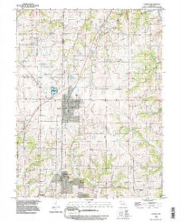
19 topographic sheets cover this place, the earliest surveyed in 1894 and the latest in 1990. It stands in Polk Township. It lies in ZIP code area 64062. The Survey maps it on the Lawson quadrangle. 2,541 people lived here at the 2020 count. It stands 1,066 feet above sea level.
Population over time
2 figuresLawson grew from 2,473 to 2,541 between 2010 and 2020. These are the recorded population figures Wikidata holds for this place, reached through the Geographic Names Information System number this page is keyed on rather than by name, so they belong to this place and not to another of the same name. Most are census counts, but not all are: an early figure may be a founding or settlement estimate, and an estimate published within five years of a census is left out. The change column is computed, and is left blank where more than 20 years separate a figure from the one before it, because a gap that long is not a change between two counts.
| Year | People | Change |
|---|---|---|
| 2010 | 2,473 | |
| 2020 | 2,541 | +68 (+3%) |
Topographic sheets covering this place
9 surveys from 19 printed sheetsMatched by testing this settlement's coordinate against the published boundary of every sheet in the United States Geological Survey's historical collection. Each opens the scanned sheet at the Survey.
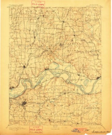
- 1894 USGS Independence quadrangle1:125000, 5 printings
- 1950 USGS Kansas City quadrangle1:250000
- 1954 USGS Kansas City quadrangle1:250000
- 1956 USGS Kansas City quadrangle1:250000, 4 printings
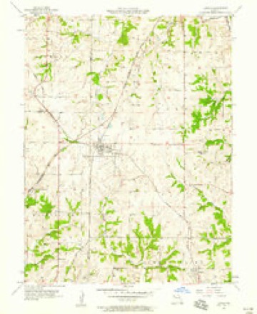
- 1957 USGS Lawson quadrangle1:24000, 2 printings
- 1960 USGS Kansas City quadrangle1:250000, 3 printings
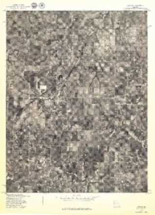
- 1978 USGS Lawson quadrangle1:24000
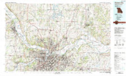
- 1983 USGS Kansas City quadrangle1:100000
- 1990 USGS Lawson quadrangle1:24000




In the county-history sources
50,099 words on this townshipHistory of Ray County, Mo., published 1881 names this settlement in its chapter on Polk Township. These are the passages that mention it, exactly as the scans read.
September 22, 1872, the session met, before public service, in their new house of worship, at Lawson, and was opened with prayer. Present, Reverend J. M. Scott, moderator, and Elder J. A. Smith. Mrs. Henrietta Rhaum and Miss Victoria Ann Smith appeared and desired membership in the church; whereupon, after the usual examination, they were received into full fellowship, they having previously been baptized. Closed with prayer by Elder J. A. Smith.
Passage source: History of Ray County, Mo., published 1881.
About the 1st of August, 1866, Elder John C. Lawson, a carpenter, as well as preacher, and at that time plying the former vocation in the neighborhood of the present site of Pleasant View, commenced a basket meeting in a beautiful grove in William Crowley's pasture, and continued the same nearly a fortnight. The result was several confessions and immersions. Great interest was awakened; and, at the close of the meeting, partial organization was effected, by electing David J. Bisbee and Thomas J. Crowley elders. Elder Lawson was engaged to labor for the church occasionally, and the place of worship was moved from Benton to Butler school-house. Here the church was reorganized, and Andrew J. Greenawalt elected elder, and William F. Potter and Samuel D. Osborn deacons.
Passage source: History of Ray County, Mo., published 1881.
Services were held at Butler school-house till the following August, when at a protracted meeting, conducted bv Elders G. R. Hand, Joseph T. Rice, and J. C. Lawson, a resolution was passed to build a house of worship at Pleasant View. Martin T. Real, James A. Potter, and A. Bisbee, Sr., were appointed a building committee, and vested with the power of trustees to receive and hold in trust property that the church might acquire. C. B. Bacon was chosen secretary and treasurer of the committee. A subscription-book was opened, and therein appear the following names of subscribers and the amount contributed by each, viz:
Passage source: History of Ray County, Mo., published 1881.
Machine-read from a century-old scan, so expect the errors a machine makes: misspelled names, dropped words, stray characters.
Read the whole chapter on Polk Township - it names this place 3 more 3 times.
Fires near this place
40 since 1992Regional context, not property-specific evidence. The federal wildfire occurrence database lists 40 fires within 5 miles of Lawson between 1992 and 2018, burning about 195 acres in total. None started naturally. 2 were recorded as arson. Distance is straight-line from the map coordinates, so a fire counted here may appear on a neighbouring settlement's page as well.
| Reported cause | Fires |
|---|---|
| Missing data/not specified/undetermined | 18 |
| Debris and open burning | 16 |
| Arson/incendiarism | 2 |
| Smoking | 2 |
| Equipment and vehicle use | 2 |
The most recent of them, most recent first, with the day each was reported and the service that recorded it.
| Date | Cause | Size | Reported by | Name on the report |
|---|---|---|---|---|
| 8 August 2018 | Missing data/not specified/undetermined | under an acre | Missouri Department of Conservation | 177901-08922-08082018-1512 |
| 16 August 2018 | Debris and open burning | under an acre | Missouri Department of Conservation | 177896-08922-08162018-1726 |
| 9 July 2018 | Debris and open burning | 7.1 acres | Missouri Department of Conservation | 177358-08922-07092018-1629 |
| 8 July 2018 | Equipment and vehicle use | under an acre | Missouri Department of Conservation | 177899-08922-07082018-1237 |
| 31 July 2018 | Missing data/not specified/undetermined | under an acre | Missouri Department of Conservation | 177895-08922-07312018-0935 |
| 25 July 2018 | Debris and open burning | under an acre | Missouri Department of Conservation | 177900-08922-07252018-1617 |
| 23 June 2011 | Missing data/not specified/undetermined | 1.0 acres | Missouri Department of Conservation | not named |
| 7 May 2017 | Missing data/not specified/undetermined | 10 acres | Missouri Department of Conservation | not named |
Settlements close enough to share some of these fires:
Mines and quarries near this place
5 within 5 milesRegional context, not property-specific evidence. The federal mineral resources record lists 5 workings within 5 miles of Lawson: 5 past producers. None of them still produces. What was taken out: Stone, Crushed/Broken. Distance is straight-line from the map coordinates, so a quarry counted here may appear on a neighbouring settlement's page as well.
| Where | Site | Commodity | Status | Recorded |
|---|---|---|---|---|
| Clemmons Qsuarry | Stone, Crushed/Broken | Past Producer | ||
| Everett Q #28-50 | Stone, Crushed/Broken | Past Producer | ||
| Lawson Quarry | Stone, Crushed/Broken | Past Producer | ||
| Mays Quarry | Stone, Crushed/Broken | Past Producer | ||
| Unknown | Stone, Crushed/Broken | Past Producer |
Storms near this place
32 since 1994Regional context, not property-specific evidence. The National Weather Service names Lawson in 32 storm reports between 1994 and 2025: 15 hail, 12 thunderstorm wind, 3 flash flood, 2 tornado. No death or injury is recorded in these reports. Each account below is quoted exactly as the forecast office filed it, from the NOAA Storm Events Database, and each date opens the federal record of that event.
| When | Event | Place named | Harm | What the report says |
|---|---|---|---|---|
| November 2005 | Tornado (F1) | Lawson | $25,000 | Tornado crossed into Ray county from Clay county in Lawson at 1759. The tornado moved north-northeast and dissipated 2 miles north of Lawson. Damage was noted to homes along 184th street to the east of US-69. Barn and tree damage was also noted along Raum Road just north of town. |
| June 1994 | Hail | Lawson | $5,000 | Large trees and a few outbuildings were knocked down from high wind gusts. Golf ball-size hail was also reported. |
| June 1994 | Thunderstorm Wind | Lawson | $5,000 | Large trees and a few outbuildings were knocked down from high wind gusts. Golf ball-size hail was also reported. |
| April 2010 | Thunderstorm Wind | Lawson | $3,000 | Power poles were reported snapped and laying across Highway 69. |
| July 2009 | Thunderstorm Wind | Lawson | $1,000 | A large tree limb fell on a car with minor damage reported. |
| May 2004 | Thunderstorm Wind | Lawson | $1,000 | Barn damaged and trees down. |
| May 2025 | Hail | Lawson | - | Quarter sized hail in Lawson. |
| March 2025 | Thunderstorm Wind | Lawson | - | Social media report of minor tree damage from estimated 70 mph wind gusts from thunderstorms. |
| July 2025 | Thunderstorm Wind | Lawson | - | Downed tree and wires near Pennsylvania Avenue from thunderstorm outflow near Lawson. |
| July 2025 | Hail | Lawson | - | Quarter sized hail reported near Lawson. |
| April 2024 | Thunderstorm Wind | Lawson | - | A barn was largely destroyed near the intersection of 208th and Raum Road north of Lawson. This was part of a large swath of wind damage in the Lawson area. |
| April 2024 | Thunderstorm Wind | Lawson | - | A barn was largely destroyed near the intersection of 208th and Raum Road north of Lawson. This was part of a large swath of wind damage in the Lawson area. |
| May 2015 | Tornado (EF0) | Lawson | - | Ahead of the advancing QLCS that was responsible for widespread wind damage a supercell formed, which caused a very brief and weak tornado that did some minor damage to residences and trees in Lawson. |
| June 2015 | Flash Flood | Lawson | - | Water was flowing over Salem Road between 174th Street and 162nd Street. |
| June 2015 | Flash Flood | Lawson | - | Water was flowing over a 50 to 100 yard stretch of road near Lawson. |
| August 2010 | Thunderstorm Wind | Lawson | - | Thunderstorm wind gusts were estimated up to 70 mph. |
| July 2008 | Flash Flood | Lawson | - | Water was reported over the road on Highway D east of Lawson. |
| May 2003 | Thunderstorm Wind | Lawson | - | Penny sized hail reported as well. |
| June 1998 | Thunderstorm Wind | Lawson | - | Thunderstorm wind gusts to 60 MPH were reported a mile east of Lawson by a HAM Radio operator. |
| June 1998 | Hail | Lawson | - | A HAM Radio operator reported one inch diameter hail in Lawson. |
| July 1995 | Hail | Lawson | - | Severe thunderstorms produced golf ball-size hail over Lawson and six miles northeast of Lawson. |
| July 1995 | Hail | Lawson | - | Severe thunderstorms produced golf ball-size hail over Lawson and six miles northeast of Lawson. |
| April 2016 | Hail | Lawson | - | no account filed |
| June 2015 | Hail | Lawson | - | no account filed |
| April 2006 | Hail | Lawson | - | no account filed |
| April 2006 | Hail | Lawson | - | no account filed |
| November 2005 | Hail | Lawson | - | no account filed |
| July 2004 | Thunderstorm Wind | Lawson | - | no account filed |
| May 2003 | Hail | Lawson | - | no account filed |
| May 2001 | Hail | Lawson | - | no account filed |
| September 2000 | Hail | Lawson | - | no account filed |
| April 1995 | Hail | Lawson | - | no account filed |
Nearest settlements
The eight closest, with where each one stands in the county. Distances are straight-line, computed from the Geographic Names Information System coordinates.
| Map | Place | Distance | Sheets |
|---|---|---|---|
| Excelsior Estates | 3.3 miles | 19 | |
| Elmira Camp | 4.7 miles | 19 | |
| Vibbard | 5.0 miles | 19 | |
| Homestead | 5.2 miles | 18 | |
| Elmira | 5.4 miles | 14 | |
| Crystal Lakes | 5.5 miles | 18 | |
| Sandals | 6.6 miles | 17 | |
| Wood Heights | 7.2 miles | 18 |
Elsewhere
Matched on this settlement's Geographic Names Information System number rather than its name, so it cannot be a different place of the same name in another state.
| Wikipedia article on Lawson | An encyclopaedic summary. Its text is share-alike, so it is linked here rather than copied. |
| Wikidata item Q965778 | The structured record the population and elevation above come from. Public domain (CC0). |
Provenance
This settlement is recorded in the Geographic Names Information System as feature 720846. The sheet list is computed by point-in-boundary test against the United States Geological Survey's historical topographic inventory. Both are works of the United States government and carry no copyright under 17 U.S.C. 105.
Wildfire. Short, Karen C. 2022. Spatial wildfire occurrence data for the United States, 1992-2020 [FPA_FOD_20221014]. 6th Edition. Fort Collins, CO: Forest Service Research Data Archive. https://doi.org/10.2737/RDS-2013-0009.6 Collected with United States Government funding and usable without additional permissions or fees.
Mines and quarries. USGS Mineral Resources Data System (MRDS) https://mrdata.usgs.gov/mrds/ A work of the United States government, no copyright under 17 U.S.C. 105.
Storms. NOAA National Centers for Environmental Information, Storm Events Database https://www.ncei.noaa.gov/stormevents/ A work of the United States government, no copyright under 17 U.S.C. 105. Narratives are quoted verbatim from the National Weather Service report and are not edited or summarised.