 Block
Mandeville, Missouri
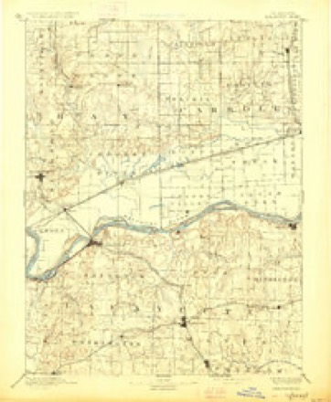
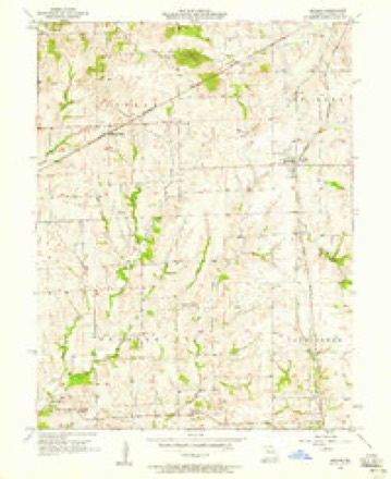
15 topographic sheets cover this place, the earliest surveyed in 1889 and the latest in 1982. It stands in Leslie Township. It lies in ZIP code area 64622. The Survey maps it on the Bogard quadrangle.
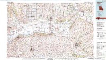
Topographic sheets covering this place
7 surveys from 15 printed sheetsMatched by testing this settlement's coordinate against the published boundary of every sheet in the United States Geological Survey's historical collection. Each opens the scanned sheet at the Survey.
- 1889 USGS Lexington quadrangle1:125000, 6 printings
- 1953 USGS Moberly quadrangle1:250000
- 1954 USGS Moberly quadrangle1:250000, 3 printings
- 1957 USGS Bogard quadrangle1:24000, 2 printings
- 1957 USGS Moberly quadrangle1:250000
- 1960 USGS Moberly quadrangle1:250000
- 1982 USGS Marshall quadrangle1:100000




What happened here
An account from the chapter on Leslie township. The inset identifies its exact source book and publication year.
Perragran C. Hartis
born July 24th, 1829, in Macklenburg county> North Carolina. Son of John and Sarah Hartis. His father was killed by a crazy man when Perragran was but a year old. His mother married again and he lived with his stepfather until 15 years of age, and after that with his brother until he went out to gain a livelihood for himself.
In the county-history sources
7,769 words on this townshipHistory of Carroll County, Missouri : Carefully Written and Compiled from the Most Authentic Official and Private Sources, Including a History of Its Townships, Cities, Towns and Villages, Together with a Condensed History of Missouri ; the Constitution of the United States, and State of Missouri ; a Military Record of Its Volunteers in Either Army of the Great Civil War ; General and Local Statistics ; Miscellany ; Reminiscences, Grave, Tragic and Humorous ; Biographical Sketches of Prominent Men and Citizens Identified with the Interests of the Country, published 1881 names this settlement in its chapter on Leslie Township. These are the passages that mention it, exactly as the scans read.
Mandeville, Leslie township, is a little village nestling in the timbered regions of the bluffs on the line between sections eight and seventeen, and contains three stores, a blacksmith and wagon shop, two church buildings and a Masonic lodge. The country surrounding is rough and rocky and covered with good timber. It has as yet attained no town organization and lays no claim to a metropolis. It is a good trading point for the immediate country surrounding, and is the center of a thriving settlement. John W. Smith, Esq., and Robert Traughber petitioned the government about 1854 for a post office at this point, with Mr. Smith as post master. The petition proposed the name of Mandeville, which was accepted by the government and the office was established with Mr. Smith as post master. The name Mandeville was proposed in honor of Amanda Shirley, of Tennessee, who was the betrothed of Mr. Traughber. In 1857 Mr. Graham succeeded to the office, owing to the fact that Esq. Smith lived about onehalf mile from the point where the office was to be held. Another report says the name Mandeville originated from the following incident: An old German and his wife, with a good-looking daughter, lived but a short distance from where the village is located, the daughter's name being Amanda. Amanda had a sweetheart acceptable to the mother but not to the father. The old couple quarreled over the matter, the father declaring in his German pronunciation that 'Mandr. " vill not marry John, " and the mother declaring that 'Manda " vill." 'Manda did. Hence the name Mandeville.
G. M. of Brunswick, Mo., on the issuance by the Grand Lodge of a dispensation dated August 9, 1870. On the 13th of October, 1871, their charter was issued embracing T. R. Brown, W. C. Baird, J. M. Stovall, B. F. Siler, W. P. Smith, of Trober, L. W. McCain, W..G. Hood, J. H. Beatty and W. O. P. Thomas, as charter members. The first officers were: I. R. Brown, W. M.; James M. Stovall, S. W.; B. F. Siler, J. W.; J. H. Beatty, S. D.; W. O. P. Thomas, J. D.; .of Trober, Treasurer, W. P. Smith, Secretary and W. G. Hood, Tyler. The lodge is in excellent working order, and the attendance large. The present officers are: J. M. Stovall, W. M.; W. C. Baird, S. W.; J. B. Givens, ]. W.; B. F. Elsas, S. D.; T. J. Mossbarger, J. D.; W. G. Hood, treasurer; W. Black, secretary and W. B. Hull, tyler. Their hall is a frame, large and comfortable, and was built in 1870 at a cost of $800. The present membership is fortyfive. In connection with Mandeville lodge is a lodge of the "Eastern Star, " for the benefit of the mothers, wives, sisters and daughters of the fraternity, and numbering about thirty members.
was born in Russia, October 3d, 1850; a son of Marcus and Basha C. Block, natives of Russia-Poland. Moses M., left his home when fifteen years old and went to Paris, France, where he obtained a clerkship. In 1866 he started on board a vessel from Havre for America, and landed in this country the 15th day of April. He came west to Illinois, stopped at La Harpe a short time, and then went to Quincy and fitted out a 'pack' of notions and peddled them through the state; he continued peddling in the states of Illinois and Missouri until 1867, when he visited Denver, and returned to Missouri in 1870, and located in Mandeville; here he and his brother. Wolf Block, were engaged in the dry goods business; in 1874 he opened a store five and one-half miles south-west of Mandeville, at a place called Cross Lanes. The year following he sold out his stock of goods to his brother, and went in his brother's store as clerk. In 1875 he went to Philadelphia and attended a course of lectures at the Jefferson Medical College. In 1876 he opened a drug store in Mandeville, and is still engaged in business there. He was married to Miss Mary A. Harford. May 4th, 1881; her parents are natives of Kentucky. Mr. Block was made a mason in 1874, and has filled various positions in the lodge; he is also a member of Independent Order of Good Templars.
Machine-read from a century-old scan, so expect the errors a machine makes: misspelled names, dropped words, stray characters.
Read the whole chapter on Leslie Township - it names this place 6 more 6 times.
Fires near this place
17 since 1995Regional context, not property-specific evidence. The federal wildfire occurrence database lists 17 fires within 5 miles of Mandeville between 1995 and 2020, burning about 230 acres in total. None started naturally. None was recorded as arson. Distance is straight-line from the map coordinates, so a fire counted here may appear on a neighbouring settlement's page as well.
| Reported cause | Fires |
|---|---|
| Debris and open burning | 11 |
| Missing data/not specified/undetermined | 3 |
| Equipment and vehicle use | 2 |
| Other causes | 1 |
The most recent of them, most recent first, with the day each was reported and the service that recorded it.
| Date | Cause | Size | Reported by | Name on the report |
|---|---|---|---|---|
| 13 July 2020 | Debris and open burning | under an acre | Missouri Department of Conservation | 251276-01702-07132020-2015 |
| 27 April 2018 | Other causes | 1.3 acres | Missouri Department of Conservation | 178906-01702-04272018-1950 |
| 24 April 2018 | Missing data/not specified/undetermined | 1.1 acres | Missouri Department of Conservation | 178905-01702-04242018-1620 |
| 23 April 2018 | Missing data/not specified/undetermined | under an acre | Missouri Department of Conservation | 178904-01702-04232018-1740 |
| 14 April 1995 | Debris and open burning | 11 acres | Missouri Department of Conservation | not named |
| 21 March 2002 | Debris and open burning | 30 acres | Missouri Department of Conservation | not named |
| 16 March 2002 | Debris and open burning | 15 acres | Missouri Department of Conservation | not named |
| 10 March 2018 | Missing data/not specified/undetermined | under an acre | Missouri Department of Conservation | 178886-01702-03102018-1420 |
Settlements close enough to share some of these fires:
Mines and quarries near this place
4 within 5 milesRegional context, not property-specific evidence. The federal mineral resources record lists 4 workings within 5 miles of Mandeville: 4 past producers. None of them still produces. What was taken out: Stone, Crushed/Broken. Distance is straight-line from the map coordinates, so a quarry counted here may appear on a neighbouring settlement's page as well.
| Where | Site | Commodity | Status | Recorded |
|---|---|---|---|---|
| Mandeville Quarry | Stone, Crushed/Broken | Past Producer | ||
| Unknown - Ls | Stone, Crushed/Broken | Past Producer | ||
| Unknown - Ls | Stone, Crushed/Broken | Past Producer | ||
| Unknown - Ls | Stone, Crushed/Broken | Past Producer |
Storms near this place
1 since 2021Regional context, not property-specific evidence. The National Weather Service names Mandeville in 1 storm report in 2021: 1 flash flood. No death or injury is recorded in these reports. Each account below is quoted exactly as the forecast office filed it, from the NOAA Storm Events Database, and each date opens the federal record of that event.
| When | Event | Place named | Harm | What the report says |
|---|---|---|---|---|
| June 2021 | Flash Flood | Mandeville | - | Numerous roads in Carroll County, including in Carrollton were impassible due to running water. |
Nearest settlements
The eight closest, with where each one stands in the county. Distances are straight-line, computed from the Geographic Names Information System coordinates.
| Map | Place | Distance | Sheets |
|---|---|---|---|
| Quote | 4.4 miles | 15 | |
| Fisher (historical) | 4.5 miles | 15 | |
| Roads | 4.7 miles | 15 | |
| Bingham (historical) | 5.5 miles | 15 | |
| Coloma | 5.7 miles | 15 | |
| Bogard | 5.8 miles | 15 | |
| Latoh (historical) | 7.0 miles | 15 | |
| Judd | 8.1 miles | 15 |
Provenance
This settlement is recorded in the Geographic Names Information System as feature 721787. The sheet list is computed by point-in-boundary test against the United States Geological Survey's historical topographic inventory. Both are works of the United States government and carry no copyright under 17 U.S.C. 105.
Wildfire. Short, Karen C. 2022. Spatial wildfire occurrence data for the United States, 1992-2020 [FPA_FOD_20221014]. 6th Edition. Fort Collins, CO: Forest Service Research Data Archive. https://doi.org/10.2737/RDS-2013-0009.6 Collected with United States Government funding and usable without additional permissions or fees.
Mines and quarries. USGS Mineral Resources Data System (MRDS) https://mrdata.usgs.gov/mrds/ A work of the United States government, no copyright under 17 U.S.C. 105.
Storms. NOAA National Centers for Environmental Information, Storm Events Database https://www.ncei.noaa.gov/stormevents/ A work of the United States government, no copyright under 17 U.S.C. 105. Narratives are quoted verbatim from the National Weather Service report and are not edited or summarised.